
Image credit: A. Brookes (19.4.2019)


Mature trees grow on the northern rampart.

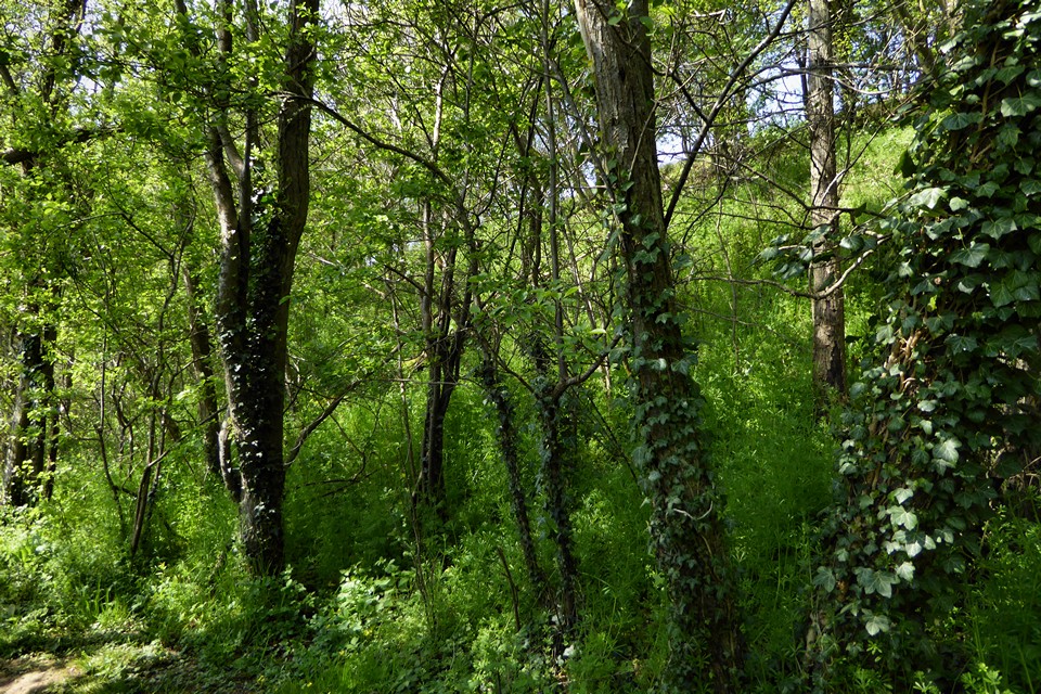
The northern rampart.
The very overgrown southeastern rampart.

Looking down on the modern southern entrance.

The western end of the interior.

Looking down from the northwestern rampart.

The northwestern rampart.

At the eastern end of the fort.

Shot of the northern rampart as seen from the interior of the fort.

The western end of the southern rampart.

Part of the northern rampart, looking towards the west.

As viewed from the WSW, approaching from Moreton on Lugg.
Visited 22.3.13
Directions:
Take the A49 north, out of Hereford, and then the minor road on the right signposts Moreton On Lugg then Sutton St Nicholas. You will come to a posh house on your right called Pool House and a yellow grit box. The track leading to the Hillfort is directly opposite – between two houses. There is a public right of way up the track although no sign indicating this.
I passed a dead badger on the verge – no doubt knocked over by a car? This was the third dead badger I had seen next to a road today.
The track is well made which makes walking up it easy. There is a locked gate you walk past to prevent vehicles being driven up the track. It is only a 5 minutes walk to the Hillfort from the main road.
As you approach the very large defensive rampart the track becomes less well maintained and increasingly muddy. The track cuts right through the rampart and you get a good appreciation of how substantial it is. It is at least 3m high – possibly 4m. The whole of the rampart is covered in trees and bushes.
Once inside the Hillfort it is difficult to get an idea of the layout due to the entire interior being overgrown with trees, bushes, brambles etc. Although it is obvious that this is a very large site. ‘Paths’ criss/cross the interior of the Hillfort. Whilst walking up the track the rain had turned to hail and now sleet – it was a bit nippy and unsurprisingly I had the site to myself. Only TMAers would be daft enough to visit in this weather!
Due to the trees surmounting the rampart and the low clouds, rain/hail/sleet it wasn’t possible to appreciate the view although it was clear that the Hillfort occupies a very prominent position in the surrounding flat landscape and would have made an ideal location.
In his ‘Guide to Prehistoric England’ (page 150/151) Nicholas Thomas states that the Hillfort encompasses an area of 29 acres. Adding that the ‘massive’ single ditch rampart has two original entrances (E+W) and that the (N+S) entrances are modern. Interestingly Mr Thomas adds that shortly before the Roman invasion the defences were strengthened although this did no good as the site was attacked in AD48 and a slaughter followed with 24 defenders being thrown in the ditch suffering from battle injuries / decapitation. The site continued to be used throughout the Romano-British period and a large iron anvil was found which is now in the Hereford Museum. Apparently this is one of the largest Pre-Roman cast iron objects ever found in Britain.
All in all this site is well worth a visit when in the area although other than the formidable rampart don’t expect to make much else out due to the vegetation.
Visited on a drizzly January day (28.1.2010), approaching from the west (Moreton on Lugg). The surrounding countryside is very low-lying, the meadows around the Lugg are constantly flooded. The fort rises above all this, occupying the top of a long, low hill on an east-west axis. To the north-west, the horizon is dominated by the much larger Dinmore Camp.
The fort has been ill-treated in the past, pretty much from when the Romans arrived and massacred the inhabitants onwards. It has been quarried and used to dump chemicals during the 20th century, none of which add much to the attraction. A footpath runs around the whole perimeter of the fort, outside the single defensive bank. Another bisects the fort about a third of the way along from its western tip. The bank itself is impressive from the outside, although there’s not much sign of the ditch that originally encircled it. The rampart is highest on the north side and would have been a pretty formidable barrier, with ditch and pallisade. Undergrowth covers the rampart itself now, so a visit at this time of year is recommended. The gates at east and west ends are hidden under vegetation. To the SSW the views extend to The Skirrid and Black Mountains, while from the east end the central part of the Malverns range is visible.
The interior is pretty much a flat and featureless open space. The site was heavily quarried and later filled after toxic waste had been dumped there. There’s not a lot to see and will be even more obscured come the summer. It contains a large area (12ha), including a ploughed field at the eastern end. The eastern half is much wider than the west, following the natural contour of the hill. The bank is at its lowest around this bowed out section.
Leaving via the footpath running south from the fort to Sutton St Michael, the natural slope is apparent. However, the hill is low and so defensive capability, particularly to the south, would not compare with the loftier hillforts in the area. From here it’s off for a quick look at the Wergins Stone before heading into Hereford.
Apparently from Howell’s ‘Collection of Proverbs’ from 1659, but quoted in ‘English Proverbs and Proverbial Phrases’ by W C Hazlitt (1907):
Sutton Wall and Kenchester Hill
Are able to buy London, were it to sell.These are two places fruitful in the country, saith Mr. Howell.
Maybe it’s a misquote and should imply the two places were better than London in the past? as they both have big forts (Kenchester is next to Credenhill Park Wood fort) – rather like the rhymes that tell ‘when [local old place] was a bustling town,
[local big city] was a furzy down’. Maybe, maybe not.
A small bubble-burst regarding the Ethelbert story:
“Around AD25, the ramparts were raised and the huts rebuilt on the same layout. Then, as Roman power extended into the area in the middle of the first century AD, a grisly episode in the history of the settlement occurred. As the Roman army advanced, the ditch at the western entrance was hurriedly recut. Immediately afterwards, many battle-scarred bodies -some of which were decapitated – were thrown into the ditch and covered with a layer of soil. It seems the Romans, under Ostorius Scapula, attacked the settlement, massacred the inhabitants and pulled down the defences over them.
.....
Excavation has revealed no evidence of Saxon occupation to support the folk-tale that Sutton Walls was the site of one of Offa’s palaces. The story of Ethelbert’s bloody murder may represent a hazy folk-memory of of the actual slaughter which took place there many centuries earlier, though recent work has suggested that Offa may have had a palace at Freens Court, just below the ramparts of Sutton Walls*.”
From “Prehistoric Sites of Herefordshire” – George Children and George Nash (1994 Logaston Press).
*On the 1:25000 OS at SO521458 there is a “moat” near Freens Court Farm, not sure if this is relevant.
A confusing tangled tale revolves around a bell here. Offa was supposed to have lived in Sutton Walls, or alternatively down in Marden below. As mentioned, there is a church on the spot where Offa murdered St. Ethelbert, and a few yards away, a pond. When the pond was being cleaned out, a bell was found, eighteen feet below the level of the adjacent ground.
The Dean of Hereford said (in the 1840s) that the bell “was formed of a sheet of mixed metal, which had been hammered into shape: it is four-sided.. riveted together on each side..” The Herefordshire SMR says it was of iron and bronze, and calls it ‘Celtic’, but it is surely newer – and where is it now?
He also said, “There is a tradition at Marden among the common people that there lies in the river Lugg, near the church, a large silver bell, which will never be taken out until two white oxen are attached to it, to draw it from the river.”
and elsewhere (eg at the Hereford Times ) there’s talk of a mermaid – the oxen had a go pulling the bell out, but the mermaid dragged it back.
It seems like one of those chicken-and-egg situations (like with the Mold cape) where you can’t tell how much story there really was before the discovery.
See the Archaeological Journal for 1848 (v5) p330
https://books.google.co.uk/books?id=XZ08AAAAIAAJ&pg=RA1-PA330
About four miles north-eastward from Hereford, is Sutton Walls, celebrated as the Palace of Offa, King of the Mercians, where the unsuspecting Ethelbert was treacherously murdered..
Giraldus Cambriensis, in his life of St. Ethelbert, speaks of this place by the name of King’s Sutton, and South-town Walls, and mentions some ruins of a Castle which he saw here. Leland also notices the “notable ruines of some auncyent and great building, sumtyme the mansion of King Offa, at such time Kenchestre stood, or els Herford was a begynning.”
Sutton Walls comprehends a spacious Encampment on the summit of a hill, surrounded by asingle rampart, with entrances to the north and south. The area includes about thirty acres, and is nearly level, excepting towards the centre, where there is a low place, called Offa’s Cellar: in digging on this spot, a silver ring, of an antique form, was found some years ago.
Sutton is included in the extensive manor of Marden, which was an ancient demesne belonging to the Crown, but given by King Offa to the Canons of Hereford.. in expiation of the murder of Ethelbert. Marden Church was built over the spot where Ethelbert was first buried, and where a well, which still exists, and is called St. Ethelbert’s Well, is said to have miraculously sprung up. This edifice was dedicated to his memory, and stands within forty yards of the river Lugg. This neighbourhood abounds with good orchards, and the cyder is particularly celebrated.
The Beauties of England, v6, by John Britton etc. (1805)


