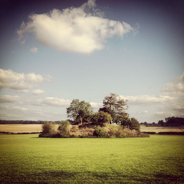
The great barrow has had some serious clearence work done on it. 3/9/12
Image credit: texlahoma
The great barrow has had some serious clearence work done on it. 3/9/12

August 2011

Strange that this was allowed to survive. Looking at an aerial map it’s evident that the area was festooned with barrows at one time, but with the exception of this beauty they’ve almost all been ploughed out.

June 2008

taken 22/4/07


We stood on top of the henge to admire the surrounding beauty, and of course, the Great Barrow. The size of this undisturbed treasure is large from a distance, and we were sorely tempted to get closer, if it had not been for the barbed wire and electric fence surrounding the field.

South-east of Knowlton Henge is this huge overgrown barrow with trees on it. It is said to have a double ditch around it (not visisble)
When visiting Knowlton Henge the barrow is unmissable.
It is in a private field next to the henge (full of sheep at the time) and does not have a public right of way to it. The field is overlooked by a farm house who I assume own the field?
If you want to access the field for a closer look it is easy over a low metal fence.
I chose to view from the henge as there didn’t seem much to gain from getting closer – other than perhaps an upset farmer?
The barrow is large but totally overgrown with several large trees and many bushes.
I would imagine climbing to the top of it would be tricky.
Details of barrow on Pastscape
A large round barrow or mound, part of a major monument complex at Knowlton and of probable Late Neolithic or Early Bronze Age date. Described in the RCHME Dorset Inventory as comprising a mound 135 feet in diameter and 21 feet high, surrounded by two concentric ditches, both largely levelled by ploughing. The inner ditch is separated from the base of the mound by a berm circa 15 feet across. The outer ditch is around 400 feet in diameter and about 35 feet wide. The air photo published by RCHME appears to show a distinct entrance causeway through the outer ditch on the northeast, althuogh the transcription shows it as a continuous feature. A pipe trench cut in July 1958 ran in a southwest-northeast direction, passing southeast of the mound but cutting across the outer ditch in two places. The pipe trench was fairly shallow in relation to the ditch, so a trial trench was excavated beside the pipe trench at the point where the latter crossed the south-southwest part of the barrow ditch. Constraints of time and space appear to have prevented a complete section being excavated. However, the ditch was shown to be 5.5 feet deep below the modern ground surface, and to be flat-bottomed. A sequence of fills was described briefly by the excavator. No artefacts were recovered. The barrow has been mapped from aerial photographs by EH’s Knowlton Circles Project.
In his book The Silbury Treasure Michael Dames identifies the Great Barrow as a possible Harvest Hill (like Silbury but smaller) because of it’s size and proximity to Knowlton Henge:
Knowlton itself is 20 feet high, and surrounded by two concentric ditches (the outermost being 354 feet in diameter and 34 feet across)... The majestic scale of the edifice disqualifies it as a Bronze Age barrow, and since Neolithic barrows in Dorset are long, not round, a harvest hill function is a reasonable provisional attribute. Thus, though the Knowlton mound is called the Great Barrow, it is not at all likely to contain a burial except perhaps as a secondary internment, inserted at a later age.


