Image Credit: Environment Agency copyright and/or database right 2015.
Image credit: Open Source Environment Agency LIDAR
Image Credit: Environment Agency copyright and/or database right 2015.

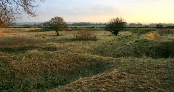
South section.

South section.

South section.
As Grrr notes this is all occupied by a very smart stud farm but a footpath skirts the N side and views of the ramparts can be seen from here. Following the side road signposted to the church, much better views can be had of the S side.
Disabled: Parking might be possible at the stud farm (Please ask) and part of the N part is circled by a flat path with wide views to the N. To the S, parking is possible where the road branches to the church (is this area private?) but the road is steep.
I parked next to the post box and wandered up to this one via the entrance to the Manor.
The banks are impressively high and steep, but pretty heavily wooded, so it’s not really possible to walk right around the top of the bank (I gave up when I slid down the ditch for the second time while trying to swing round a tree using a branch which wasn’t attached to anything).
The bank now surrounds a stud farm, and was a bit lacking in atmosphere. Nice horses, though.
Pevsner/Lloyd (Hampshire & the Isle of Wight) mention that in the 1960s, an excavation near the N defences found the plan of a circular wooden house 25ft in diameter. Pottery dated it to Iron Age B cultures. The site was occupied in the Mesolithic and Roman periods.
Two large ramparts and outer ditches with a counterscarp on the northern half. The fort covers about 16 acres and is Iron Age in date.