
Open Source Environment agency LIDAR
Image credit: © Environment Agency copyright and/or database right 2015.
Open Source Environment agency LIDAR


18/1/12

The road as it cut’s through the inner bank of Buzbury Rings

18/1/12

18/1/12

25/11/2007

25/11/2007

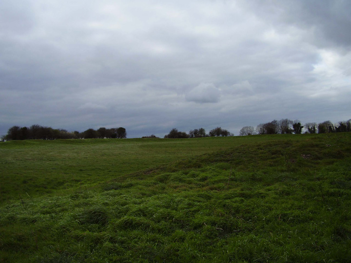
The northeastern bank.

These humps and bumps look like the entrance to the fort.

The southern bank.
The south west corner with the north bank in the foreground.

The southeast corner from the road.
A very misty morning certainly helps to add atmosphere to any site. Having said that I found Buzbury Rings to contain an incredible amount of atmosphere even after the mist had lifted, revealing views for miles in most directions, apart from looking North West where the line of trees obscure any view towards where Blandford Forum sits today.
The banks here are very shallow to be defensive, especially when compared to the nearby Badbury Rings, although if you imagine away the road, the golf club across the road and the fences surrounding the site, this is a high point in the landscape. If you travel from Blandford this in the highest point so far after leaving the town, climbing all the way. Heading in the same direction toward Wimborne Minster you will dip right down immediately after Buzbury Rings before ascending again towards the grander spectacle of Badbury Rings. The road being modern itself of course, so maybe this is still based on a modern viewpoint. Interesting though.
Another interesting feature here is the combination of a large outer bank followed by a second smaller bank, a ditch and then the inner bank to the central enclosure. Useful for keeping animals within perhaps but it does feel create a unique sense of space in this landscape.
These days it is left to the Birds, Badgers, Rabbits, Hares and judging from the litter in the lay by other human visitors, exploring this site.
Although Buzbury Rings is definitely less immediately spectacular than Badbury Rings, what Badbury Rings has in grandeur and scale, Buzbury rings has in it’s lack of sign posts, car parks, and a true sense of mystery alive and well.
I visited this site again today, the more I look at it the less convinced I am about it being a hillfort. For one thing it’s not on much of a hill, I know that doesn’t rule it out, but it would be very unusual in Dorset. Also the banks look far too insubstantial for defensive use. I don’t see any reason why it shouldn’t have been an enclosure for animals, this is an area of very good grazing for livestock. I’m more than happy to be wrong about this but, as Moss says it is unique in the Wessex area.
Am not sure about “...a secure area for animals and people...“! These ditches and banks were never big enough to even be secure. This coupled with its topographic sitting (with very little of the surrounding landscape visable) it is hard to believe that this monument had anything to do with the inhabitants feeling secure defensively or in any other way!
The neolithic causewayed enclosure theory i believe to be sound and its continued use into later periods is also plausable. However as for the interior housing “...elaborate structures dating from c.1000 b.c.e...” well this is just speculation! The interior does house a very large amount of pits and post holes, but so many that no definite conclusion as to their nature or date can be assertained at this time. However study of this monument is continuing and further details as to its nature will be released in due course.
According to Nicholas Thomas – A Guide to Prehistoric England, this is a hill-slope fort and boundary ditch. He goes on to say that it is interesting because it is the only example in Wessex of this type. He also says its less defensive more to do with the herding of cattle, similar to ones found in Cornwall, Devon and South Wales. Date approximately 2nd-1st Century bc.
Two main earthworks – outer one, kidney shaped enclosing 12 acres, and an inner one roughly circular, but not concentric with the outer one, 2.1/2 acres.
A series of ditches radiate out from the Rings, could be late B/A but more likely iron age, being a ‘celtic’ field system, apparently the west ditch is probably the track down to the river for watering the cattle presumably...
More a secure area for animals and people, this is not a major defensive structure. It is very strongly believed to have originally been a neolithic causwayed enclosure, added to over a considerable period of time. Fairly elaborate structures dating from c.1000 b.c.e have been seen in a large geophysical survey of the site. The ancient track from Badbury rings was “romanised” and Buzbury was occupied during the roman period. It is now clipped on its northern edge by a modern road and is part of a golf course, it can be clearly seen from the road. I’m not sure about access, but will try and find out as I want to visit the site properly and not just look at it from my car window, hopefully more information will follow soon including some photos.


