Captain’s Bridge (Drummochreen) SE Dun viewed from Captain’s Bridge.
Image credit: Mark Johnstone
Captain’s Bridge (Drummochreen) SE Dun viewed from Captain’s Bridge.

Captain’s Bridge (Drummochreen) SE Dun viewed from S.

N Flank of Captain’s Bridge (Drummochreen) SE Dun.

E Flank of Captain’s Bridge (Drummochreen) SE Dun.

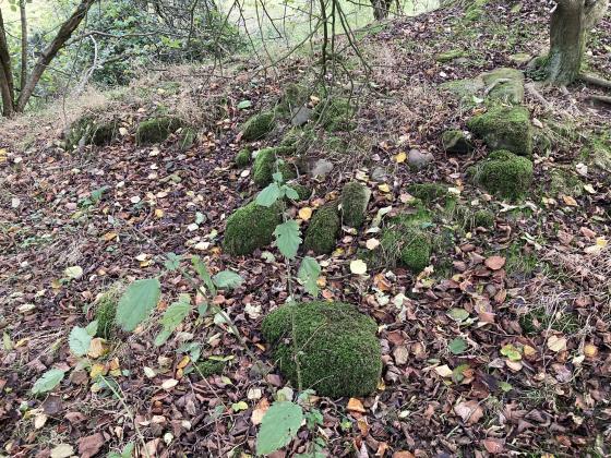
S Flank of Captain’s Bridge (Drummochreen) SE Dun.

Possible Entrance in NW Flank of Captain’s Bridge (Drummochreen) SE Dun.

Enclosure of Captain’s Bridge (Drummochreen) SE Dun viewed from SW.

Summit of Captain’s Bridge (Drummochreen) SE Dun on W End of Enclosure.
Directions to Captain’s Bridge (Drummochreen) SE: Take the B741 Dailly road off the A77, N of Girvan. After c. 5 miles stay straight on for Maybole at the Dailly junction. Continue towards Maybole for c. 1.7 miles to a farm junction on the left. Park up and walk c. 150 yards SW round the corner to Captain’s Bridge (Drummochreen) SE on the S end of the bridge.
Visited 02.05.23
Captain’s Bridge (Drummochreen) SE Dun is located c. 20 yards SE of Captain’s Bridge on the B741, c. 4 miles S of Maybole in South Ayrshire.
The small dun which reaches up to 20 feet high on the W end has steep defensive sides on the N and E flanks. The S and W flanks provide possible access to the SW-NE sloping summit plateau. It has been populated by mature trees making measurement difficult. Canmore ID 40868 quotes the internal dimensions of Captain’s Bridge (Drummochreen) SE Dun as “11 m by at least 8m”. There are no significant stones visible on the summit plateau.
Captain’s Bridge (Drummochreen) SE on Google Maps