Image credit: http://www.british-history.ac.uk/rchme/dorset/vol4/pp52-55
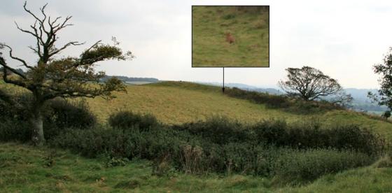
(15) Iron Age Settlement (891097), on Pimperne Down, excavated in 1960–3 by I. M. Blake and D. W. Harding, lies about 350 ft. above O.D. on a gentle S.E. slope near the summit of a N.—S. Chalk ridge. (fn. 1) The settlement comprises an oval, univallate enclosure of 11½ acres, bisected by the PimperneStourpaine road and for the greater part visible only on air photographs. Until recently the N.E. sector survived unploughed and it was there that excavations were largely concentrated. ‘Celtic’ fields (Group (73)) adjoin the enclosure on the N.E. and a smaller enclosure (16) lies immediately S. of it. The excavations indicate early Iron Age occupation, with Second or late First ‘A’ culture. The bank survived to a height of 1 ft. to 1½ ft. in the N.E. sector. The ditch was initially of shallow ‘V’ profile, becoming steeper towards a narrow, flat bottom, and reaching a depth of 5 ft. to 6 ft. below present ground level.
Two entrances to the enclosure were demonstrated. Excavation of the E. entrance revealed a parallel line of post-holes, 8 ft. apart, which extended a little over 20 ft. into the interior of the camp from the causeway between the ditch terminals. Recutting of the post-holes indicated that the entrance passageway had been reinforced or rebuilt in a second phase of construction. The ditch on both sides of the entrance was flat-bottomed, with nearly vertical sides, but on the southern side of the gateway a rubbish pit, into which quantities of animal bones had been thrown, had been cut into the ditch after its initial silting. N. of the entrance the ditch had been refilled shortly after construction, and it had been sealed by a closely-packed flint capping beneath which was found a human femur and the right half of a human skull.
Excavation of the S. entrance revealed three post-holes spanning the entrance causeway, one of them of adequate size for a post to sustain a gate. The ditch system of the S. entrance was more complex than that on the E. The main enclosure ditch on the S.W. side of the causeway was intersected by a shallower ditch which led outwards from the camp to a secondary enclosure (16) on the S.E. This ‘antenna’ ditch was not of defensive proportions and more probably served to guide cattle into the camp from the secondary enclosure. At least three major structural phases were represented. Within the butt end of the main enclosure ditch, adjacent to its intersection with the ‘antenna’ ditch, were found the semi-articulated remains of part of a horse and the skull of an ox, together with two small rectangular chalk lamps. Taken in conjunction with human remains at the E. entrance, there are grounds for supposing that these were deliberate deposits, chosen with regard to the respective functions of each entrance.
The existence of an entrance on the N. side of the camp was indicated in 1963 by magnetometer survey, but no excavations took place in this area.
Inside the settlement the principal discovery was the remains of a circular timber house (Plate 55). It consisted essentially of two concentric circles of post-holes. The inner circle, 32 ft. in diameter, must have been for the main supports of the roof since there was no central post-hole or group of holes. The outer circle, 42 ft. in diameter, was composed of smaller stakeholes cut not more than 9 ins. into the chalk; it probably retained a wall of woven saplings. A larger and less continuous circle of shallow scoops and irregular holes may have held external supports for the walls and roof rafters.
Occupation was clearly in two principal phases, in the second of which the house was completely rebuilt, although the same porched entrance served both phases. A baked clay hearth was located within the house, together with a number of shallow post-holes, the latter probably associated with domestic appliances such as looms or drying racks.
Small finds included a bronze finger-ring, two iron arrow-heads and several fragments of shale bracelets. Pottery included coarse-ware shouldered jars with finger-tip ornament and some haematite-coated bowls. The occupation of the site should most probably be assigned to the 5th century B.C., but insufficient stratified material was available to supply a satisfactory chronology of the structural phases represented.
Details of Settlement on Pastscape
An irregular univallate oval enclosure at Pimperne, partly excavated in 1960-63. Located on a gentle southeast-facing slope near the summit of a chalk ridge, the enclosure is circa 11.5 acres in extent. At the time of excavation, the northeastern sector of the enclosing bank and ditch was still extant as (plough-damaged) earthworks. The site has since been levelled by the plough and survives only as cropmarks. A second, smaller enclosure lies immediately to the south (ST 80 NE 32), and the two appear to be linked by a linear ditch. “Celtic” fields (ST 81 SE 34) extend northeast along the slope from the main enclosure, and appear to be connected with it. Excavations were small scale, but confirmed the presence of an enclosing ditch with internal bank. Evidence for revetment of the bank was poor, with the exception of the area around the eastern gateway. The eaastern entrance was marked by inturned bank terminals accompanied by parallel lines of postholes. The northern ditch terminal contained a human femur and part of a skull beneath a layer of flint nodules. The southern terminal featured an extensive midden deposit which also included some human remains. A northern entrance was suggested by geophysical survey, but is not supported by cropmark or earlier earthwork evidence. A southern entrance was confirmed by excavation. One of the ditch terminals featured deliberate backfill containing horse and ox bones, among other items. A linear ditch headed south from this entrance to the smaller enclosure ST 80 NE 32. Inside the main enclosure was a substantial roundhouse. 2 phases of construction were evident, each comprising 2 concentric circles of postholes with a southeast-facing entrance. A reconstruction was built at Butser Ancient Farm. Pottery and radiocarbon dates suggest a date circa 800-400 BC for occupation of the site. A dewpond in the enclosure contained Iron Age potsherds but is effectively undated.