The remains of Dunan an Aisilidh standing on top of a 15 metre crag at the tip of the Braes peninsula.
Image credit: Les Hamilton
The remains of Dunan an Aisilidh standing on top of a 15 metre crag at the tip of the Braes peninsula.

The probable entranceway into the dun.

Approaching the dun from the south.

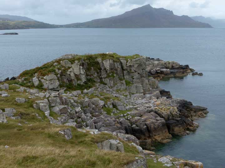
Looking north over the ruins of Dunan an Aislidh and towards Beinn Tianavaig.

Panoramic view of Dunan an Aisilidh from the north.
Visited: September 1, 2014
Somewhat more remote than most duns, Dunan an Aisilidh is nevertheless easy of access. Situated right at the northern tip of the Braes peninsula, a few kilometres south of Portree on Skye, you can make your way there by a pleasant walk of about 2 kilometres from the community of The Braes, following the coastline round Balmeanach Bay, then walking above cliffs northwards (past a natural arch and a sea stack) as you make your way up the eastern coast of the peninsula.
As you near your goal, the cliffs decrease almost to sea level before one final rise to the 15 metre high crag bearing Dunan an Aisilidh. Carnmore lists this galleried dun as a possible semibroch, but there is little more to see now than some foundation walling and a pile of fallen masonry on its western flank.
Nevertheless, with Ben Tianavaig to its North and the Black Cuillin to the south, it is a great outlook point on some magnificent scenery.
This map indicates the general direction of your route.


