13/04/2019 – Last site of a long day out.
13/04/2019 – Last site of a long day out.

The possible front door on the east with the traces of an outer rampart.

Looking north east towards the Beauly Firth.

Hints of rampart on the southern side.

North west section looking towards Beauly, The River Beauly and Wyvis.

West section of the fort.

The north east part of the fort looking towards the Beauly Firth.

The walk between Spynie and Phoineas could described as difficult also included : fences, steep climbs, a maze of paths, mud etc etc. Conditions between Phoineas and Cabrich (or Dun Mor) are quite a bit easier as we swung north west and then east eventually finding a path which we thought would make things easier. It did until we ran out of path on the last section, a steep climb containing a tree that stole my rucksack. Once at the top easy enough, keep going east and the fort is reached.
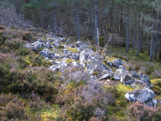
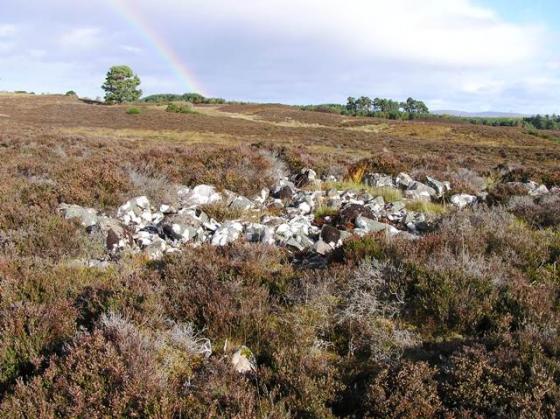
The fort was built in two sections described by Canmore as a ‘citadel’ on the south west crags and a ‘bailey’ on the the flatter eastern side. There are remnants of a rampart swinging from the east to the south. Paths in the north east mark the entrance to the site.
A great way to end a superb day hiking around the Beauly area. We ended by looking over to were we’d started at Redcastle’s crannog, a stunning view of the Beauly Firth, also stunning was the scenery around Ben Wyvis.
Take me to the ice cream shop :-)
Visited 13/4/2019.