This is the view of Dun Ela from the coastal car park.
Image credit: Les Hamilton
This is the view of Dun Ela from the coastal car park.

Dun Ela lies right on the shore of the Sound of Sleat.

Daunting cliffs defend the prow of Dun Ela.

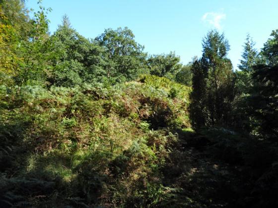
The tree-clad summit of Dun Ela.

Dun Ela from the north, illustrating its amazingly vegetated summit.

There is a small amount of remnant masonry at the neck of the ridge that leads up to the site of Dun Ela.
Visited: September 9, 2015
I am mystified reading Carl’s fieldnotes: I cannot imagine an easier site to visit. Perhaps he mistook where he was. There are neither trees nor cliffs to trouble the visitor.
From the coastal car park (at NG646057) about 800 metres past Ostaig House, simply descend to the beach and follow the coastline (a sandy beach in the main) northwards for about 400 metres. Dun Ela is obvious as a small, rugged headland from the moment you step out of your vehicle. If the stream proves an obstacle, walk up the road past the bridge before descending to the beach.
The 8 metre tall dun, which stands right on the shore about 400 metres SSW of Ostaig House, is a flat-topped rock, broadest nearest the sea where the actual dun was located, and which tapers into a narrow ridge towards the shore. On my visit it was a very low tide, and the dun was surrounded by seaweed covered shingle. Clearly, at high tide, it is surrounded by the sea.
As to the site of the dun, little can be said because it is thickly clothed in vegetation, including a number of semi-mature trees: no significant detail can be discerned. But it would clearly have been an ideal defensive location, surrounded by cliffs on all sides and with only the narrow neck of the ridge to defend.
‘A view from the roadside’ 31.7.13
Spotted this Dun on the O/S map and as we were heading down the A851 to catch the ferry at Armadale I thought it was worth a quick look. We pulled in a convenient lay-by.
I had intended to try to actually visit the site but it immediately became apparent that it would take quite a time to battle through the trees to attempt this – if indeed it was possible at all? There is no public right of way to the Dun.
From the beach it would be impossible unless you happen to be Spider-Man.
The cliffs are vertical and high. The site itself didn’t look to be that big so I guess that over the years the promontory has been eroded by the sea and when first built the site would have been a lot bigger?
Canmore description:
On the shore about 400 yards SSW of Ostaig House is a flat-topped rock tapering away towards the land in a gradually narrowing ridge and rising abruptly some 25ft above the strand. The summit it occupied by the remains of a Dun Ila, a small fort of quadrilateral shape, measuring internally some 46ft NW-SE and 31ft across the widest part, which is next the sea. The remains of its wall, built on the edge of the rock, are traceable all around except on the NE flank. The best preserved parts are towards the land to the NW, where it shows a breadth of 9ft and a height of 4ft 6ins above the interior, and at the W corner, where it is 3ft 6ins high.