
mall platform area on the west side of the fort.
Image credit: drew/amj
mall platform area on the west side of the fort.

The north west defences.

From the front door in the south.

North west internal wall.

South wall looking east.
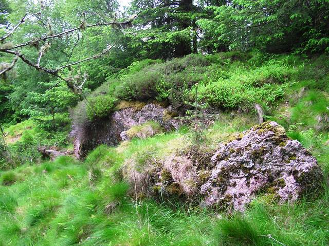
Rocky defences in the north.

Internal wall south west side.

North west rampart.

East side looking north.

Ditch/rampart on the western side.

The defence on the eastern side.

East looking west.

East side.

Enclosure/internal wall.

Wall, ditch and rampart.

North east rampart.

The fort was situated amongst these trees, the rocky outcrop is further east. Part of the northern rampart can be seen.
This story comes from the Press and Journal’s Alistair Beaton, whose sub heading was :
Archaeologists uncover Aberdeenshire’s hidden history on the slopes of Bennachie.
There might have been a settlement, here, for over 9000 years.
The rest of the story is found on :
I joined an archaeological dig close to here which has been investigating another site with possible usage back to the neolithic. In time I’ll log that but perhaps it’s best kept unmentioned for now since the dig is ongoing – happy to share details privately.
Afterwards I decided go for a walk on the hill and “discovered” the maiden castle [hahaha] whilst checking out the graveyard structure which is basically next to it. The wall of that can now easily be seen from the footpath since the (plantation) trees have been chopped down. If you make your way over the logging destruction, then you’ll see the “castle” behind it marked by a ring of mighty beech trees. I guess it was a dun which has been looted over time?
Maiden’s Castle is a great location, was cool to stumble across it. The mysteries of Bennachie are plentiful!]
” Apart from evidence of non-ferrous metalworking, a piece of early medieval decorated glass and a glass bead, there are three radiocarbon dates from contexts below and above the inner rampart, and beneath the wall of the circular internal building, all of them falling in the range of AD 410-640. ” -hillforts.arch.ox.ac.uk/records/SC2962.html
Go to the Rowan Tree car park near the Chapel Of Garioch and the Maiden Stone, look left when entering. Walk through the quarry following the fairly steep track. This will lead straight to the fort. On the way some seriously large rocks would have hopefully been used to help with the defences.
The fort is almost 40 meters wide and has a later built enclosure/roundhouse inside. A ditch and rampart surround the site with much robbed walls still visible. Entrance to the fort was from the south.
Nearby is small grave yard probably connected to the nearby Pittrodie House.
Mither Tap is obviously more famous but this is a fine site well worth a visit.
Visited 9/08/09.
Re-visited 1/6/2017
All of their finds at this site.


