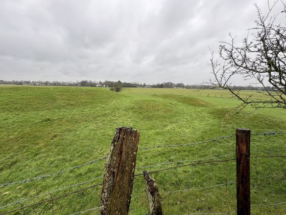
Possibly a small bronze age barrow.
Image credit: ryaner

Possibly a small bronze age barrow.

Much more overgrown than 19 years ago.

Marked as a mound on the map, this looks to be a small, oval barrow, about 15 metres on the longer axis and roughly 2 metres high.
Lismahon mound, or barrow if you like, is 100 metres in off the Ballymaglassan road that runs south-west out of Batterstown. It’s not much but it’s on a mate’s uncle’s land and I’ve been meaning to check it out for a while.
I’d been here before, 19 years ago, and hadn’t bothered getting into the field. At the junction of a couple of drains, nowadays it’s completely overgrown and difficult to interpret. It has been mentioned that it could be spoil from the digging of the drains, but the landowner, Mattie Nolan, refers to it as a moat (motte? or mound?) and I’d prefer to go with his interpretation. That said, it is only with excavation that its provenance could be realised.
From the SMR at archaeology.ie, updated November, 2021:
Situated on a level landscape and just N of where three old field drains meet. A small circular feature described as ‘Lismahon Moat’ is depicted on the 1836 edition of the OS 6-inch map and it is described similarly on the 1908 edition. This is an oval, flat-topped and grass-covered mound (dims of base 16m E-W; 9m N-S; dims of top 6.5m E-W; 1.5m; H 1.6m at E to 2.2m at W) at the S corner of a field with large silted drains just to the E and W.