
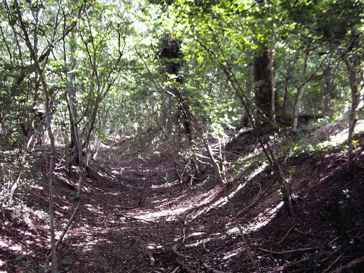
The southern ditch and bank.
Image credit: Mike Rowland 11/09/2007.
The southern ditch and bank.

The north east corner.

The interior of the northern rampart.

The north western bank and outer ditch.

This is where the western rampart and ditch fades out.
The east outer ditch and inner rampart looking south.
A small round univallate hillfort in woodland to the north of Sixpenny Handley. This is little known and I suspect little visited, it’s in dense deciduous woodland. The tree roots are damaging the banks and a large amount of badger setts aren’t helping either.
This fort is only about three quarters complete and appears to be unfinished originally. The missing ditch and rampart is mostly on the west side. On this side the ditch can be seen as a series of round pits, lessening in depth as they move south. It looks like the spoil from these holes would have been thrown up to make the rampart, which peters out at this point also. This looks like Ladle hill in Hampshire but only in it’s partial incompleteness on the west side.
Although quite remote it is easy to visit as it is next to an R.S.P.B. nature reserve with a good car park and is well served with footpaths. There are many other sites of interest very close to this site.
Details of site on Pastscape
An earthwork enclosure in Mistleberry Wood, immediately adjacent to the Wiltshire border. Described by RCHME as an unfinished hillfort, it occupies a less than ideal defensive location on the southern slope of a spur, overlooked by higher ground to the northeast. The enclosing earthworks consist of a bank with external ditch. Assuming that a complete enclosure was the intention, the eastern half is more or less complete, with a southeast facing entrance gap. On the northwest, the bank gradually reduces in height, while the ditch becomes a series of shallow pits. No earthworks are evident in the southwest quadrant (this area may, of course, have been enclosed by some other, non-earthwork, means). At its maximum extent, the bank is 24 feet wide and 4 feet high. The ditch is also a maximum of circa 24 feet wide. If complete, the earthworks would enclose an area of circa 2 acres. The site is probably to be identified with Mealeburg, which is mentioned in a charter of 956 AD. Otherwise there is no dating evidence, although an Iron Age date is commonly assumed.


