Details of Settlement Site on Pastscape
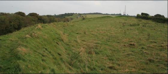
(15) Enclosure (948095), probably Iron Age or Romano-British, lies 500yds, E of Launceston Farm on the S.W. slope of a chalk spur, between 250 ft and 275 ft above O.D., overlooking the Tarrant valley. The site, revealed by a soil-mark on air photographs (C.U.A.P., ANC 75, AQY 90), is an almost circular enclosure, about 500 ft in diameter, defined by a narrow ditch. There are traces of an entrance on the N. side, and of a ditch running N.W. in a curve for some 500 ft. from just E. of the entrance. Faint traces of a ditched feature are found inside the enclosure, and there is evidence of a smaller angular enclosure attached to the exterior on the S.E. (1) Tarrant Launceston 15. Subcircular enclosure, area 3ha. [Plans of comparable sites]. (2-3)
The curvilinear enclosure referred to above (1-3) is visible as cropmarks on aerial photographs taken in 2006, which show a number of probable causeways between the irregular ditch sections that define the curvilinear enclosure, suggesting that the site is possibly a Neolithic causewayed enclosure. (4)
The later Prehistoric settlement site referred to above (1-4) is visible as soilmarks and cropmarks on aerial photographs, including source 4. The oval enclosure is centred at ST 9481 0950 and comprises an arrangement of short sinuous ditches and pits which combine to form a single circuit defining an oval enclosure. The enclosure measures 183m long by 172m at its widest points and is orientated roughly WSW / ENE. It sits between the 70m and 80m contours on the south-western slope of a chalk spur overlooking the Tarrant Valley. TL15’s morphology and topographic setting argue strongly for the site?s re-interpretation as a Neolithic causewayed enclosure (for example, see Robin Hoods Ball SU 14 NW 3 / UID: 218882). The site is visible as a soilmark on aerial photographs taken in 1946, which indicates that the site has been ploughed for at least 60 years and that any sub-surface features may therefore be severely truncated. (5)