Showing 1-10 of 408 posts. Most recent first | Next 10  
|
 Posted by spencer
2nd January 2024ce
|
|
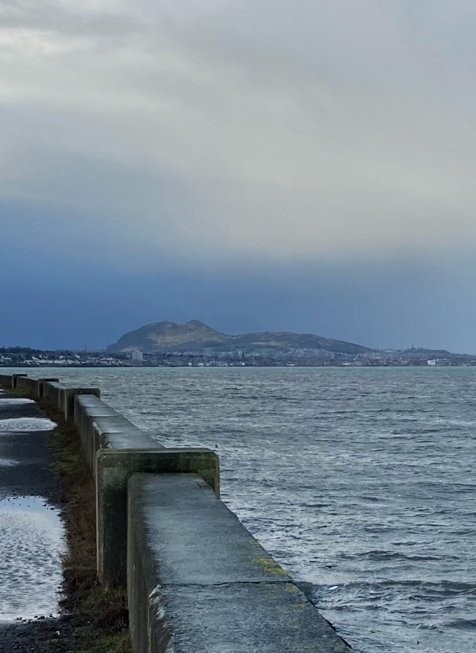
Direction to Caerketton Hill Cairn: I parked at NT 24954 66968, a car park at the Hillend Ski Centre junction with the A702 on the S edge of Edinburgh. A path leading W starts here, before it turns to the SW. This path leads up to an elevated ridge which commands impressive views of Edinburgh. Caerketton Fort and Cairn are accessed by this moderately steep route. My route can be viewed on Caerketton Hill Cairn.
|
Posted by markj99
26th November 2023ce
|
I'm glad HornbyPorky's fieldnotes say the graffiti is gone. I thought I'd add this to show the indignities have been going on for a while. I hope when McDonalds crumbles these stones will still be here.
On Saturday, the Greater Edinburgh Club, under the leadership of Mr Sterling Craig, visited "Edinburgh's Stonehenge," a group of four large stones at Lochend, opposite the point where the new Glasgow road branches off the old road to Broxburn. For 4000 years these megaliths have stood like the peak of a submerged mountain rising out of the ocean of prehistoric darkness, but testifying to the existence of a lost continent.
Local tradition says that there was originally an avenue of standing stones, 350 yards long, crossed by a shorter double row of megaliths about 80 yards from its western end. A Bronze Age burial ground, 30 yards in diameter, of much later date, has been erected in the northern part of the crossing. The eastmost megalith is eleven feet high and three to four feet broad, and the others are about six feet in height, standing at the souther, western, and northern extremities of the crossing avenues.
The unity of the monument is now difficult to recognise, because it is broken by a deep railway cutting and a wide road. The terminal megalith (now in a piggery) is obscured from the rest by a large advertisement hoarding, but it undoubtedly belongs to the same period as Stonehenge and was erected by the same fogotten race.
In The Scotsman, 23rd May 1938.
|
 Posted by Rhiannon
31st May 2023ce
|
    
|
Posted by markj99
25th April 2023ce
|
Visited 21.04.23
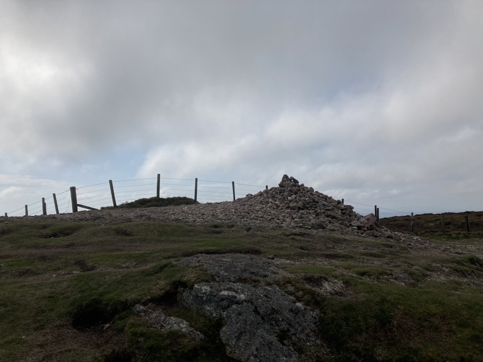
There is a stony footprint of a cairn on the summit of Caerketton Hill, c. 0.5 mile SW of Hillend Ski Centre in Midlothian. The round cairn, which measures c. 50 feet in diameter, has been razed to ground level on all but the S Arc. A fence running E-W bisects the S half of the cairn, leaving a perimeter of original cairn stones c. 6 feet wide on the S Arc. A modern cairn, c. 3 feet high, has been constructed in the centre of the cairn. Caerketton Hill Cairn has panoramic views in all directions due to it's elevated location, c. 480m above Sea Level.
Canmore ID 51764 has details of surveys of Caerketton Hill Cairn in 1928 and 1969.
|
Posted by markj99
25th April 2023ce
|
Visited 21.04.23
Galachlaw Cairn is a sub-circular mound in woodland on the S edge of a housing estate in Fairmilehead on the S fringe of Edinburgh. The cairn, which measures c. 45 feet in diameter and 5 feet high, has been almost entirely robbed of stone, leaving several putative kerb stones on the S Arc, as noted in Canmore ID 51710. The largest stone measures c. 1.5 x 1 x 0.5 feet. An eroded path crosses the centre of the cairn on an E-W Axis. There is a significant excavated hollow in the N half of the cairn. Galachlaw Cairn would have had a 360° vista previous to afforestation and urban development.
Galachlaw Cairn on Google Maps
|
Posted by markj99
25th April 2023ce
|
Showing 1-10 of 408 posts. Most recent first | Next 10
|