The Modern Antiquarian
Log in
|
Register
Home
Latest Posts
Forums
Maps
Help
Browse Sites
News
Blog
Contributors
The Books
Select
-
Belgium
Denmark
Eire
France
Germany
Greece
Italy
The Netherlands
Norway
Portugal
Republic of Malta
Spain
Sweden
Switzerland
United Kingdom
Wales
Gwynedd
Harlech Standing Stones
Fonlief Hir Stone C
Standing Stone / Menhir
Fonlief Hir Stone C (Standing Stone / Menhir) on The Modern Antiquarian, the UK & Ireland's most popular megalithic community website. 19 images, 2 fieldnotes, plus information on many more ancient sites nearby and across the UK & Ireland.
Image © b
Nearest Town:
Porthmadog (8km NW)
OS Ref (GB):
SH60673203 /
Sheet: 124
Latitude:
52° 52' 2.37" N
Longitude:
4° 4' 12.41" W
Added by
Idwal
Images (19)
Fieldnotes (2)
0 discussions
Start a topic
Show |
Hide
Web searches for Fonlief Hir Stone C
Flickr
Google
Google Images
The Megalithic Portal
Bing
Stone Pages
Streetmap.co.uk
Wikipedia
Show map
(inline Google Map)
- Sites within 20 km -
-
Fonlief Hir Stone D (0.04km ENE) (16 posts)
Moel Goedog Stone 2 (0.2km NE) (12 posts)
Moel Goedog Stone 3 (0.25km ENE) (7 posts)
Moel Goedog Stone 1 (0.36km NE) (11 posts)
Fonlief Hir Stone E (0.51km SSW) (9 posts)
Moel Goedog West (0.52km NE) (28 posts)
Moel Goedog East (0.56km NE) (19 posts)
Moel Goedog (0.78km NE) (27 posts)
Moel-y-Sensigl (0.79km SW) (22 posts)
Harlech Circle (1.04km ESE) (40 posts)
Carreg (Llanfair) (1.36km SW) (17 posts)
Ffridd Fron, Y Rhinogydd (2.5km ENE) (15 posts)
Llanfair (3.75km SW) (1 post)
Gwern Einion stone (3.85km SSW) (6 posts)
Gwern Einion (3.95km SSW) (34 posts)
Llyn Eiddew-Bach SW (4.05km NE) (8 posts)
Llyn Eiddew-Bach (4.35km NE) (21 posts)
Llyn Eiddew-Bach NE (4.39km NE) (6 posts)
Moel y Geifr (4.54km NE) (6 posts)
Maes y Caerau (5.03km NE) (19 posts)
Y Gyrn (5.08km NE) (38 posts)
Bryn Cader Faner (5.25km NE) (98 posts)
Llyn Du, Y Rhinogydd (5.33km E) (4 posts)
Llanbedr Stones (5.56km SSW) (33 posts)
Llanbedr Church Stone (5.57km SSW) (17 posts)
Moel Ysgyfarnogod, Y Rhinogydd (5.76km ENE) (11 posts)
Rhinog Fawr, Y Rhinogydd (5.83km E) (19 posts)
Bron y Foel Isaf (7.43km SSE) (26 posts)
Cwm Moch (7.51km ENE) (7 posts)
Moelfre, Y Rhinogydd (7.69km SE) (23 posts)
Cairn, South of Ffridd Lwyd, Y Rhinogydd (7.97km ENE) (14 posts)
Waun Hir (8.03km SSE) (22 posts)
Cefn Clawdd Settlement, Y Rhinogydd (8.22km ENE) (8 posts)
Pont Scethin, Double cairn (8.46km SE) (6 posts)
Pont Scethin mounds (8.53km SE) (1 post)
Pont Scethin standing stones (8.56km SE) (21 posts)
Cist Cerrig (8.91km WNW) (21 posts)
Moel y Gest (8.92km WNW) (32 posts)
Craig y Dinas Cairnfield (8.95km SSE) (20 posts)
Cors y Gedol settlement (8.98km S) (2 posts)
Craig y Dinas (9.19km SSE) (37 posts)
Cors y Gedol (9.23km S) (34 posts)
Dyffryn Ardudwy (9.29km S) (72 posts)
Llecheiddior Cairns (10.01km SSE) (10 posts)
Fach-Goch (10.02km NW) (13 posts)
Maen Llwyd (Bronaber) (10.04km ENE) (10 posts)
Llawlech (10.1km SE) (8 posts)
Diffwys (Y Rhinogydd) (10.23km ESE) (14 posts)
Tyddyn y Felin (10.24km S) (3 posts)
Maen Twrog (10.29km NE) (16 posts)
Llecheiddior (10.33km SSE) (9 posts)
Ffridd Newydd (10.76km SSE) (10 posts)
Cwm Mawr (10.77km WNW) (1 post)
Cwm Mawr (10.89km WNW) (1 post)
Trefllys (11.11km WNW) (5 posts)
Pen y Dinas (Dyffryn Ardudwy) (11.12km SSE) (17 posts)
Caer-Dyni (11.4km W) (39 posts)
Carneddau Hengwm (11.54km SSE) (23 posts)
Egryn Abbey (11.63km SSE) (3 posts)
Hengwm Ring Cairn (11.76km SSE) (15 posts)
Pen-y-Stryda (11.86km E) (0 posts)
Criccieth (12.06km W) (8 posts)
Cefn Coch (Dolbenmaen) (12.14km NW) (0 posts)
Bwlch y Rhiwgyr (12.19km SSE) (10 posts)
Garth y Foel (12.38km N) (16 posts)
Bryn Castell (12.4km SE) (20 posts)
Llech Idris (12.42km E) (21 posts)
Mynydd Egryn (12.62km SSE) (15 posts)
Cerrig y Cledd (north) (12.63km SE) (8 posts)
Cerrig y Cledd (12.91km SE) (10 posts)
Cerrig Arthur (13.44km SSE) (44 posts)
Ffridd Isaf (13.6km NW) (11 posts)
Cwm Croesor (13.69km N) (6 posts)
Gorseddau (13.76km NW) (7 posts)
Pen-y-Gaer (Aberglaslyn) (13.85km NNW) (33 posts)
Llyn Stwlan, Moelwyns (13.88km NNE) (3 posts)
Mynydd Llanaber (13.9km SSE) (9 posts)
Cwm Ystradllwyn (14.12km NW) (8 posts)
Cwm Ystradllwyn (14.12km NW) (7 posts)
Aberglaslyn west, Cwm Cyd (14.19km NNW) (7 posts)
Castell Llanaber (14.19km SSE) (11 posts)
Ystumcegid (14.24km WNW) (40 posts)
Braich y Gornel (14.25km NW) (5 posts)
Plas Llyn (14.25km NW) (4 posts)
Bryniau'r Tyddyn (14.42km WNW) (6 posts)
Aberglaslyn West, Bwlch Golau (14.53km NNW) (6 posts)
Cefn Isaf (15.09km W) (30 posts)
Cefn Coch, Y Rhinogydd (15.14km ESE) (11 posts)
Moel Hebog (15.44km NW) (53 posts)
Dinas Oleu (16.27km SSE) (10 posts)
Bryn-y-Castell (16.29km NE) (19 posts)
Betws Fawr (16.53km W) (7 posts)
Moel yr Ogof (16.56km NW) (4 posts)
Kenric's Stone and Llanelltyd Church (16.66km ESE) (7 posts)
Llyn yr Adar (16.81km NNE) (8 posts)
Llyn Llagi (16.82km N) (4 posts)
Dinas (Beddgelert) (16.85km NNW) (14 posts)
Coed Dol-fawr (16.96km ESE) (2 posts)
Craig y Castell North (16.99km ESE) (15 posts)
Dinas Emrys (17.04km NNW) (37 posts)
Foel Faner (17.09km ESE) (26 posts)
Pentre Farm (17.2km ESE) (3 posts)
Gamallt (17.35km NE) (7 posts)
Coed Pen-y-Bryn (17.41km ESE) (0 posts)
Y Garnedd (Y Moelwynion) (17.45km NE) (13 posts)
Afon Prysor (Cairn to NW of) (17.51km ENE) (10 posts)
Cairn with kerb (17.76km ESE) (32 posts)
Cairn, upon a woodland saddle (17.86km ESE) (20 posts)
Pared-y-Cefn-Hir (17.88km SE) (57 posts)
Cairn, W of Waen Fechen (17.93km ESE) (5 posts)
Foel Offrwm (17.95km ESE) (45 posts)
Cairn, S.W of Woodland saddle (18.06km SE) (10 posts)
Cairn below Pared y Cefn hir (18.08km SE) (6 posts)
Foel Offrwm, Lower Settlement (18.11km ESE) (14 posts)
Plas Cregennen Stone (18.28km SE) (7 posts)
Craig y Castell (18.44km SE) (31 posts)
Arthog Standing Stones (18.67km SE) (36 posts)
Ffridd y Beudail (18.68km SE) (4 posts)
Morfa Abererch (18.92km W) (13 posts)
Carreg y Big (Arthog) (18.98km SE) (25 posts)
Waen Bant (19.25km SE) (16 posts)
Hafotty-Fach Stones (19.28km SE) (12 posts)
Hafotty-Fach Cairns (19.44km SE) (46 posts)
Mynydd Graig Goch (19.5km WNW) (16 posts)
Bron-llety-Ifan (19.56km SSE) (12 posts)
Garnedd Goch (19.89km NW) (16 posts)
Craig Cwm-Silyn (19.92km NW) (36 posts)
Carnedd Lwyd, Tyrrau Mawr (Cadair Idris) (19.99km SE) (51 posts)
- Add -
-
Add news
Add an image
Add fieldnotes
Add folklore
Add miscellaneous
Add a link
Add a nearby facility
Add an alternative name/spelling
Images
(click to view fullsize)
Add an image
Fieldnotes
Add fieldnotes
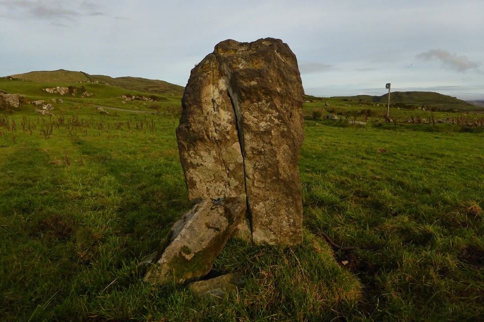
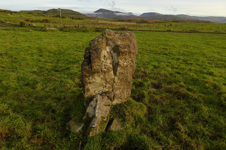
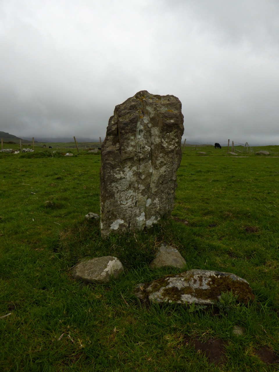
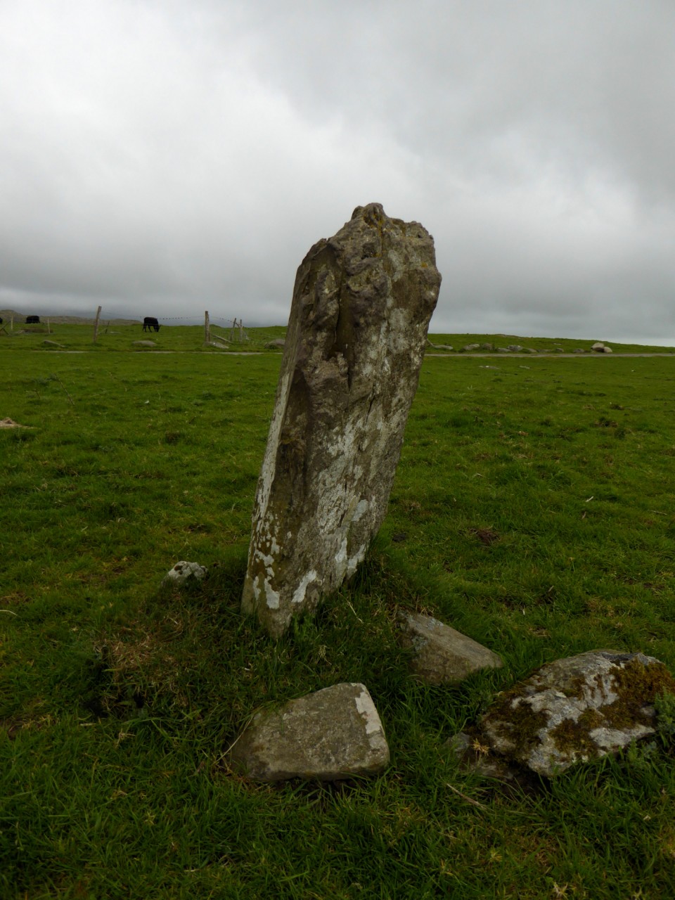
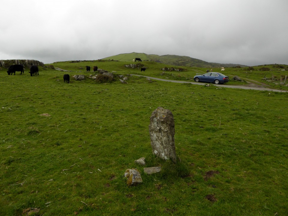
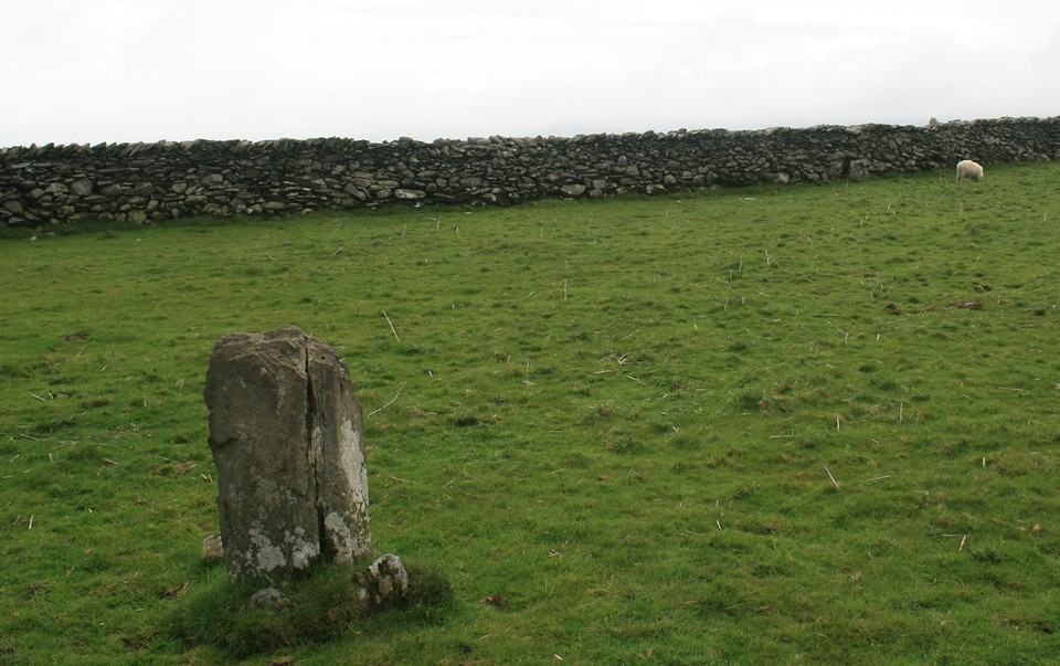
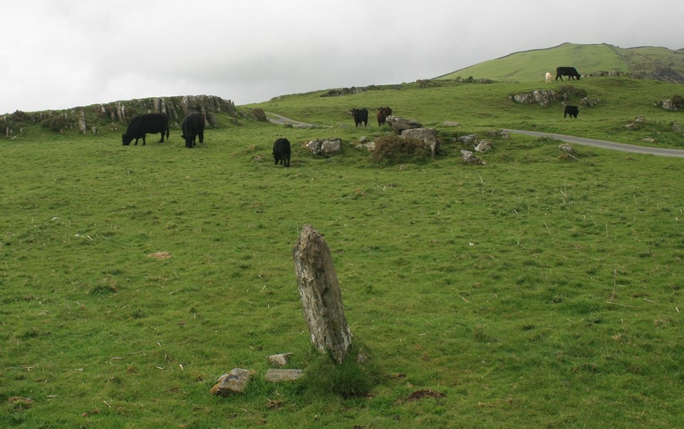
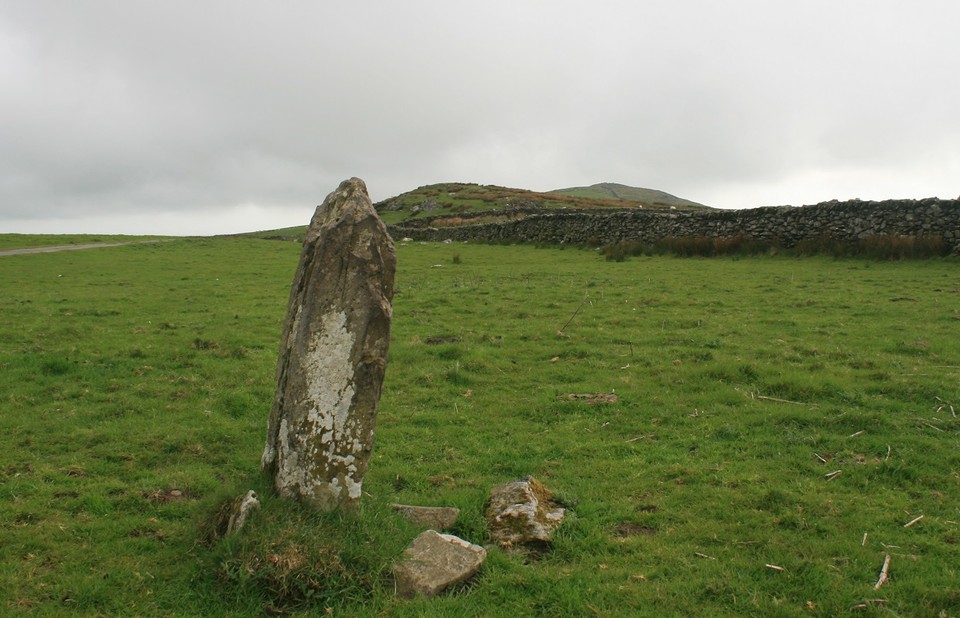
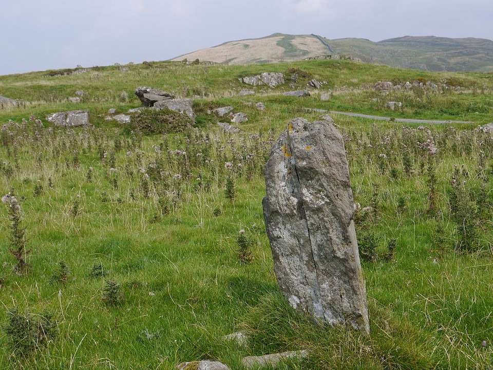
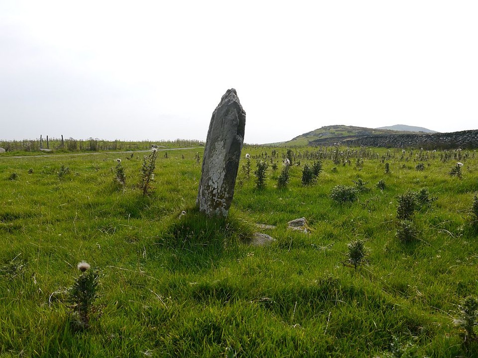
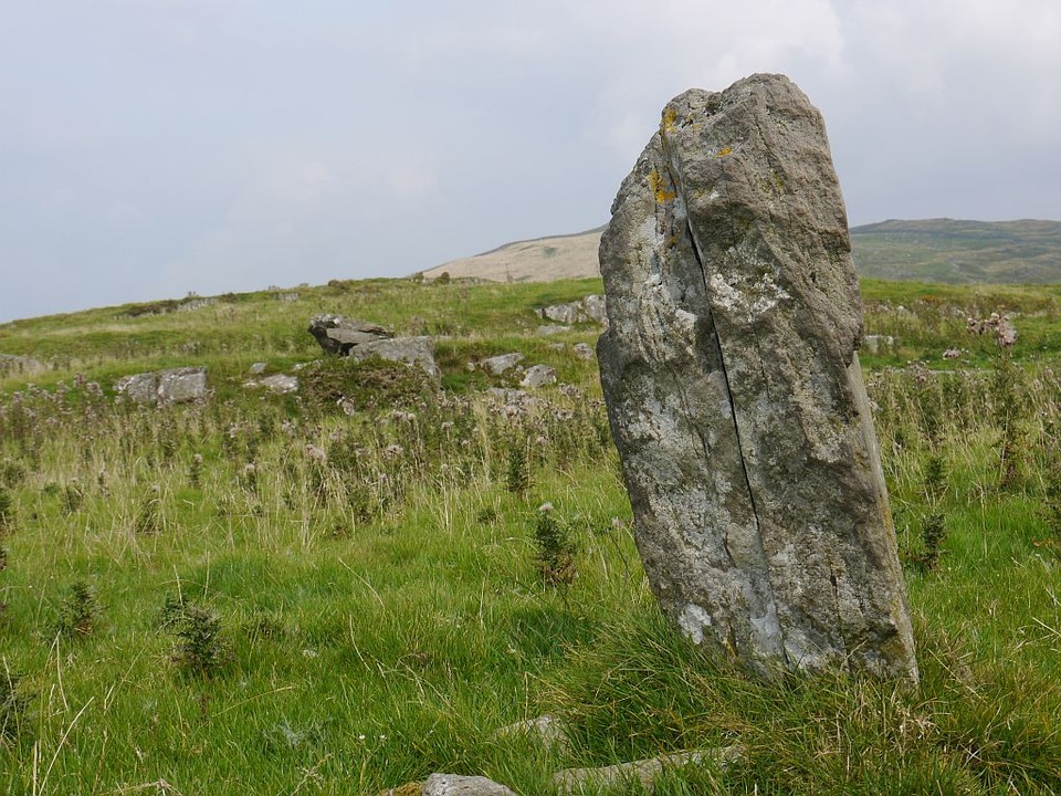
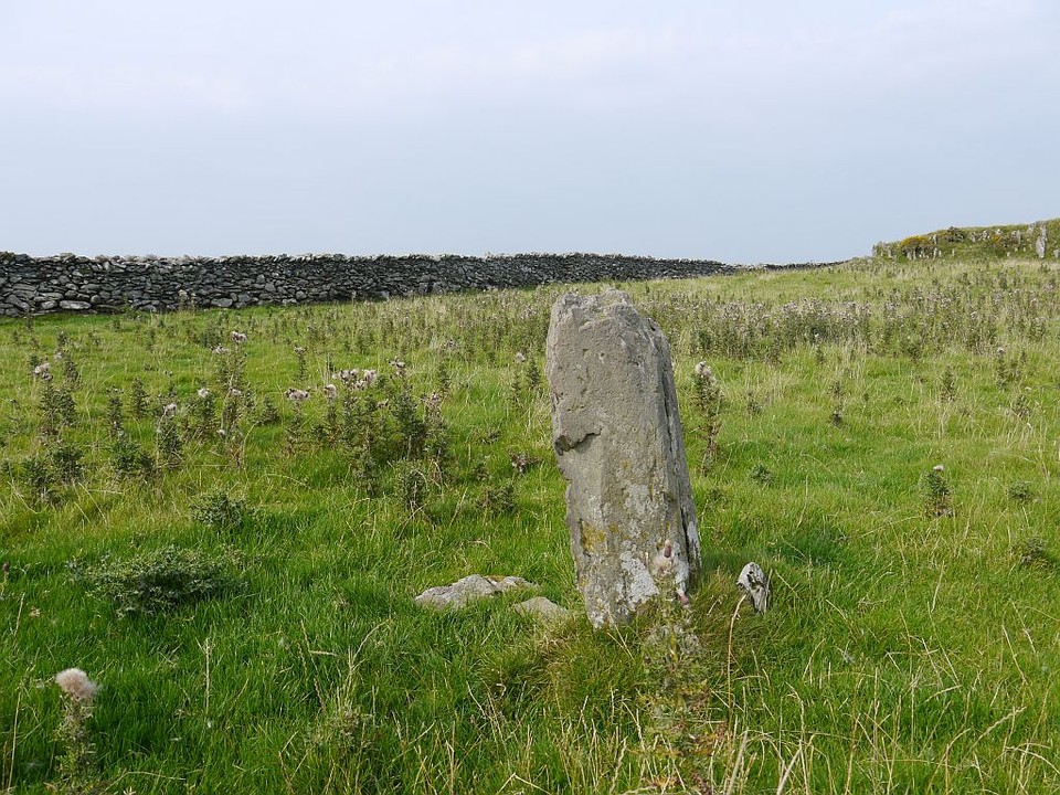
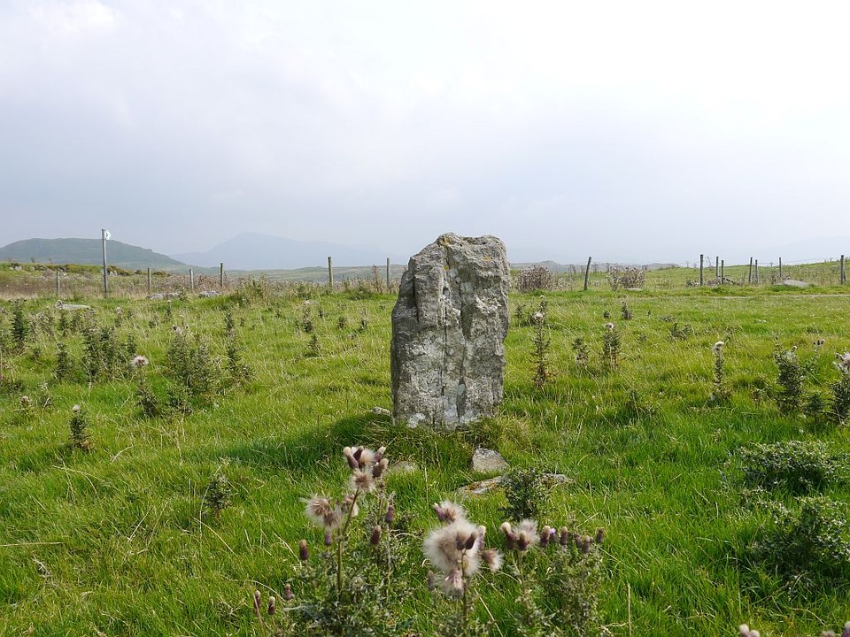
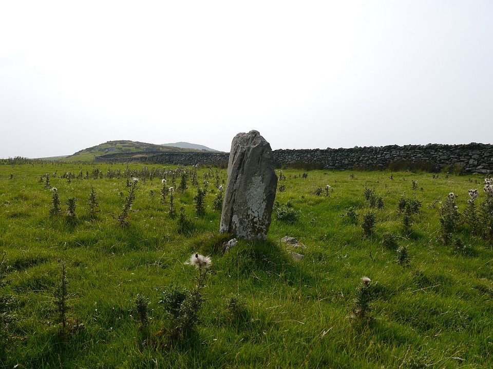
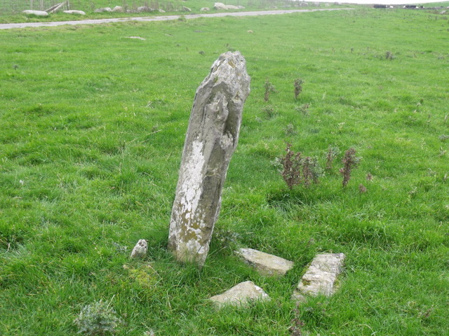
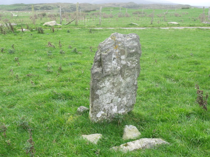
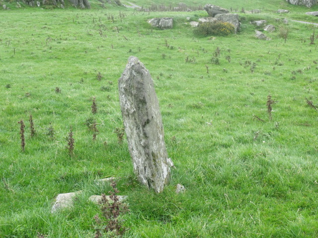
Following along the same road as Carreg and Moel y sensigi pass through a gate. Just before the road forks on a wide grass verge next to the road on the left is this small very thin standing stone.
Tiny compared to the other stones in the area.
Comments (0)
|
Add a comment
|
Permalink
Posted by
blossom
13th October 2011ce
Edited 13th October 2011ce
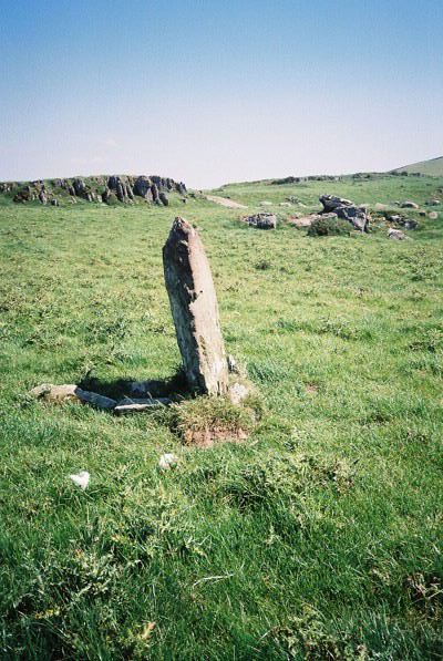
It stands to the W of the road, just S of where the track braches off to Moel Goedog.
Coflein description: "Standing stone 1m high by 0.5m by 0.18m, leaning slightly to the W."
Comments (0)
|
Add a comment
|
Permalink
Posted by
Idwal
27th June 2006ce

 Posted by blossom
 Posted by Idwal