The Modern Antiquarian
Log in
|
Register
Home
Latest Posts
Forums
Maps
Help
Browse Sites
News
Blog
Contributors
The Books
Select
-
Belgium
Denmark
Eire
France
Germany
Greece
Italy
The Netherlands
Norway
Portugal
Republic of Malta
Spain
Sweden
Switzerland
United Kingdom
England
Southern England
Cornwall
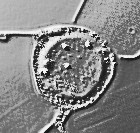
Lesingey Round
Hillfort
Lesingey Round (Hillfort) on The Modern Antiquarian, the UK & Ireland's most popular megalithic community website. 22 images, 1 fieldnote, plus information on many more ancient sites nearby and across the UK & Ireland.
Image © Malcolm Kewn
Nearest Town:
Penzance (2km ENE)
OS Ref (GB):
SW454304 /
Sheet: 203
Latitude:
50° 7' 5.98" N
Longitude:
5° 33' 43.34" W
Added by
kingrolo
Images (22)
Fieldnotes (1)
0 discussions
Start a topic
Show |
Hide
Web searches for Lesingey Round
Flickr
Google
Google Images
MAGIC
The Megalithic Portal
Bing
Stone Pages
Streetmap.co.uk
Wikipedia
Show map
(inline Google Map)
- Sites within 20 km -
-
Lescudjack Castle (2.18km ENE) (14 posts)
Faugan Round (2.21km S) (10 posts)
Ennis Farm (2.34km SSW) (1 post)
Madron Holy Well (2.53km NW) (31 posts)
Tremayne (2.59km W) (9 posts)
Trewern Round (2.63km WNW) (11 posts)
Drift Stones (2.7km SW) (47 posts)
Trewern (2.71km WNW) (10 posts)
Tresvennack Pillar (2.77km SSW) (13 posts)
Chyenhal (2.91km S) (13 posts)
Sheffield Menhir (2.92km SSE) (6 posts)
Rosemorran (2.96km NE) (7 posts)
Rosemorran Fogou (3.03km NE) (1 post)
Kerris (3.16km SSW) (16 posts)
Paul Celtic Cross (3.44km SE) (3 posts)
The Blind Fiddler (3.69km SW) (58 posts)
Sancreed Holy Well (3.75km WSW) (31 posts)
Redhouse (3.84km S) (7 posts)
Carfury (3.86km NW) (20 posts)
Chy-Gwidden Round (3.9km W) (0 posts)
Sancreed Beacon (3.99km WSW) (32 posts)
Crankan courtyard settlement (4km N) (0 posts)
Bosvenning Common (4.08km W) (11 posts)
Ding Dong lane (4.19km NW) (10 posts)
Higher Bodinnar Fogou (4.2km W) (3 posts)
Lanyon Quoit (4.21km WNW) (130 posts)
Trevelloe Carn (4.39km S) (4 posts)
Bosiliack Barrow (4.43km WNW) (42 posts)
Mulfra courtyard houses (4.46km NNW) (15 posts)
Boscawen-Un hedge (4.57km SW) (17 posts)
Toldavas (4.57km SW) (10 posts)
West Lanyon Quoit (4.59km WNW) (12 posts)
Try (4.6km N) (12 posts)
Trelew Menhir (4.73km SW) (16 posts)
Lanyon (4.74km WNW) (7 posts)
Merlin's Rock and the Mousehole (4.77km SE) (1 post)
Goldherring (4.81km WSW) (10 posts)
Bodrifty Reconstruction (4.84km NNW) (4 posts)
Boscawen Menhir (4.87km SW) (15 posts)
Changwens Menhir (4.88km SW) (4 posts)
Caer Bran (4.89km WSW) (27 posts)
Castallack (4.89km SSE) (9 posts)
Castallack 2 (4.89km SSE) (8 posts)
Mulfra Hill (4.92km NNW) (4 posts)
Boskednan Southern Cairn (4.92km NW) (17 posts)
Chysauster Village (4.93km NNE) (87 posts)
Mulfra Quoit (5km NNW) (93 posts)
Castallack Round (5.04km S) (8 posts)
Castallack Carn (5.04km S) (8 posts)
Nine Maidens of Boskednan (5.06km NW) (137 posts)
Bodrifty Iron Age Settlement (5.07km NNW) (25 posts)
Botrea Barrows (5.14km W) (18 posts)
Boscawen-Un (footpath) (5.15km SW) (5 posts)
Boscawen-Un (5.15km SW) (168 posts)
Creeg Tol (5.15km SW) (12 posts)
Swingate (5.2km SSE) (12 posts)
Mulfra Hill round barrows (5.21km NNW) (21 posts)
Pridden (5.29km SW) (4 posts)
Boskednan Cairn (5.34km NW) (34 posts)
Bodrifty Barrows (5.35km NNW) (11 posts)
Wheal Buller Menhir (5.36km W) (13 posts)
Men-An-Tol (5.37km WNW) (131 posts)
Trye (5.39km N) (2 posts)
Venton Bebibell (5.4km NW) (5 posts)
Carn Euny Fogou & Village (5.42km WSW) (142 posts)
Boleigh (5.43km S) (66 posts)
Tonkins Downs (5.5km NNE) (9 posts)
Kerrow Bosullow (5.5km WNW) (3 posts)
Castle-an-Dinas (Nancledra) (5.54km NNE) (29 posts)
The Four Parish Stone (5.56km NW) (10 posts)
Little Galva (5.56km NW) (5 posts)
Men Scryfa (5.58km NW) (57 posts)
Brane (5.63km WSW) (39 posts)
St Euny's Well (5.68km WSW) (21 posts)
Kemyel (5.7km SSE) (8 posts)
Brane Long Barrow (5.71km WSW) (10 posts)
Kemyel 2 (5.83km SSE) (4 posts)
Bosporthennis 'Beehive Hut' (5.84km NW) (52 posts)
Bosullow Trehyllys Courtyard House Settlement (5.87km WNW) (20 posts)
Conquer Downs (5.89km N) (12 posts)
Boswens Croft (5.89km W) (35 posts)
The Pipers (Boleigh) (5.9km SSW) (92 posts)
St. Michael's Mount (6km E) (27 posts)
Bartinne Castle Enclosure (6.02km WSW) (15 posts)
Chun Castle (6.06km WNW) (51 posts)
Higher Downs (6.11km W) (2 posts)
Noon Digery banjo enclosure (6.12km NNE) (0 posts)
The Beacon (Zennor) (6.12km NNW) (5 posts)
The Merry Maidens (6.19km SSW) (154 posts)
Watch Croft (6.23km WNW) (23 posts)
Watch Croft (6.23km WNW) (35 posts)
Porthmeor (Treen Common) (6.27km NNW) (19 posts)
Chûn Quoit (6.3km W) (113 posts)
Hannibal's Carn (6.32km NW) (4 posts)
Bosporthennis Quoit (6.35km NW) (21 posts)
Tregiffian (6.36km SSW) (75 posts)
Chûn (6.37km WNW) (2 posts)
Trevean Round (6.37km WNW) (8 posts)
Gun Rith Menhir (6.4km SSW) (44 posts)
Trevorgans Menhir (6.44km SW) (20 posts)
Tredinney Barrow (6.46km WSW) (20 posts)
Trevowhan (6.49km WNW) (2 posts)
Carn Galva (6.52km NW) (30 posts)
Choone (6.66km SSW) (9 posts)
Trevean North (6.71km WNW) (5 posts)
Crofto (6.72km WNW) (0 posts)
Boslow Stone (6.79km W) (19 posts)
Tregeseal Holed Stones (6.8km W) (58 posts)
Treen Entrance Graves (6.88km NW) (32 posts)
Kerrow (6.89km NNW) (3 posts)
Truthwall Common (6.9km W) (43 posts)
Portheras Common Barrow (6.91km W) (33 posts)
Porthmeor Fogou (6.98km NW) (0 posts)
Boscawen-Ros (6.99km SSW) (27 posts)
Carn Kenidjack (7.03km W) (20 posts)
Porthmeor Roundhouses (7.05km NW) (0 posts)
Tregeseal (7.06km W) (123 posts)
Hailglower Farm (7.08km W) (2 posts)
Porthmeor (7.13km NW) (20 posts)
Chapel Carn Brea (7.18km WSW) (54 posts)
Chapel Carn Brea North (7.21km WSW) (13 posts)
Pennance (7.21km NNW) (19 posts)
Chapel Carn Brea long cairn (7.22km WSW) (15 posts)
Little Brea (7.25km WSW) (2 posts)
The Giant's Grave (Morvah) (7.29km WNW) (2 posts)
Bosigran Settlement (7.37km NW) (0 posts)
Numphra (7.45km WSW) (0 posts)
Bosigran Cliff (7.45km NW) (32 posts)
Higher Botallack (7.5km W) (5 posts)
Foage (7.53km N) (5 posts)
Tregeseal Entrance Grave (7.56km W) (12 posts)
Bosworlas Lehau (7.57km WSW) (2 posts)
Carn Bean barrow (7.6km W) (6 posts)
Kerrowe Menhir (7.71km NNW) (6 posts)
Zennor Quoit (7.82km N) (105 posts)
Treverven (7.86km SW) (28 posts)
Alsia Holy Well (8.06km SW) (12 posts)
Sperris Quoit (8.07km N) (27 posts)
Chypraze (8.19km WNW) (15 posts)
Sperris Croft (8.21km N) (15 posts)
The Selus Stone (8.33km W) (6 posts)
Gurnard's Head (8.35km NW) (41 posts)
Giant's Rock (8.39km NNW) (11 posts)
Wicca Round (8.41km N) (2 posts)
Trink Hill (8.43km NE) (9 posts)
Towednack Double Armed Cross (8.46km NNE) (4 posts)
Tregiffian Vean (8.51km WSW) (17 posts)
Tom Thumb Rock (8.53km WSW) (6 posts)
Trencrom Hill Well (8.61km NE) (4 posts)
Trencrom Hill (8.61km NE) (56 posts)
Trendrine Hill (8.66km N) (21 posts)
Giant's Well (8.83km NE) (2 posts)
Lower Boscaswell Fogou (8.84km W) (19 posts)
Pendeen Vau (8.93km W) (35 posts)
Botallack (9.09km W) (2 posts)
Nanjulian (9.28km WSW) (0 posts)
The Bowl Rock (9.32km NE) (8 posts)
Treveneague Fogou (9.39km ENE) (2 posts)
Trevear (9.63km WSW) (1 post)
Letcha (9.66km WSW) (6 posts)
Escalls Cliff (9.67km WSW) (11 posts)
Boscregan (9.69km WSW) (21 posts)
Beersheba (9.74km NE) (19 posts)
Cudden Point (9.8km E) (2 posts)
Rosewall Hill (9.87km NNE) (9 posts)
Carn Gluze (9.9km W) (82 posts)
Treryn Dinas (9.97km SSW) (44 posts)
Kenidjack Castle (10.1km W) (33 posts)
Kenidjack Cairn Circle (10.14km W) (12 posts)
Cape Cornwall (10.46km W) (16 posts)
Table Mên (10.48km WSW) (3 posts)
Mayon Standing Stone (10.56km WSW) (4 posts)
Carbis Bay Longstone (10.86km NE) (9 posts)
St. Levan's Stone (11.02km SW) (14 posts)
Sennen (11.05km WSW) (5 posts)
St. Levan's Well (11.17km SW) (8 posts)
St Erth Round (11.21km ENE) (0 posts)
Mayon Cliff (11.34km WSW) (27 posts)
Maen Castle (11.55km WSW) (38 posts)
The Fairy Well (11.57km NE) (9 posts)
Carn Les Boel (12.2km SW) (21 posts)
Carnsew (12.22km NE) (9 posts)
Roskestal West Cliff (12.22km SW) (1 post)
Pordenack Point (12.41km WSW) (20 posts)
Godolphin Hill (13.77km ENE) (8 posts)
Castle Kayle (13.92km ENE) (0 posts)
Phillack Towans (14.12km NE) (5 posts)
Castle Pencaire (14.45km ENE) (28 posts)
Trewavas Cliff (14.71km E) (17 posts)
Camel Rock (14.84km E) (6 posts)
Tregonning Hill (14.91km E) (11 posts)
Connor Downs (17.27km NE) (0 posts)
Gear Round (17.31km ENE) (0 posts)
Drym Round (17.67km ENE) (0 posts)
Godrevy Barrow (18.08km NE) (20 posts)
Garland Round (18.67km E) (0 posts)
Tregear Round (18.93km ENE) (0 posts)
The Hood (19.25km ENE) (3 posts)
Men Amber (19.6km ENE) (11 posts)
Hudder Down (19.91km NE) (11 posts)
- Facilities within 20 km -
-
Castle Horneck (Youth Hostel: 0.4 km NE)
Penzance (Youth Hostel: 0.4 km NE)
Lanyon Tearoom (Cafe: 3.2 km W)
Cardinney Caravan and ... (Camping Site: 6.1 km SW)
Boleigh Farm (Camping Site: 6.5 km SSW)
The North Inn (Camping Site: 8.2 km WNW)
Trewellard Manor Farm (Holiday Cottage: 8.6 km WNW)
Lands End (Youth Hostel: 9.2 km WSW)
- Add -
-
Add news
Add an image
Add fieldnotes
Add folklore
Add miscellaneous
Add a link
Add a nearby facility
Add an alternative name/spelling
Images
(click to view fullsize)
Add an image
Fieldnotes
Add fieldnotes
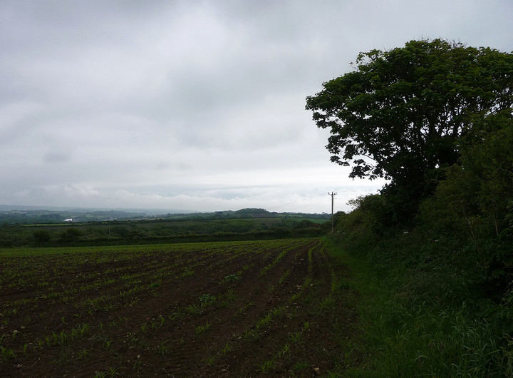
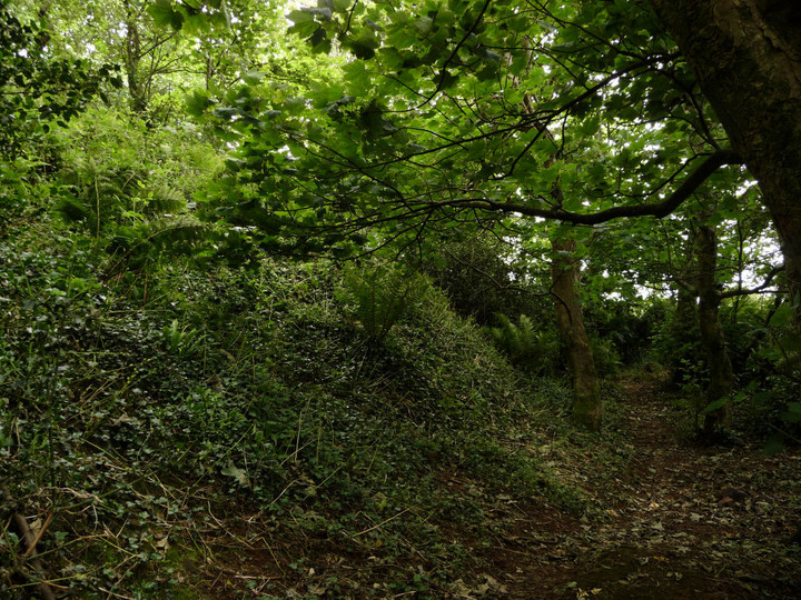
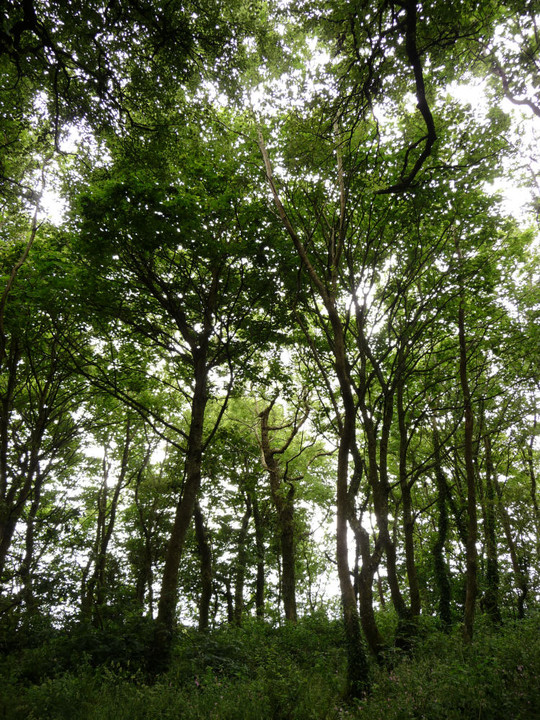
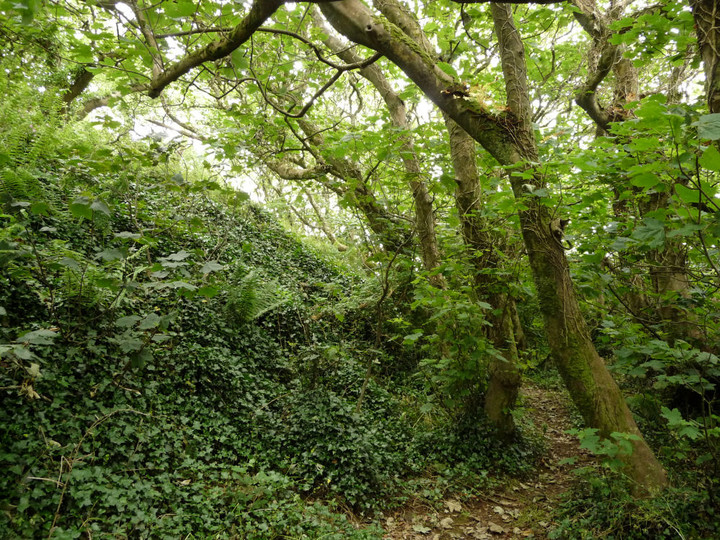
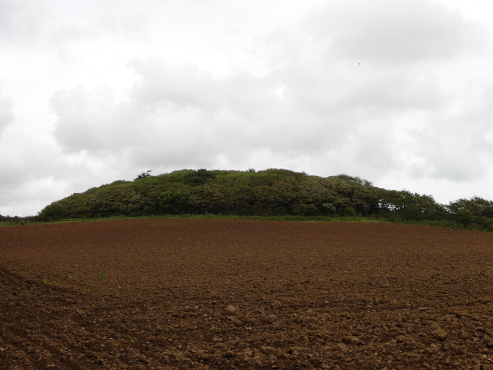
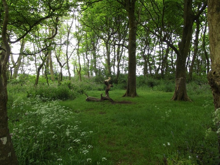
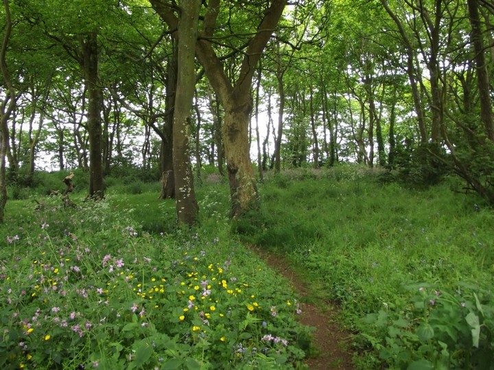
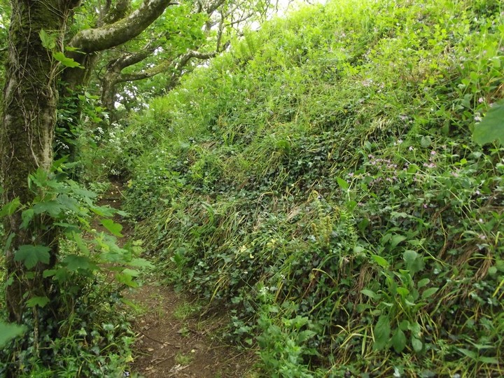
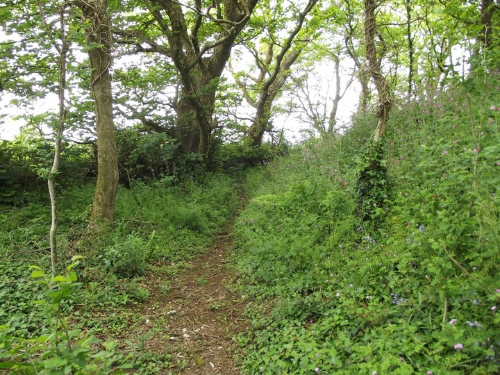
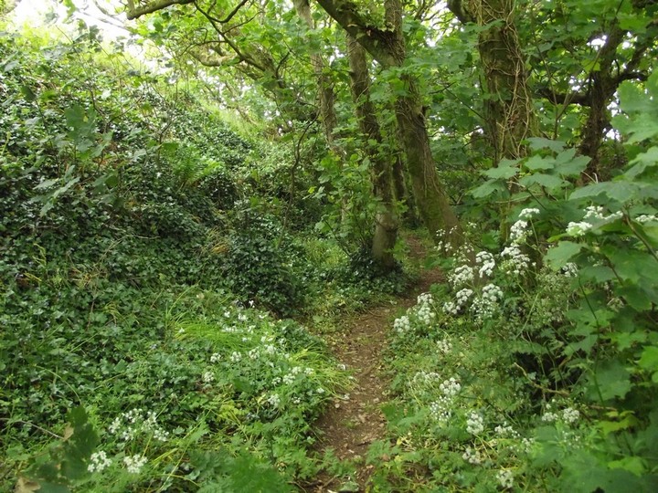
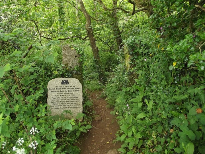
Another 2 ditched hill fort, like Faugen and Chun Castle, but totally overgrown with trees. Some nice trees though. Again some tip top views and a half and a good start out of Penzance to get an alternative view of the surrounding country.
Comments (0)
|
Add a comment
|
Permalink
Posted by
kingrolo
25th September 2001ce