The Modern Antiquarian
Log in
|
Register
Home
Latest Posts
Forums
Maps
Help
Browse Sites
News
Blog
Contributors
The Books
Select
-
Belgium
Denmark
Eire
France
Germany
Greece
Italy
The Netherlands
Norway
Portugal
Republic of Malta
Spain
Sweden
Switzerland
United Kingdom
England
Northern England
North Yorkshire
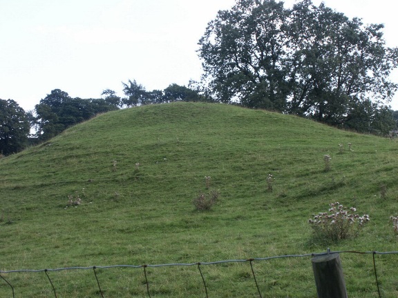
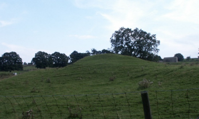
Grinton Round Barrow
Round Barrow(s)
Grinton Round Barrow (Round Barrow(s)) on The Modern Antiquarian, the UK & Ireland's most popular megalithic community website. 2 images, plus information on many more ancient sites nearby and across the UK & Ireland.
Image © BrigantesNation.com
Nearest Town:
Richmond Yorks (13km ENE)
OS Ref (GB):
SE039985 /
Sheet: 98
Latitude:
54° 22' 54.22" N
Longitude:
1° 56' 23.81" W
Added by
BrigantesNation
Images (2)
0 discussions
Start a topic
Show |
Hide
Web searches for Grinton Round Barrow
Flickr
Google
Google Images
MAGIC
The Megalithic Portal
Bing
Stone Pages
Streetmap.co.uk
Wikipedia
Show map
(inline Google Map)
- Sites within 20 km -
-
Harkerside Moor Circle (0.98km SSW) (18 posts)
Maiden Castle (Grinton) (1.62km WSW) (32 posts)
Reeth Strip Lynchets (2.23km W) (3 posts)
Calverside Moor Neolithic Enclosure (2.35km WNW) (1 post)
Castle, Nr Reeth (2.56km NW) (7 posts)
How Hill, Low Whita (3.69km WSW) (4 posts)
Booze (4.29km NW) (4 posts)
Cock Howe (5.31km ENE) (1 post)
Holgate (6.49km NNE) (3 posts)
How Hill Swaledale (6.89km E) (1 post)
Downholme (7.98km ENE) (3 posts)
Frankinshaw Cairn (8.15km NNE) (3 posts)
How Tallon (8.79km N) (18 posts)
Low Feldom Farm (8.82km ENE) (0 posts)
Thackwaite Beck (8.83km SW) (1 post)
Osmonds Gill Cairn (9.08km N) (2 posts)
Eel Hill (9.36km N) (6 posts)
Barningham Moor (9.39km N) (34 posts)
Carperby (9.45km SW) (12 posts)
Carperby B (9.53km SW) (3 posts)
Stone Man (9.55km NE) (1 post)
Osmonds Gill (9.79km NNE) (9 posts)
Whitcliffe Scar (10.31km ENE) (2 posts)
Gayles Moor (11.01km NE) (29 posts)
Aske Moor (11.33km ENE) (0 posts)
Aske Moor (Silver Hill) (11.33km ENE) (1 post)
Castle Steads, Gayles (11.42km NE) (4 posts)
Burton Moor (12.42km S) (2 posts)
Mudbeck (12.5km WNW) (3 posts)
Mudbeck (12.5km WNW) (6 posts)
Castle Dykes, Wensleydale (12.55km SSW) (18 posts)
Haw Beck Burnt Mounds (13km SSW) (4 posts)
Dove Stones (13.18km SW) (1 post)
The Ravensworth Stone (13.83km NE) (3 posts)
Bainbridge Camp (13.83km SW) (3 posts)
Addlebrough (13.99km SW) (5 posts)
Devil's Stone (Addlebrough) (14.13km SW) (1 post)
Stony Raise (Addlebrough) (14.53km SW) (7 posts)
Castle Steads, Coverham (14.82km SE) (3 posts)
Flamstone Pin (15.22km SE) (1 post)
Braithwaite Wood Hillfort (15.32km ESE) (5 posts)
Diana's Well (15.7km ESE) (2 posts)
Bowes Barrows (15.7km NW) (1 post)
Deepdale (18.29km NNW) (7 posts)
Gayle Camp (18.97km WSW) (1 post)
Catterick Henge (19.03km E) (3 posts)
Stanwick Fortifications (19.13km NE) (3 posts)
Scorton Cursus (19.48km ENE) (5 posts)
Rey Cross (19.54km WNW) (7 posts)
West Agra (19.67km ESE) (17 posts)
- Facilities within 20 km -
-
Tan Hill Inn (Bed & Breakfast: 16.5 km WNW)
The Tan Hill Inn (Pub: 16.5 km WNW)
The Bowes Museum (Museum: 17.9 km N)
- Add -
-
Add news
Add an image
Add fieldnotes
Add folklore
Add miscellaneous
Add a link
-
Add a site
Add a nearby facility
Add an alternative name/spelling
Images
(click to view fullsize)
Add an image
 Image © BrigantesNation.com