Looking down Foxhole Slade. The fort is top right, the tide well and truly ‘in’.
Image credit: Robert Gladstone
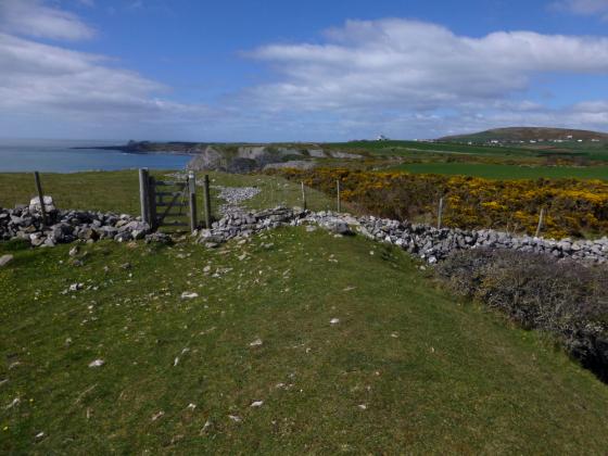
Looking down Foxhole Slade. The fort is top right, the tide well and truly ‘in’.

The wondrous cave is out of sight below.... but not out of mind.

With the wind a’blowing some knots I don’t mind admitting a fair degree of vertigo. One assumes the former inhabitants were not prone to sleepwalking?


House?

Sad because weve got to go?


Inner rampart – I think – looking toward Foxhole Slade.

The Horse Cliff enclosure can be seen crowning the cliff line centre top left

The main bank looking approx SE....

The natural seaward defences... Worm’s Head can be seen top right apparently making its way out to sea. I’m offski...

Looking approx NW along the main upstanding cross bank.

The main defences from within...

Looking across to the Paviland cliff fort from Horse Cliff... The famous cave is within the cliff face, centre right

Gorse in flower on the outer rampart.


Looking down on Foxhole Slade from the fort’s eastern flank.

Looking towards Rhossili Down.

A small robbing scoop in the inner bank.

The rock cut ditch and inner bank.

Paviland fort from Horse Cliff.

Looking SE along the outer rampart.

Looking SE along the inner rampart.

The view over the cliffs of “Yellow Top”. Goat’s Hole cave is out of sight, but the sloping tongue of rock that allows access to it at low tide is visible at the very bottom of the picture.

Looking back down to Foxhole Slade from the fort after our climb up.

The outer rampart.

Looking towards the inner rampart from the outer.
As hors d’oeuvres go, they don’t come much better than this. I re-visit the cliff fort perched above the enigmatic ‘Goat’s Hole’...
Visited 30.9.13
After the huge disappointment of not being able to access Paviland Cave I somewhat reluctantly headed up to the top of the cliff (after first visiting Foxhole Slade) to have a look at the remains of this Cliff Fort.
There is little I can add to the previous fieldnotes.
I purposefully looked for, and found, the metal ring used by those abseiling down the cave (the one the always show on TV!). Small consolation I know.
I peered over the edge to see if I could at least glimpse the cave entrance – I couldn’t.
I was however nearly blown over the edge by a strong gust of wind and I had to quickly drop to all fours to avoid getting a very brief glimpse of the cave before hitting the rocks!
Be careful out here!
Visited 26 April 2013
After reluctantly leaving Goat’s Hole cave, we make our way back up the gulley of Foxhole Slade. Passing the sheer cliffs that mark the southern extent of the promontory fort far above us, G/F points to the only slightly less steep grassy slopes to our left and says “we could climb up there”. Fresh from the revelation of her enthusiasm for the inaccessible upper chamber of the cave, she’s obviously feeling adventurous, so climb it we do.
This brings us out beside the inner rampart of the fort, with a dizzying view back down to Foxhole Slade behind us. We flop down on the grass of the flat interior to get our breath back.
This is actually my second visit to this fine little fort, as I came a little more than a year earlier on a coast walk with some friends. That was a rather flying visit, so today I’m keen to stay a while longer. It is very windy up here, luckily blowing inland over the cliff edge and unlikely to hurl us broken to our deaths far below.
The cave that we recently left is invisible in the cliff face below us, although we can see the “tongue” of rock that allowed us to scramble up to it, the far end now starting to disappear beneath the waves. The seaward aspect of the fort is pretty formidable, even if the tide is out only a lunatic would make any Guns of Navarone style approach to the defences from down there.
There are two certain lines of defences, one of which is further protected by an apparently rock-cut ditch. There may be a possible two further lines, although these appear more to be slight augmentations of the tilted planes of rock that form the headland and, indeed, the Gower’s entire southwestern coast line.
We sit for a while at the exposed and windswept tip of the fort, above the “Yellow Top” that provides the alternative name. Exmoor can be seen hazily across the Bristol Channel, forming the far edge of the pre-Ice Age plain that once stretched sway from these cliffs.
It’s a great spot, worth the longer visit this time round. We head off to meet the neighbours at Horse Cliff.
Good Friday. Despite being a candidate for perhaps one of the most ironic epithets ever conceived... when stripped of its religious connotations, the thought of quality time spent upon the Gower today is nevertheless an appealing one. Needless to say the plan didn’t involve an unscheduled drive along the northern coastline of the peninsular, courtesy of a navigational error in the vicinity of Gowerton; however to my mind there are less salubrious ways to spend time. (Eventually) arriving at Pilton Green there is parking to be had on the verge of the access track for Pilton Green Farm (incredibly, notices appear to indicate that previous punters have actually seen fit to leave their cars upon the track. No wonder some farmers get pissed off with tourists). More or less opposite, across the B4247, a public footpath heads approx south-west (ish) along the border of a cultivated field, slowly losing height as it approaches the dramatic, crumbling cliff-line that constitutes ‘the coast’ in these parts. Where better, by definition, for a modern antiquarian with a penchant for cliff-forts to indulge himself on a sunny afternoon?
In a little under a mile (I think) the path reaches said coastline, continuing down a rocky cove toward the equally rocky foreshore below the famous Paviland Cave... you know, the one that was the last resting place of the ‘Red Lady’. Clearly well worth a look, but some other time, perhaps? Instead I head to the right along the coastal path and, in short order, come face to face with some pretty substantial defences isolating the cliff top from the hinterland to the north-east, demarcating a reasonably sized enclosure. I count three – no, four? – successive barriers which, although obviously now pretty denuded – understandably so after being subjected to a couple of millennia of storms and what-have-you – nevertheless must have proved a formidable deterrent to any marauding war band back in the day. Steep, rocky flanks and plunging, vertical cliff-lines rendered any further artificial fortification superfluous to the other points of the compass. So, that’s the archaeology, then. Or at least my basic interpretation of it. Good, solid, but not overwhelming. Not so the location.... what a glorious place to be!
Having a ‘mooch’ about the enclosure, as you do, trying not to be blown over the edge by the powerful – not to mention freezing – wind (again, as you do), I notice an iron ring affixed to a rock. The mind retrieves the image of Neil Oliver (the hirsute archaeologist chap on TV.... Scottish, apparently) standing in what must be this very spot, trying not to appear utterly terrified prior to abseiling down to the Paviland Cave, the cave therefore no doubt located immediately below me. Yeah, buried in the very bowels of the living rock. Fair play to him, I say... it does seem a very small piece of metal to trust your hopes, dreams and aspirations – your very life – to. As for myself, I lie supine and simply enjoy the moment, the sheer aesthetic beauty of the location matched by an overwhelming feeling of belonging, if only for a short while, to something that transcends the here and now, if you get what I mean? The association of what it is to be human, to be part of humanity (and all the good, bad and humdrum ‘stuff’ that entails) with the imperium of time itself. Hence the need to lie down.... wouldn’t be a good idea to get overly dizzy with all that thinking. Not when perched upon a towering cliff face.
There is more. Much more, the enclosure set above the Paviland Cave but one of a chain of fortified settlements located, like a string of precious pearls, along this wondrous coast. One such example, in fact, lies immediately to the west in plain sight upon the Horse Cliff. It’d be rude not to go have a look while I’m here... a good Friday after all.
Coflein website, containing description and a number of aerial photos of the fort.