The Modern Antiquarian
Log in
|
Register
Home
Latest Posts
Forums
Maps
Help
Browse Sites
News
Blog
Contributors
The Books
Select
-
Belgium
Denmark
Eire
France
Germany
Greece
Italy
The Netherlands
Norway
Portugal
Republic of Malta
Spain
Sweden
Switzerland
United Kingdom
County Cork
Oughtihery W
Stone Circle
Oughtihery W (Stone Circle) on The Modern Antiquarian, the UK & Ireland's most popular megalithic community website. 8 images, 1 fieldnote, plus information on many more ancient sites nearby and across the UK & Ireland.
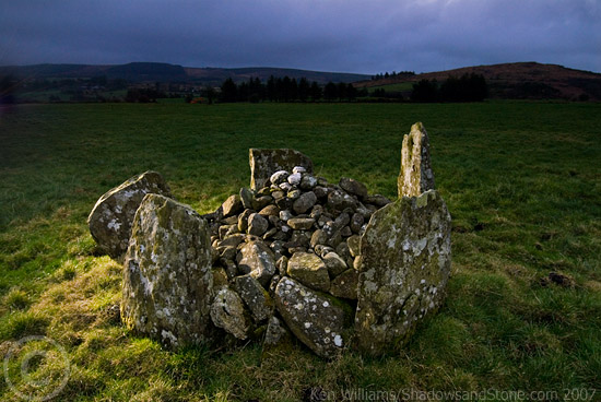
Image © Ken Williams/ShadowsandStone.com 2007
Nearest Town:
Cookstown (17km SSE)
OS Ref (IE):
W391821 /
Sheet: 79
Latitude:
51° 59' 15.98" N
Longitude:
8° 53' 11.76" W
Added by
FourWinds
Images (8)
Fieldnotes (1)
0 discussions
Start a topic
Show |
Hide
Web searches for Oughtihery W
Flickr
Google
Google Images
The Megalithic Portal
Bing
Stone Pages
Wikipedia
Show map
(inline Google Map)
- Sites within 20 km -
-
Maulmore (0.22km ENE) (8 posts)
Carrigagulla (2.05km W) (7 posts)
Carrigagulla NE (2.15km W) (10 posts)
Carrigagulla (2.46km W) (20 posts)
Carrigagulla NE (2.54km WNW) (17 posts)
Oughtihery E (3.05km ESE) (9 posts)
Knocknagappul (3.65km WSW) (3 posts)
Knocknagappul (3.85km WSW) (3 posts)
Kilberrihert large wedge tomb damaged (4.13km SSW) (2 posts)
Knockagappul 1 (4.15km WSW) (5 posts)
Stone Row, partially ruined (4.65km W) (5 posts)
Knocknagappul (4.67km W) (5 posts)
Caherbaroul (4.71km SW) (7 posts)
Rylane (4.75km E) (5 posts)
Knockagappul 2 (4.89km W) (6 posts)
Laharankeal (4.91km SSE) (1 post)
Rylane (5.03km E) (3 posts)
Deelish (5.59km SSE) (4 posts)
Laharankeal (5.6km SSE) (4 posts)
Kilmartin Lower (5.97km ENE) (1 post)
Knocknagappul (6.82km W) (2 posts)
Lackaduv (8.02km WSW) (5 posts)
Scrahanard (8.22km WSW) (15 posts)
Bealick (8.72km SSW) (0 posts)
Knockraheen (8.97km WSW) (19 posts)
Cloghboola Beg (9.11km W) (12 posts)
Kilboultragh (9.46km SW) (1 post)
Knocknakilla (9.62km W) (24 posts)
Knocknakilla (9.68km WSW) (0 posts)
Carriganimmy (9.78km W) (15 posts)
Gowlane North (9.94km ENE) (8 posts)
Bealick (10.15km SSW) (3 posts)
Carrigonirtane (10.67km WSW) (6 posts)
An Seisear (10.71km ENE) (14 posts)
Glantane East (10.85km W) (7 posts)
Glantane East N (10.92km W) (5 posts)
Glantane East N (10.92km W) (14 posts)
Glenleigh (11.03km WNW) (3 posts)
Glantane East S (11.03km W) (16 posts)
Glandine (Monkey's Bridge) (11.19km NE) (15 posts)
Glantane South (11.29km W) (8 posts)
Rosnascalp (11.32km S) (4 posts)
Cabragh N (11.49km WSW) (6 posts)
Cabragh (11.49km WSW) (4 posts)
Cabragh (11.5km WSW) (4 posts)
Clashmaguire (11.63km WSW) (2 posts)
Clashmaguire (11.79km WSW) (1 post)
Carrigonirtane (11.8km WSW) (4 posts)
Gortnalicky (11.81km WSW) (1 post)
Knockavullig NE (12.21km SE) (2 posts)
Gortyleahy (12.35km SW) (4 posts)
Knockavullig SW (12.4km SE) (4 posts)
Cloghboola Beg (12.42km W) (0 posts)
Cloghboola More (12.42km W) (0 posts)
Garrane (12.56km NE) (7 posts)
Carrigaphooca (12.93km SW) (7 posts)
Gneeves (13.35km NE) (3 posts)
Lissacresig 1 (13.39km WSW) (4 posts)
Lissacresig 2 (13.47km WSW) (5 posts)
Lissacresig 3 (13.47km WSW) (4 posts)
Bweeng (13.63km ENE) (6 posts)
Lissacresig (13.92km WSW) (3 posts)
Inchinlinane (14.16km SW) (5 posts)
Carrigcleena (15.49km ENE) (3 posts)
Kylefinchin 2 (15.69km SW) (5 posts)
Kilmeedy E (15.99km W) (0 posts)
Claragh E (15.99km W) (2 posts)
Kylefinchin (16km SW) (1 post)
Teergay (16.1km SW) (8 posts)
Kilmeedy W (16.41km W) (0 posts)
Ballyvoge 1 (16.49km SW) (6 posts)
Claragh W (16.91km W) (2 posts)
Cools (16.93km WSW) (3 posts)
Nursetown Beg (16.93km NE) (6 posts)
Clearagh (17.11km S) (2 posts)
Gortdonaghmore (17.55km E) (4 posts)
Rossnakilla (17.69km SSW) (9 posts)
Rossnakilla (17.69km SSW) (0 posts)
Currabeha (North) (17.93km SSE) (7 posts)
Currabeha (South) (18.2km SSE) (7 posts)
Bellmount Upper NE (18.25km SSE) (9 posts)
Bellmount Upper SW (18.28km SSE) (9 posts)
Barnadivane (18.54km SSW) (0 posts)
Lios na Ratha/Loughane East (18.62km E) (4 posts)
Ballymakeery (18.62km WSW) (5 posts)
Knockane (18.63km SSW) (8 posts)
Shanralagh (18.76km WNW) (3 posts)
Knockawaddra (Muskerry East By.) (18.76km SE) (9 posts)
Knocknaneirk NE (18.87km S) (13 posts)
St Abban's Grave (19.19km WSW) (4 posts)
Shanacloon (19.19km WSW) (5 posts)
St Abban's Grave (19.19km WSW) (1 post)
Loughane East (19.45km E) (6 posts)
Knocknaneirk SW (19.48km S) (17 posts)
Laughtneill (19.63km SSE) (9 posts)
Hornhill (19.71km S) (8 posts)
Gortanimill (19.9km WSW) (16 posts)
- Add -
-
Add news
Add an image
Add fieldnotes
Add folklore
Add miscellaneous
Add a link
-
Add a site
Add a nearby facility
Add an alternative name/spelling
Images
(click to view fullsize)
Add an image
Fieldnotes
Add fieldnotes
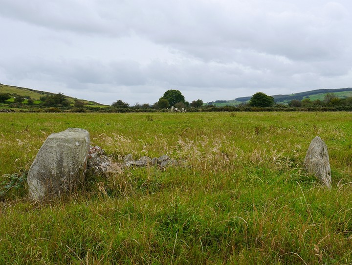
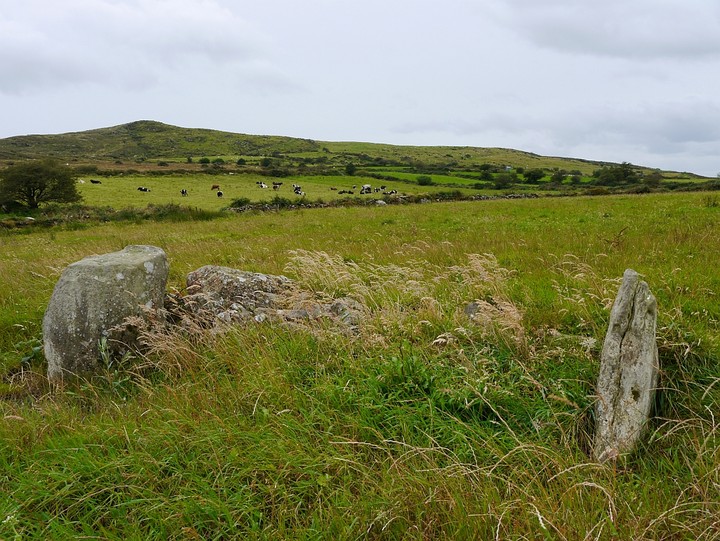
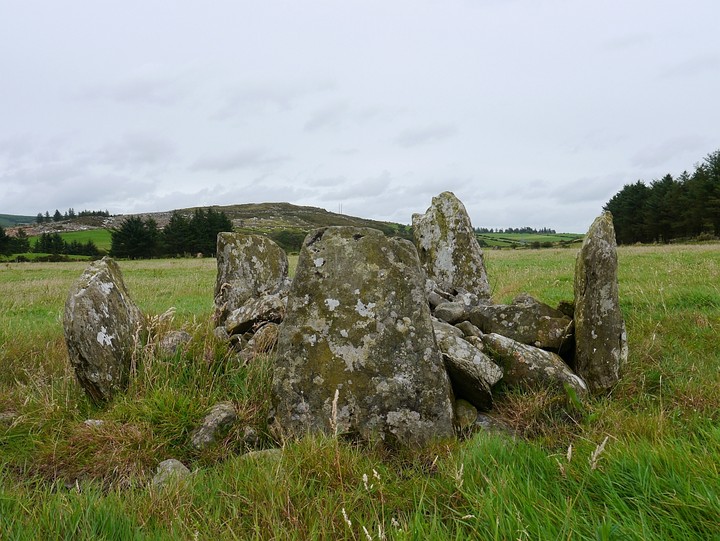
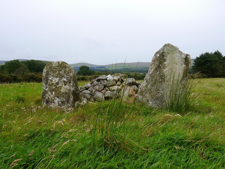
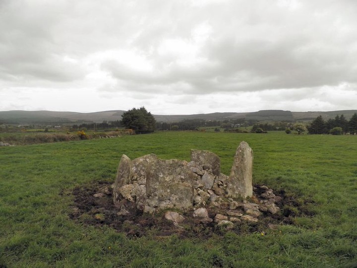
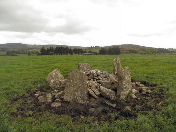
The main pointer to this stone circle is the huge standing stone at Maulmore. The stone circle is only about 400m from it. There is what looks perhaps like the remains of a tomb or a cairn in the same field as it.
Comments (0)
|
Add a comment
|
Permalink
Posted by
bawn79
22nd September 2011ce
Edited 23rd September 2011ce