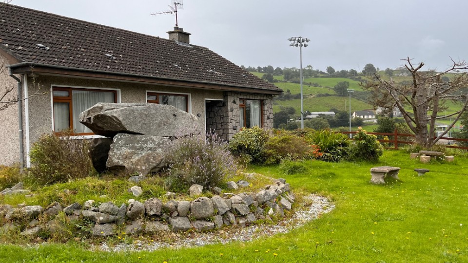
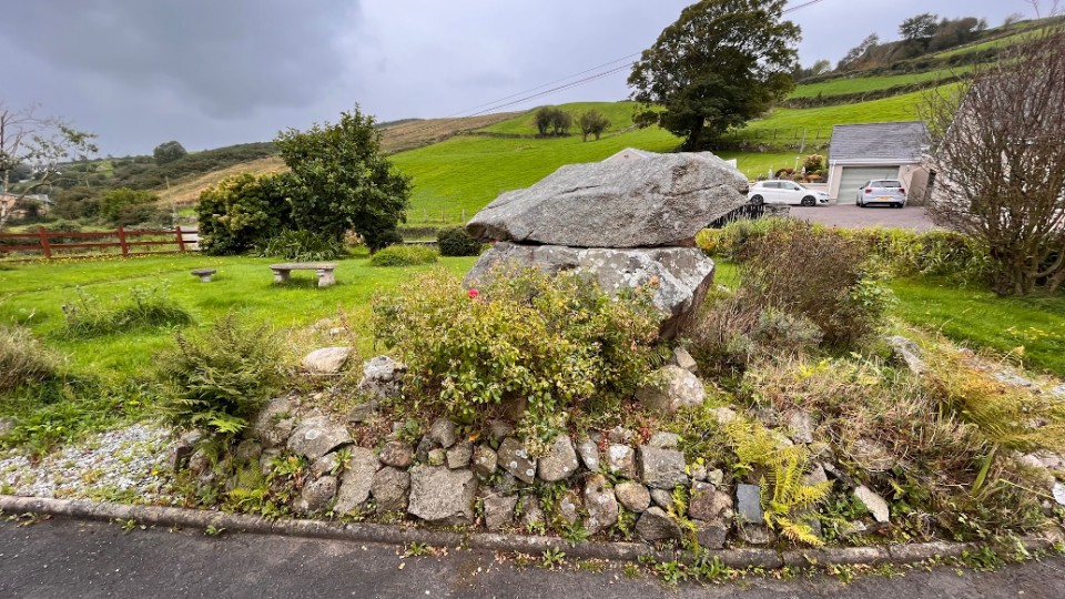
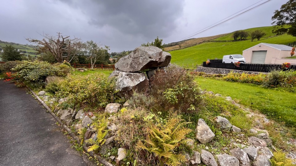
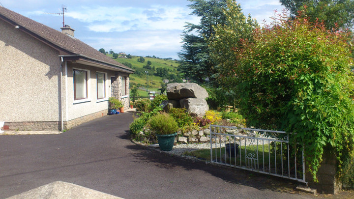
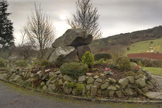
Log in
|
Register
Home
Latest Posts
Forums
Maps
Help
Browse Sites
News
Blog
Contributors
The Books
Select
-
Belgium
Denmark
Eire
France
Greece
Italy
The Netherlands
Norway
Portugal
Republic of Malta
Spain
Sweden
Switzerland
United Kingdom
Northern Ireland
County Down
Burren
Cist
Burren (Cist) on The Modern Antiquarian, the UK & Ireland's most popular megalithic community website. 1 image, plus information on many more ancient sites nearby and across the UK & Ireland.
Image © megaman
OS Ref (GB):
J135225 /
Sheet: 29
Latitude:
54° 8' 20.04" N
Longitude:
6° 15' 47.3" W
Added by
FourWinds
Images (1)
0 discussions
Start a topic
Show |
Hide
Web searches for Burren
Flash Earth
Flickr
Google
Google Images
Megalithomania
Bing
Stone Pages
Streetmap.co.uk
Wikipedia
Show map
(inline Google Map)
- Sites within 20 km -
-
Tamnaharry (2.68km NE) (0 posts)
Mayo 2 (3.88km NE) (0 posts)
Mayo 1 (4.79km NE) (0 posts)
Clontygora - Court Tomb (4.8km SW) (18 posts)
Crobane (5.57km NNW) (0 posts)
Carnadranna (5.88km NE) (0 posts)
Clontygora - Wedge Tomb (6.87km E) (0 posts)
Ballymacdermot (7.11km W) (11 posts)
Murphy's Fort, Mullaghmore (7.36km NE) (1 post)
Corrakit (7.4km S) (0 posts)
Mullaghmore (7.44km NE) (0 posts)
Clermont Cairn (7.72km SSW) (0 posts)
Tamary Cairns (8.08km NNE) (0 posts)
Slieveemartin Cairn (8.22km ESE) (0 posts)
Saval More Graveyard Stones (8.6km NNW) (0 posts)
Saval More (Field Stone) (8.78km NNW) (0 posts)
The Meadow (8.86km SSW) (0 posts)
Clonlum South (9.06km WSW) (1 post)
Clonlum (9.13km WSW) (1 post)
Ballyedmond Cairn (10.37km ESE) (0 posts)
Aghnaskeagh (10.54km SW) (2 posts)
Aghnaskeagh Chambered Cairn (10.62km SW) (3 posts)
Knockshee (10.85km ESE) (3 posts)
Barnmeen (11.11km NNE) (1 post)
Callaigh Berra's House (11.17km WSW) (16 posts)
Slieve Gullion - North Cairn (11.43km WSW) (3 posts)
Callaigh Berra's Lough (11.53km WSW) (2 posts)
Ballintur (11.62km ESE) (0 posts)
Ballymakellet Standing Stone (11.65km SSW) (1 post)
Ballymakellet (11.74km SSW) (3 posts)
Aghmakane (11.79km W) (1 post)
The Ballard Longstone (11.89km W) (2 posts)
Kilfeaghan (11.98km ESE) (5 posts)
Eshwary (12.36km W) (0 posts)
Goward (12.44km ENE) (0 posts)
Goward Chamber Cairn (12.47km ENE) (1 post)
Proleek (12.59km SSW) (18 posts)
Proleek (12.59km SSW) (5 posts)
Goward Cairn (12.64km ENE) (0 posts)
Faughart (12.94km SW) (6 posts)
Goward (13.78km NE) (10 posts)
Ballykeel (13.96km WSW) (14 posts)
Souterrain (14.31km SE) (0 posts)
Rockmarshall (14.51km S) (0 posts)
Grange Irish (Ruined Tomb) (14.52km SE) (0 posts)
Grange Irish (Court Tomb) (14.68km SE) (0 posts)
Carranmore (14.94km SE) (0 posts)
Grange (15.24km SE) (0 posts)
Rush's Cove (15.44km E) (2 posts)
Lurgankeel (15.51km SW) (0 posts)
Lurgankeel (15.58km SW) (1 post)
Carn Mountain (15.61km ENE) (0 posts)
Ballyrogan Giant's Grave (15.97km E) (2 posts)
Mucklagh (16.47km SE) (0 posts)
Dunnaman (17.02km E) (4 posts)
Riverstown (17.23km SSE) (0 posts)
Killin (17.48km SW) (0 posts)
Castletown - Standing Stone (17.53km SW) (0 posts)
Loughanhatten (17.65km ESE) (1 post)
Castletown - Souterrain (17.67km SW) (0 posts)
Castletown (17.67km SW) (0 posts)
Carn Hill (18.16km ENE) (0 posts)
Kilkeel (18.74km E) (4 posts)
The Mother Church of Mourne (18.77km E) (1 post)
The Three Sisters (18.84km NNW) (0 posts)
- Facilities within 20 km -
-
Lake Vyrnwy Tourist In... (Tourist Information: 11.9 km WSW)
Welshpool Tourist Info... (Tourist Information: 17.7 km SE)
- Add -
-
Add news
Add an image
Add fieldnotes
Add folklore
Add miscellaneous
Add a link
-
Add a site
Add a nearby facility
Add an alternative name/spelling
Images
(click to view fullsize)
Add an image