|
|

|
|
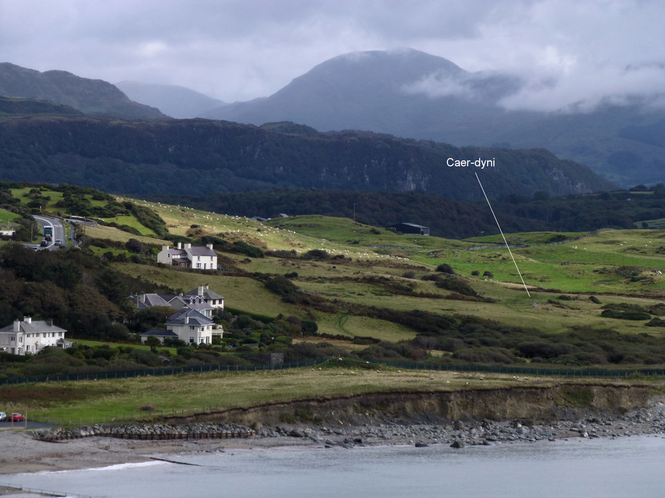
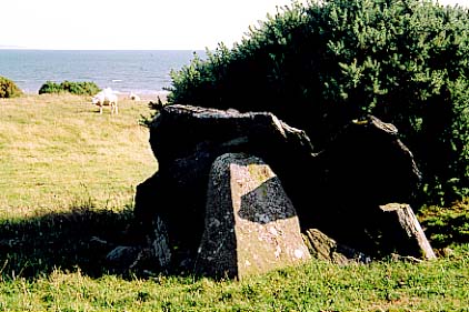
Caer-DyniBurial Chamber
|
||||||||||||||||||||||||
|
|
|
Images (click to view fullsize) |
|

|
Fieldnotes |
|
|
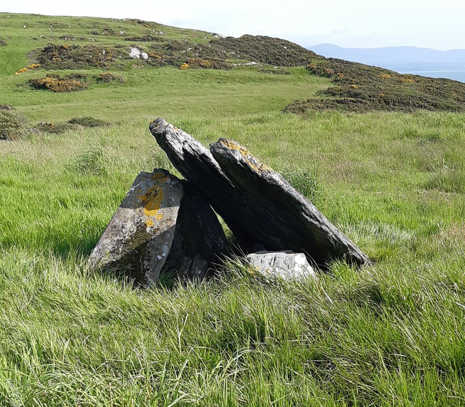
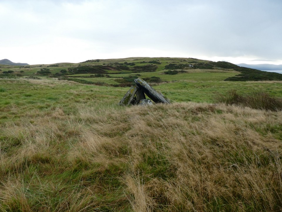
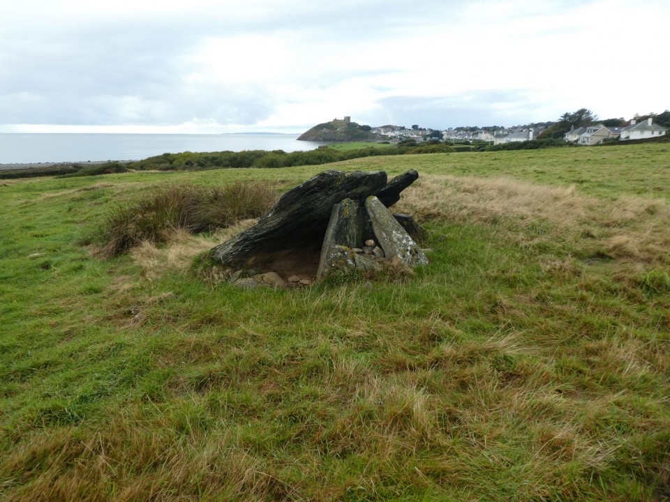
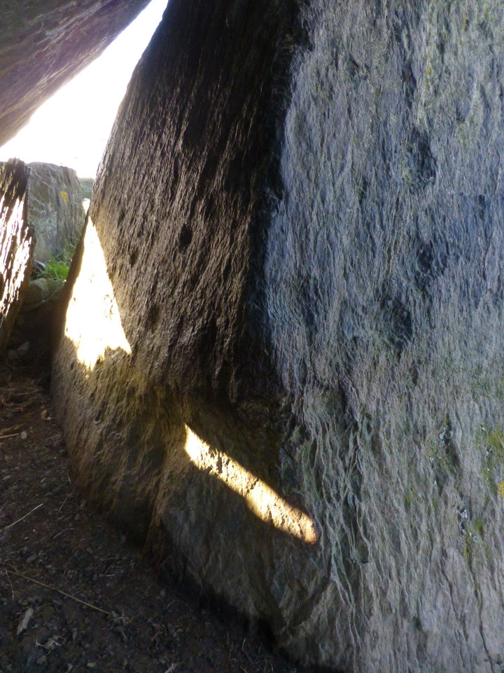
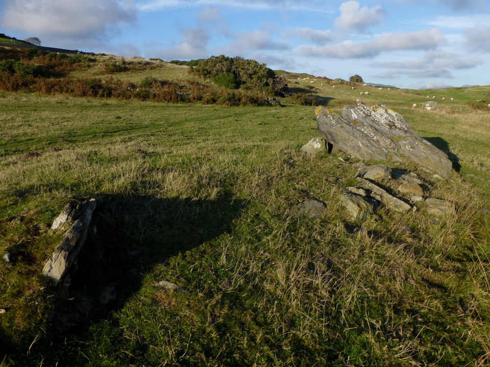
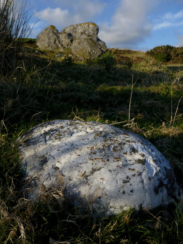
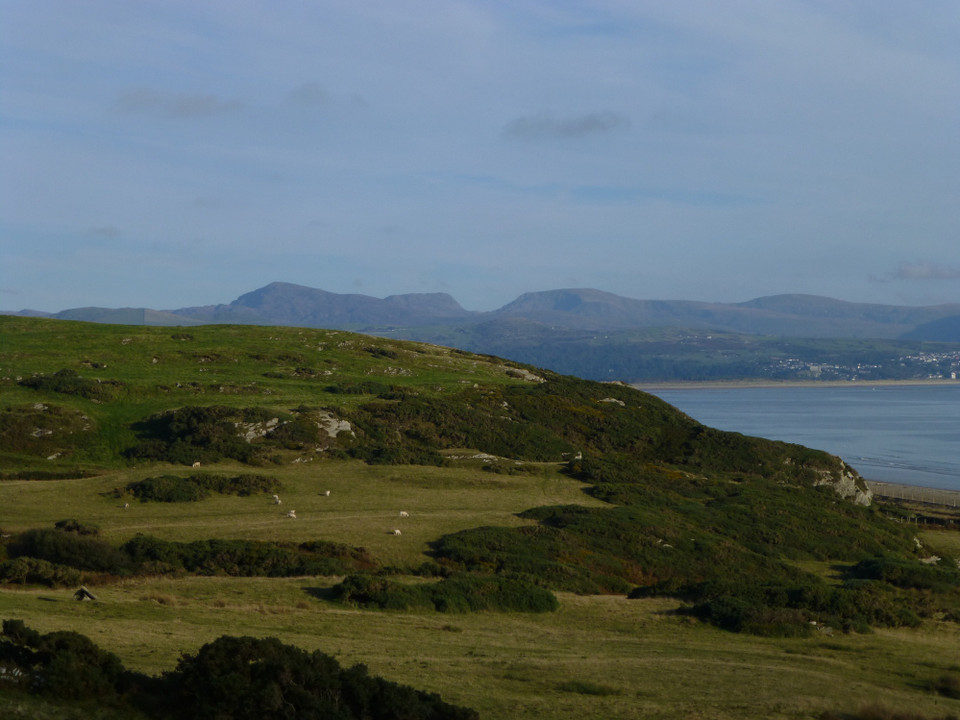
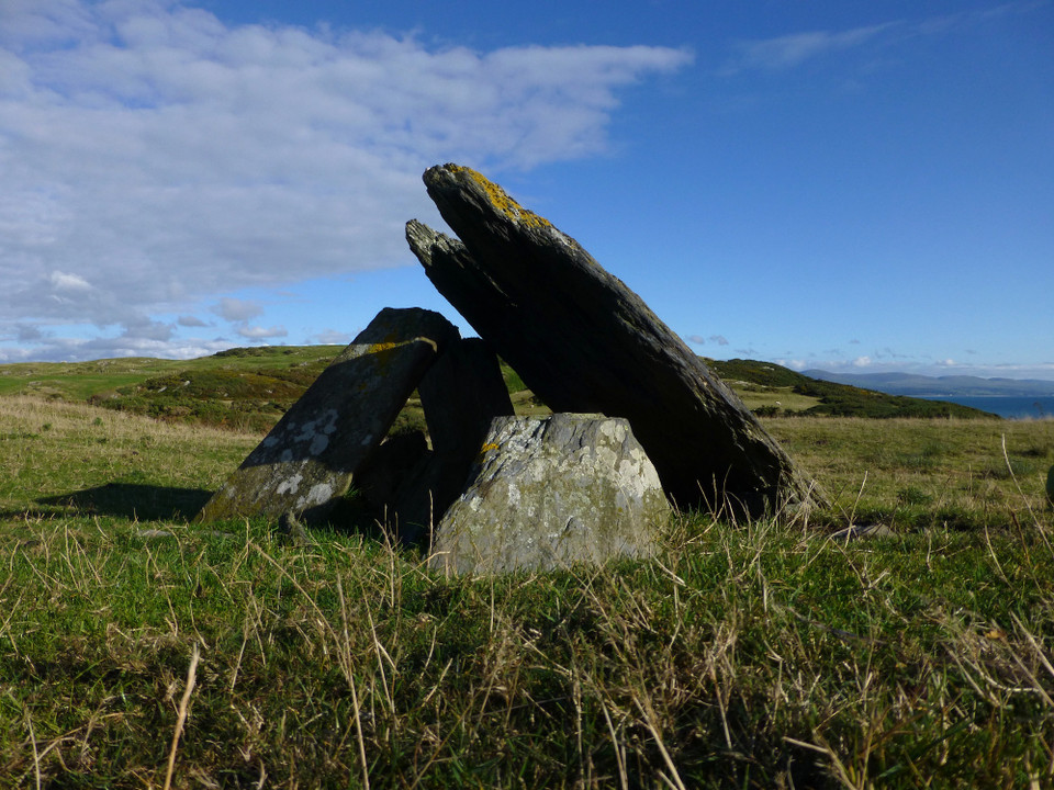
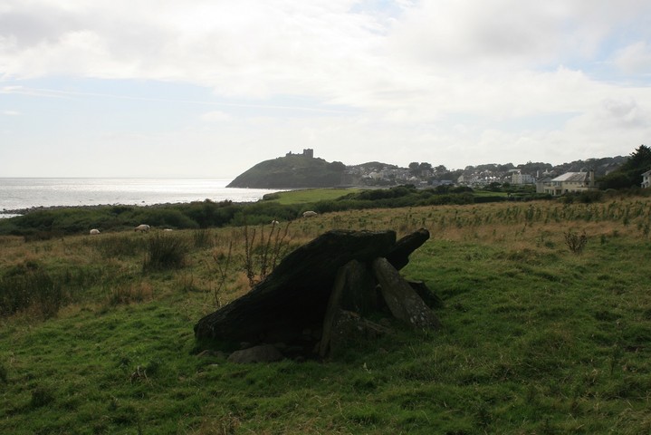
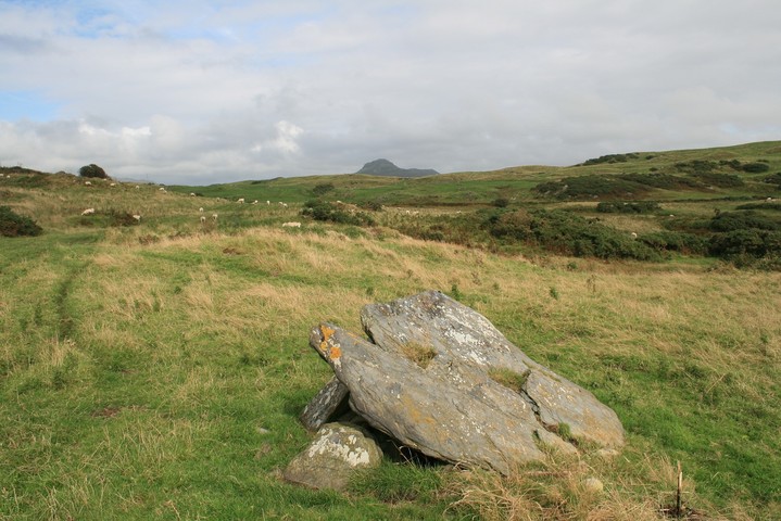
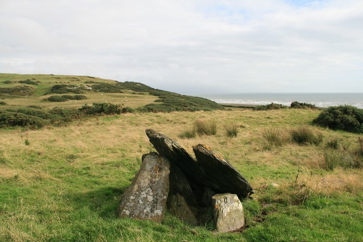
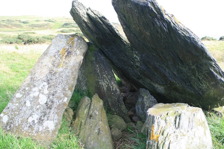
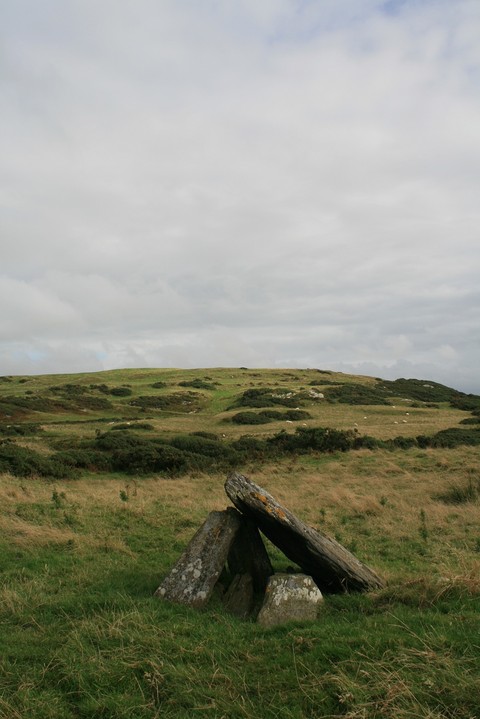
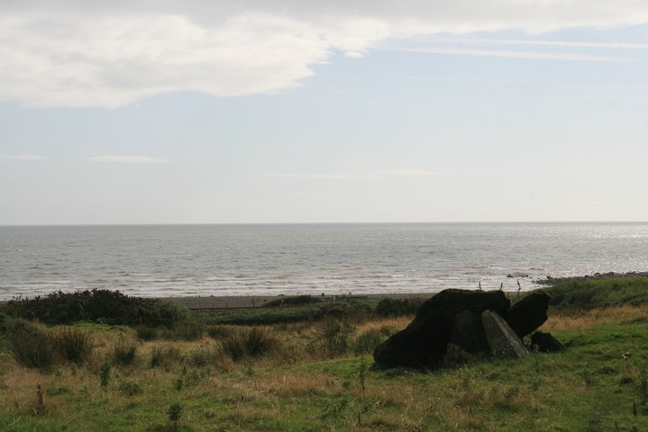
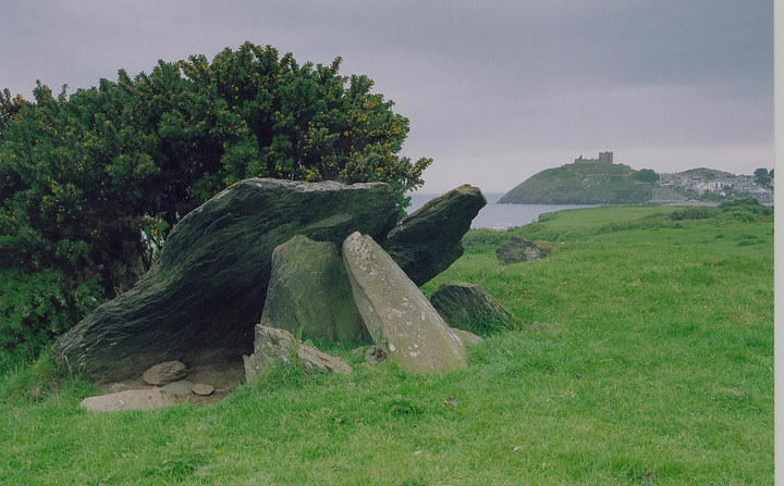
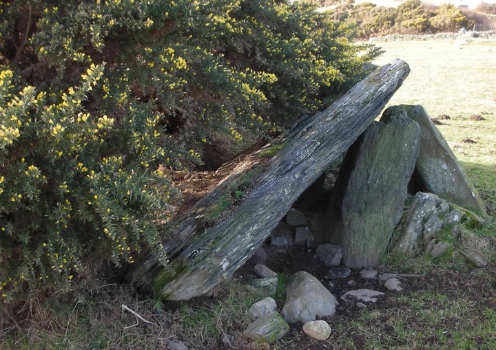
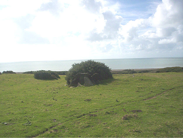
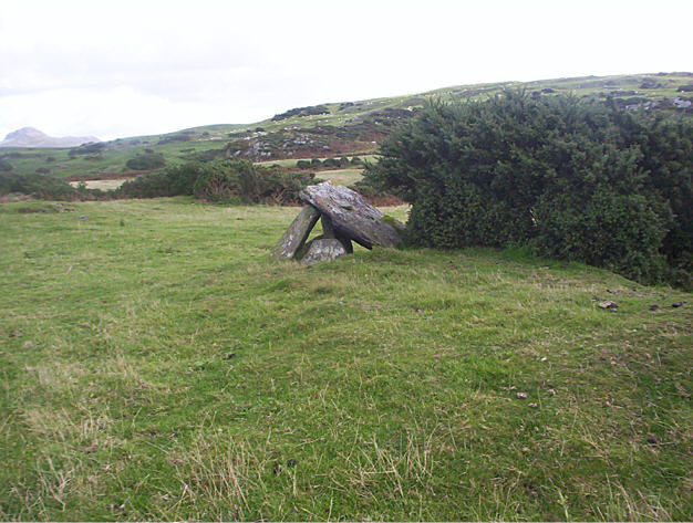
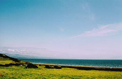
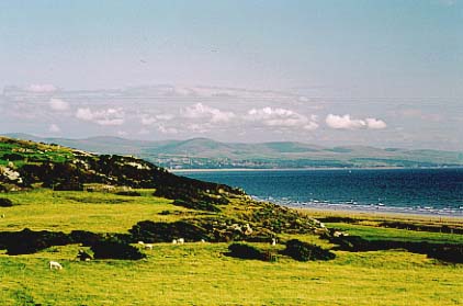
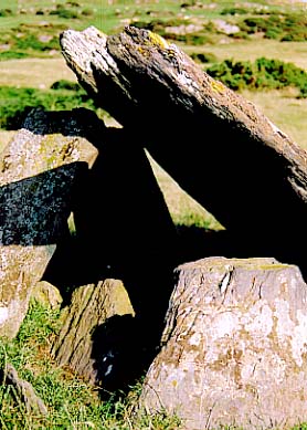
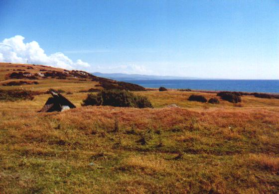
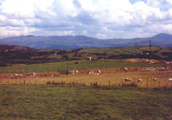
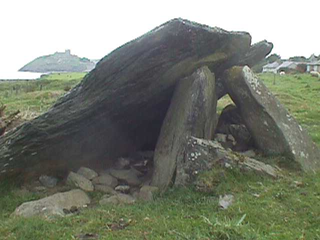
Visited 5.4.16 Directions: When driving out of Criccieth (east bound) park in the large car park at the top of the hill. You can actually see the burial chamber from here. You can then either walk back down the hill and follow the Public Footpath sign or climb over the metal field gate next to the car park. Either way it is only a short (if somewhat muddy) walk to the site. The burial chamber was a lot smaller than I was expecting and quite ruined (although I have been to a lot worse!). The capstone is now only half upright and the stones are covered in white and yellow There are great views over to Criccieth Castle (CADW) and the Snowdonia Mountains. I wonder how many people visit the castle and are awe struck by how old it is? I imagine the vast majority of those same people are oblivious of this much more ancient site. It’s a pity there isn’t an info board about the burial chamber at this obviously popular car park. Well worth visiting when in the area. |
Posted by CARL 12th April 2016ce |
|
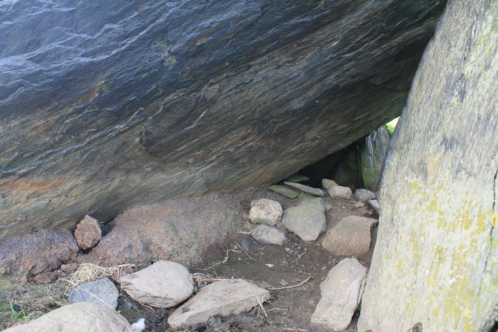
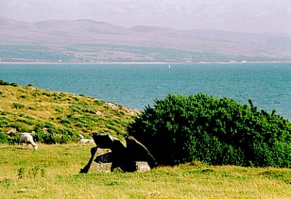
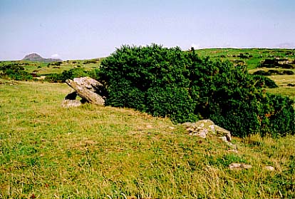
Probably the most easily visited site on the whole peninsula, however, from the lay by, I couldn't see it, but I knew from a previous visit, so long ago that Eric had not yet been born, that it was by a bush no more than a hundred yards away. It may be easy to find and easy to get to, only a fence or gate to climb or just jump over the wall at the lay by. Even without the map and untold years of fool proof memory it was still easy to find, and find it I did. Quel suprise, the bush has gone, I wonder who did that, enterprising avid stone watcher ?, surely not, farmer ? doubtful, my money is on local archaeology group, who ever, good one. That said it's not an impressive or inspiring site, who knows what it would have looked like when it was more together. The capstone leans against just one of the few stones under it, a huge notch has gone from the stone, giving it a pacman sort of look. The thing I saw as most interesting, is the weird red/grey concrete or stone that is right under the capstone joining it to the ground, is it concrete to fasten the stone in place ? or is it iron rich rock ? or what, anyway it looked weird and out of place. |
 Posted by postman
25th August 2012ce |
|
Visited Caer Dyni today, 22 August 2010, and the area around the stones has been cleared of the gorse, etc. It may not be on anyone's top-top, but the location is stunning so adds to the experience. It can now be clearly seen from the road (stop at the layby on hill as you rise out of Criccieth and walk back 150yds to footpath). With the clearance you can see a little more of the immediate surrounding ground area (original cairn perimeter?). (NB: While there I was told that Tan Y Muriau had also been cleared, but had no time to go back. Visited Tan Y Muriau last month and got ripped to shreds by bracken and gorse almost chest high on the approach path, only to find the site over run by ferns and weeds). |
Posted by JohnAko 22nd August 2010ce |
| It was a lovely day when I got here, I'd just been round the peninsula and stopped off at Criccieth for a break and saw this marked on the map. What an enchanting but forlorn site, but it has survived here hidden from pitying eyes. I felt a tingle when near the stones which made me feel good. |
 Posted by hamish
10th November 2004ce Edited 11th November 2004ce |
Links |
|
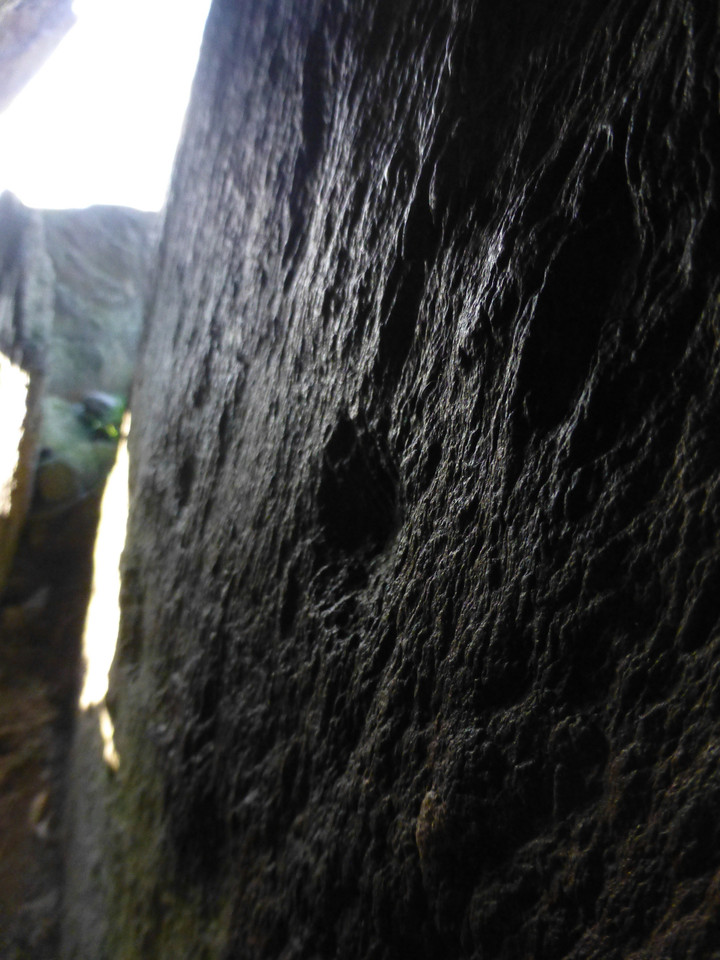
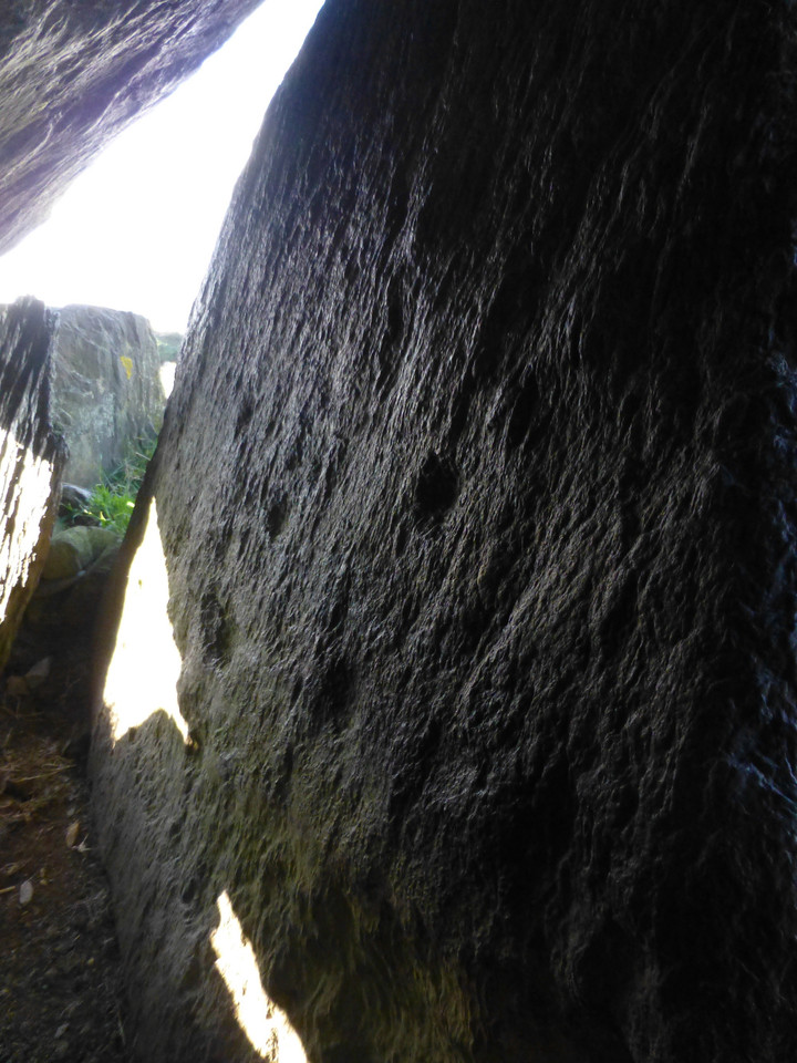
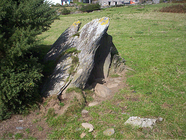
Scandinavian Society for Prehistoric ArtThe Clifton Antiquarian Club surveyed the stones in 2006 and found 13 cupmarks on one of the supporting uprights. The SSPA link is a pdf of the CAC article, and includes a plan of the cupmarks. |
 Posted by Rhiannon
10th June 2009ce Edited 31st May 2023ce |