|
|

|
|
Pen y CrugHillfort
|
||||||||||||||||||||||||
|
|
|
Images (click to view fullsize) |
|
|
Fieldnotes |
|
|
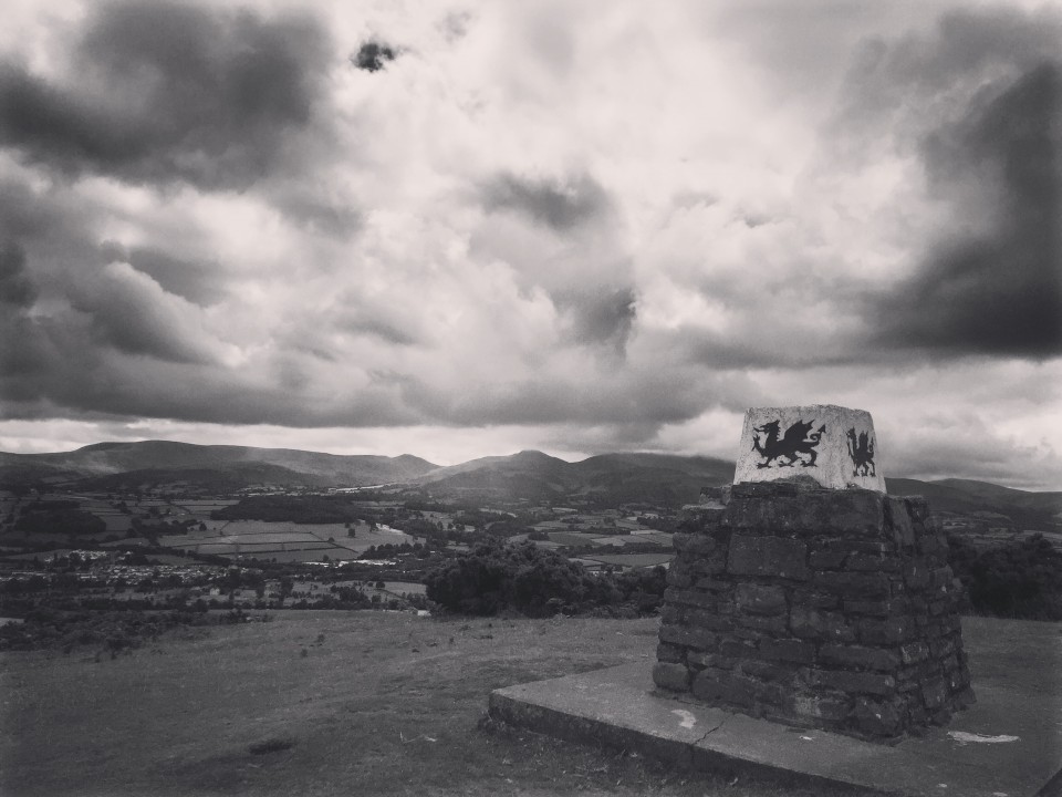
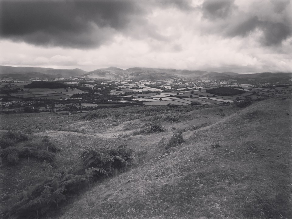
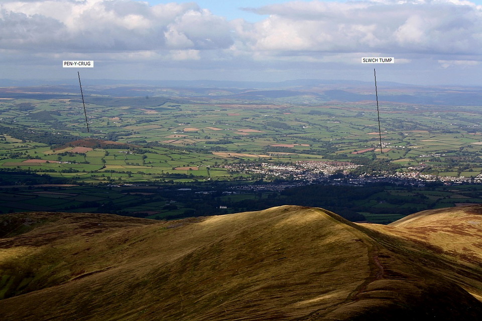
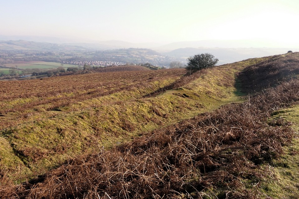
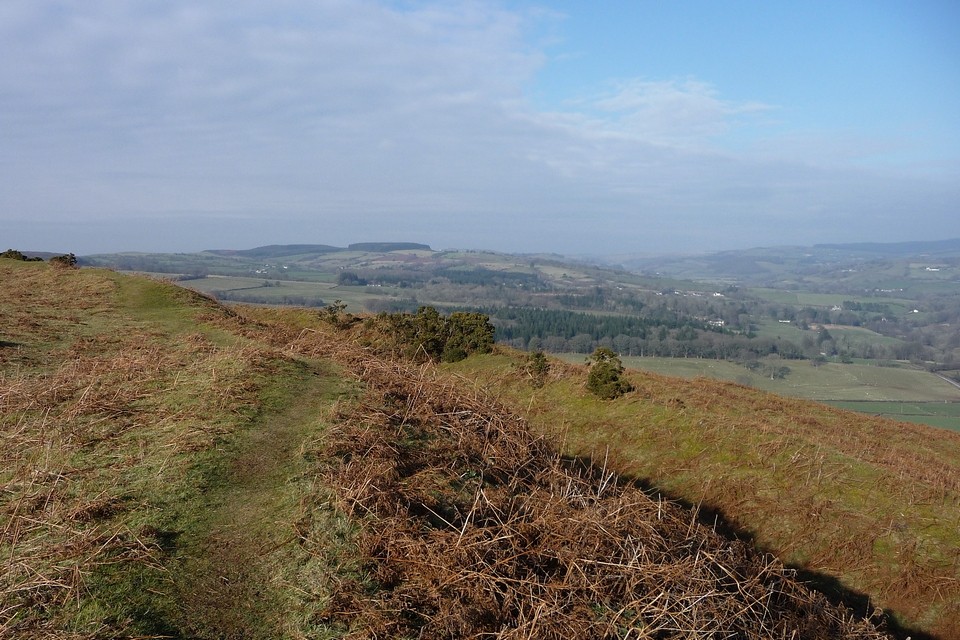
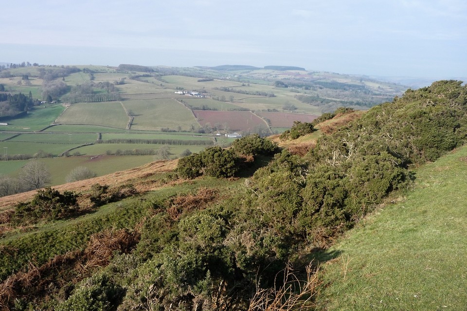
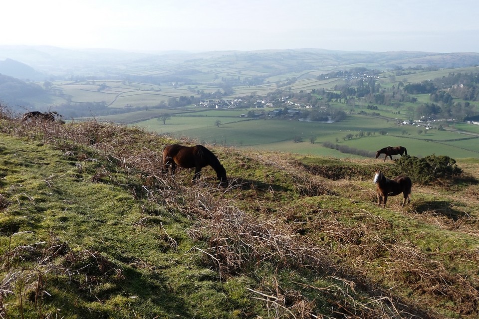
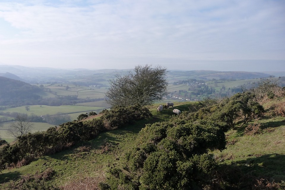
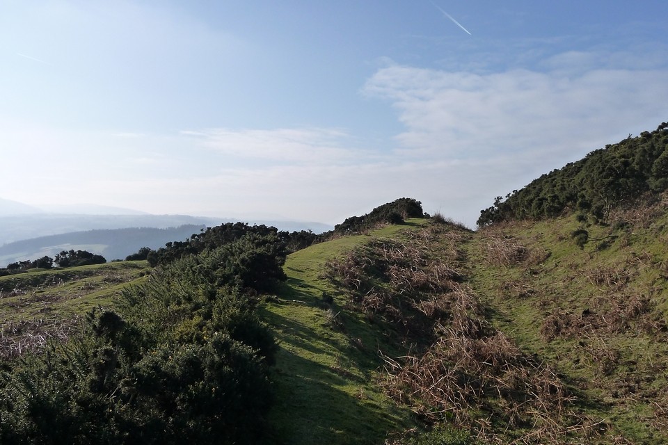
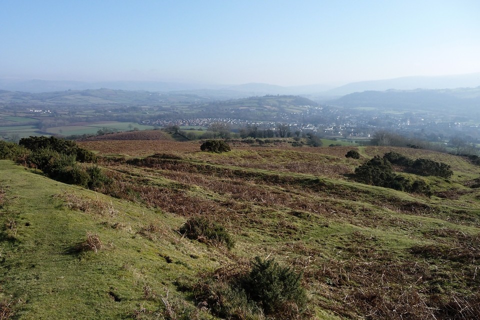
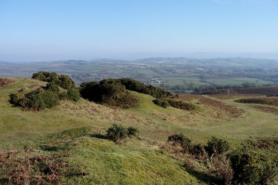
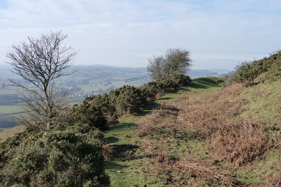
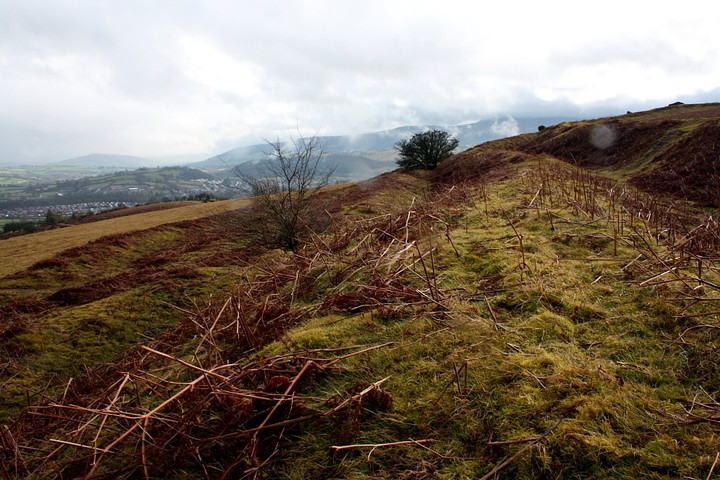
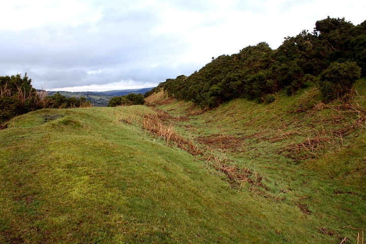
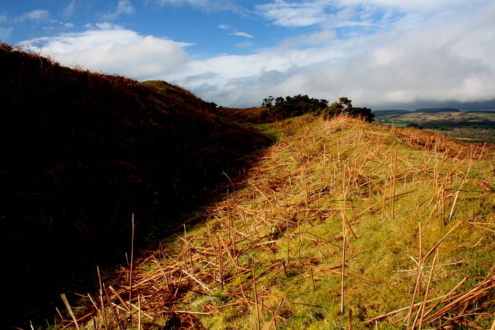
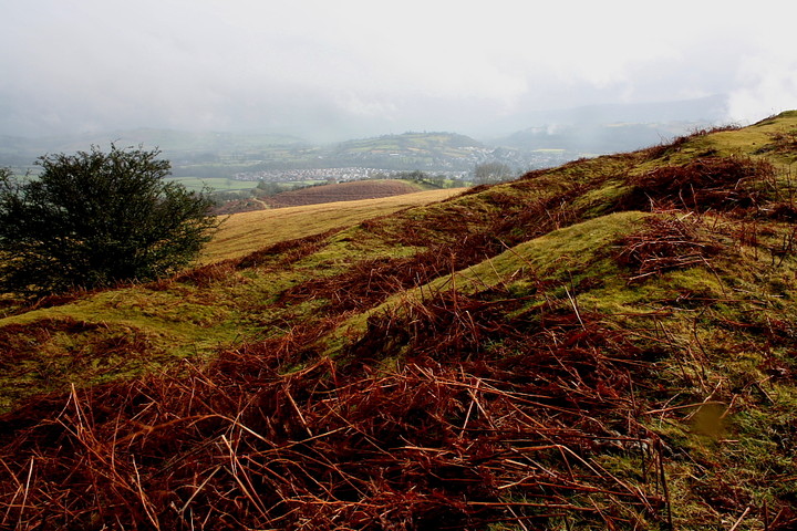
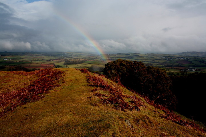
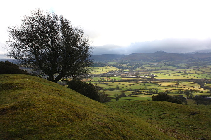
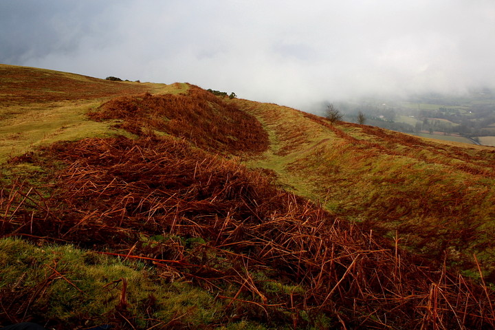
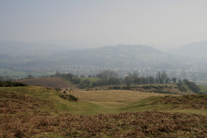
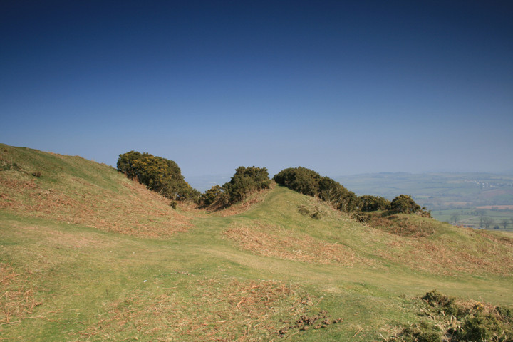
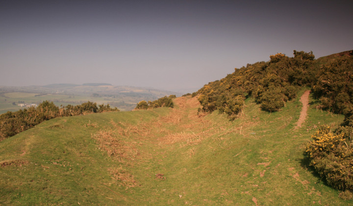
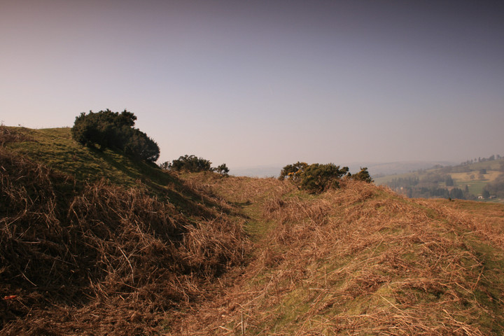
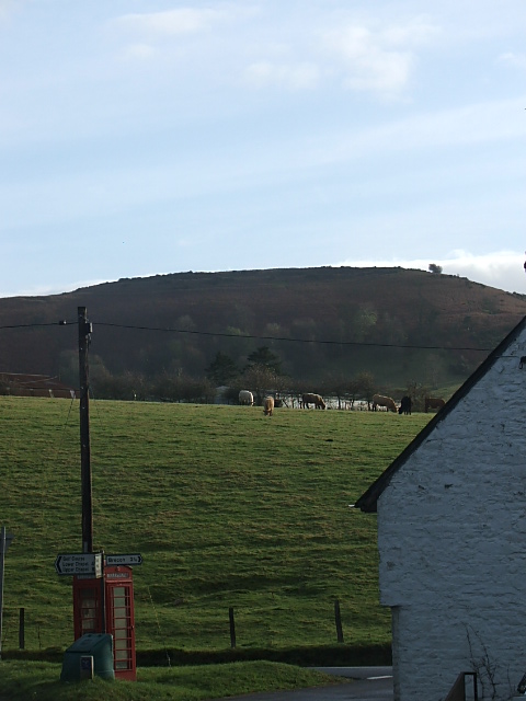
It would appear that Brecon has always been a town of some significance. Today it is probably best known for lending its name to the 'Brecon Beacons National Park', a great east-west mountain escarpment effectively isolating South Wales from Mid, the highest summits of which soar above the town to the south. Topography was clearly the prime factor in assuring Brecon's local primacy, a glance at the map highlighting the confluence of several rivers in the immediate locality, most notably the Usk and Honddu (Brecon is 'Aberhonddu' in the vernacular), as well as the north/south A470 and east/west A40 land routes. Those bleedin' Romans - no mugs, it has to be said - were clearly well aware of this strategic value, siting a fort (Y Gaer) a little to the west, overlooking a ford across the Afon Ysgir near its confluence with the Usk, superseding a hillfort upon Coed Fenni-fach. The Normans, too, erecting a motte nearby, this itself replaced by the stone castle which still stands in the hotel grounds. Another hillfort is sited at Slwch Tump, not to mention several small enclosures upon the great northern ridges of the Brecon Beacons themselves. But it is that upon the great, isolated hilltop of Pen-y-Crug to the north-west that dominates the town. It is possible to approach Pen-y-Crug on foot from Brecon... however the Mam C and I make our way to the north, via the little village of Cradoc, where parking can be found beside a recycling area. A bridleway, initially very muddy today, leads to the base of the hill before ascending the left hand flank, and hence gaining the ramparts. We're here since a cloudbase of approx 1,000ft has buggered up any plans of adding to yesterday's snow-bound excursion along Craig y Fan Ddu and Graig Fan Las. But any sense of this being 'second best' is immediately and irrecoverably banished upon setting eyes upon this fine fortress. Surely this must be up there with Wales' finest Iron Age creations? To say I wasn't exactly expecting to find a powerful quadrivallate enclosure (although reduced to tri-vallate at the steeper western flank, it has to be said) occupying the summit of this hilltop is an understatement all right. Nice. Quarrying to the south-east has left its unwelcome legacy to some degree, but nonetheless the ramparts remain relatively well preserved, the views, particularly across the fertile Usk valley to the cloud-wreathed mountain summits, of sufficient quality to no doubt have excited Wordsworth should he have ever come here. Sadly I don't believe he ever did, nor do I possess his poetic genius, but I think I get what the man meant when visiting such landscapes.... The aforementioned low cloud, not content with the likes of Pen-y-Fan, decides to pay our hilltop a visit, engulfing us in evocative, swirling mist before peeling away to leave washes of brilliant sunshine and a rainbow girdling the inner rampart. Hey, it's true. There is treasure at the end of the rainbow! Hang on... where's that 'Ladybird Book of Poetry' again? The hillfort's relationship to the surrounding landscape is intruiging - in particular with respect to the other two nearby enclosures. Were these contemporary? Surely not hostile? Friendly rivals?It's also interesting that the Roman engineers didn't consider Pen-y-Crug sufficient for their needs. Guess they required a much more aggressively placed site to control local movement. Ditto William the Bastard's lot. The Mam C's long wanted to experience what the great Wessex hillforts are like. Ha! Pen-y-Crug. |
 Posted by GLADMAN
12th March 2011ce Edited 12th March 2011ce |
|
Visited 26.6.10 As previously described parking is easy and the walk up the hill is pretty much straight forward. When I visited it was a scorcher of a day and the cows and sheep in the fields were all sat down in the shade trying to keep cool. I of course was carrying Dafydd up the hillfort whilst sweating like a pig!! Although there is a lot of bracken about there is a clear path all the way up (30 minute walk). The ramparts are in pretty good condition and the views are obviously good. Nearby Slwch Tump hillfort is easily visible. |
Posted by CARL 9th July 2010ce |
|
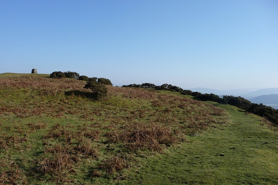
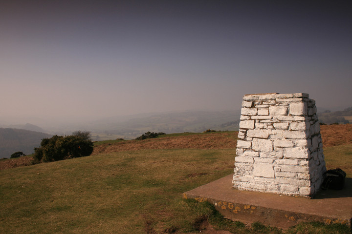
I parked to the north of the fort and climbed the hill on the footpath, there so easy to find, these hillforts a nice change from camoflagued stones hiding in the undergrowth. When visiting a burial chamber one has to get in, when visiting a stone circle one has to count and touch every stonen with a hillfort you have to walk the perimeter and identify the entrance, after thats done take photos and sit around gawping at the view, my favourite bit. I sat with back against the trig point (331m) out of the howling wind which had threatened to throw me off my step ladder earlier that morn, it wasn't clear but it was sunny..... Yay Wales. |
 Posted by postman
23rd March 2009ce |
|
SO 029 303 If you're in Brecon, Powys, well worth a visit. Great example of what you'd expect a hillfort to be. Commanding the top of a hill, several concentric rings of banks and ditches, a single entrance and to the north a steep drop of over 100 metres. It is easy to imagine defending the site and watching attackers having to deal which a succession of rising banks before reaching the scrap which in some places is still 5 metres. Bracken abounds, but now (in February) it has died back but the wind is a bit cutting on the summit of the Crug. To reach it: B 4520 north out of Brecon. This road rises all the way and as you approach the northern end of Brecon, take a left. As you continue to climb, on your left is a housing estate (Bron Y Crug and Maes Y Fynon), to your right trees followed by open countryside. Just past a mini-roundabout there is some parking, infact all along this road there are no yellow lines. I mention this approach because the walk begins at Maen-du Well, an ancient well, the site is now rundown and vandalised, but the spring is still there housed in an 18th century building of local stone. This is the nearest source of fresh water to the hillfort. Behind the building is a stile, and it is simply a matter of walking up through the middle of the fields heading for the each stile in turn (about 6). The Cadw guide for the region gives the total defended area as 182m by 134m. Nearby Slwch Tump is easy to spot, just look for the TV Antenae. |
Posted by elderford 23rd February 2003ce |