|
|

|
|
DruidstonesStone Circle
|
|
|
|
Images (click to view fullsize) |
|
|
Fieldnotes |
|
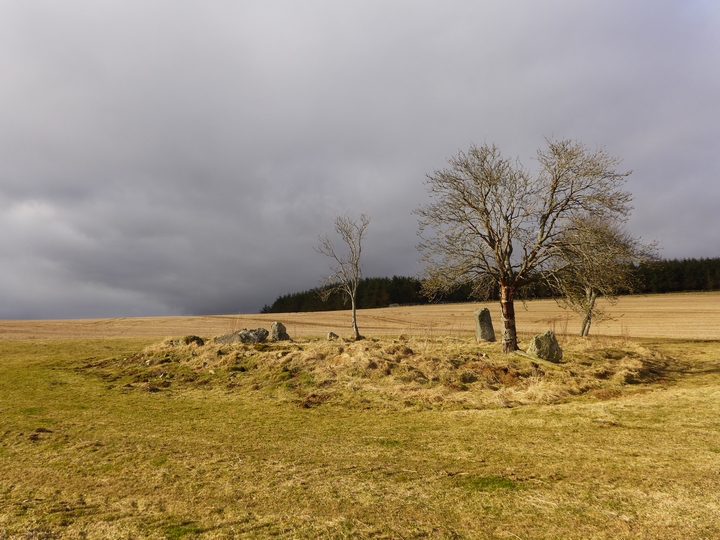
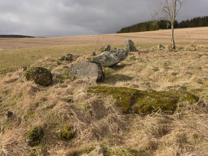
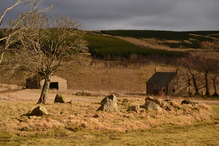
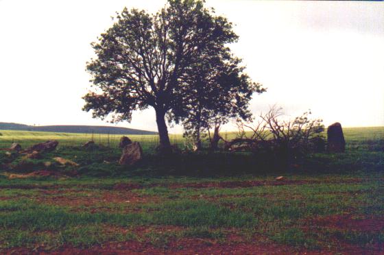
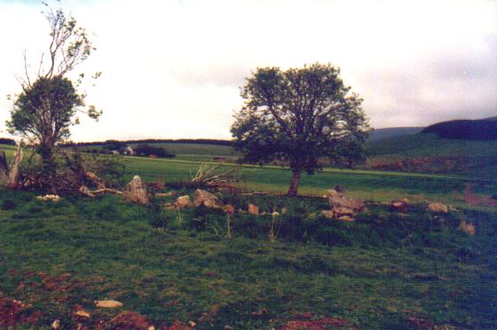
| 03/03/2013 - We parked just off the road where the Gordon Way crosses the B992 heading west to Knock Saul. There's space for 2-3 cars (NJ 6108 2170). Walking south we passed the track to Towmill and took the Gordon Way heading NE. This took us to about 300m south of the circle. We left the path where it turns east to head up Bennachie (NJ 6170 2187). Climbing over the fence and crossing the Broclach Burn, we followed the field edges to the circle behind the deserted Druidstone Croft. This is quite a good way to the circle as you can see if the field is in crop. Field edges take you to within 30m. What a great circle this is. Stone wise, it's pretty ruined but it doesn't detract from the setting and feel of the place. Prone flankers still there and the big outlier is nice. Well worth a visit. It's a nice place just to sit and watch the world go by. |
 Posted by thelonious
3rd March 2013ce |
|
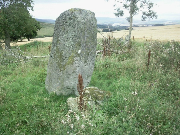
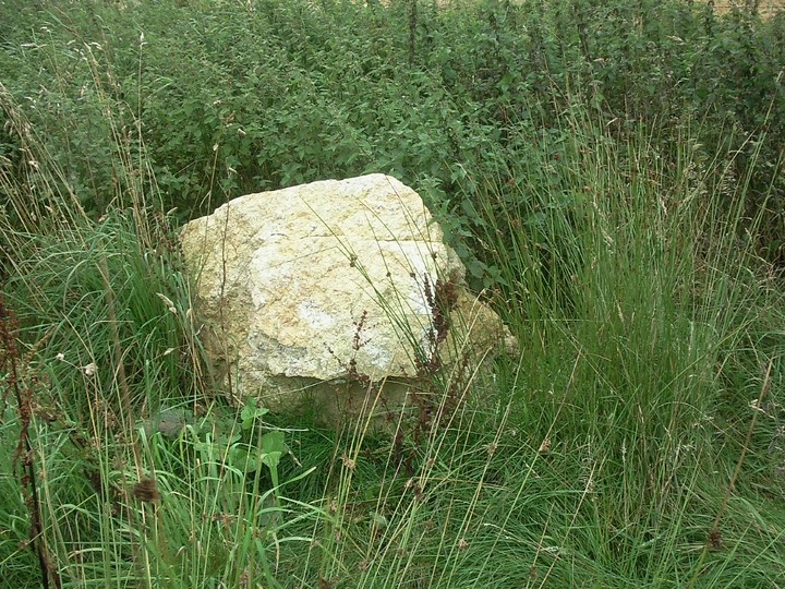
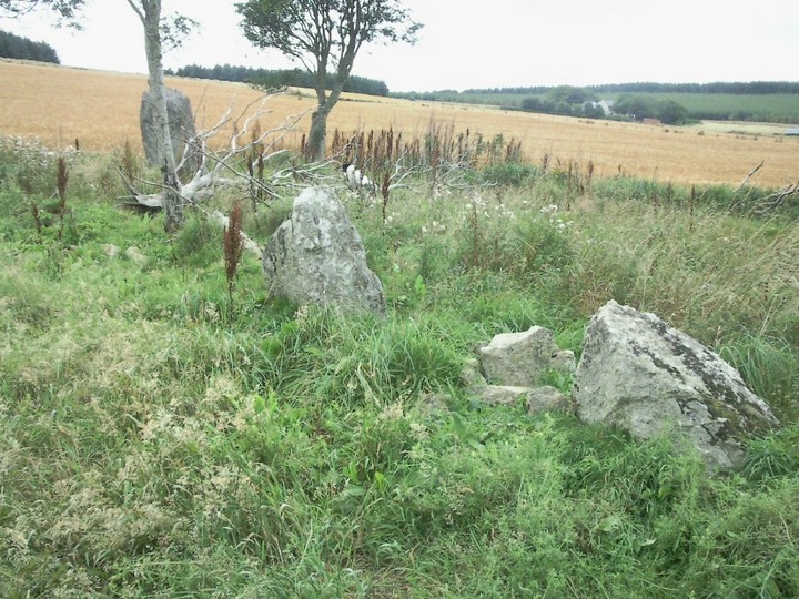
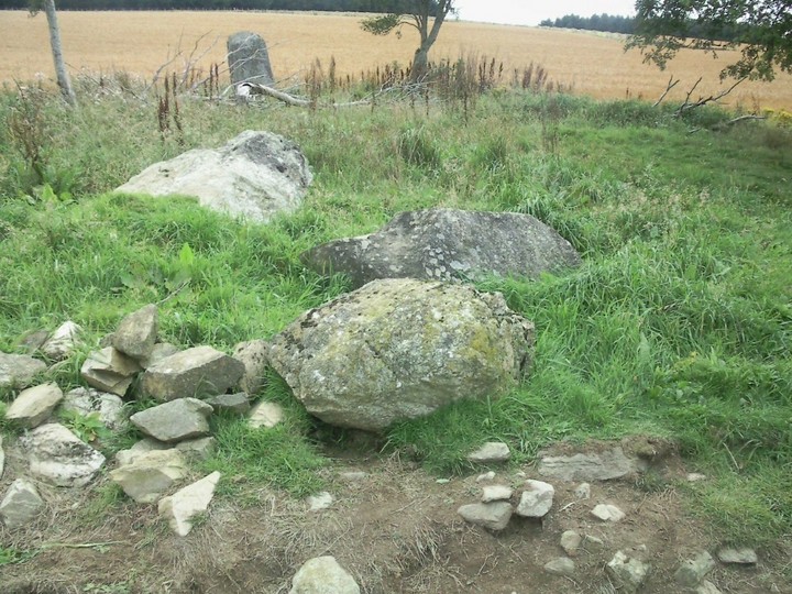
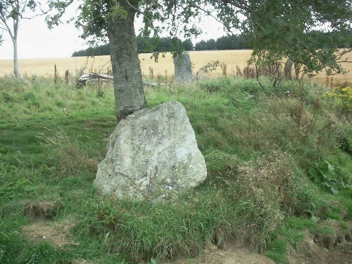
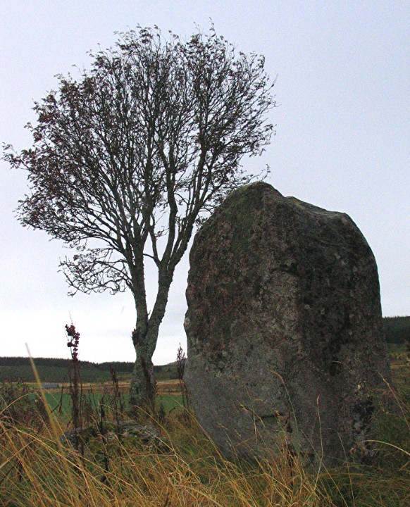
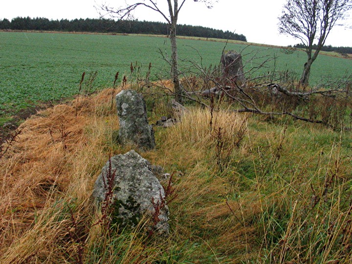
This is not the most impressive of recumbent stone circles. The recumbent has gone, both flankers are down and the views aren't great. But it does, like Balquhain, have an outlier so that makes it unusual and interesting. The 2.3m outlier lies to the N of the site in an area where the line of the circle is difficult to establish because of the absence of stones but the grading rules of RSCs mean that this cannot be a circle stone. The prior existence of the recumbent was confirmed to Coles when he surveyed the site in the early 20th century. The tenant farmer claimed it had been removed by a neighbouring farmer. It was wet when I visited this site. I'd had several attempts at finding the right tractor tracks to lead me to the site (they're opposite the caravan). My boots were thick with mud. Mrs G had given up. Maybe these explain why I'm I bit downbeat about this site. Try it on a good day! Visited 20 October 2005 |
 Posted by greywether
1st November 2005ce Edited 1st November 2005ce |
|
I had previously entered this circle on this website as 'Corrie Hill', having visited a few years ago. I can't remember where I got that name from, but it has been pointed out that the site seems to be the same one as this, added by Merrick. And I'm quite happy to go for 'Druidstones'. Merrick's pretty much said it all, all I'd add is that it's certainly well worth a visit if you're around! When I went, I approached the same way as Merrick did in the end. I had a word with a (slightly eccentric, but very pleasant) woman at the bungalow at the top of the hill, who said that the farmer is quite happy for people to visit the circle. Obviously, it'd be unwise to approach if it could cause damage to crops and it'd be a REAL shame to abuse this trust. |
11th December 2003ce Edited 11th December 2003ce |
|
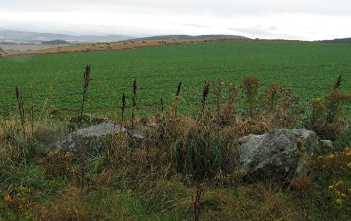
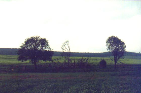
(notes from inside the circle, 2 July 00) Intrigued by the OS map marking a circle not even credited in the Modern Antiquarian's list of 'non-gazetteer sites', we wilfully sought this one out. On the OS map the track up from Towmill looks best, but it's actually overgrown in grass a metre and a half high, and anyway it's uphill from there. So we came to the next turnoff to the north. It was marked Druidstone Croft. Druidstones! At last we had a name for this circle! We looked it up in the Modern Antiquarian index and it gets a quick mention in a list of sites unvisited in 1994. Very mysterious. A household called Rashiewells is nearest the road, and the entrance to the field with the stones is straight in front (*not* down the track to the right). Through the entrance to the field we found that a generous gap of fifteen or twenty metres had been left between the edge of the crop and the edge of the field. We walked along this, soon cresting the hill and seeing the two small copses in the field, the nearest of which was around the stones. We walked down a tractor wheel-run to the trees and stones. Behind them is an abandoned house with some trees beside it. The OS map optimistically shows four blobs for this stone circle. There are two stones standing, one is at the north-west, two and a half metres tall, a metre across each side and grey. The other's opposite, a tiny metre-high thing, and at the south-west there's a jumble of large rubble, surely the remains of the recumbent and/or flankers. Five trees grow in the circle among knee-deep grass. Despite the two standing stones this feels like a truly ruined circle, the destruction here has a feeling of absoluteness, somehow. The dead tree in the circle and the abandoned house beyond the don't generate the creepy vibe you'd expect, in fact there's seemingly nothing of such potency here. That said, the sense of place is amazing. To the south-east Corrie Hill slopes down to allow a clear line of sight on Cothiemuir Wood and beyond to a far horizon of the Corrennie Moor peaks. The south-west aspect looks over Brindy Hill and, behind and left, the two peaks of The Barmkyn. To go straight over the absent recumbent would take you through the lea of The Barmkyn peaks and directly down to the recumbent of Old Keig! Druidstones circle is in sight of Cothiemuir Wood, yet this is on a slope and the circle at Cothiemuir Wood is on a summit. If Druidstones were on a summit then The Barmkyn would no longer be the far horizon. I'm thinking this really suggests The Barmkyn as a sacred hill. The positioning of this circle is superb, and for me this is a must-visit. |
Posted by Merrick 7th August 2000ce |
Folklore |
|
|
'The farmer then removed a stone circle nearby and paid a great price. All his cattle died of disease. Several cairns about 100 paces to the west were removed entirely.' McPherson's Primitive Beliefs (It is believed that the circle involved was Druidstones.) |
26th February 2010ce Edited 26th February 2010ce |