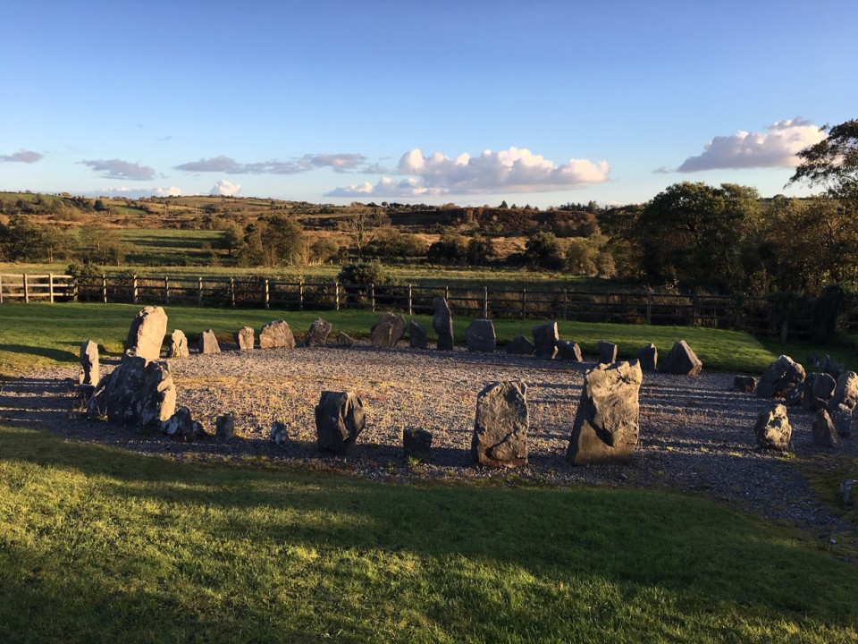
Second time at Drumskinney, slightly less underwhelmed this time. The polar opposite to Montiaghroe stone circle back down the road, its post-excavation restoration leaves you cold – well you can’t have it both ways, so put up or shut up I guess. But you could have a middle way, which seems to be occurring naturally as mother nature begins to weather the enclosure and moss starts to encroach onto the gravel and the stones begin to look less scrubbed.
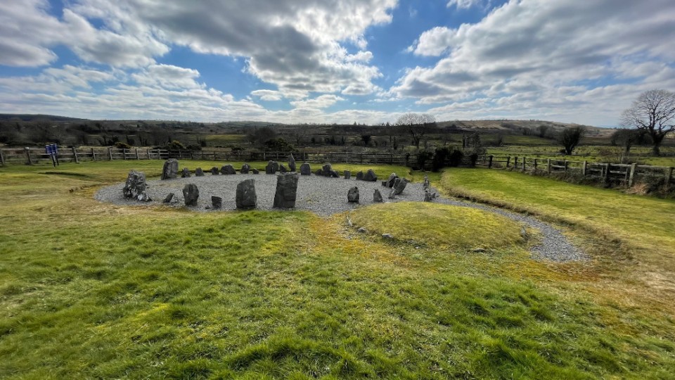
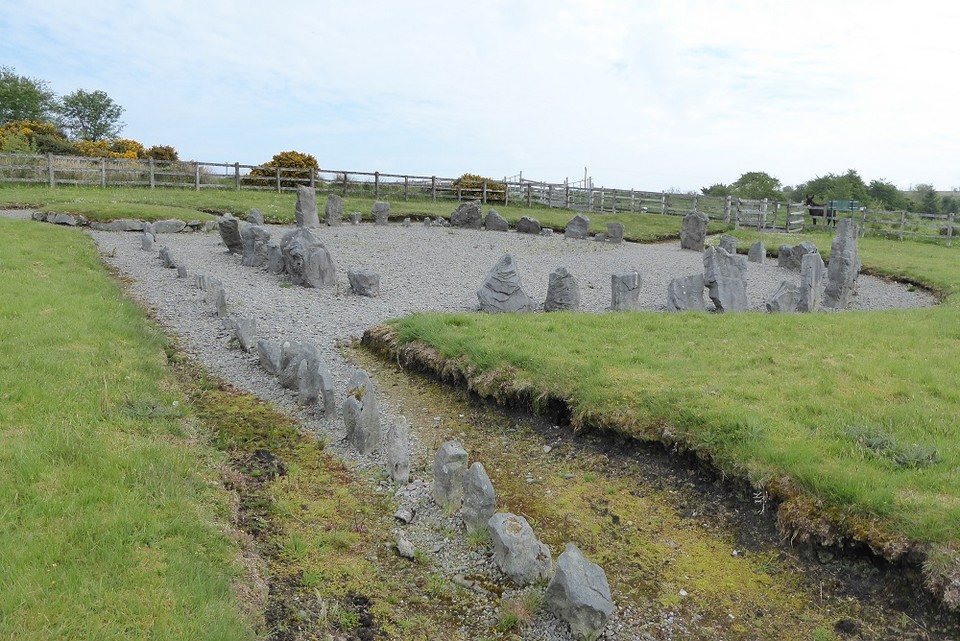
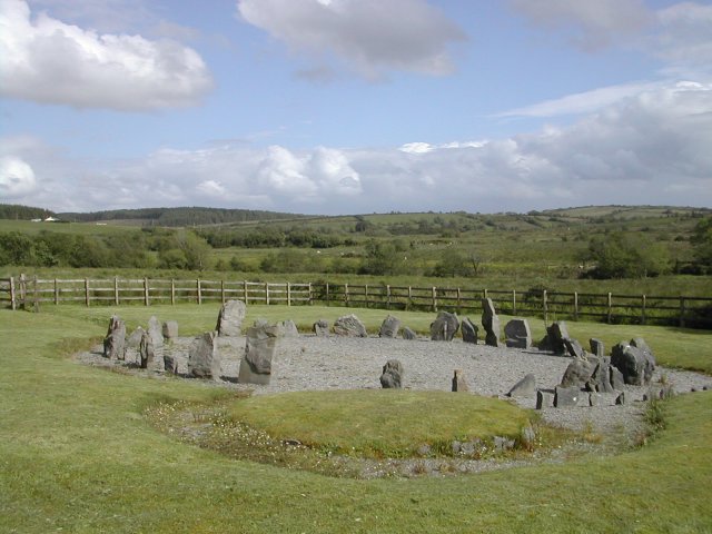
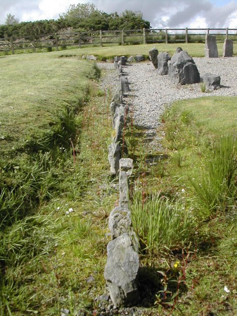
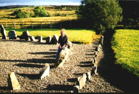
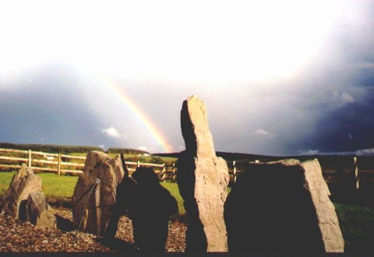
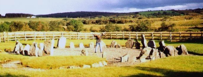
I had seen the sign for Drumskinny Stone Circle on the journey towards Donegal and made a mental note to try and visit on the way back as just over the border with Northern Ireland in County Fermanagh off the main road between Donegal Town and the village of Kesh. The monument consists of a stone circle, cairn and stone alignment and comes as something as a surprise as it seems to be in miniature. The peat bog has also been removed around the monument replaced by gravel. There is an information board by the gate into the site which verifies it authenticity - I've recorded it below as some will find the measurements a little odd. Could this be a place of 'the little people' I wonder :)
"Management History: Drumskinny Stone Circle first came under public management in 1934 when it was taken under the charge of the Ministry of Finance (MOF). Lying in shallow upland bog, poor drainage had caused recurring water-logging of the site. This was detrimental to the presentation of the monuments and inhibited inspection by visitors. In 1962 measures to improve the site’s amenities were implemented by the Ancient Monuments Branch of the MOF and involved the removal of peat down to the natural boulder clay and the laying of stone chippings in the area of the monument. As no previous examination of the monument had taken place, these works allowed for an archaeological excavation under the supervision of D.M. Waterman.
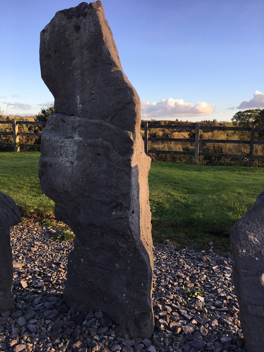
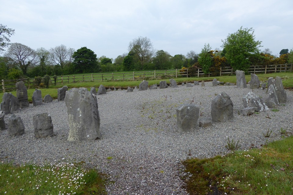
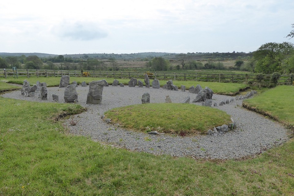
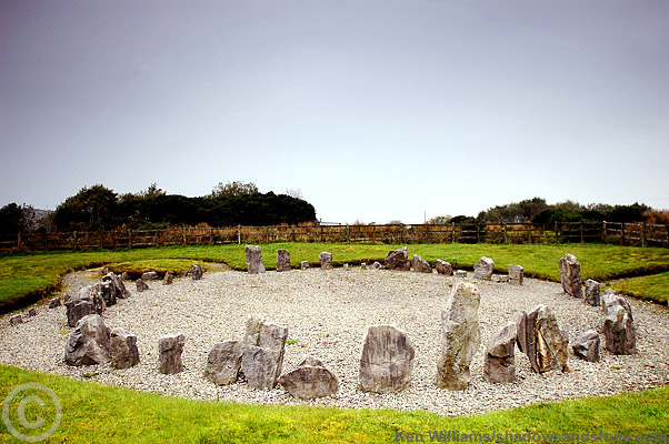
The Monuments: The archaeological monument at this site consists of a stone circle, a cairn, and alignment. The stone circle, although not geometrically accurate, maintains a fairly consistent diameter of 13.1m and includes three apparent gaps. Waterman’s excavation discovered 31 standing stones, an additional fallen stone lying adjacent to its socket and the former presence of seven more uprights (indicated by stone socket holes), suggesting an original minimum of 39 stones around the circumference. The stones vary in size and shape with the shortest only 38cm above ground level, while the tallest rises to almost 1.8m.
The circular cairn, lying one metre north-west of the stone circle, is carefully constructed of boulders and slabby stones. It has a regular diameter of 4 metres, and stands approximately 30cm in height at the edges, rising to 45 cm in the centre of the cairn. During excavation, no trace of burial or any other form of deposit was revealed.
The alignment directed towards the centre of the cairn consists of small stone uprights and extends to a distance of 15m towards the south. Of the original estimated 24 stones only 16 remained at the time of Waterman’s excavation. The highest stone still standing rises to 48 cm.
The Finds: during excavation, a small number of artefacts were discovered. A small piece of probable Neolithic potter was found in clay at the east of the stone circle. A hollow scraper was found under stone spread at the north-west side of the cairn. Six further flints were found in the area of the cairn, two them burnt."
Note: After our visit, on the drive back to the main road we noticed three large standing stones in a field opposite a small white church, not far from Drumskinny. Didn't have time to investigate as had to get down to Dublin. I'd very much like to know any information about these stones.
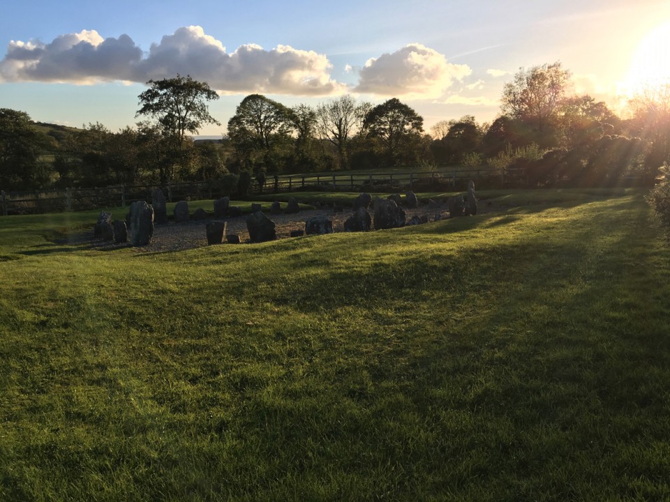
After a spectacular sunrise at Beltany Tops, the morning took a more gloomy and dank feel by the time I got to Drumskinny. It was 10.30am on a Sunday yet I wasn't the first here, a couple were leaving just as I arrived.
The circle is really nice, 'nice' is a good word because it does feel 'nice' but not quite 'right'. It can be hard to ignore the newness of the place though the stones are quite charming, it feels like it could be one of those modern public artworks you see in pretentious 'Business Parks'. Its even been signed by the heritage people! (The missing stones have been carved to indicate they are not original). I didnt notice from other photos that its on such a slope, maybe this adds to the unrealness of the place, maybe the weather was affecting my mood...


 Maps / Plans / Diagrams:
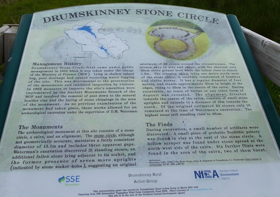
 Posted by ryaner
 Posted by tjj