The Modern Antiquarian. Stone Circles, Ancient Sites, Neolithic Monuments, Ancient Monuments, Prehistoric Sites, Megalithic MysteriesThe Modern Antiquarian


Stroanfreggan Craig

Hillfort

<b>Stroanfreggan Craig</b>Posted by markj99Image © Mark Johnstone
Nearest Town:New Galloway (14km S)
OS Ref (GB):   NX6370092064 / Sheet: 77
Latitude:55° 12' 14.02" N
Longitude:   4° 8' 31.17" W

Added by markj99


Discussion Topics0 discussions
Start a topic


Show map   (inline Google Map)

Images (click to view fullsize)

Add an image Add an image
<b>Stroanfreggan Craig</b>Posted by markj99 <b>Stroanfreggan Craig</b>Posted by markj99 <b>Stroanfreggan Craig</b>Posted by markj99 <b>Stroanfreggan Craig</b>Posted by markj99 <b>Stroanfreggan Craig</b>Posted by markj99 <b>Stroanfreggan Craig</b>Posted by markj99 <b>Stroanfreggan Craig</b>Posted by markj99 <b>Stroanfreggan Craig</b>Posted by markj99 <b>Stroanfreggan Craig</b>Posted by markj99 <b>Stroanfreggan Craig</b>Posted by markj99 <b>Stroanfreggan Craig</b>Posted by markj99 <b>Stroanfreggan Craig</b>Posted by markj99 <b>Stroanfreggan Craig</b>Posted by markj99

Fieldnotes

Add fieldnotes Add fieldnotes
Visited 11.04.22

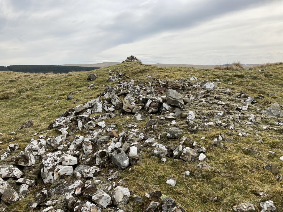
Stroanfreggan Craig Hillfort was an Iron Age fort on a ridge rising from the B729 c. 0.5 mile WNW of Stroanfreggan hamlet. The ruined hillfort enclosed c. 0.5 Acre on a lower summit of Stroanfreggan Craig. There is an extensive spread of stones on the N and W flanks, remains of a double wall enclosure according to Canmore ID 64376 (go to Links). The S flank is protected by a steep slope with a possible entrance to the fort up a natural gully. There is also a possible entrance on the E flank via a SE path. The rocky interior is featureless except for a linear scatter of stones in the N quadrant and a modern cairn marker in the centre of the enclosure.
Posted by markj99
15th April 2022ce
Edited 15th April 2022ce

Links

Add a link Add a link

Canmore ID 64376


Stroanfreggan Craig Hillfort on Canmore
Posted by markj99
15th April 2022ce