The Modern Antiquarian
Log in
|
Register
Home
Latest Posts
Forums
Maps
Help
Browse Sites
News
Blog
Contributors
The Books
Select
-
Belgium
Denmark
Eire
France
Germany
Greece
Italy
The Netherlands
Norway
Portugal
Republic of Malta
Spain
Sweden
Switzerland
United Kingdom
England
Southern England
Wiltshire
Cherhill 4
Round Barrow(s)
Cherhill 4 (Round Barrow(s)) on The Modern Antiquarian, the UK & Ireland's most popular megalithic community website. 6 images, plus information on many more ancient sites nearby and across the UK & Ireland.
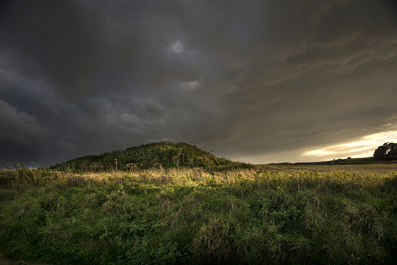
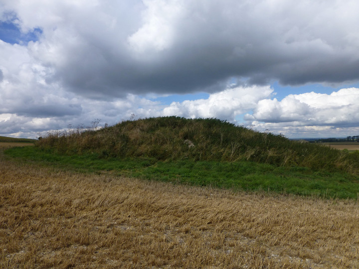
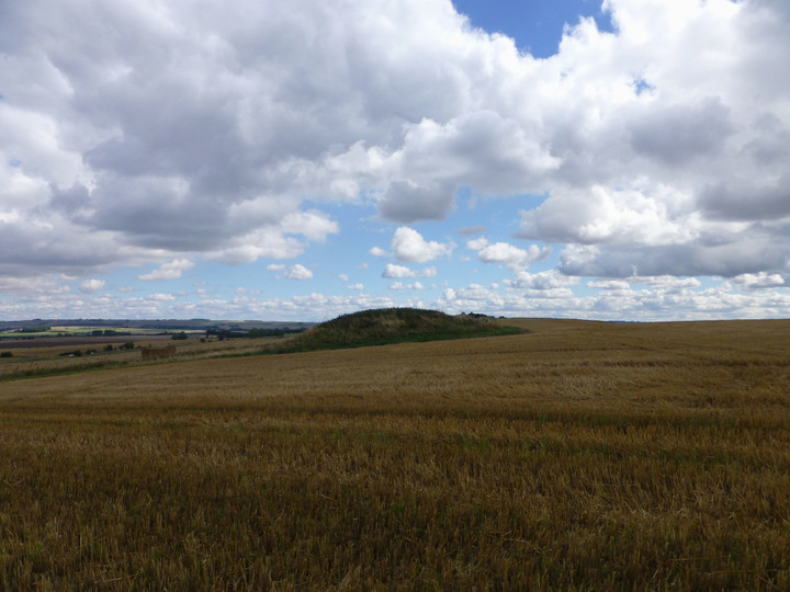
Image © A. Brookes (7.9.2013)
Nearest Town:
Calne (6km W)
OS Ref (GB):
SU05566984 /
Sheet: 173
Latitude:
51° 25' 37.19" N
Longitude:
1° 55' 12.07" W
Added by
thesweetcheat
Images (6)
0 discussions
Start a topic
Show |
Hide
Web searches for Cherhill 4
Flickr
Google
Google Images
MAGIC
The Megalithic Portal
Bing
Stone Pages
Streetmap.co.uk
Wikipedia
Show map
(inline Google Map)
- Sites within 20 km -
-
Knoll Down Earthwork (0.53km WSW) (2 posts)
Cherhill Down and Oldbury (0.92km SW) (68 posts)
Oldbury Long Barrow (1.02km WSW) (5 posts)
Old Bath Road Barrow (1.19km E) (11 posts)
Calne Without (1.22km WSW) (8 posts)
West Down Gallops Barrows (1.24km ESE) (8 posts)
Cherhill cross dyke (1.4km WSW) (4 posts)
Yatesbury Field Barrow (1.4km NE) (1 post)
Yatesbury Field Cursus (1.49km ENE) (1 post)
Cherhill Hill (West) (1.78km WSW) (11 posts)
Knoll Down Barrows (1.79km E) (2 posts)
Little London Pair (1.84km NE) (8 posts)
Little London Barrow (1.96km NE) (1 post)
Yatesbury Village Barrow (2.04km NNE) (1 post)
West Down Long Barrow (2.04km ESE) (1 post)
West Down Roman Road Barrows (2.07km ESE) (9 posts)
Noland's Farm Barrow (2.18km N) (1 post)
Harepit Way (2.25km E) (1 post)
Fox Covert Barrow Group (2.26km E) (4 posts)
North Down (2.38km SE) (39 posts)
Mount Wood (2.38km WNW) (10 posts)
Penning Barn (3km E) (3 posts)
Horslip (3.1km ENE) (6 posts)
Long Stones (3.31km E) (16 posts)
The Longstone Cove (3.37km E) (78 posts)
Baltic Farm (3.41km SSW) (4 posts)
South Street (3.49km E) (11 posts)
Windmill Hill (3.5km ENE) (98 posts)
Beckhampton Avenue (3.57km E) (13 posts)
Wagon and Horses Barrow Cemetery (3.66km E) (1 post)
Beckhampton Road Enclosures (3.68km E) (2 posts)
Morgan's Hill (eastern group) (3.7km SW) (11 posts)
Easton Down (3.81km SSE) (22 posts)
Morgan's Hill (3.81km SW) (28 posts)
Horton Down (3.99km SE) (2 posts)
Shepherds Shore Long Barrow (4.12km SSW) (1 post)
Roughridge Hill (4.14km S) (8 posts)
Beckhampton Penning Enclosure (4.25km E) (1 post)
Silbury Hill (4.5km E) (227 posts)
Millbarrow (4.53km ENE) (2 posts)
Avebury (4.53km ENE) (487 posts)
The Cove (4.58km ENE) (65 posts)
Beckhampton Penning Barrow Cemetery (4.62km ESE) (1 post)
Winterbourne Monkton (Churchyard) (4.7km ENE) (8 posts)
West Kennett Avenue (4.84km E) (148 posts)
Avenue stone with axe grinding marks (4.88km E) (13 posts)
Swallowhead Springs (4.88km E) (45 posts)
Waden Hill (4.99km E) (6 posts)
Beckhampton Plantation Stone Circle (5.06km E) (3 posts)
The Shelving Stones (5.09km ENE) (1 post)
West Kennet Avenue Settlement Site (5.16km E) (29 posts)
Falkners Circle Long Barrow (5.2km E) (1 post)
West Kennett (5.24km E) (225 posts)
Kitchen Barrow (5.24km SSE) (10 posts)
Allington Down (5.25km ESE) (15 posts)
Silbaby (5.25km E) (26 posts)
Falkner's Circle (5.35km E) (41 posts)
Tan Hill (west) (5.36km SE) (13 posts)
Falkners Circle mounds and barrows (5.37km E) (3 posts)
West Kennett Palisaded Enclosures (5.6km E) (5 posts)
West Kennet Hollow Way (5.67km E) (1 post)
Avebury Down (5.96km ENE) (27 posts)
Penning (5.98km ENE) (14 posts)
King's Play Hill (6.01km SW) (23 posts)
Roundway Hill (6.08km SW) (10 posts)
Tan Hill (east) (6.09km ESE) (7 posts)
Tan Hill (6.1km SE) (12 posts)
Winterbourne Monkton oval mound (6.17km ENE) (1 post)
The Sanctuary (6.2km E) (80 posts)
Overton Hill (6.51km E) (113 posts)
Rybury (6.53km SE) (26 posts)
Monkton Down (6.67km ENE) (13 posts)
Harestone Down Stone Circle (6.69km E) (25 posts)
Harestone Down barrow (6.71km ESE) (3 posts)
East Kennett (6.74km E) (60 posts)
Winterbourne Bassett (6.91km NE) (49 posts)
Experimental Earthwork (7.35km ENE) (10 posts)
Down Barn standing stones (7.38km E) (5 posts)
Overton Down (7.39km ENE) (20 posts)
Little Avebury (7.47km ESE) (20 posts)
Laggus Farm Mound (7.49km WSW) (1 post)
Pickledean Stone Circle (7.52km ENE) (12 posts)
Oliver's Castle (7.55km SW) (45 posts)
Berwick Bassett Down (7.55km ENE) (4 posts)
Roundway Hill Covert (7.64km SW) (3 posts)
The Mother's Jam (7.85km ENE) (22 posts)
White Horse Barrow (7.87km ESE) (11 posts)
Old Chapel (7.93km ENE) (2 posts)
Monster Stone (7.93km ENE) (7 posts)
Fyfield Down (7.98km ENE) (22 posts)
Mother Anthony's Well (8km SW) (8 posts)
Knap Cottage Stone (8.24km ESE) (3 posts)
Bowood Park Mound (8.45km WSW) (1 post)
Fiddlers Hill (8.47km NE) (2 posts)
Adam's Grave (8.56km ESE) (69 posts)
Rough Hill Barrows (8.58km ENE) (1 post)
Knap Hill and Walker's Hill (8.6km ESE) (8 posts)
Fyfield Down settlement (8.6km ENE) (4 posts)
Piggle Dene (8.63km E) (20 posts)
Hackpen Hill (Wiltshire) (8.67km NE) (10 posts)
Rough Hill Row (8.68km ENE) (1 post)
Knap Hill Pass (8.7km ESE) (2 posts)
Fyfield 1 and 2 barrows (8.73km ENE) (3 posts)
Bowood (8.74km W) (1 post)
Hoare Stone (8.74km W) (1 post)
Adam's Grave Fallen Stone (8.74km ESE) (5 posts)
Long Tom (Fyfield) (8.93km ENE) (11 posts)
Knap Hill (9.02km ESE) (47 posts)
Lockeridge Dene (9.07km E) (25 posts)
White Barrow (Lockeridge) (9.09km E) (1 post)
Brade Wyll (9.22km ESE) (3 posts)
Manton Down (9.23km ENE) (16 posts)
Alton Priors (9.33km ESE) (20 posts)
Golden Ball Hill (9.36km ESE) (13 posts)
Devil's Den (9.51km E) (126 posts)
Ridgeway (Southernmost Remains) (9.64km ESE) (9 posts)
Temple Bottom (9.65km ENE) (4 posts)
Clatford Barrows (9.85km E) (1 post)
Draycott Hill (10.21km ESE) (28 posts)
Loxwell (10.24km W) (3 posts)
The Hanging Stone (10.29km SE) (6 posts)
Broad Stones (Clatford) (10.74km E) (2 posts)
Bincknoll Castle (10.75km NNE) (13 posts)
Barrow Copse (10.77km E) (30 posts)
Manton Round Barrow (10.93km E) (12 posts)
Picked Hill (11.14km ESE) (13 posts)
Ogbourne Maizey Down Barrows (11.17km ENE) (2 posts)
Woodborough Holed Stone (11.31km SE) (6 posts)
Barton Copse Barrows (11.33km E) (1 post)
Barbury Castle (11.49km NE) (59 posts)
Huish Hill (11.77km E) (9 posts)
Marden Henge (and Hatfield Barrow) (12.13km SE) (34 posts)
Naish Hill (12.17km WSW) (5 posts)
Swanborough Tump (12.24km ESE) (9 posts)
Marlborough Common Golf Course Barrows (12.46km ENE) (3 posts)
Granham Hill (12.51km E) (2 posts)
Marlborough Mound (12.75km E) (28 posts)
Giant's Grave (Martinsell) (12.85km E) (19 posts)
Ogbourne St Andrew Church (13.42km ENE) (9 posts)
Ogbourne St Andrew Barrow (13.42km ENE) (23 posts)
Martinsell (13.48km E) (22 posts)
Pewsey Church (14.34km ESE) (8 posts)
Whitefield Farm (14.42km ENE) (1 post)
Broadbury Banks (14.75km SSE) (2 posts)
Pewsey (14.76km ESE) (9 posts)
Forest Hill Farm (15.33km E) (5 posts)
Burderop Wood Stone Circle (15.83km NE) (1 post)
Devil's Footprint (16.03km NE) (1 post)
Rushy Platt Bowl Barrow (16.04km NNE) (4 posts)
Savernake (16.31km E) (11 posts)
Mud Lane Barrow (16.34km E) (1 post)
Broome Temple (16.87km NE) (2 posts)
Broome Long Stone (16.87km NE) (1 post)
Ringsbury (16.95km N) (11 posts)
Square Copse Barrows (17.13km E) (1 post)
Coate Mound (17.31km NE) (2 posts)
Savernake Temple (17.32km E) (1 post)
Casterley Camp (17.37km SE) (4 posts)
Giant's Grave (Milton Hill) (17.56km ESE) (18 posts)
Holy Well (17.72km W) (2 posts)
Savernake Lodge (17.75km E) (6 posts)
Coate Stone Circle (17.85km NE) (33 posts)
Liddington Castle (18.16km ENE) (38 posts)
Lanhill (18.45km W) (50 posts)
Ell Barrow (18.55km SSE) (1 post)
Chisenbury Camp (18.62km SE) (1 post)
Down Farm Group (18.62km ESE) (5 posts)
Shipley Bottom (18.66km ENE) (4 posts)
Everleigh Barrows (18.71km ESE) (14 posts)
Easton Clump (18.73km ESE) (3 posts)
Bushy Barrow (18.88km W) (4 posts)
Slay Barrow (18.93km SSE) (1 post)
Grant's Firs Group (19.17km ESE) (1 post)
Liddington Warren Farm (19.46km ENE) (16 posts)
Enford (19.58km SE) (5 posts)
Oldhat Barrow (19.59km ESE) (14 posts)
Warren Farm (19.61km ENE) (2 posts)
Aldbourne (west of Giant's Grave) (19.83km ENE) (8 posts)
Lidbury Camp (19.84km ESE) (1 post)
The Giant's Grave (Aldbourne) (19.98km ENE) (21 posts)
- Facilities within 20 km -
-
The Red Lion Inn (Pub: 4.4 km ENE)
Alexander Keiller Museum (Museum: 4.4 km ENE)
The Lodge Avebury (Bed & Breakfast: 4.4 km ENE)
Manor Farm (Bed & Breakfast: 4.4 km ENE)
Avebury Tourist Inform... (Tourist Information: 4.5 km ENE)
The New Inn (Bed & Breakfast: 4.9 km NE)
Avenue Farm (Camping Site: 4.9 km NE)
The New Inn (Bed & Breakfast: 4.9 km NE)
The Crown Inn (Pub: 6 km S)
The Old Forge (Bed & Breakfast: 6.6 km E)
The Barge Inn (Pub: 9.5 km SE)
Devizes Museum (Museum: 10 km SSW)
The Wiltshire Heritage... (Museum: 10 km SSW)
The Millstream (Pub: 12.3 km SSE)
Raj Indian Restaurant (Restaurant: 13.3 km E)
Marlborough Tourist In... (Tourist Information: 13.5 km E)
Foxlynch (Camping Site: 14.1 km ENE)
- Add -
-
Add news
Add an image
Add fieldnotes
Add folklore
Add miscellaneous
Add a link
Add a nearby facility
Add an alternative name/spelling
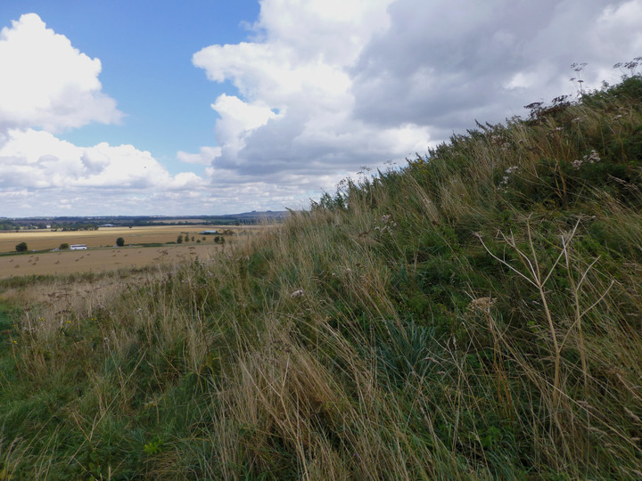
Images
(click to view fullsize)
Add an image
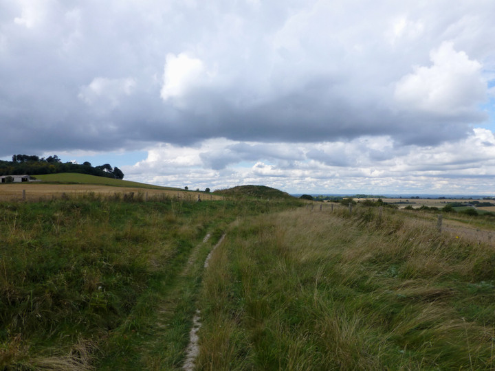
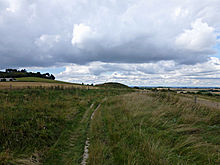 Image © A. Brookes (7.9.2013)
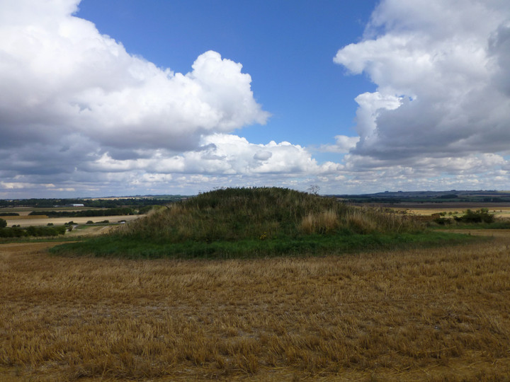