|
|

|
|
BeacharrChambered Cairn
|
||||||||||||||||||||||||
|
|
|
Images (click to view fullsize) |
|
|
Fieldnotes |
|
|
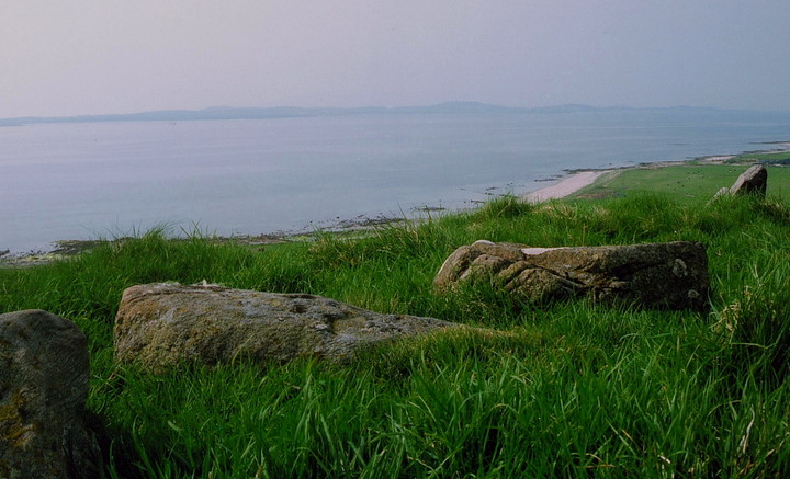
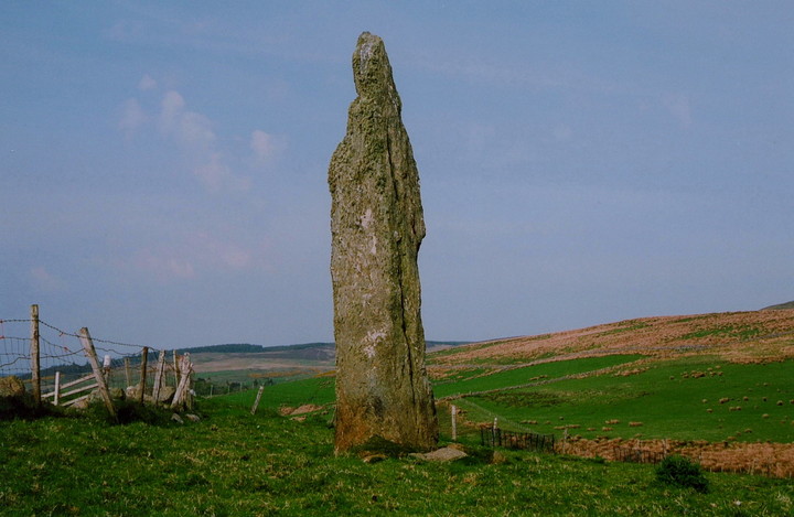
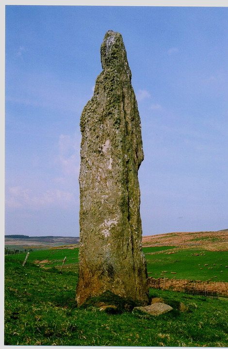
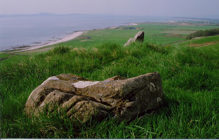
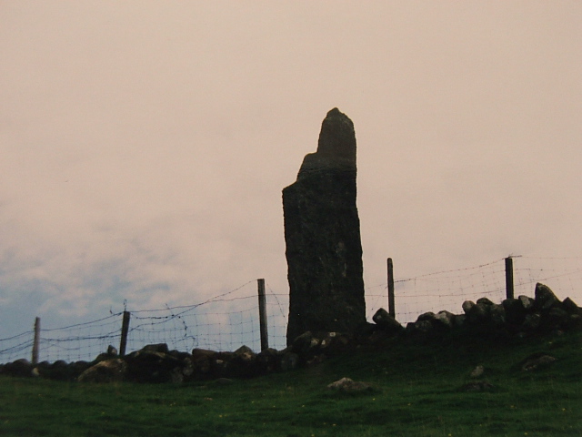
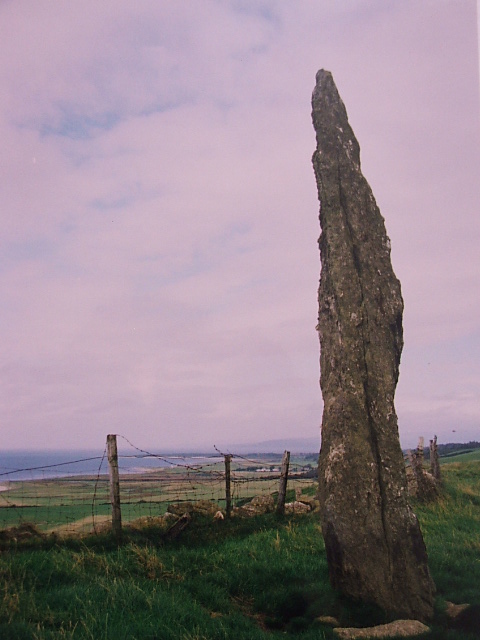
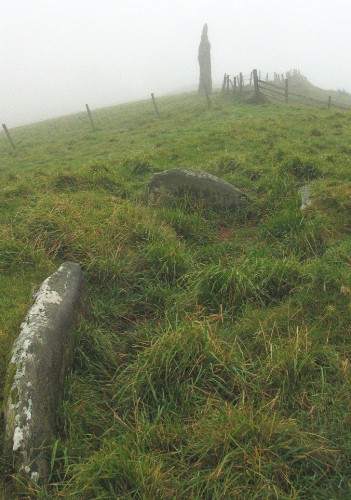
Visited 11/5/08 The track to the left of Tigh Chromain climbs steeply up hill (who'd have thought it, eh?) until - upon approaching the farmhouse - I see, or more accurately 'hear', the farmer working the fields in his tractor. Waving him down, he readily agrees to me taking a look at the site. Excellent. The monolith is a beauty, the coastal views towards Gigha and Cara (like a sea monster making its way up the Sound) exceptional. The chambered cairn has been badly dealt with, but a few stones still remain in situ... and of course there's that view! Incidentally the fence is currently 'step-over-able', so to speak, so no need to descend/re-ascend. The icing on the cake is the remains of a dun at the southern end of the ridge (beyond the monolith, that is). Great stuff. |
 Posted by GLADMAN
17th June 2009ce |
|
Easyish to find with an OS map just follow the track from the white cottage on the Campbeltown road (with convenient parking space). The cairn and menhir are seperated by an unclimable fence (d'oh!), necessitating a walk to the bottom of the hill by the farm again. The cairn is almost destroyed but the cist holds a slight depression which affords much-needed shelter in the wind and rain that invariable batters the coast of Kintyre. The stone is a beauty perched on top of its pre-glacial cliff face. Tall and imposing, it is one of a number of similar examples to be seen along the west-coast road (another is a couple of miles south on the other side of Muasdale). Although aligned with the cairn, the overwelming impression I get about this lithic finger is that it is simply a marker of territory, placed, as is the associated barrow, on the prominant hilltop. Its effect now when first glimpsed at 50 mph must by similar to that intended by it's erectors four millenia ago - an impossing, majesterial statement of perminance. |
Posted by stubbo 3rd October 2005ce |
|
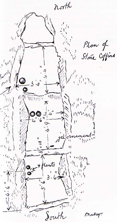
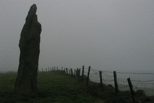
This was a disappointing chambered cairn. What I had read had led me to expect that more would be visible. All that you can now see of what was the longest chamber in Kintyre are a few stones poking through the grass. The standing stone is a beauty though especially when viewed in atmospheric misty weather. Just a fraction over 5m high. Access. There is a parking area at the foot of the track up to the farm. Steep but short climb. One fence. Visited 27 September 2004 |
 Posted by greywether
13th October 2004ce Edited 14th October 2004ce |