|
|

|
|
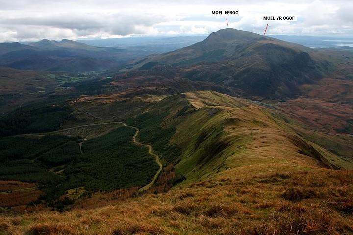
Moel HebogBarrow / Cairn Cemetery
|
||||||||||||||||||||||||
|
|
|
Images (click to view fullsize) |
|

|
Fieldnotes |
|
|
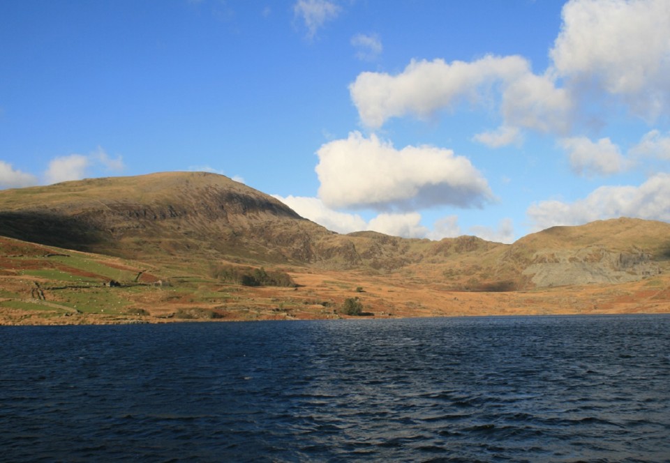
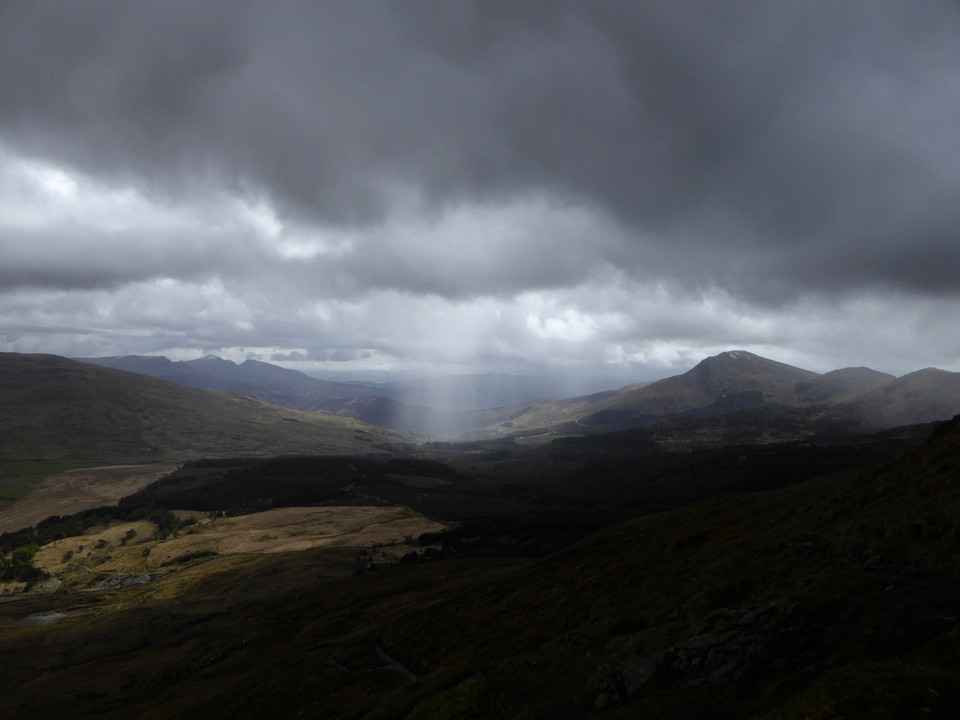
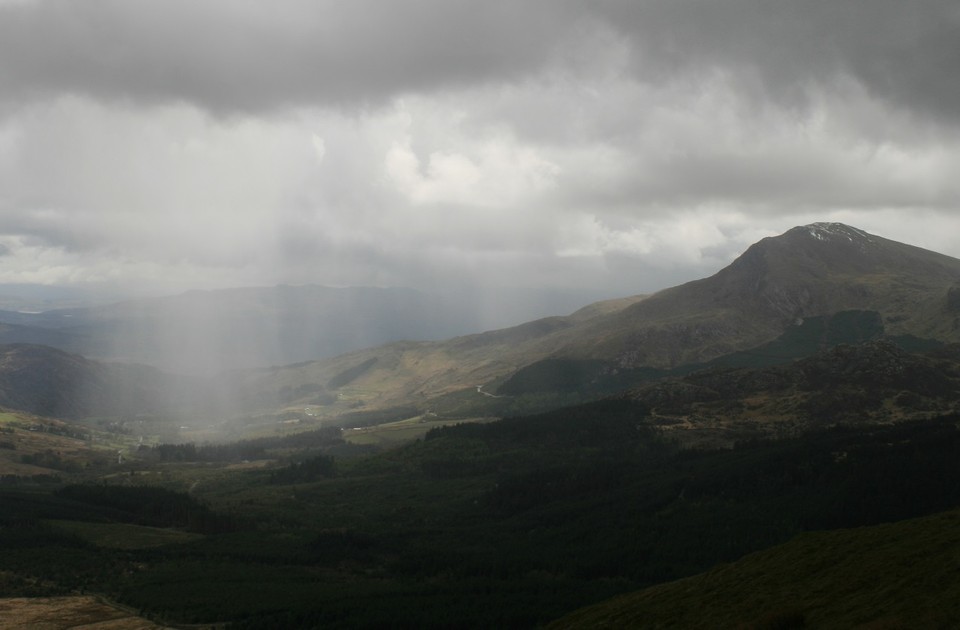
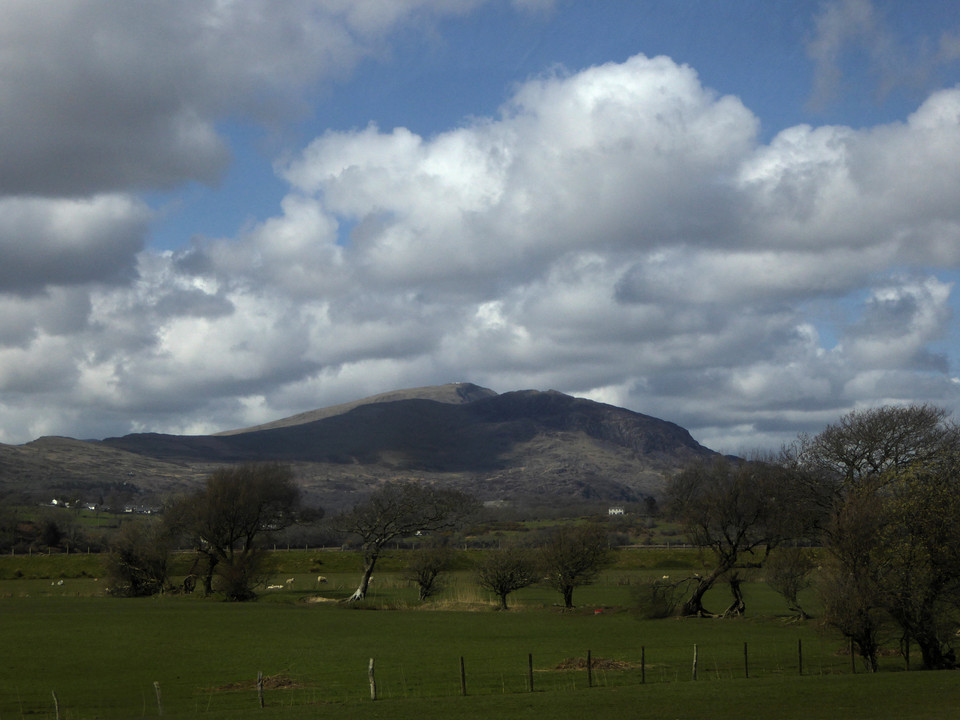
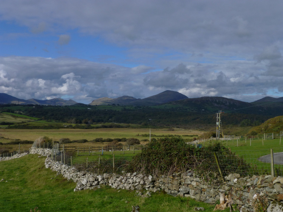
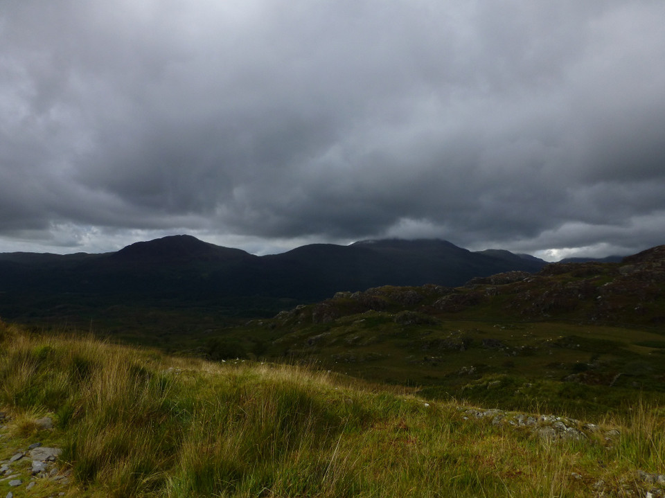
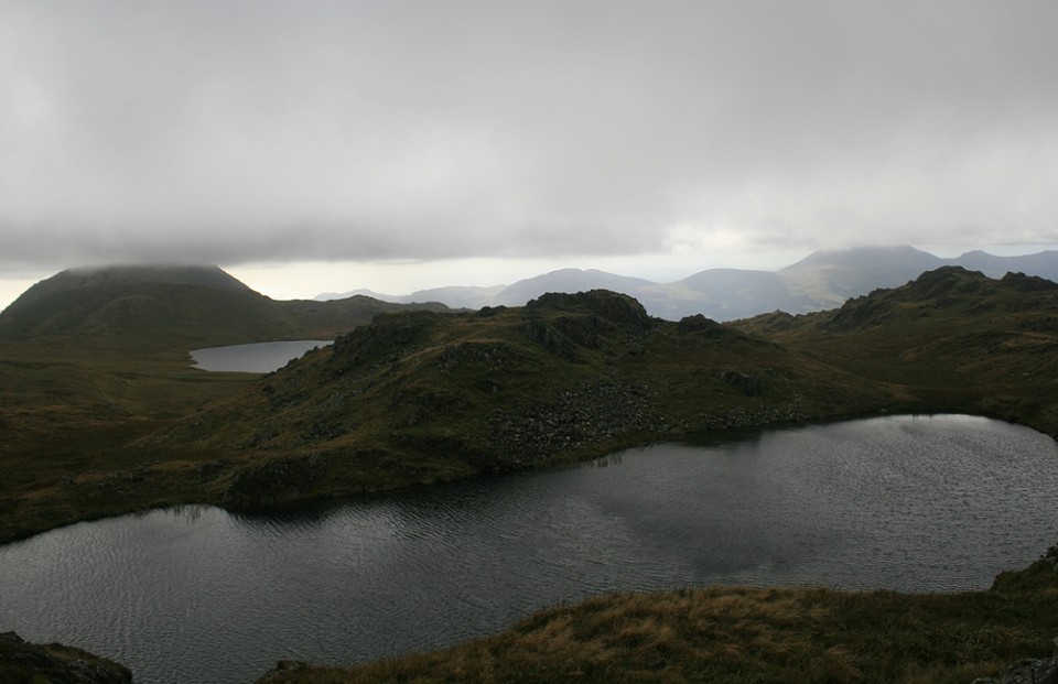
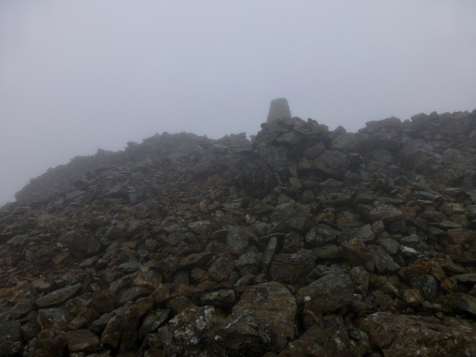
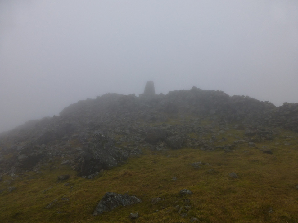
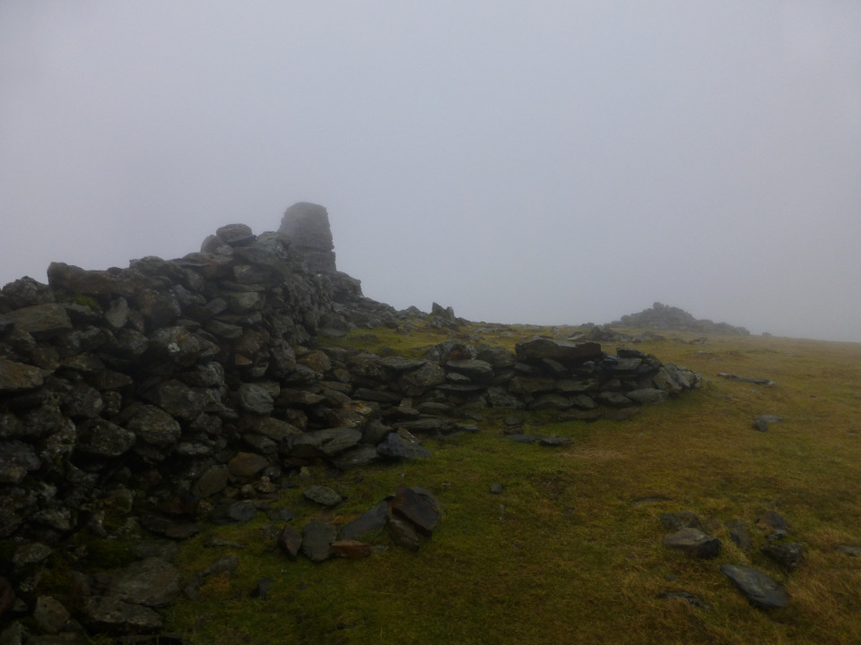
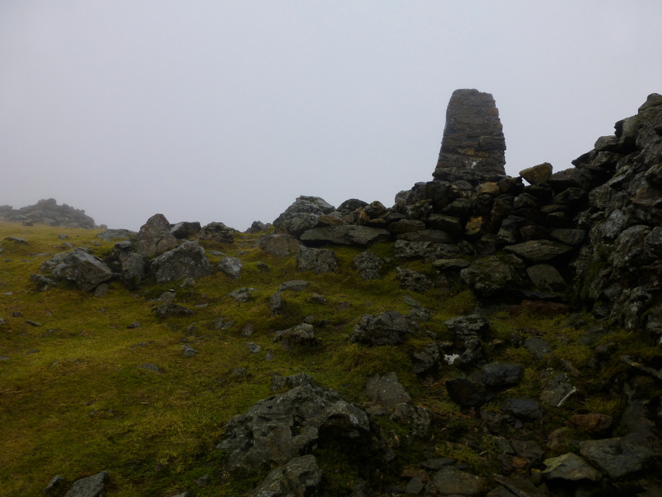
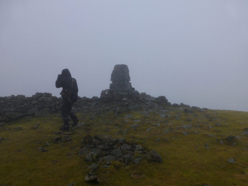
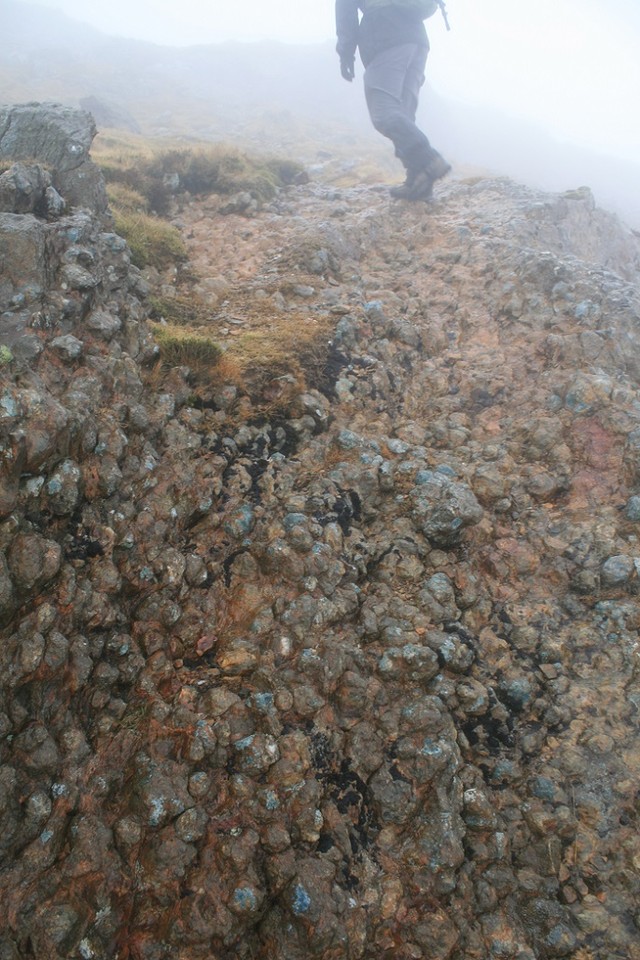
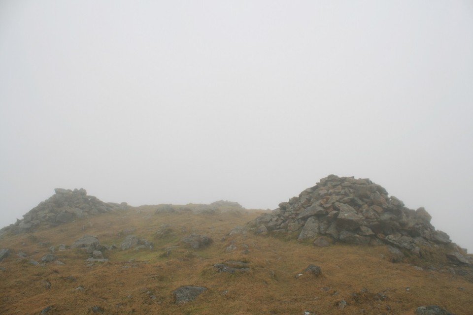
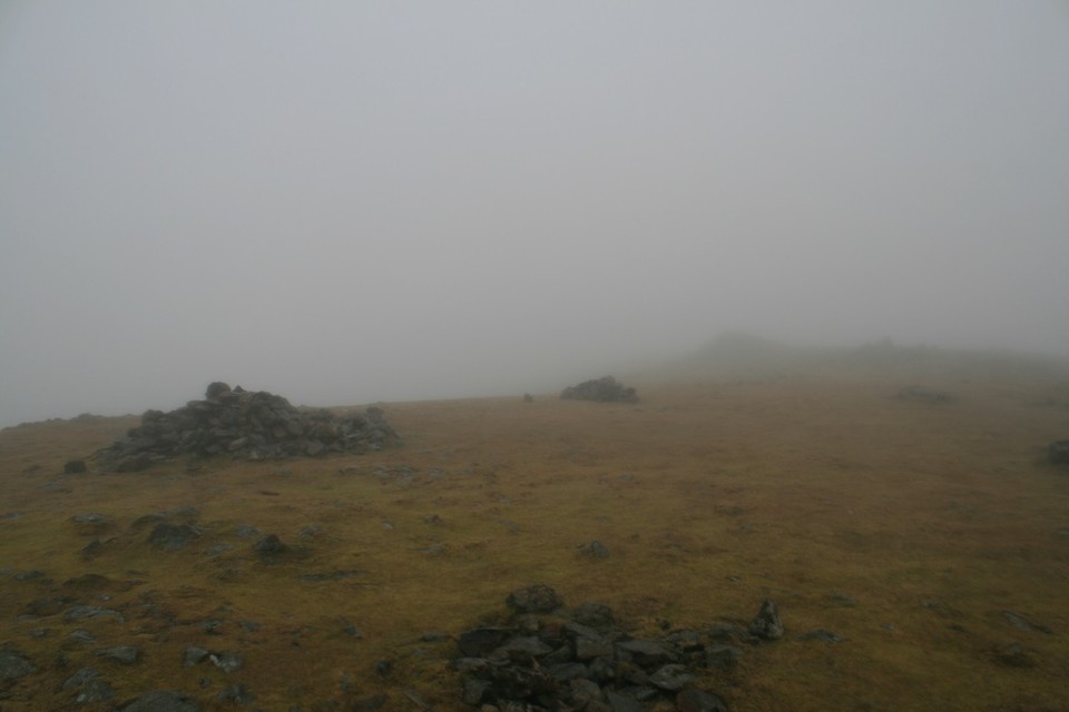
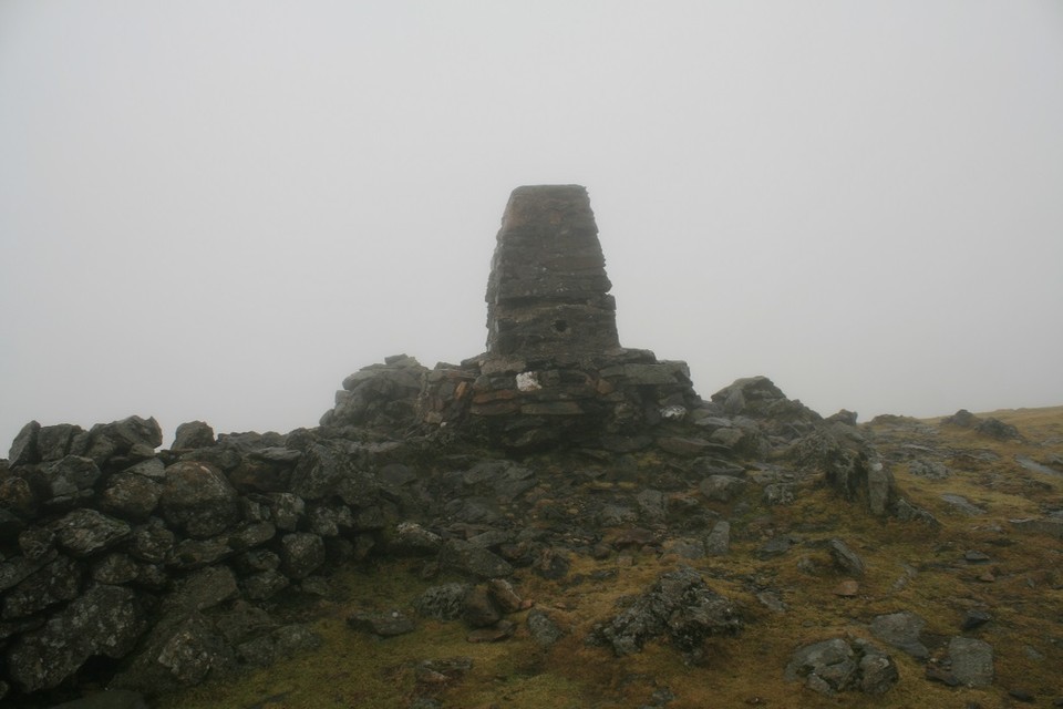
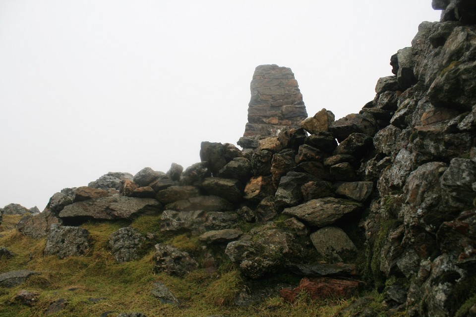
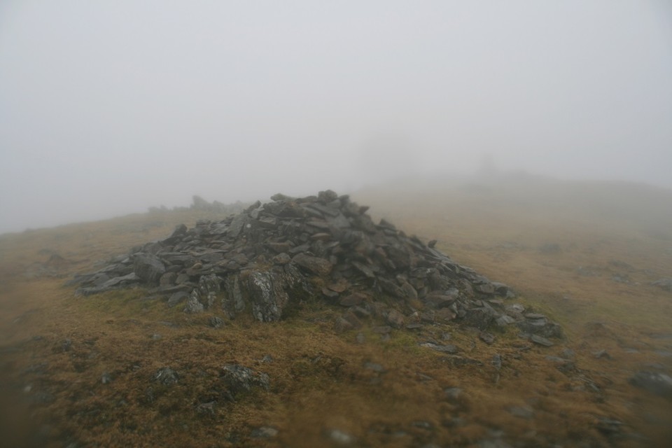
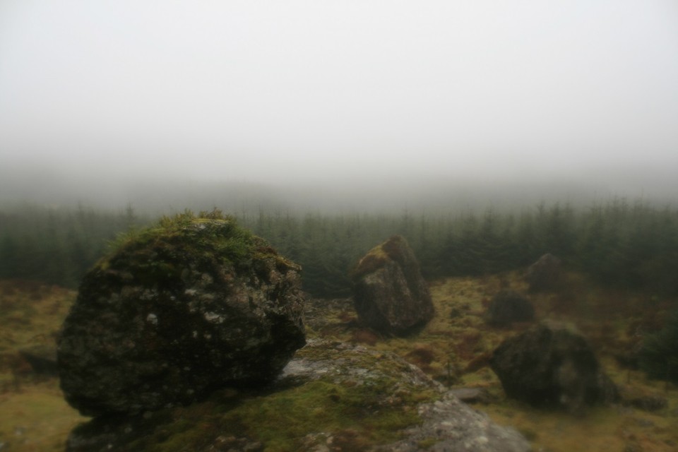
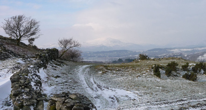
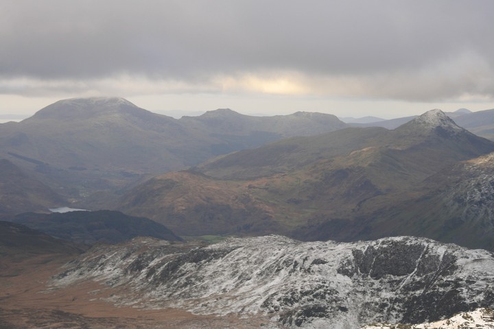
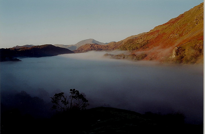
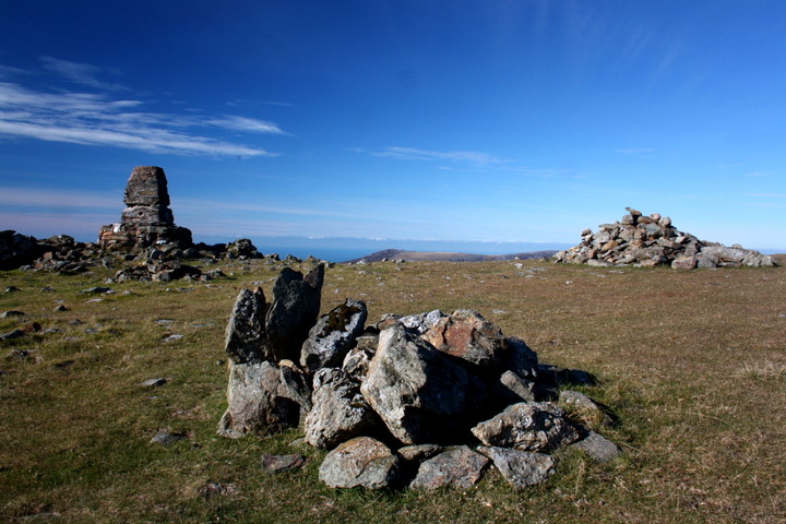
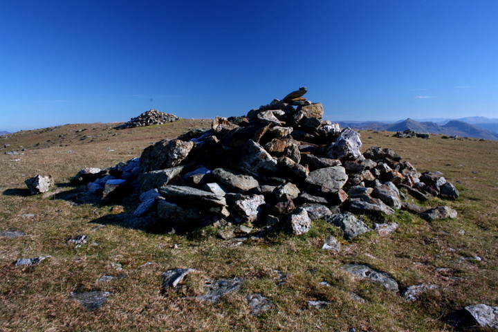
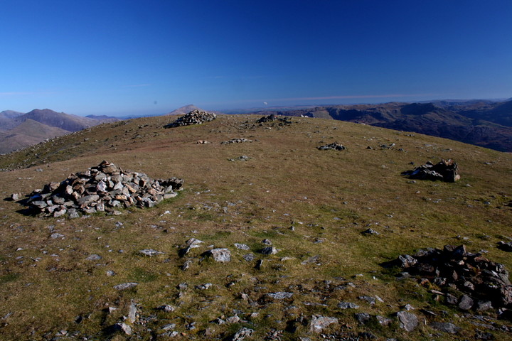
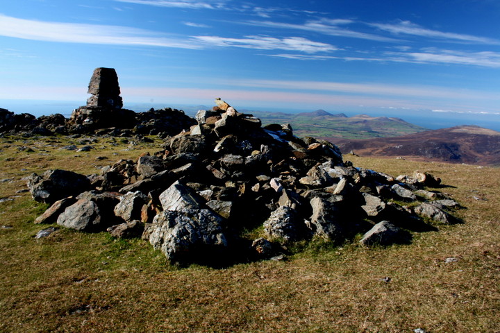
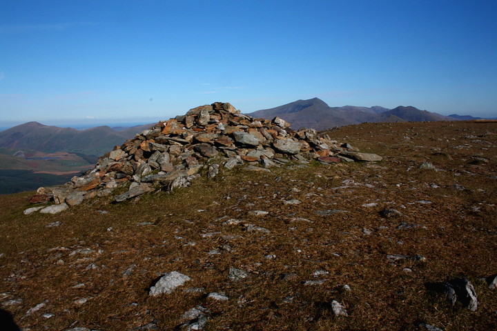
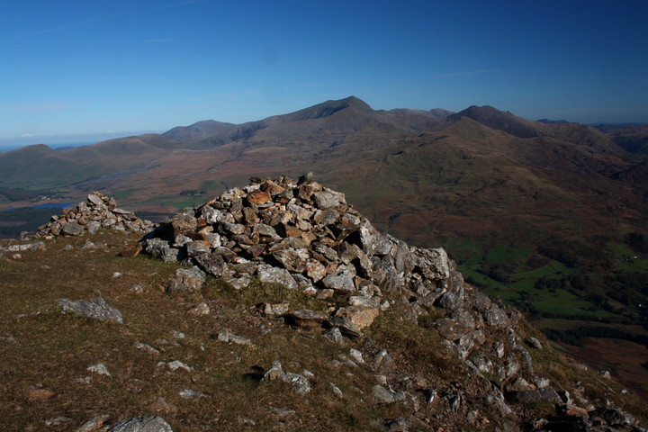
It was never going to be a blue sky with fluffy white clouds sort of day, there wasn't going to be 360 degrees of grand sweeping vistas, but, on the drive over there were patches of blue sky, so we crossed our fingers and made our way through the mountains. As luck would have it, and it usually does, upon automobile disembarkation in Beddgelert, the mountain, Moel Hebog, was almost completely hidden among the clouds. But, brave and hardy souls that we are, we carried on regardless. Over the river, over the railway tracks, and off up the hillside, it didn't take long to get into the clouds, and once in them, we stayed in them. As you get higher the path crosses rocky outcrops rusty in colour and full of rock balls, like cricket ball sized tektites. I thought of taking one home with me, but when climbing a big mountain the last thing you want is rocks in your pockets. The path was easy enough to follow, but even so, when a well waterproofed walker passed us coming down I had to ask him if it was far to the top, 15 minutes he said, them turn left, or something like that. He was wrong, perhaps it took him 15 minutes to get down, but it took us longer than that. Or perhaps we're just old and knackered. After a certain amount of time it feels like the top is approaching, there is grass once more underfoot, long drifts of snow persist out of the suns sight. The rest of the world still remains out of sight, it's out there somewhere, one presumes. When the wind picks up, it really picks up, it's hard to stand still and even through so many layers I can still feel the cold in the wind. It isn't and hasn't rained the whole time but the wind ravaging around in the clouds hurls the mist at you at many hundred miles per hour, threatening to penetrate even the so called waterproofed outer layer. Throw your arms aloft and shout victoriously into the void, for we have arrived at the top. There are what looks like over half a dozen cairns on the wide short haired mountain top. Coflein says four or five are part of the bronze age cemetery, the rest are walkers cairns. The only definite cairn is the big one under the trig point, half of the cairn abuts against a massive drift of scree, that side of the cairn is far too windy for me, but thesweetcheat braves it for a minute or two. My side of the cairn, the north side seems to have some kerbing still in tact, it could be a fortuitous later arrangement, but I'm willing to look on the bright side, even on a day like today. After huddling on the wind free side of the wall to consume much needed butties, I set about the mountain top with my camera. Usually, on a good day on the mountain I could easily take four hundred photos, but today I'm barely up to fifty, and half of them are a tad blurry. We've taken on the mountain and the weather and come out on top, but barely. After no more than half an hour we follow the wall back down towards Meol yr Ogof, on that good day, we'd have scaled that mountain too but the harsh wind and swirling mists have gotten the better of us. We could have stayed and appreciated the otherworldliness a bit more I guess, but I've seen otherworldly enough for today and there are places we could go to after getting back to the car, like Llangernyw Yew tree, the oldest living thing in Wales. En route back down we came across a strangely magical place, we called it the valley of big rocks, it doesn't do it much justice, but it is what it says it is. Giant house sized rocks with there own little ecosystems on top, one balances precariously on the edge of a cliff, it was just on the edge of the clouds and visibility was beginning to return. We decided it should be marked on the map, but as it wasn't and seeing as the place seemed to have a magical quality we deemed the place as to not occupying a real place in our universe but was actually and decidedly other worldy. And then we were down, the car park was free. |
 Posted by postman
8th March 2015ce Edited 8th March 2015ce |
|
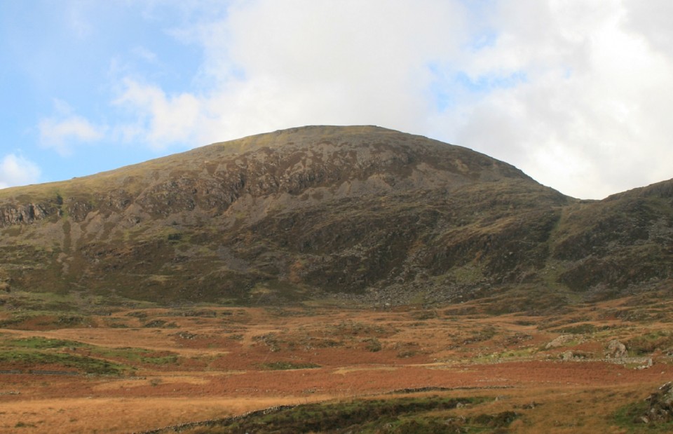
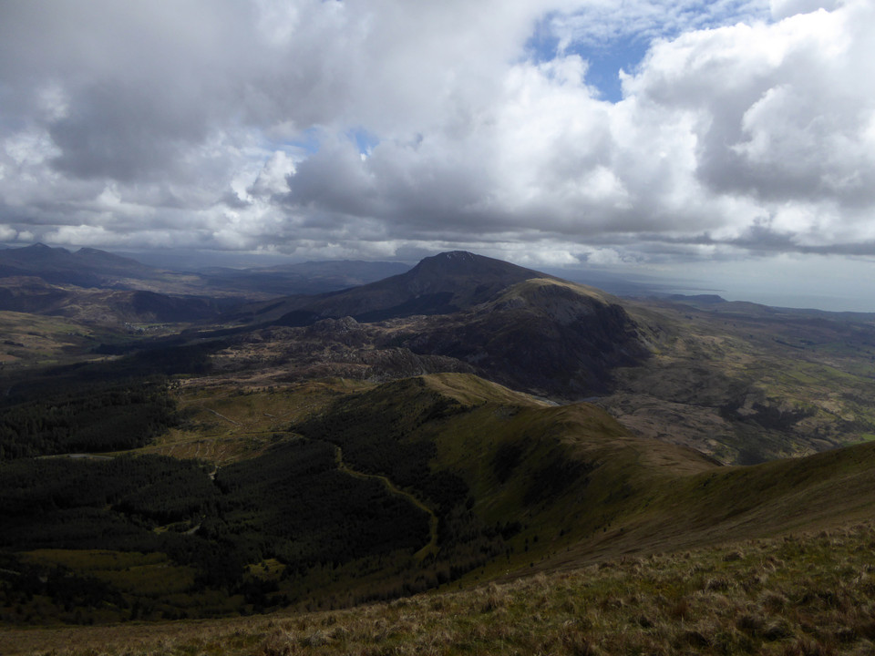
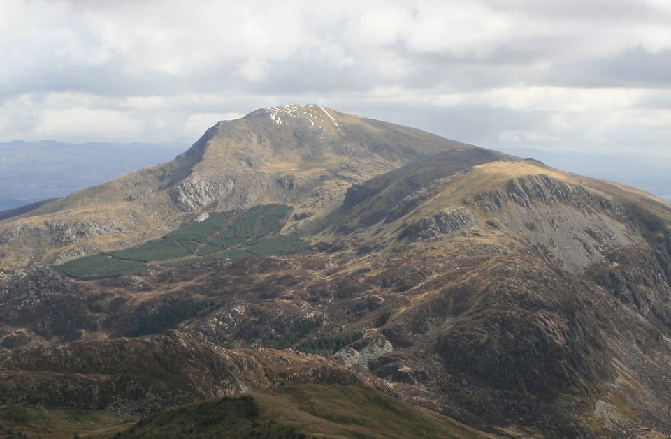
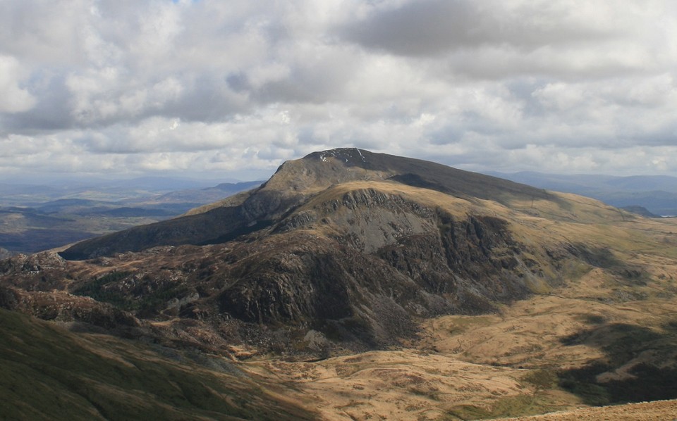
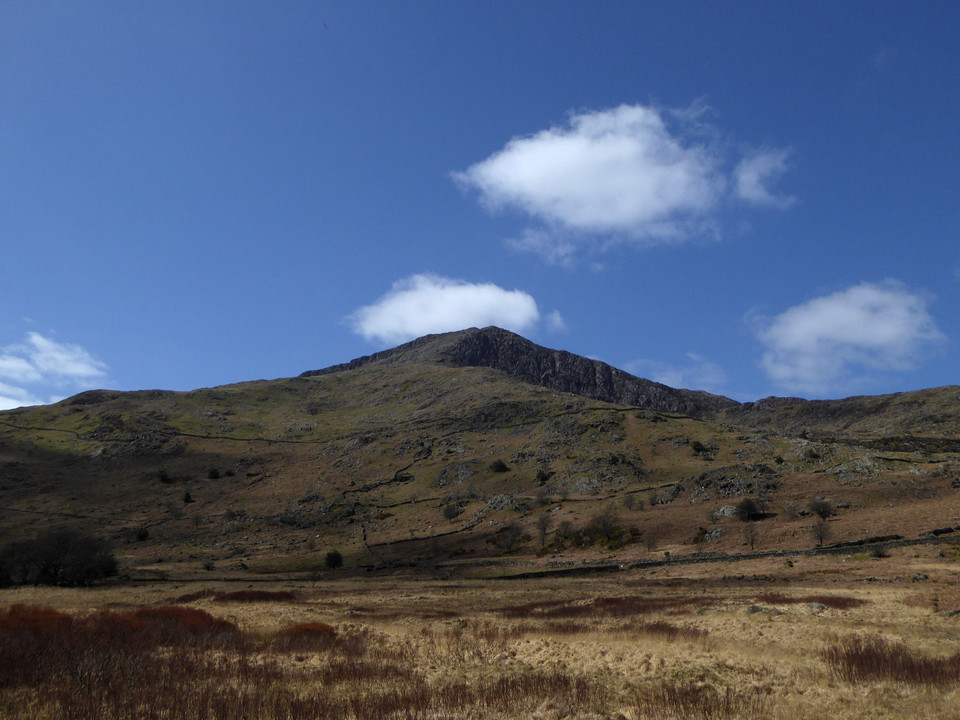
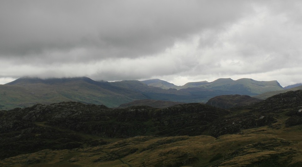
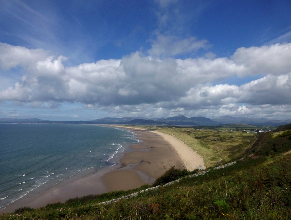
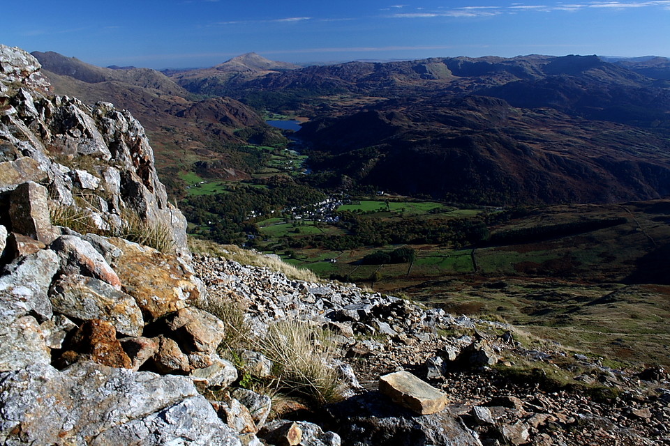
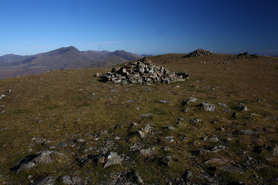
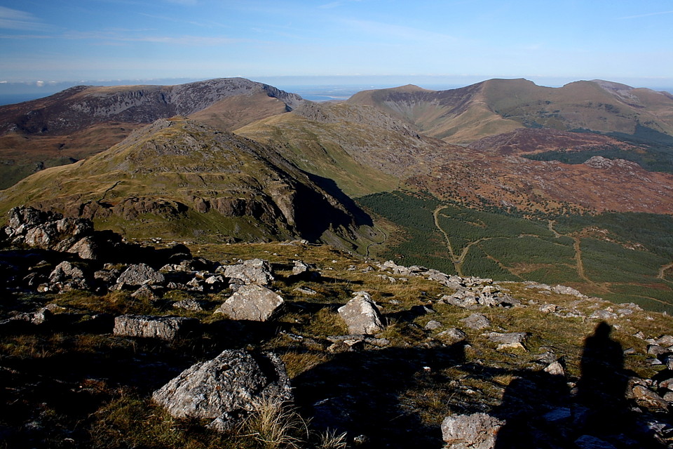
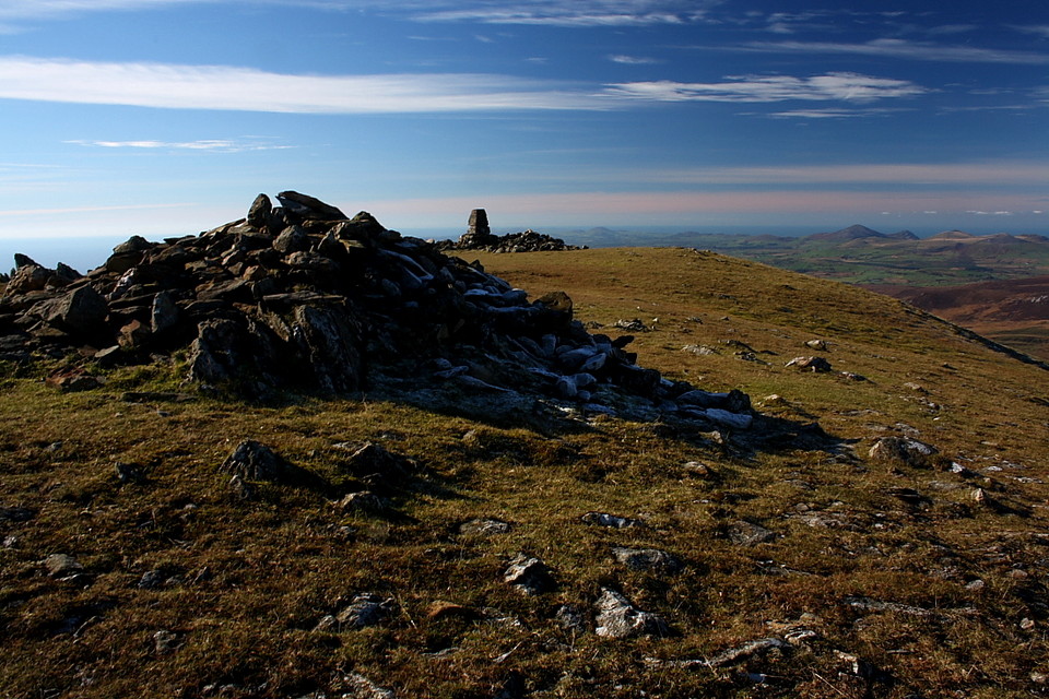
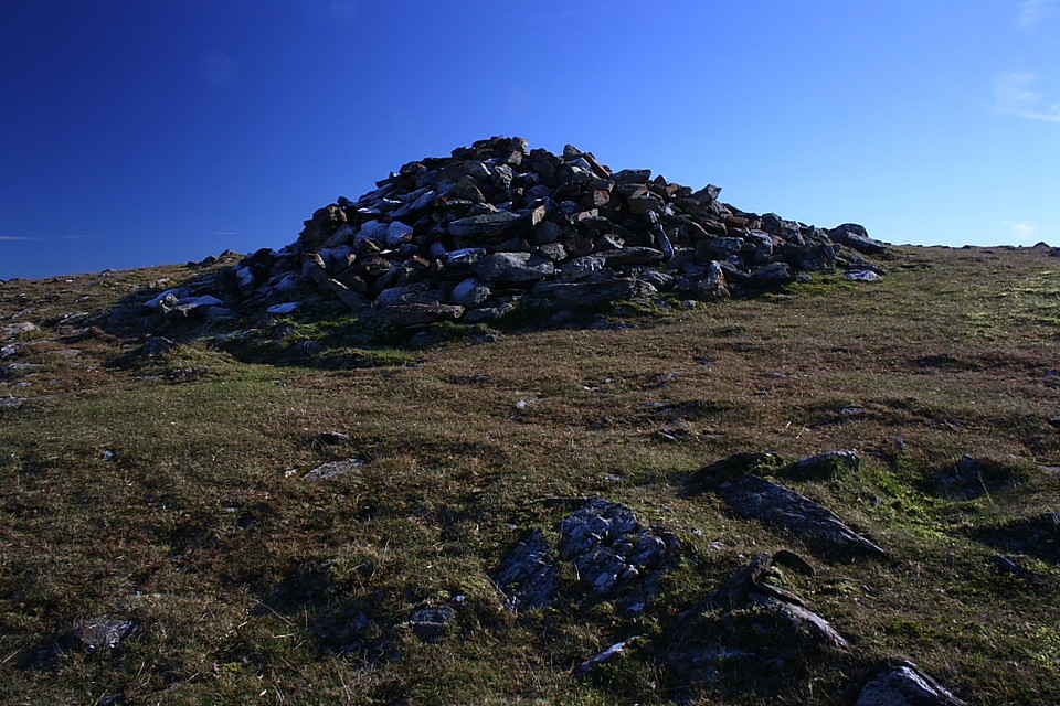
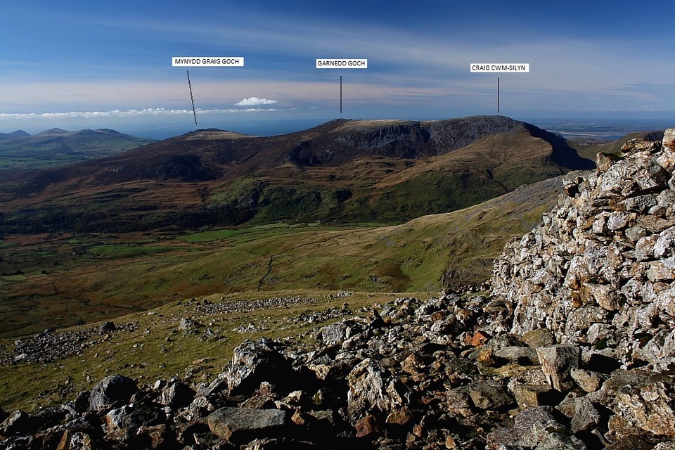
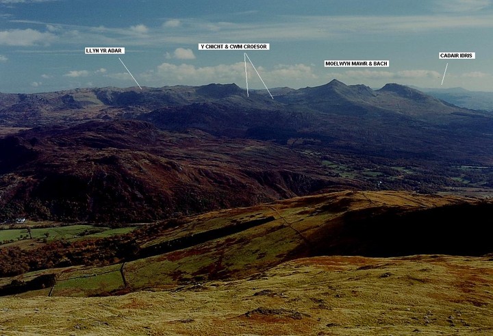
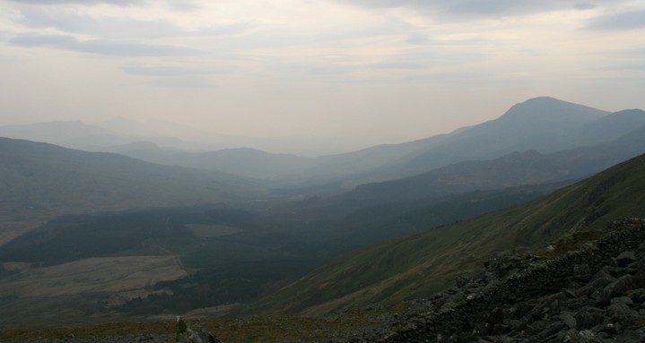
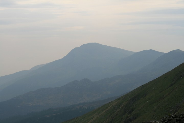
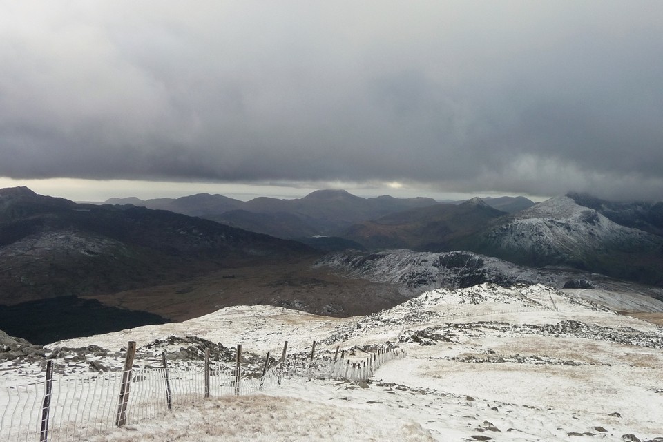
A virtually cloudless dawn - tent and car once again caked in ice and Moel Siabod sitting pretty in pink on the skyline - prompts a snap decision to reacquaint myself with the Bronze Age funerary cairns that crown the 2,565ft summit of Moel Hebog... here we go again...... The 'Hill of the Hawk' is a fine mountain presenting a distinctive wedge shaped profile when viewed towering above and to the south west of the tourism orientated, yet nonetheless attractive village of Beddgelert. The legend pertaining to Prince Llewelyn's dog, Gelert, needn't detain us further, the settlement almost certainly name-checking an early christian linked to the local ruined priory. Hey, but that was only yesterday! For immediately to the north the town is overlooked by Dinas, a flat-topped hillfort, whilst the iconic Dinas Emrys rises above Llyn Dinas a little way to the north-east. You've no doubt guessed that the word 'Dinas' refers to a fort or stronghold.... The usual route taken by those who wish to ascend Moel Hebog begins in town, where there is a large, albeit expensive, pay and display car park (limited roadside parking is available for those on a budget if you arrive early enough - ha!). After crossing the railway line - incidentally running recently restored steam engines - via a bridge, I follow the public footpath, through woodland glistening with frost, to veer right along a track to the isolated farmsteads within Cwm Cloch. Here the mountain rises in an awesome, majestic display of raw power to the south-west, its profile accentuated by a sky of unprecedented blue. Although the onward path is obvious, the angle is very steep, so it's just as well the retrospective view grows progressively more magnificent in scope with every step... just for starters check out the prehistoric monuments on display - the two aforementioned hillforts, a distant Carnedd Moel Siabod and, just across the valley, Yr Wyddfa (Snowdon) herself... Nice. Sure, it's a struggle, particularly the last section of unstable scree [please bear this in mind if you are not familiar with such potentially dangerous features] until a pair of modern (I think) marker cairns signify the final stretch, the be-cairned Nantlle Ridge announcing it's presence beyond a similarly blessed Moel-yr-Ogof, a ferociously biting wind doing likewise. And there they are. Four, possibly five, small Bronze age cairns crowning the summit plateau before the rather dilapidated OS triangulation pillar. Two are reasonably sized, but by no means large .... and certainly nothing to trouble my Citizen Cairn'd stock of construction eulogies. The others are even smaller, so it's not really surprising they didn't really register from my last visit here in the mid-90's. Sit a-while, however, and it soon becomes apparent that here we have a small Bronze Age cemetery commanding one of the most awesome all-round panoramas you could possibly wish for! Yeah, these people sure knew what they were doing. If you're looking for eternity, here 'tis. The multiple-cairned Nantlle Ridge completely dominates proceedings to north-west, Criccieth Castle upon it rock, Tre'r Ceiri and the glistening Lleyn to the west, Southern Snowdonia to the... er... south, not forgetting the mountains of Central Snowdonia to the north-east. Hillforts, dolmens, chambered cairns, Bronze Age cairns.... hell, prehistory wherever you look, all set amongst a landscape of the highest quality. OK, the Moel Hebog cemetery is a modest one in terms of construction. Perhaps that's being somewhat generous, even? But make the not inconsiderable effort to come here and I think you'll leave more emotionally enriched than when you arrived. Which, when you think about it, is not a bad return in this modern world full of bland 'experiences' and computer generated fantasy. Give me the real deal any day. Even if it did all but freeze the wotsits off me! |
 Posted by GLADMAN
23rd November 2010ce Edited 12th January 2011ce |
Miscellaneous |
|
|
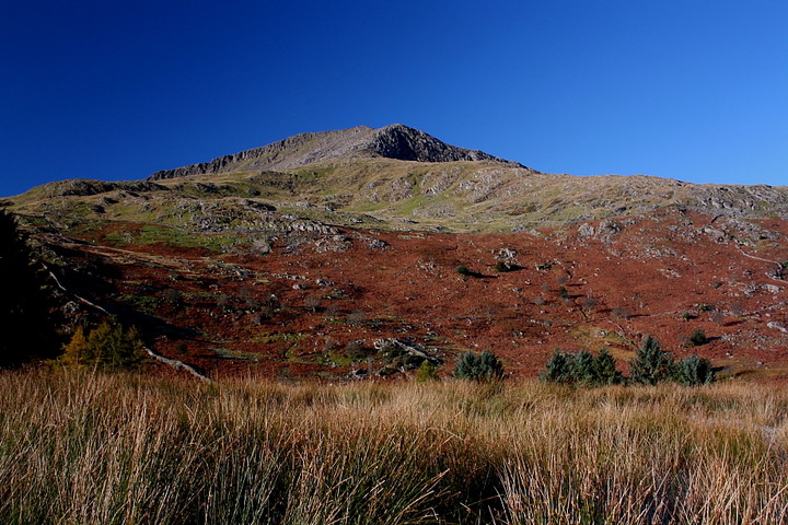
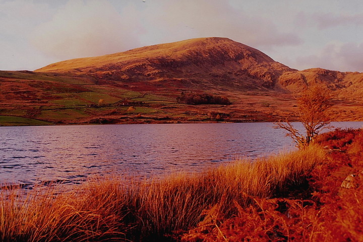
Moel Hebog - The Hill of The Hawk - is a fine 2,565ft mountain rising to the approx south-west of the attractive town of Beddgelert. Aside from being an truly exceptional viewpoint - assuming a clear day, naturally (yeah, right) - it also possesses at least four Bronze Age funerary cairns in the vicinity of its summit. I make that a cemetery! Anyway, according to our friends at Coflein: '1) SH5650346951 - A roughly round cairn base, with only 1 layer of stone left above ground, measuring approx 0.9m in diameter. 2) SH5649546945 - A slightly oval cairn measuring 1.2m x 1.5m and surviving to a height of approx. 0.4m. 3) SH5650246948 - A roughly formed cairn measuring 1m in diameter and surviving to a height of up to 0.3m. 4) SH5649346930 A small, roughly oval cairn measuring 1.5m x 1m and reaching 0.3m in height.' Another 'possible' is located at SH5648646944. All of the above were noted during an Upland Survey conducted by Archaeophysica, 2005-6. The 'classic' ascent of the mountain is from Beddgelert itself, via Cwm Cloch. Usual warnings and required dress apply... and note you can 'bag' another Bronze Age cairn upon nearby Moel yr Ogof if you so wish. Plus fantastic views of The Snowdon Massif, Nantlle Ridge and whatever else takes your fancy. |
Posted by GLADMAN 16th October 2010ce Edited 16th October 2010ce |
Links |
|
British MuseumThe perfect condition Late Bronze Age shield found in a bog near Moel Hebog in 1784. So many circles. |
 Posted by Rhiannon
28th October 2018ce |