|
|

|
|
Aber SychnantCairn(s)
|
||||||||||||||||||||||||
|
|
|
Images (click to view fullsize) |
|
|
Fieldnotes |
|
|
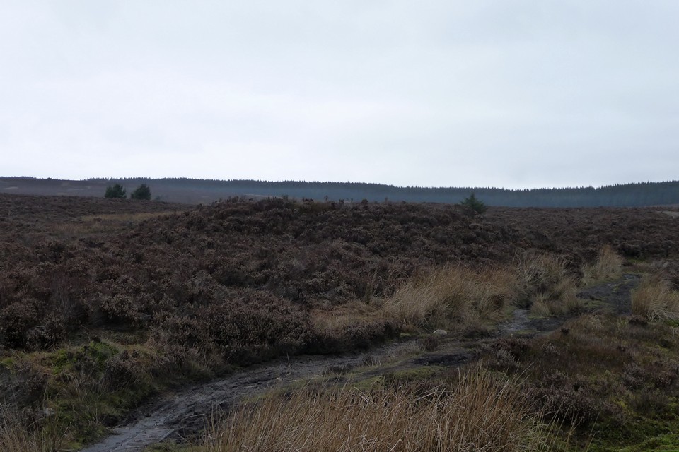
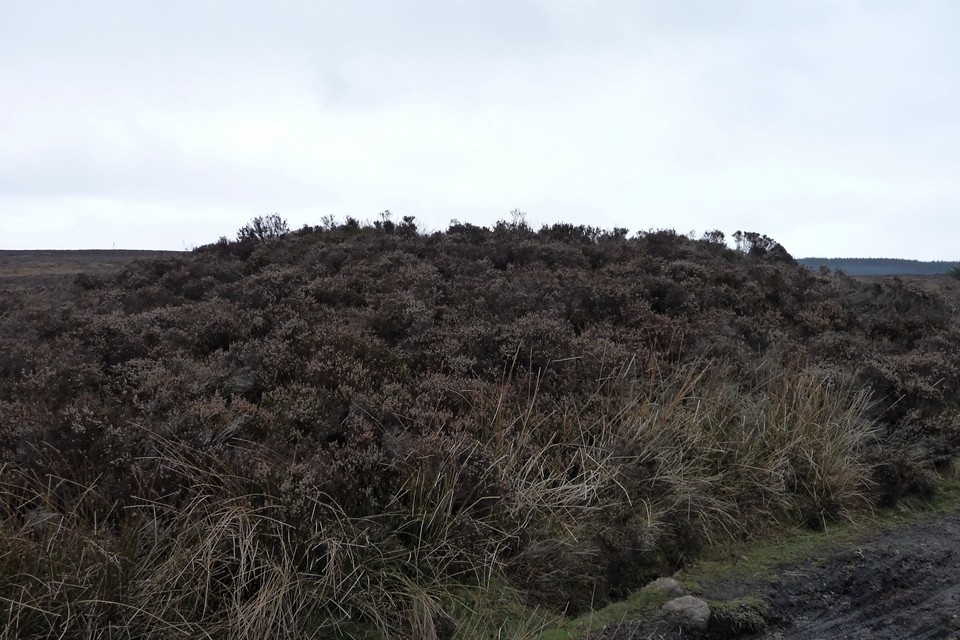
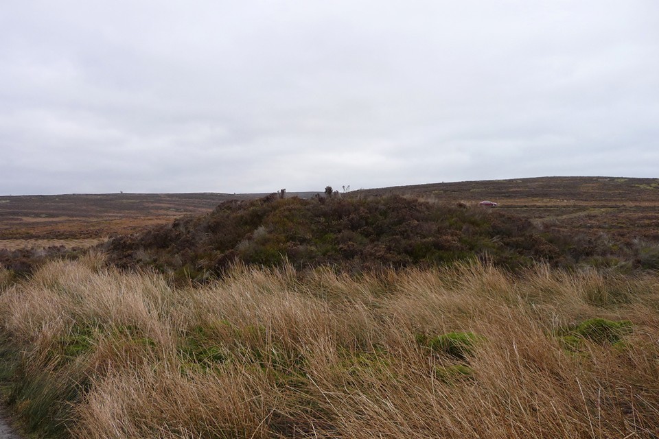
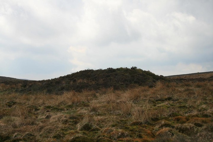
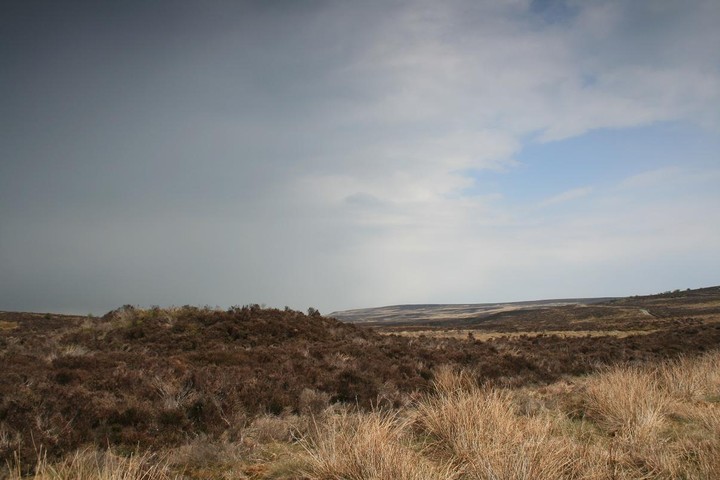
Offa’s Dyke Path has been routed across the moor on a snaking network of duckboards, making our progress across what would be tough terrain much quicker and smoother than expected. It doesn’t take us long to reach Aber Sychnant cairn, which is skirted by the Path itself – probably a little too close for comfort, but tired legs and receding daylight make me grateful for the ease of access today. The cairn is all but buried under a heather toupee, but is a good size and largely intact apart from the inevitable central scoop. The views are not that extensive, as the cairn sits in a shallow valley, with higher parts of the moor rising on all sides. Substantial enough to be worth a visit though, despite the irritation of dropping my glove and having to come back again to retrieve it. This post appears as part of the weblog entry Offa’s Dyke Path IV – Clwyd Gate to Llangollen 22 January 2011
|
 Posted by thesweetcheat
24th January 2013ce |
|
The last place visited today and by the time I found it I was completly cream crackered. Nor was it easy to find, coming from across the moor from the other barrow Cefn y Gader the going was hard through the thigh high heather and as the barrow is covered in heather too its almost invisible from most directions. Eventually stumbling across the well laid Offas dyke path which runs right next to the barrow, it passes by just inches from it. Inside the summit scoop the wind is gone and a few stones poke through the grassy surface, I sit for a while reflecting on the mornings proceedings and am startled back to life by half a dozen walkers just a few metres away. |
 Posted by postman
12th May 2010ce Edited 12th May 2010ce |
Miscellaneous |
|
|
Coflein lists a number of barrows at Aber Sychnant, as well as possible (fallen) standing stone: LLANDEGLA PLANTATION, STANDING STONE Grid Reference SJ23455008 OAN field survey, located by GPS to an accuracy of +/- 1m. Standing stone located approximately 500m to the east of Llandegla plantation and about on the line of the boundary markers. The stone is recumbent, is about 1.4m long by 0.9m wide and tapered at both ends. The opposite ends of the stone have differential degrees of lichen growth with the western end having the appearance of not having being exposed for as long as the east,. This suggests that the stone was once standing, it is unclear whether the stone was a boundary marker or prehistoric in nature. 2002/10/10/OAN/NW ABER SYCHNANT, FORD CAIRN II Grid Reference SJ22784985 OAN field survey, located by GPS to an accuracy of +/- 1m. Heather covered cairn located on the gently sloping valley side to the west of Aber Sychnant about 70m south of Offa's Dyke footpath. It is approximately 7m in diameter and stands up to 0.6m high with a central depression up to 0.65m deep. The cairn could possibly have a ring around it as there is evidence of a depression to the south west. 12m to the south east is a large highly weathered squat sub-circular stone of about 1.1m diameter, this may be associated with the cairn or could just be an erratic. 2002/10/10/OAN/NW ABER SYCHNANT FORD CAIRN Grid Reference SJ23695006 Situated 230 paces NW of Aber Sychnant Ford, a mutilated tumulus 14m diam. Large hole in centre and traces of a cist. Based on CPAT SMR account. No further comments as result of OAN fieldwork, 2002. ABER SYCHNANT, CAIRN Grid Reference SJ23454963 A centrally depressed round cairn, 19m in diameter and 2.1m high, opened c.1890, producing black ash, small bones, a horse tooth and a flint arrowhead. OAN Site visit 2002/10/11/PJS. OAN field survey, located by GPS to an accuracy of +/- 1m. The site is located on the south west side of Offa's Dyke Footpath and the base of the north side of the cairn has been truncated by it and is actively being eroded. ABER SYCHNANT BARROW Grid Reference SJ24225026 Close to footpath on N side 600yds SW of the ford. A small tumulus 5m diam and 0.2m high. Based on CPAT SMR account. No further comments as result of OAN fieldwork, 2002. |
Posted by thesweetcheat 16th January 2011ce |
|
A centrally depressed round cairn, 19m in diameter and 2.1m high, opened c.1890, producing black ash, small bones, a horse tooth and a flint arrowhead. (source Os495card; SJ24NW15) J.Wiles 15.11.02 OAN Site visit 2002/10/11/PJS. OAN field survey, located by GPS to an accuracy of +/- 1m. The site is located on the south west side of Offa's Dyke Footpath and the base of the north side of the cairn has been truncated by it and is actively being eroded. Phwoar... flint arrowheads, and over two metres high, i'm on my way. |
Posted by postman 3rd January 2010ce |