The Modern Antiquarian
Log in
|
Register
Home
Latest Posts
Forums
Maps
Help
Browse Sites
News
Blog
Contributors
The Books
Select
-
Belgium
Denmark
Eire
France
Germany
Greece
Italy
The Netherlands
Norway
Portugal
Republic of Malta
Spain
Sweden
Switzerland
United Kingdom
England
Southern England
Hampshire
Slap Bottom
Round Barrow(s)
Slap Bottom (Round Barrow(s)) on The Modern Antiquarian, the UK & Ireland's most popular megalithic community website. 1 image, 1 fieldnote, plus information on many more ancient sites nearby and across the UK & Ireland.
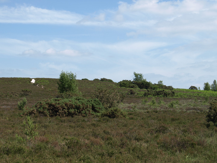
Image © Mike Rowland 09/06/2008.
Nearest Town:
New Milton (8km SE)
OS Ref (GB):
SU205019 /
Sheet: 195
Latitude:
50° 48' 56.46" N
Longitude:
1° 42' 32.31" W
Added by
formicaant
Images (1)
Fieldnotes (1)
0 discussions
Start a topic
Show |
Hide
Web searches for Slap Bottom
Flickr
Google
Google Images
MAGIC
The Megalithic Portal
Bing
Stone Pages
Streetmap.co.uk
Wikipedia
Show map
(inline Google Map)
- Sites within 20 km -
-
Burnt Axon (1.14km WNW) (5 posts)
Castle Hill (Burley Street) (2.12km NW) (8 posts)
Vales Moor (2.4km WNW) (8 posts)
Collins Grave Bowl Barrow (2.84km NNE) (1 post)
Creek Bottom Barrows (3.1km ENE) (1 post)
Holman's Bottom Barrows (3.39km ENE) (1 post)
Elkham Grave Barrow (5.79km ESE) (1 post)
Bratley Plain (6.84km N) (6 posts)
Castle Piece (7.02km NNW) (2 posts)
Longsdale View Barrow (7.57km E) (3 posts)
Whitefield Moor (7.7km ENE) (2 posts)
St Catherine's Hill (9.11km SW) (8 posts)
lbsley Common (9.13km NW) (1 post)
Setley Plain (9.27km E) (6 posts)
Shirley Holms (9.56km E) (3 posts)
Setley Pond (10.01km E) (5 posts)
Gorley Hill (10.23km NW) (1 post)
Hengistbury Head (11.71km SSW) (39 posts)
Buckland Rings (12km E) (12 posts)
Ralph's Barrow (12.25km WSW) (2 posts)
Malwood Castle (12.47km NE) (1 post)
The Butt (Fritham) (12.51km NNE) (5 posts)
Mag's Barrow (12.56km WSW) (3 posts)
Parley Barrow (12.97km WSW) (2 posts)
Pudding Barrow (13.06km E) (5 posts)
Dudsbury Camp (13.37km WSW) (7 posts)
The Butts (New Forest) (13.72km N) (1 post)
Verwood Stone (13.79km WNW) (6 posts)
Frankenbury Camp (13.82km NW) (2 posts)
Wur Stone (13.87km W) (1 post)
Summerlug Hill (13.96km W) (3 posts)
Beaulieu Heath (13.97km E) (4 posts)
Pompey's Corner (14km WSW) (4 posts)
Simons Ground (14.34km WSW) (3 posts)
Black Bush Plain (14.44km NNE) (1 post)
Cold Pixie's Cave (14.44km E) (6 posts)
Ashurst Lodge (14.58km ENE) (8 posts)
Hatchet Pond (15.18km E) (1 post)
Bull Barrow (Holt) (15.25km W) (4 posts)
South Baddesley Stone (15.49km E) (5 posts)
Canon Hill (15.88km WSW) (5 posts)
Jacob's Barrow (16.01km N) (4 posts)
Stagsbury Hill (16.19km NNE) (8 posts)
Yew Tree Heath (16.21km ENE) (1 post)
West Cliff Barrow (16.66km SW) (4 posts)
North Yew Tree Heath Barrows (17.17km ENE) (5 posts)
Money Hills (17.34km NE) (2 posts)
Tatchbury Mount (17.64km NE) (2 posts)
Branksome Library Stone (18.24km WSW) (15 posts)
Dibden Bottom (18.45km ENE) (5 posts)
Canford Heath (18.77km WSW) (2 posts)
Marchwood Inclosure (18.95km ENE) (4 posts)
Giant's Grave (19.28km NW) (6 posts)
Whitsbury Castle Ditches (19.28km NW) (8 posts)
Breamore Down (19.37km NW) (3 posts)
Wimborne St. Giles (19.49km W) (1 post)
Knoll Camp (19.67km WNW) (2 posts)
Horton Inn (19.85km W) (0 posts)
The Great Barrow (19.86km W) (11 posts)
Dibden Inclosure (19.88km ENE) (2 posts)
Knowlton Henges (19.9km W) (80 posts)
New Barn Farm (19.9km W) (1 post)
Testwood Lakes (19.99km NE) (1 post)
- Add -
-
Add news
Add an image
Add fieldnotes
Add folklore
Add miscellaneous
Add a link
Add a nearby facility
Add an alternative name/spelling
Images
(click to view fullsize)
Add an image
Fieldnotes
Add fieldnotes
This is a bell barrow on a rise above the excellently named Slap Bottom, the best photo I could get was from a a distance as the barrow is covered in gorse and bracken.
Comments (0)
|
Add a comment
|
Permalink
Posted by
formicaant
11th June 2008ce

 Posted by formicaant