Col. A. L. Fox — On the Threatened Destruction of the British Earthworks near Dorchester, Oxfordshire.
Special Meeting, June 21st, 1870.
[Held in the Theatre of the Royal United Service Institution, Whitehall Yard, by the permission of the Council of the Institution.] Professor Huxley, LL.D., F.R.S., President, in the Chair.
The following paper was read by the author;—
XXXVII. On the threatened destruction of the British Earthworks near Dorchester, Oxfordshire. By Col. A. Lane Fox, Hon. Sec. Ethn. Soc.
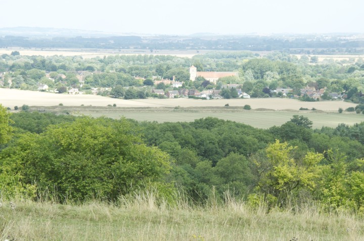
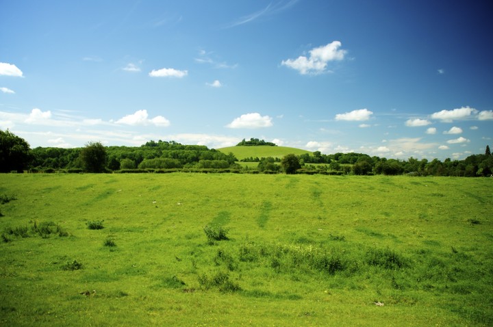
Although the subject is not in any way connected with the paper that is to be read this evening (Mr. Forbes’s paper on the Aymaras), yet, knowing the interest which is taken by this Society in the preservation of our prehistoric antiquities, I venture to think that a few words in reference to the Dykes at Dorchester in Oxfordshire may not be without interest to the Meeting, owing to the report which has appeared in the papers since our last meeting, relative to the threatened destruction of these works by the owner of the property on which they stand. The ancient fortifications of this place consist of two distinct works—one on the south and the other on the north bank of the Thames. The former (on the south side) occupies the more eastern of two conspicuous hills, each of which is topped by a clump of trees, known as the Wittenham Clumps. This work is about a quarter of a mile to the south of the river-bank, and three miles to the north-east of Didcot Station on the Great Western Railway. The entrenchment, like that of most British camps, follows the outline of the hill, running round it in the most suitable position for defence. It commands an extensive view of the country for miles round; but the interior of the camp is itself commanded within 150 yards by the adjoining hill to the north-west. It is of an irregular oval form, about 400 paces across from S.E. to N.W. The defences consist of a ditch, about five paces wide at the outer in consequence of the natural slope of the hill. The inner rampart, if it ever existed, has been destroyed by cultivation; but it is not improbable, from the great command which the inner side of the ditch has over the opposite side, that the defence may originally have been confined to an escarpment surmounted by a stockade or some other defensive obstacle on that side. This mode of defence appears not infrequently to have been adopted by the ancient Britons in cases where the ground itself afforded the necessary command of the exterior. There is an entrance on the north-west salient angle which is swept by a knoll on the inner side of the ditch. Another entrance on the north-west leads in the direction of the ancient ford on the Isis. All these are characteristics of a British earthwork. The interior of the camp is terraced on the north side; but these terraces are evidently the result of cultivation in modern times. I found no sufficient evidence of the fabrication of flints in this work; but I picked up in the interior a fragment of a polished celt and a sea-shore quartzite pebble rubbed to an edge at one end. Pebbles similarly rubbed at one end are not uncommon amongst the relics of the prehistoric age. I exhibit a precisely similar implement which I found amongst the debris of a barrow on the Yorkshire Wolds.
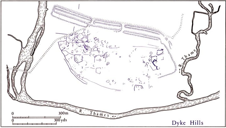
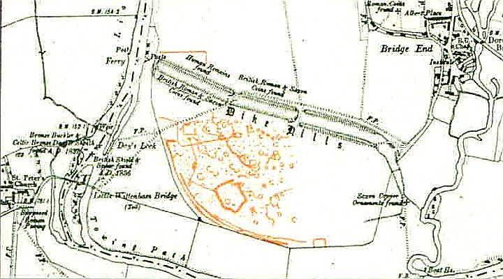
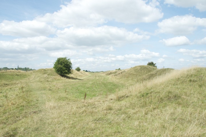
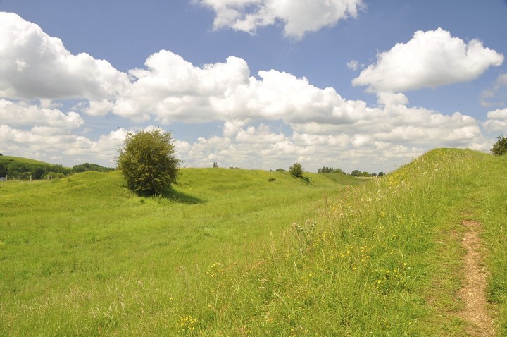
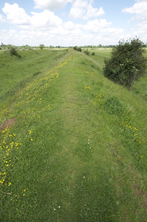
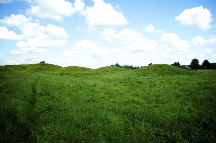
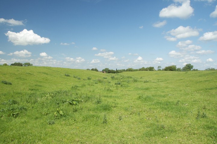
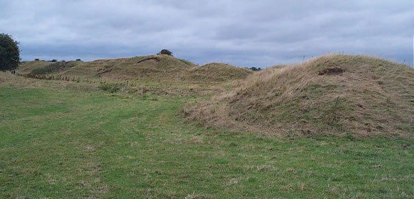
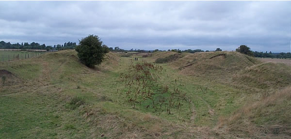
Passing over the Thames, to the north side, we come to the Dykes, the threatened destruction of which is reported in the newspapers. They consist of a nearly straight line of entrenchments, about 900 yards in length, and composed of double banks and ditches, which cuts off a promontory formed by the bend of the river, and encloses an area of about three-quarters of a mile in length by a quarter of a mile in breadth. The principal ditch, about 57 feet in width, is situated between the two banks. There is a smaller ditch on the outer or north side. The outer or northern bank appears to have been the highest, which is probably to he accounted for by its being placed between the two ditches, and having received the materials excavated from both. This was well shown in the section of a fresh cutting made through the bank, in which the lines of the successive deposits could be traced. This section also showed that the banks are covered with a thickness of from 8 to 12 inches of vegetable soil, entirely devoid of stones or pebbles of any kind, and which must, in all probability, have accumulated from the decay of the grass on the banks. The length of time necessary for the formation of so great a thickness of vegetable soil must have been considerable. There are at present three openings through the dykes. About 200 yards of the right flank of the dyke is thrown back in the direction of the junction of the Thame stream with the Isis. From this point the river assumes the name of the Thames River. On carefully searching the ground which had been excavated from the banks on the left flank, and the cultivated ground in the interior of the camp, I found abundant evidence of the fabrication of flint implements [a number of cores, flakes, and chips from this spot were exhibited to the Society}; but I did not succeed in finding any flint tool, with the exception of one fragment of a well-chipped spear-head. I also found on the dykes several pieces of pottery of undoubtedly British production, and a fragment of wheel-made pottery of later date.
In the year 1836 an oval bronze shield, 14 by 13 inches in diameter, was discovered in the bed of the Isis, about 150 yards to the rear of the left flank of the dyke, beneath an accumulation of recent drift. {A drawing of this shield was exhibited, of the actual size.]The original is in the British Museum, and is described in vol. xxxviii. of the ^Archseologia'.
Mr. Clutterbuck, the rector of Long Wittenham, and the writer of an article on this place in the 'Archoeologia’ is of opinion, from the position of this discovery, that the river still runs in its original course, and no doubt this is the case to a considerable extent; but there is, I think, evidence that the river has slightly altered its course since the dykes were erected. From the curve which the river makes at this point it might naturally be expected that it would leave the dykes on the north, and work its way southward; but it was no doubt checked by the higher ground on the south. The sketch plan exhibited to the Meeting shows, however, that the flanks of the dyke do not reach the present bank of the river, and that a space of thirty paces intervenes on the left flank, while on the right the dyke stops seventy paces short of the Thame stream. It is improbable that the defenders should have neglected to secure their flanks by causing them to abut upon the banks of the river as they existed at the time of its construction. The position of the portion of the dyke which is thrown back on the right flank also shows the Thame stream must have extended more to the westward, probably up to the line now marked by a small ditch. From the nearest point of this original line the dyke is drawn straight across to the Isis; but the meadow-ground below Dorchester, on the right bank of the Thame stream, must have been covered with water, though probably shallow and fordable; and it was in order to command this ground that an epaulement was thrown back on the right flank; but the abrupt termination of the work at seventy paces distance from the present stream shows that deep water must have existed to the westward of the present stream.
I found no trace of Roman tiles or pottery, nor can I learn that any thing Roman has been discovered on the site of the camp, though no doubt Dorchester itself was at one time a Roman station. This circumstance, coupled with the discovery of a bronze shield and the evidence of flint cores and debris (all of which must have been imported, as this is not a flint-producing district), appears to me conclusive in determining the fortifications to be of British construction. Viewing the position of the two works, and the position of the ancient ford between them, it may safely be assumed that they were connected in the defence of this locality, and were the work of the same people.
The ancient Britons never constructed their camps upon low ground. Sinodun Hill was no doubt the principal stronghold; and the Dorchester dykes on the low ground to the north of the river were thrown up to cover the passage of the river at the ford, and secure a communication with the left bank. About 200 yards of the left flank of the Dorchester dykes have now been levelled, or rather reduced for cultivation; a portion of this, however, was done by the former owner. I called upon Mr. Latham, the present owner, by whom the work of demolition is now being continued. After some conversation I elicited from him a promise that the levelling should be discontinued for the present; but I could obtain no assurance that it would not be continued at some future time. This is much to be regretted, as the ramparts are now in a good state of preservation. Traces of the work, however, will still be seen in those parts which have been lowered for cultivation.
The Journal of the Ethnological Society 1870, Page 412 to 415
|
 Posted by Chance
5th February 2012ce
|

 Maps / Plans / Diagrams: