|
|

|
The Gypsey Race: Latest Posts |
Rudston Monolith (Standing Stone / Menhir) — Fieldnotes |
|
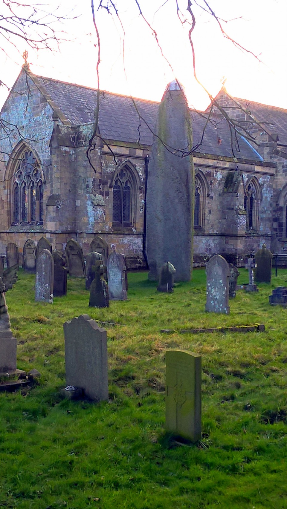
25/09/2017 – We had popped down to Scarborough for a long weekend just for a bit of walking really. A few days before we came I noticed that we weren’t too far from Rudston so we crammed 3 days of walking into 2, leaving our last day free for a visit to this mega monolith. Easy enough to get to by car but we were on the bus, which still wasn’t too tricky. Morning 121 bus from Scarborough to Burton Agnes and then a 3 mile or so walk down quietish country roads to Rudston. We arrived at the south side of the church and had a little debate as to which way round the church we wanted to go for our first sight of the stone. These things are important I think, it’s not every day you get to see the tallest standing stone in Britain for the first time. We chose clockwise. Rounding the corner of the building and there it stood in all its glory. It really is impressive and as wonderful as I hoped it would be. It seemed to grow and grow as we edged closer. It was hard not to just keep staring at it. So solid and timeless. I know the church and graveyard setting isn’t everyone’s cup of tea but I quite liked it and loved the difference in height between the monolith and the similar shaped gravestones round it. After having a look at the small stone and cist in the corner (it looked a little sad hidden away and dark with the overhead leaves at this time of year) we sat across the road on a bench and had our butties. The inside of the church is worth a look and has a small display about the history of the area. After one last look at the stone we started the slow walk back to the bus stop. We kept an eye out for any sign of the cursus that crosses the road to the south of Rudston but no luck. Did manage to find a coffee shop in Burton Agnes which helped with the wait for the bus. Top day out and the Rudston monolith is a must see site. Happy us on the bus back to Scarborough for an evening of chips and gravy and two penny falls. |
 Posted by thelonious
29th September 2017ce Edited 2nd October 2017ce |
Sands Wood (Round Barrow(s)) — Miscellaneous |
|
Drive by 30.7.17 I didn't have time for a proper visit so was hoping to spot the barrow via a 'drive by'. Unfortunately the wood is quite dense with plenty of vegetation so I failed to spot it. Nice spot though for someone to have a proper look. |
Posted by CARL 6th August 2017ce |
Rudston Monolith (Standing Stone / Menhir) — Fieldnotes |
|
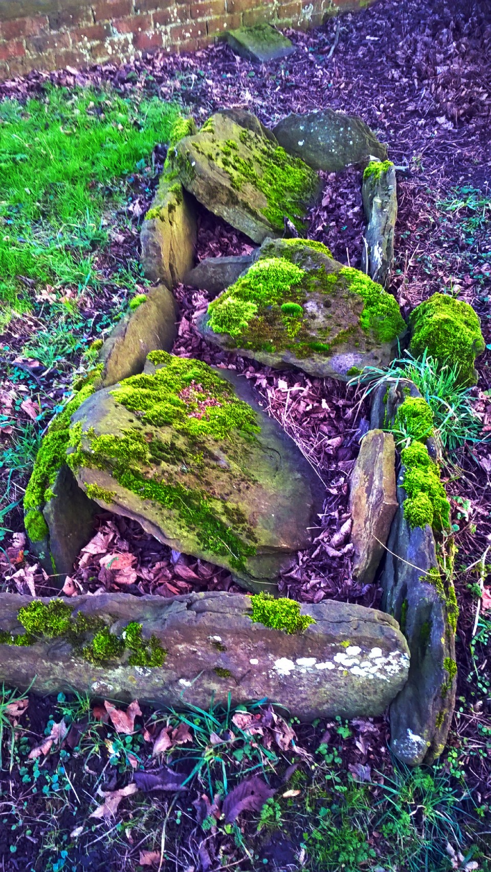
Visited 1.8.17 Looking at my previous fieldnote I am back here exactly 2 years later - I had no idea! When you are anywhere near the area of this hugely impressive stone you just have to visit. And it is just as impressive the second time around (no doubt also the third, fourth, fifth etc). All was quiet in the churchyard (we were the only visitors), the sun was shining, the birds chirping - very peaceful on this late summer evening. The stone still dominates the church, as it has always done. Rudstone is one of those special places that everyone should try to visit at least once in their lives. *** Don't forget to check out the cist and Roman coffin lid in the corner of the churchyard under the trees. |
Posted by CARL 6th August 2017ce |
Rudston Monolith (Standing Stone / Menhir) — Images (click to view fullsize) |
|
Posted by carol27 5th February 2017ce |
Sands Wood (Round Barrow(s)) — Miscellaneous |
|
Details of barrow on Pastscape The earthwork remains of a bowl barrow, located in the southern corner of Sands Wood. The barrow is sited on the north side of a ridge on gently sloping ground. It survives as a well rounded mound 20 metres in diameter and 1.5 metres high, surrounded by the slight impression of a broad and largely infilled ditch. The berm between the outer edge of the cenral mound and the inner lip of the encircling ditch is gently sloping, but obviously not as steep as the sides of the central mound, and is slightly elongated north to south. The form of the berm is considered to be the result of weathering of the mound and ditch sides. The mound, ditch and encircling berm together comprise an area of roughly 30 metres in diameter. Scheduled. |
 Posted by Chance
9th May 2016ce |
Rudston Monolith (Standing Stone / Menhir) — Miscellaneous |
|
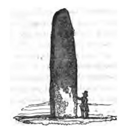
Details of stone on Pastscape Late Neolithic or Early Bronze Age standing stone in churchyard, with modern cap of metal, and suggested cup and ring markings. The stone is approximately 8 metres high, 1.75 metres wide and 1 metre thick, the stone tapers to a point which at some point has been broken and repaired with a lead hood. Excavations in the 18th century suggested the monument extends as deep below the ground as it stands above. The monolith is of gritstone, the nearest source of which is 10-20 miles away. It is unclear whether it was brought to the site in the Neolithic/Bronze Age or arrived much earlier in a glacier flow. It has been suggested that the stone marks the convergence of the Rudston cursus monuments. Cursus A passes to the east of the monolith and cursus C passes to the north, where they converge. The terminus of cursus B is probably on the spur of land on which the monolith stands, but this is concealed by the village. Cursus D runs along the valley floor below the monolith. There is no dating evidence to suggest which came first, but if the monolith is of Late Neolithic/Early Bronze Age date it almost certainly post-dates the cursuses. |
Posted by Chance 9th May 2016ce |
Greenwells No 62 (Round Barrow(s)) — Miscellaneous |
|
Details of barrow on Pastscape Round barrow, now just a slight rise. The barrow was excavated in 1864 by Greenwell and a rescue excavation was carried out in 1968 by the Ministry of Public Buildings and Works as the monument was being destroyed by ploughing. It is probably that the primary burials were destroyed when a burial pit was cut through the mound, the pit contained two cists, one with inhumations and a beaker, the other a cremation and beaker. The 1968 excavations revealed Neolithic pottery and flints on the old ground surface beneath the north-east quadrant of the mound. The secondary burials from the central pit were removed in the 19th century, however the 1968 excavations revealed three more secondary burials. The first was a crouched inhumation, on its right side with its head towards the centre of the mound, without any grave goods and was found 6 metres east of the centre within the area of the turf mound. The second was on the north-east edge of the central pit. It was a crouched inhumation without any grave goods, partly on its right side with the head slumped forward on to the chest, it was in a shallow pit just below the level of the pre-barrow turf. The third burial had been cut through the chalk capping of the barrow. It was also a crouched inhumation without any grave goods, the body had been place partly on its back with its knees drawn up to the right side and hands crossed on the chest. The barrow was surrounded by a wide ditch cut into the chalk. |
Posted by Chance 9th May 2016ce |
Rudston Beacon (Sacred Hill) — Miscellaneous |
|
Details of Beacon on Pastscape A Bronze Age round barrow still extant as an earthwork mound circa 32 metres in diameter and 1.5 metres high. In the 1870s Greenwell described it as "almost entirely removed many years ago, when bones are said to have been found in large quantities". There is documentary evidence for re-use of the mound as a beacon, possibly as early as 1573 if not before. More recently the mound has been damaged by the presence of an Air Ministry observation point and the erection of an Ordnance Survey trig point. (TA 09466558) Rudston Beacon (NR) (1) (TA 09466558) Rudston Beacon; described by Greenwell (2) as "almost entirely removed many years ago, when bones are said to have been found in large quantities". In 1963 (3) it survived as a mound, 19.8m diameter, 0.76 high, overgrown with brambles and bushes, and damaged by an Air Ministry observation post on the summit adjacent to an OS trig point. (2-3) "There were beacons in 1573 at 'Many Howes in Rudston Field', presumably on the hill by the southern parish boundary, near several barrows, on which a later beacon certainly stood". (a) The later beacon was probably taken down circa 1830 (b). (4) Now cleared of vegetation and visible as the remains of a turf-covered mound about 32m diameter and 1.5m in maximum height. It has been severely mutilated in the S (presumably by the observation post mentioned) where the interior has been removed almost to ground level. The OS, pillar occupies the highest part of the barrow in the NW. Published Survey (25") Revised. (5) TA 095 655. Rudston Beacon (and round barrows to east). Scheduled No HU/68. (6) |
Posted by Chance 9th May 2016ce |