Entry for the site on Keys to the Past
|
A round enclosure, probably Iron Age (according to Keys to the Past) approximately 70m across.
On the ground the some of the inner rampart and parts of the ditch can be seen. On Google earth the camp shows up well in the surrounding farmland.
Easy to reach, about 2 mins drive from the A1 the best access is from the road to the south. This enclosure sits at the highest point on a finger of high ground pointing towards the NE.
Bronze age axes have been found nearby (exact location not clear) and two Bronze age cists were found near Swarland old town hall (Keys to the Past) so the area was obviously in use for some time.
|

Part of Neanderthal Skull dredged up from North Sea
Well known that there must be lots of ancient archeology under the North Sea but first evidence of Neanderthals dredged up.
BBC web site article at
http://news.bbc.co.uk/1/hi/sci/tech/8099377.stm
|
Iron Age defended settlement with double bank and ditch. Approx 55m across.
Visible from the road to the South of Hinding Lane just before it joins the B6346 north of Alnwick, almost direct access to the first ditch from the side of the road.
In trees so original views etc somewhat obscured.
|

Describes the crags on the west side of the hill.
Some photos.
|

|
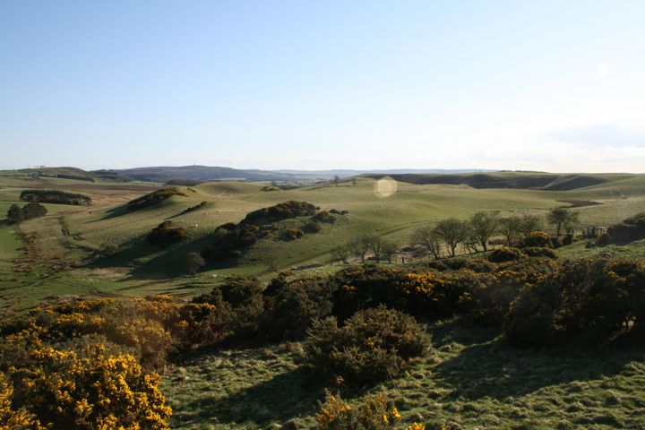
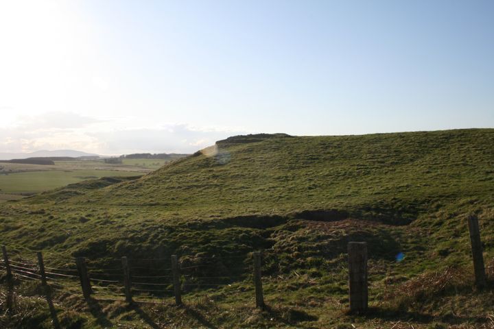
This site has two entries listed on Keys to the Past. One cites the cairn/barrow/cists at the top of the hill. The second cites the three ring features around this cairn but lists the date of these as "uncertain" stating they are probably "tree rings" and therefore not ancient. I'm less certain of this interpretation and list a number of the features here in support of this. This is one of the most interesting sites I've visited and given its closeness to Alnwick and the A1 I'd recommend others visit - if only to comment on my interpretations!
Have a look on Google Earth and a number of interesting features stand out; three ring features on the hill top ranging from 50m to 70m across, rock outcrops along the west side of the hill and large stone features to the north and south of the hill.
Park off the Alnwick to Eglingham road near White House farm and walk along the right of way to the west of the site going north. Cut east through the trees and approach the hill top from the south west. The first things you see are the rock "gate" (photo) to the south of the site and the rock overhangs (photo) in the forest plantation to the west of the site.
There are lots of rock outcrops in the slope before you reach the summit but only one I looked at (I didn't check them all) had an interesting feature. This is vertical sided "bowl" (photo) around 15cm across. Pass this and climb to the top and you meet the first ring feature.
The main features of the site are:
1) Rock "gate" to south of site. This is probably made by a fallen overhang but gives a very dramatic "entrance" to the hill from the south.
2) SE Ring, this is the most prominent of the three.
The ring is around 50m across and lies on a slight slope towards the SE, to the SE of the Trig Point. There is a clear raised rock circle but no obvious ditch inside or out of this. There is an entrance on the SE (150 deg) and a flat "platform" (photo) inside the ring next to the tree and the NE of the ring. This platform has a semi-circle cut into the bedrock around 4m across and facing east. None of the rings look defensive in nature.
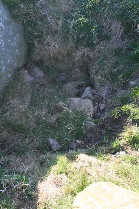
3) Cairn, Cist, Barrow, when you reach the top of the hill it's obvious that the Trig Point is not at the highest point on the hill. The reason for this being the long (20m) rock cairn just to the north of the TP.
Multiple cists were opened here in the early 1800s.
4) NE Ring, largest of the three (around 70m) but less distinct than feature 1. Again with a raised ring (some rock showing) but no obvious ditch. Lying to the NE of the TP this again is on a slight slope, this time to the NE. Again there are "platform" features inside the ring, offset toward the TP from the centre of the ring. There are at least 2 of these but they are less clear than the platform in the SE ring.
5) NW Ring, this is the least distinct on the ground an unlike the first two has been cut by field boundaries so the whole ring is not clear. Construction appears similar to the other two. The exception being that there is a central rock "cairn" feature which looks disturbed. This is the only ring of the three to have a central feature.
6) Rock overhang outcrops along the west side of the hill. After looking at the rings I retraced my steps back to the south and descended the western slope to cut across to the first (from the south) overhang. The outcrops are in a forest plantation with young trees so is easy to view and access but will become less so as the trees grow. In 5-10 years or so the outcrops may not be visible.
There are about 5-6 major rock outcrops (photos). All have some form of overhang on the west side and offer both protection from the elements and great views to the west. The level of protection gets better as you move north.
6a) "Hole" feature (photos). This is in the second major outcrop from the south end of the plantation, slightly higher up the hill and north of the first outcrop. A crack in the rock face seems to have been enhanced by the addition of a deep horizontal hole in the rock face at the top. The whole thing could be natural but the possible sexual connotations are none too subtle. This hole feature is almost identical in size and context (west facing vertical face of rock outcrop) to one at the Beanley Plantation Site (see link below to photo there).
6b) "Cup" features (photo). These are on the top platform of the 3nd major rock outcrop on the west side.
6c) Potential vertical "Peck marks" (photo). One of the rock faces has twin vertical lines cutting directly downwards, offset from the natural grain of the rock. These could be natural weathering, I don't have enough experience to tell.
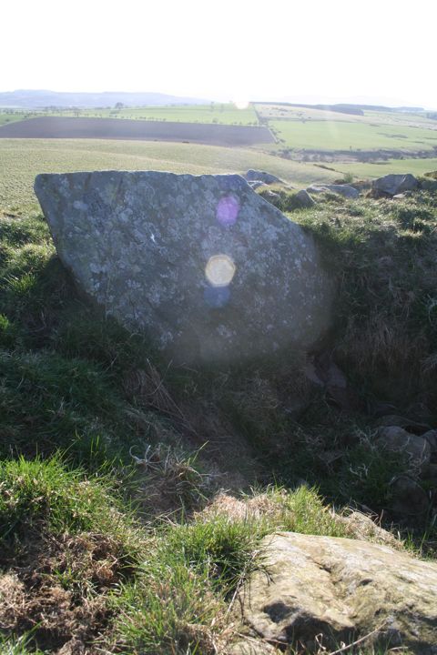
7) The final feature is to the North of the site on the slope of the hill down to White House Folly farm. A large "standing" stone (photo) sits next to a pillbox. I wasn't able to get close to this as it was lambing time and the field was full but this is an impressive piece of rock and shows up well on Google Earth.
The earliest maps in Keys to the Past show a circle of trees where the SE ring is now and this may be one reason for the interpretation given for the features. It is however interesting that the old northern boundary wall (since moved) for the site on the same map seems to respect the curves of the most northern part of the two rings north of the TP. Hinting that the rings pre-date that boundary wall?
Overall the whole site is fascinating and worthy of a visit. There is so much exposed rock that I probably looked at less than 5% of the total in the 2 hours I was on site.
One I'll go back to again soon.
|
            
|
   
|
Easily access from the A1 north of Alnwick to the west of B6341. Unfortunately the site was planted with trees sometime after 1865. The earliest map on the Key to the Past web site shows the outline of the site before these were planted.
Listed as an Iron Age defended settlement the ring shaped enclosure has an outer ditch with two inner ramparts.
|
|
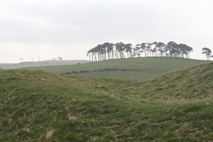
Impressive defensive enclosure, listed as Iron Age in Keys to the Past. Around 80m across with what look like multiple entrypoints the triple ditch system shows up very well on Google Earth.
|
Details of this site at Keys to the Past
|
Easy access through South Charlton village, less than a mile off the A1 north of Alnwick. Helpful details of the route to the site are given as part of a local Village Walk listed on the web with a downloadable PDF Map. Honey Hill enclosure is around 1.5km walk south from the village.
Circular enclosure with outer ditch system. Around 70-75m in diameter internally with what looks like an entrance on the eastern side.
The outer ring is very clear on the ground but the inner ring that appears well defined on Goggle Earth is less clearly defined on the ground. The inner part of the ring is very disturbed with lots of mounds and no distinct features.
Walking back to South Charlton it's clear that this old track has been there a long time, becoming a hollow way in a number of places.
There appears to be a clear entrance on the west and the south east side. Both these have raised linear features extending outside the ring. These may be an old collapsed stone wall as they link in with old field boundaries (there is a linear feature to the west of the ring which shows as a field boundary/wall on older maps).
|
Details of this site at Keys to the Past
|
Easy access through South Charlton village, less than a mile off the A1 north of Alnwick. Helpful details of the route to the site are given as part of a local Village Walk listed on the web with a downloadable PDF Map. The cist is marked on the map as a "Cairn" early on the walk, south of Crag Hill.
As an alternate to the route shown on the map, turn left after the last house on the left going out of South Charlton and go through the gate onto a bridleway (shown branching left of the first section of the marked walk). You immediately enter a secluded "valley like" area with higher ground on each side, following what looks like an old riverbed, cutting east to west through the two slopes on either side. The top of the south slope seems to have earth works at the top. Impossible to tell if these are repeated on the north side due to heavy gorse. The path goes to the north side of the "valley" but Google earth and the eye shows what looks like a set of impressive trackways or terraces on the south side. This "valley" opens out into a secluded "hidden" boggy area surrounded by high ground on nearly all sides. As this is the first high ground encountered coming inland from the North Sea this valley could have made an impressive entrance route into the whole Langley Fell area?
The bridleway then cuts right and climbs towards the marked path on the map and towards "Crag Hill" alongside heavy gorse on the right and views to the south on the left.
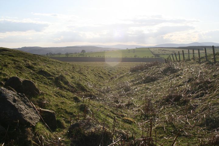
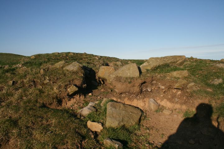
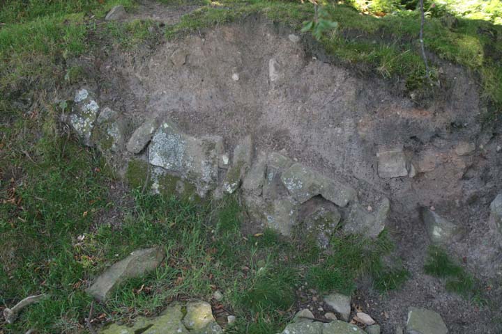
Before reaching Crag Hill you will start to encounter a rather weird ditch feature. This is weakly defined east of Crag Hill but very strongly defined to the west. On the west side it is tightly "V" shaped (photo) and appears to have rocks and stones lining it. At first appearance it looks like a stream cutting but there is no obvious source of the amount of headwater that would be required to make such a cutting and the feature climbs from the west, over the sky line and descends to the east. As a result it's almost certainly man made and looks like a ditch, but offers no obvious function either defensive or boundary. It is linear and appears unconnected with any other feature, but does follow the line of an old right of way running east to west towards Eglingham and the area of Beanley Moor and The Ringses. Looking across the "ditch" towards crag hill a small hump stands out to the south west of top of the hill. This is the burial "barrow" (photo).
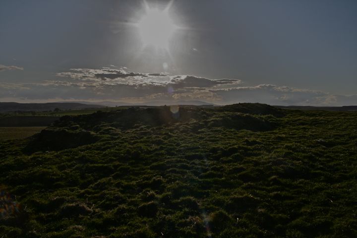
Approaching the top of the barrow you quickly see the capping stop, lying on its side to the west of the cist. This stone is about 1m by 1.6m and very impressive bit of stone in its own right (photo). The cist, though full of stones and grass, stands out quite clearly. Roughly 1m long and ½m wide, the stones that line the west, north and east sides are clear to see (Photo). The cist looks like it was originally covered with a barrow. This barrow stands on the southwest edge of Crag Hill and offers great views to the west and southwest.
http://www.archive.org/details/historyofnorthum09nort "> A History of Northumberland (Vol 2, 1893) states that the Barrow was excavated in 1824 and the remains are now at Alnwick Castle Museum. "In the
centre a fine urn or 'food vessel' was found, lying upon its side and filled
with ashes. It is 5 inches in height, 5 inches in diameter at the top, and 2
inches at the bottom. It is dark in colour, and is ornamented round the
shoulder by a grooved line, on which there are unpierced ears at regular
intervals. The urn is now preserved in the museum at Alnwick castle." Other sources state that 9 other burials were found around the cist.
This is the first Cist site I've visited and I found the site easy to find and the state of preservation to be surprisingly good. The views from the site in fine weather made the whole trip worthwhile.
Other points of interest:
1) There is a small circular enclosure around 22m across at the top of Crag Hill but http://www.keystothepast.info/durhamcc/K2P.nsf/K2PDetail?readform&PRN=N5039"> Keys to the Past has this as probably a post-medieval animal enclosure.
2) The whole area of Longlee Moor looks big and interesting, viewed on Google it looks like there are lots and lots of earthworks over a wide area of higher ground bounded by streams on all sides. My first trip was very short and I decided to focus on finding the Cist. Some of the earthworks look like natural formations but I'm heading back again, it would be easy to spend a day just generally looking over the area. http://www.british-history.ac.uk/report.aspx?compid=50866#s35 "> A Topographical Dictionary of England published in 1848 says of the area "A great portion of North and South Charlton is covered with ancient roads and earthworks; and graves of rude workmanship are frequently discovered, containing bones, urns, and armour."
3) The access track to quarry at Crag Hill has some interesting rock groupings near it and on along the slope to the west hand side of it. These appear to be grouped in small collections of 5-8 large stones some of which have "star shaped" holes worked into them, possibly for lifting? Some of these appear to have quite sharp edges so are probably the result of steel chisels and as such reasonably recent in nature? Some of the natural outcrops of rocks on the west slope may have markings but I would guess all are natural features as light was fading at this point I didn't have enough time to look at all the outcrops.
|
|