
Round feature on top of the hill which may be the remains of a dew pond.
Image credit: Chance - May 2008

Round feature on top of the hill which may be the remains of a dew pond.

One of the hills’ half buried sarsans

Standing on barrow 609 looking North. Barrow 606 is to the right with 606 centre and 604 with the small hole. The raised mound on the horizon is probally the remains of a dew pond.

Barrow 605 and the most northenly 604 with the elongated 606 on the right hand side. Standing on barrow 609

Barrow 605 showing the silted up ditch

Barrows 609 and 605 with Goldenball Hill in the background


From left to right Barrows No. 604, 605 and 609
Field notes
Draycott Hill – Barrow Cemetery – May 14th 2008
Ordnance Survey Explorer Map 157 – Scale 1:25000
Marlborough and Savernake Forest Avebury and Devizes
ISBN 978-0-319-23611-6
A fine group of barrows over looking the hamlet of Huish. Not easily accessible. A single track road runs up from Manor Farm and the church of Huish. I’m told that this area is owned by the Rothschild’s and is fiercely protected. My visit was via the bridleway from West Woods which seemed like an ancient path, very flat with small half buried sarsen stones, appearing to be placed along its route. The path opened out beside what looked like a dried up, tree lined pond. (SU 14243 64535)
At this point several bridleways and footpaths go off in different directions. If you came up the track from Huish in a car, this would be as far as you could drive. The path leading east, up the hill, passes some medieval earthworks.
The easiest path to the barrows at this point, is the northern bridleway which skirts the edge of Gopher wood. I choose to travel along the muddy path which goes through the middle of the wood. It was cool in the hot afternoon sun and the bluebells looked very pretty. The whole wood seemed magical and was populated with Sessile Oaks, ash and service trees. The majority of trees seemed to be 100 or so years old. I have not encountered another wood like this along the Pewsey Vale. Most trees are beech arranged in clumps, but this wood seemed unmanaged and natural. It was obviously a favourite with the horse riders of the area.
Reaching the gate at the end of the wood, a “access land” sign proclaims you have reached the strip of land that runs along the top of the ridge, designated access land under the Countryside and Rights of way act 2000. See www.countrysideaccess.go.uk for all the details of these rights. This designation continues from here, past Golden Ball hill and onto Knapp Hill. A bridleway runs along the top of the ridge, so gates are available to get a bike through.
The barrows lie just over the crest of the hill. I got the impression that the large disc barrow (SU16SW608) was the original resident, and the others were constructed soon afterwards. The disc barrow probably filled the tip of the spur and its ditch would had originally followed the 240m contour exactly. The later bowl barrows all seem to fight for space. They were probably constructed by the same tribe or group over several generations. I would guess that following the disc barrow, the most northern bowl was built (604), and then slightly east (607). The smaller bowl barrows of 609 and 605 were then
constructed and cut into the ditches of the existing barrows. The remaining three barrows which merge to form the elongated 606, where the final additions before the whole of the spur was filled up. Each barrow merges with its predecessor as if to reinforce the continuity of the separate generations. Whether this was due to religious belief or a visual symbol of the tribes ancestral right to the land is unknown, maybe it was a bit of both. The different type of barrows may indicate different cultures or tribes where colonizing the same area over different time periods. Golden ball hill next to Draycott hill, had evidence of Mesolithic activity which would had been thousands of years before any barrows, disc, bowl or even long, where used.
A very beautiful area with more than a hint of mystery about it. The wood itself is well worth a visit just for the oak trees. As I travel by bicycle, I usually go in only one direction. If you travel here by car, consider parking at the Knap hill car park (SU 11588 63758) and making the effort to walk out to this hill. Once past the climb behind Knap hill, the ridge is flat and level making walking easy. Many TMA sites can be seen from up here and different perspectives gained on a truly spectacular landscape.
Chance
SMR Number : SU16SW608
Site Name : Gopher Wood
Grid Ref : SU13986393
Parish : Wilcot
Site Type : Bronze Age Disc Barrow
Scheduled Monument : AM035
Finds : Ceramics; Worked animal bone; Worked bronze; Human burial, secondary; Flint
Description
A Bronze Age disc barrow, 33ft by 3ft, excavated in the 19th century by Cunnington
Other barrows in this group include
SU16SW609 – Two bowl barrows, 10 paces by 2ft with traces of a ditch, opened by Cunnington. One had an urn with 2 perforated bone pins; the other a bone pin in a cist but no urn.
SU16SW606 – Three ditched confluent bowl barrows opened by Thurnam in 1863. The western interment was not reached; centre and east contained primary cremations.
SU16SW604 – A ditched bowl barrow, 11 paces by 3ft. B)It was visited by the Ordnance Survey in 1974 – 17.0m by 2.4m with a ditch 0.4m deep in the south side. Barrow is overlain by SU16SW605.
SU16SW605 – Bowl barrow, 10 paces by 3ft. It was visited by the Ordnance Survey in 1974 and found to overlay SU16SW604.
SU16SW607 – A bowl barrow with a smaller bowl barrow overlaying it on the south side

The Kauri-stone
The groove resembles the slit of the cowrie-shell which has been the universal divine yoni from extremely ancient to modern times.
In Hindu religious lore the megalith would be treated as a stone manifestation of the Goddess Devi-Kunti, and the cowrie-shell was her talisman.

Stone Circle and the presumed Cove on Harestone Down.
At the centre of the 10-metre (33-foot) diameter circle is a quasi-pyramidal standing stone.
1 is a broken sarsen; 2: a fallen triangular sarsen; 5: a fallen sarsen: 6: the stump of a missing sarsen whose bearing from the centre is the Hallowe’en sunset; 7: a splendid high megalith but fallen. Its direction from centre is the May-Festival sunset (62 degrees west of north).
3, 4, 8, 9 are positions suggested for missing stones.
The ‘cove’ may have faced either midwinter sunset or midsummer sunrise.
The bearing from the ‘cove’ of the centre stone of the circle is 50 degrees east of north.
The distance between ‘cove’ and centre stone is about 35 metres (38 yards).
Picked Hill – Field notes /blah blah blog
Ordnance Survey Explorer Map 157 – Scale 1:25000
Marlborough and Savernake Forest Avebury and Devizes
ISBN 978-0-319-23611-6
I have only climbed this hill once. 2006 I think it was. My crazy Swiss artist friend, Patrick Mayland had decided to camp out on the top of Milk Hill and I had foolishly agreed to join him. He really wanted to be present when the aliens were making one of their crop circles. Arriving on top of this hugh flat hill after dark and looking for a tent was not easy. I came across half a dozen other people up there, moving around in the dark. Some ran away when I got near, some couldn’t speak English, and some thought I was a croppy called Ray.
We came down from the hills using the Workway Drove, an old track that leads from Knap Hill into the village of Wilcot. From here it was a walk down the Kennet and Avon canal towpath to Pewsey and the Co-op supermarket.
Check out this link for more info from Walking World
We came back along the towpath and thought it cool if we climbed up a hill to get a clearer view of the surrounding landscape. I choose Woodborough Hill as it seemed to have more features, trees, strip lynchets and a public foot path, while Patrick choose Pecked Hill. We tossed a coin and he won.
First let me state that this is private land and we had no right to be there.
We got under the wire fence at SU 12458 60636 and stashed the shopping. I remember there were young bullocks in the field but over towards the Western end. We climbed up the hill along the Eastern fence line and picked lovely fresh cherries from the trees along the lower slope. There was no human path, but seemed to be some form of track. It was a long haul in the hot sun and I remarked upon this when we reached the top and found no shade.
From this hight the whole valley is visible. I guess you could see over a dozen and a half TMA sites from here.
Looking West to East – Morgans Hill, Kitchen Barrow, Rybury, Tan Hill, Adam’s Grave, Little Eve, The Ridgeway, The Altons, Knap Hill, Golden Ball Hill, Draycott Hill, The Giant’s Grave and the Hill Fort at Martinsell. Over on the other side of the valley lies the other Giant’s Grave on Milton Hill, the Long Barrow and the later Everleigh Barrows. Then there are the standing stones like Alton Priors Standing Stone, The Hanging Stone and Woodborough Holed Stone. Of course the one missing from this list is Hatfield Barrow, which nestled in the ruins of Marden Henge.
The canal cuts around the base of this hill, but may well follow the same route that the Ridgeway did.
This area would had run with springs from the hills above, like the `laughing wells’ at Alton Priors (SU 10843 62201). Honey Street gets it’s name from the gluttonise mud track once found there, not because of bees. King Alfred swore an oath with all his remaining brothers, when they met up at Swanborough Tump. This was in 870 when the Vikings where using the Ridgeway to raid the towns along it’s route.
The area at the bottom of the hill also contains one of the most graceful parts of the canal. When the canal route was surveyed in 1793, the land was owned by Lady Susannah Wroughton, who would have nothing to do with it. She was finally appeased by 500 pounds, the building of a highly ornate bridge, No. 120 Lady’s Bridge, dated 1808 and the landscaping of the marshy area around it.
When John Rennie originally planned the canal, this area was to be the highest point and feed by the springs from the hills above. In effect he planned a ¬`top pond’, a 15 mile long reservoir to feed the canal as it fell towards Bath and Bristol in the West and Newbury and Reading in the East. This required a 4312 yard tunnel to be built and so a second opinion was sought by William Jessop. He suggested a shorter tunnel in conjunction with a steam pumping station at Crofton. This was chosen and saved the company 41,000 pounds. It still produced the 15 mile flat section or Pound from lock 50, Kennet Lock at the Devizes town bridge to lock 51, the Wootton Rivers Bottom Lock.
The Crofton pumping station is a heaven for Fred Dibnah types, and actually fires up the original coal feed boilers on special steam days. see https://en.wikipedia.org/wiki/Crofton_Pumping_Station and their own site at https://www.croftonbeamengines.org/intro.html for more details. Be careful if you take kids here. It seem like a health and safety nightmare, but well worth seeing if you have the time.
Another high light of this valley is The Bedwyn Stone Museum, which is based on the mason’s yard.
Bedwyn Stone Museum, 91 Church Street Great Bedwyn, SN8 3PF – Tel: 01672 870234.
See https://www.kennet.gov.uk/great-bedwyn-1.pdf for more details of a walking route.
Chance – May 2008

Woodborough Hill, Picked Hill’s neighbour, as seen from the where the Ridgeway once ran

Picked hill from it’s neighbour, Woodborough Hill showing the gentle northern rise to it’s summit.

Looking Eastwards from just above the stone known as Adam’s fallen stone or Sweet Little Eve .
This may have been the great entrance stone to Adam’s Grave at the top of the hill.
From here, the sacred hill may once had looked like Glastonbary Tor, set among the ancient marsh of the young river Avon.

The Aldbourne Blowing Stone – All smashed up with no one to blow.
A lost piece of village history or an obstuction to modern living.

The Aldbourne Blowing Stone – As you can see the stone is next to the village phone box and 3 meters from the Crown Inn. It has survived the water co., BT and the electric co. laying cables and digging trenchs around it.
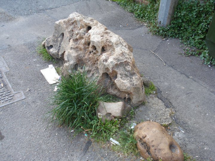
The Aldbourne Blowing Stone – If this is the famous stone, with a small deep hole at one end, then it looks like this section has been broken off.
Boys with toys, eh
As you can see the stone is next to the village phone box and 3 meters from the Crown Inn. It has survived the water co., BT and the electric co. laying cables and digging trenches around it.
I have my doubts if this is the “Blowing Stone”. It fits the position for the description above, but as for the small deep hole at one end, it looks like this section has been broken off. The area were the grass is growing may had been where the small boys blew. Who knows. None of the locals I spoke to knew anything about it.
The stone lies opposite the village pond, which has half a dozen stones around it. Any one of these could be a “Blowing Stone” and some looked far more impressive.
The famous Blowing Stone at Uffington is much more of a man’s “Blowing Stone”, fit for a king.
Chance – May 2008

The approach to Stonehenge by road from the east.
This view is one that has been seen by countless millions of motorists and their passengers travelling along the A303 to the West Country. As the sign at the side of the road says, ‘Fork left for Exeter’.
Stonehenge has not changed, but in 1930, in addition to the AA box, the view included two fairly new buildings. Dead ahead, in the fork of roads, lie the custodians cottages, built in 1920, and on the opposite side of the A344 is the slightly more recent Stonehenge Cafe.
This was not a popular addition to the setting of Stonehenge, being described at the time as `a cheap, flashy little building like the worst type of bungaloid growth’.
The cottages went first, the cafe followed soon afterwards.
Liddington Warren Farm Long Barrow – May 11th 2008
This long barrow sits on top of a ridge over looking the B4192 from Liddington to Aldbourne.
The road shows the precision of a Roman hand and I get the impression that this was the territory prized for it’s fertility. This whole area of the Ridgeway was rich agricultural land long before any Roman marched here.
The Aldbourne Circular Route, a bridleway/ride, follows the ridge and runs next to the barrow.
The way this route follows the top of this ridge, from the old Ridgeway at Liddington Castle down to the Aldbourne Four Barrows and on into the church at Aldbourne, is very processional. This whole area must had been the height of pre-roman achievement. Once the Romans came, it would had mushroomed into a major agricultural complex.
To visit this Barrow, I would suggest you park at SU 21822 80419, where the other cars pull up when visiting Liddington Castle, at the top of the hill. The traffic is slower here and you can see what’s coming. This road is an accident black spot, as the signs proclaim. If you park here, there is a stile leading into the field and a straight track directly up to the barrow. If you want to get nearer, park at SU 22035 80044 and get under the wire. The road past this point is tree lined with Horse Chestnut trees and can get very dark. It is very wide too, with well dug side ditches and numerous pieces of sarsen half buried. I could imagine it being a drover’s road, long before any car thundered along it.
It would have been the main road out to Cirencester, the second largest city in Roman Britian.
Walking up to the barrow you can see the fence line cutting the Eastern flank. This fence is the border. The parish was marked out on known landmarks and you don’t get much older a Neolithic Long Barrow. The barrow has been mutilated by man and beast. The black and whites are resident here and they have made quite a mess. When the fence was erected in 1890, three skeletons were dug from the barrow with a fourth, that of an adult male, was found later. The bones of at least one of these were forwarded to St Thomas’s Hospital. All are now lost.
The barrow mound is ovoid in plan and orientated WNW-ESE.. It survives to 42m in length, is 30m wide and stands 1.5m high. Although no longer visible at ground level, flanking ditches, from which material was quarried during the construction of the monument, run parallel to the north and south sides of the mound. These have become in filled over the years but survive as buried features 3m wide.
The barrow was first recorded by A.D. Passmore in 1922, who recorded a mound 165 feet long, 42 feet wide and up to 5 feet high, oriented SE-NW. Any sign of the side-ditches had been obliterated by ploughing. L.V. Grinsell was quoted as believing twelve sarsens protruding from the mound, although I could only see two. As it has never been properly excavated, these may be in situ from the original burial chamber. The hollow in the central area of the barrow mound represents only partial excavation by antiquarians, probably in the 19th century.
There might not be a lot to see at this barrow, but it does date from the same period of the ancient Ridgeway. It survived for 5000 years, but has only fallen into a ruin in the last 100 years.

The only glimpse most drivers get of the barrow looking up from the B4192. The damage to the Western side of the barrow is very evident from this angle.

The damage done by the erected fence of 1890 and the modern wildlife. This shot gives a good indication of the higher valley sides.

One of the protruding sarsen stones which may be part of the unexcavated burial chamber.

The Long Barrow with the Aldbourne Circular Route and bridleway stretches off towards Sugar Hill and down to the Aldbourne Four Barrows

All trace of the side ditches has been ploughed out or filled in.


The Long Barrow as seen from the Aldbourne Circular Route, the bridleway which runs along side the barrow.

At the E. end of the barrow there is a marked depression some 8.O m in diameter, which is probably the remnant of Thurnam’s 1860 intrusion.

The Easton Down Long Barrow looking at the side ditch and the area taken out of cultivation

The Easton Down Long Barrow looking East towards Tan Hill.

The Easton Down Long Barrow looking North towards its Bronze age Bowl Barrow neighbour

The Easton Down Long Barrow looking North showing fence posts for scale. Note the remaining ground marks of the side ditch.

The Easton Down Long Barrow looking East towards the A361.

General view of Easton Down Long Barrow from the farm track, which now measures roughly 40 m by 28 m.
Morgan’s Hill
After the rain
a long view – and larks.
A climb through three gates,
but worth it for the best of Wiltshire.
We, surprised even now by this green antiquity
touching instinct, breathe in and smile.
And the sun points out meadows,
clouds paint themselves
and high Morgan’s Hill sings its great wide song
to us until
we turn to the circle of trees,
and the hollow hauls us into itself.
A stump, scattered stones,
a fire’s corpse and a stagnant pool;
a rook floats, sodden, swollen.
Here we are no longer part of things -
or part of something other.
We leave symptoms of ourselves everywhere.
Out there the winds dilute us.
Here, face to face with these echoes,
we fall silent.
Saddened, with nothing
but the rushing of beech about us,
we stumble out,
finding a sky we do not recognize
full of something darker than the rain.
Sean Street, 1989
South Street Long Barrow SU 0902 6928 (Avebury G 68)
This long barrow has been greatly reduced, so the majority of these field notes will consist of the report on the barrow from W.A.M. Vol. 79 page 23.
I have included some site pictures to show what little remains of this barrow.
Two show the remains from the filled-in side ditch on the south side of South Street, the other two show the remaining mould north of the road and between Adam and Eve, on the Beckhamption Ave.
This long barrow, oriented ESE-WNW, was situated 120 m E of the Longstones and to the N of South Street, a minor road running between Beckhampton and Avebnry Trusloe. Stukeley was the first to record the mound, but his several drawings of the site give no consistent indication of its precise form. Further details of past records are to be found in the account ol the barrow’s excavation
(Ashbee, Smith and Evens 1979: page 250-75).The earthen and chalk mound was 41.3 m long with a maximum width of 15.0m, and though unfinished appeared to he rectangular in shape. The parallel flanking ditches both ended, at the E, level with the proxinial end of the barrow. This had been delimited by a cresccntic zone ol chalk rubble, into which a late neolithic/beaker pit had been dug subsequently.
Of the ditches the S was the more regularly cut, tapering from E to W, while the N appeared to be unfinished. As at the Beckhampton Road long barrow, the mound behind the frontal chalk rubble was shaped by a series of wooden hurdling bays, here 20 bays to either side ot the long axis. In these had been placed material from the side-ditches, laid down in the order in which they would have been encountered during the quarrying – turves and loose soil against the axis, then sub-soil, with the chalk towards the edges. Towards the front of the mound five large sarsens, and several smaller ones, had been included in the bay structure, but there was no evidence that these represented a collapsed chamber. Two disturbances in the mound at this point would appear to have been the result of the removal of at least four large sarsens, perhaps during the medieval period.
It is possible that it was these, left on the adjacent field boundary, that Stukeley saw and mistakenly drew as a peristalith (1743: Tab. 24). No human burials were found within the barrow.
The construction of the barrow was dated to the second quarter of the third millenium BC by radiocarbon estimations taken from ox vertebrae (2750 +/- 135 b.c.; BM-357) and an antler (2670 =/- 140 b.c.; BM-358a) •from the bottom of the N ditch, and from an antler included in the filling of one of the bays (2580 +/- ±110 b.c.; BM-358b).

Plan showing the magnetometer survey carried out on behalf of the Avebury World Heritage Site Management Officer to accurately locate the barrow so it could be ‘removed from cultivation’.

The remains of the barrows southern side ditch. The south street lane which bisects the barrow can be seen, along with a strip of land left uncultivated, marking the side ditch’s position.

The remains of the barrows southern side ditch can just be seen as a strip of land left uncultivated.

The remains of the barrow can be seen as a darker patch covered with danelions. Adam and Eve standing stones in the background.

The remains of the barrow looking north towards the Adam and Eve standing stones

Reconstruction of Lanhill Long Barrow
Plan of the barrow showing known chambers and the degree of destruction

Langdean Stone Circle
In the valley due south of the village of East Kennett stands an unrecorded stone circle, to which I have given the above name, which Mr. Crawford tells me was the title of the valley in the 17th century.

Plan of Pennings Circle, Avebury – O.G.S. Crawford, F.S.A. 1922
Stones are shown in solid black and depressions in the grass where stones may have stood by broken circles
North Down Barrow Cemetary on the A361 between Devizes and Avebury.
Top Deck of the Trans Wilts Express – Chance October 2007

Badger set in Manton Round Barrow. The `Old Creature’ has a black and white friend or two.

Manton Round Barrow looking towards the River Kennett and Plough cottage

In woods marked Stone Woods Field up from the Barrow