

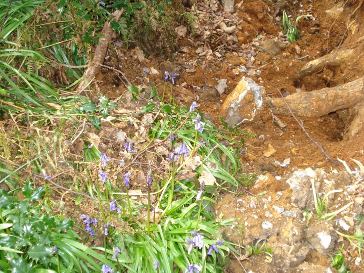


The Barrow Southern side with blown over Beech tree


A Village Republic
Sarsen is a village that has no great landlord. There are fifty small proprietors, and not a single resident magistrate. Besides the small farmers, there are scores of cottage owners, every one of whom is perfectly independent.
Nobody cares for anybody. It is a republic without even the semblance of a Government. It is liberty, equality, and swearing. As it is just within the limit of a borough, almost all the cottagers have votes, and are not to be trifled
with. The proximity of horse-racing establishments adds to the general atmosphere of dissipation. Betting, card-playing, ferret-breeding and dogfancying, poaching and politics, are the occupations of the populace.
A little illicit badger-baiting is varied by a little vicar-baiting.
Richard Jefferies, 1879
Time on Time
Here in Yarnbury Camp, said the man, his shadow falling across us sunned and silent, they dug up a Roman soldier.
complete with all his gear they found him, even to the rivets, brass-bronze, I should say – that fastened his leather sandals.
I’m interested in these things myself, whenever I come here I make a special point of looking in all the rabbit-holes.
He paused a little, and went; and after him came the Roman. shadowless stepping the turf that hid him unsunned and silent,
here in Yarnbury Camp, saying, we dug up a Briton, buried with all his goods, his worked flints and his amber.
Mortality is a strange thing, I muse and ponder about it as I stand here on my watch, so still that at dusk the coneys nibble the grass at my feet, heeding me no more than a dead man.
I looked at your wrist, at the transient flesh and the bone beneath it, and time bound dancing there with a viper’s-tongue flicker.
To that coranto, I thought, north-east of us the shadows of Stonehenge veer onward into another evening.
Sylvia Townsend Warner, 1937

Beacon Hill from Oliver’s Castle – Chance April 2008

Roundway Down – A Special place – Chance – 18/04/08

The ancient track to Oliver’s Castle – Chance – 18/04/08

Standing on the edge of Oliver’s Castle – Chance – 18/04/08

Moon Rise over Oliver’s Castle
Chance – 17/04/08

Morgans Hill from Kings Play Hill Long Barrow

Looking South West from the Barrow looking towards Olivers Castle

The Barrow again with Morgans Hill in the background

Kings Play Hill Long Barrow – The green patch with the tyre tracks going over it

Kings Play Hill looking towards Olivers Castle


Morgans Hill as seen from Oldbury Castle

Part of the North Down area as seen from Oldbury Castle looking South towards the Vale of Pewsey
Mount Wood Fieldnotes – Sunday 13-04-08
Seeing site listed on TMA web site, decided to visit while cycling around Cherhill / Oldbury area. I Know some of the bridleways of Yatesbury and Compton Bassett as they lead out towards Avebury. Leaving the A4, opposite track to the White Horse, go down Park Lane to the farm by triangle wood. Up the bridleway and the mount is on the left, just over the fence, as the ground levels off.
I’ve seen many barrows before but this one is truly different. 8 Feet high and 25 feet in diameter, it looks like a mini Silbury Hill. It’s conical shape and steep sides seem to have never been dug by man or beast. As a consequence, it is undated, but is thought to be Romano-British. (Looks like it slipped through TMA Roman net!). As you can see from the pictures, it has a number of beeches and sycamore trees growing on and around it, but is still in perfect condition. Maybe, and this is a wild guess, it is a bowl-barrow with another burial on it’s top. LVG didn’t seem to know what to make of it either as it’s marked down as Ba, Roman or later. It is Scheduled Monument No.SM12338. It must had always been known for being different. Why else would it be called Mount wood rather than Barrow wood or Barrow copse? I have included a picture looking towards Oldbury Castle from the site to illustrate it’s prospect.
On leaving, I travelled down the rest of the bridleway and on towards Nolands farm and Jugglers Lane. I was struck by the width and straightness of the later track. It screamed Roman to me with the area towards the end may be a ruined building of some sort. Needs more investigation, me thinks.
I know that the site of Cherhill Church is built over a Roman villa or shrine. I also know that a major Lay-line passes through this same site, as it does the church in Calne, Stanley Abbey, Lanhill and the temple of Apollo at Nettleton. In the other direction, the Lay-line travels through Silbaby and the Sanctuary before going through Savernake forest and the middle of Tottenham house.
Chance – April 2008

Prospect of Oldbury Castle and White Horse from Mount Wood

South side of the Mount with filled in ditch


The Mount looking south showing conical shape unlike other barrows


Plan of the southern sector of the circle showing the numbering of the stones.
The outer circle numbering starts at the begining of the West Kenett Aveune junction at the stone known as the Devil’s chair or Goddess stone No.1. The numbers then move round clockwise until they reach the final stone of No.98.
The position of the Ring Stone is shown in relation to the overall plan

Plan of the Northern sector of the circle showing stones, numbers 30 to 50 in the outer circle and the remaining stones of the northern or moon circle, numbers 201 to 210.
The postion of Cove is also shown in relation to the northern or moon circle.

Stonehenge reconstructed showing stones standing, fallen, missing and their numbers.

The Ladies of the Bristol and Gloucestershire Archaeological Society examine the Piggledean sarsen’s before an address by the Rev. E.H Goddard. – Summer Outing 1907
This year the Wiltshire Wildlife Trust celebrates the 20th anniversary of the Sarsen Trail, and to mark this milestone is encouraging us to take part in the ‘Walk for Wildlife Week’ which precedes the Trail, Saturday 26th April to Sunday 4th May.
The Week will culminate with the Sarsen Trail and Neolithic Marathon on Sunday 4th May.
The Sarsen Trail and Neolithic Marathon is a 26-mile sponsored walk and run between the two World Heritage Sites of Avebury and Stonehenge, with shorter courses available to those who prefer shorter distances.
The route offers some of the most spectacular view across Wiltshire’s undulating downland and the opportunity to walk on Ministry of Defence land that is usually closed to the public. Part of the route is also of major historical importance as it traces the approximate trail along which the Sarsen stones were dragged to build Stonehenge in the Neolithic times.
The event is the Trust’s most important annual fundraiser. Over 1,700 walkers and 400 runners from across the UK and from abroad, 100 dogs, and 250 staff and volunteers took part in last year’s event raising over £60,000, money that will be used to help protect Wiltshire’s wildlife and environment and safeguard its natural heritage for future generations.
There are frequent water stations along the route and once you’ve reached Stonehenge, you can lie back and enjoy a well-earned massage or feast on a hog roast.
The Sarsen Trail walk, Neolithic Marathon and Half Marathon are organised to raise vital funds for the Wiltshire Wildlife Trust.
The next Sarsen Trail and Neolithic Marathon and Half Marathon will take place on Sunday 4th May 2008.
The Marathon starts at Avebury at 10.30am. The half marathon starts at Charlton Clumps on Salisbury Plain at 11am.
wiltshirewildlife.org/ – Click link on right for Sarsen Trail
REGISTRATION FEES 2008 – Close Registration – 11th April
Adult Full Walk £24.00
Adult Half Walk £18.00
WWT Member £12.00
Child (under 16) £6.00
Watch Member £4.50
Child Group £4.50
Family (2 adults, 3 children) £50.00
WWT Family £35.00
Group Rate (5 or more) £20.00
Marathon £30.00
Marathon (WWT Member) £15.00
Half Marathon £25.00 £20.00
Half Marathon (Member) £12.50
Bringing the birds and bees and monkey babies together – Lovely

Stonehenge Free Festival – June 1982 – Stonehenge, the car park and in the top right, the Cursus Barrow Group

Stonehenge Free Festival – 21 June 1976 – The Stones and “camp site” from the east

Stone 53 – The Dagger Stone – July 1953 with Custodian

Stone 53 showing multiple Daggers – 5pm 19th July 1953 as recorded by Professor Atkinson
Sarsen, a type of sandstone laid down in warm shallow seas, varies consideiahly in its composition and hardness, The slabs into which it naturally fractures often have one rough side and one that is much smoother.
Holes made by the roots of aquatic plants and burrowing marine creatures create weaknesses that weather can modify and enlarge, the stones sometimes taking on fantastic shapes and contours. The base of Stone 60 had eroded into what was effectively a tiny cave, big enough for four people at a squeeze.
In 1959 Stone 60 was straightened and, at the same time, in order to deal with what was seen as a weakness in its structure, the ‘cave’ in its base was filled in.

The “restored” Stone 60 sits in a sea of gravel – 1964

In 1959 Stone 60 was straightened and, at the same time, in order to deal with what was seen as a weakness in its structure, the ‘cave’ in its
base was filled in. Here the wooden shuttering is constructed prior to pouring in the concrete.

Amesbury’s Rock n’ Roll Rebels wait for the dawn – Summer Solstice 1958

Amesbury’s Rotary Ladies Club also wait for the dawn – Summer Solstice 1958

Ground Plan of Horslip Long Bartrow as Excavated 1959 by Ashbee & Smith

Ground Plan of Long Stones Longbarrow, Beckhampton as Excavated between 1820 and 1850

Ground Plan of South Street Long Bartrow as Excavated between 1964 & 1967


Ground plan of Stonehenge – 1959
Note the raised position of stones 57 and 58 to the earlier plan of 1953

Ground plan of Stonehenge – 1953
Note the fallen position of stones 57 and 58 to the later plan of 1959

Stone No. 50 – Shergar or The Nags Head, Looking West
Stone No. 50 in foreground with Stone 46, the Swindon stone, followed by Stone 44 etc.

Avebury NE sector – Stone 50 – Shergar or The Nags Head
This has to be the most loneliest stone of the original bunch. It stands in it original position and has never been altered.