
Looking towards Furze Knoll and the summit, from the Southern gate.
Image credit: Chance - May 2008
Looking towards Furze Knoll and the summit, from the Southern gate.

The inner enclosure of Furze Knoll. An ancient flint mine or a gateway to the underworld.

The Wansdyke with the Radio Masts.
The site was only used after Alexander Keiller brought Windmill Hill to prevent the B.B.C. building the first radio transmitter outside London in 1924.

The Wansdyke snakes down to Baltic Farm and across Bishops Cannings Down.

Furze Knoll, with it’s guardian enclosing beech trees, sits on the top of the downs. If the Avebury region is sacred, then this high point must have been marked by something special.

The Wansdyke snakes up to the summit of Morgan’s Hill between the radio masts and Furze Knoll.

This is the site of two Bronze Age Round Barrows. Now the North Wiltshire Golf Club. They might still be there somewhere.

The Bronze age round barrow NMR No. 45564 with Furze Knoll in the background.


The edge of the downs looking towards Calne showing linear features possibly strip lynchets (or trackways).

The fosse caused the Roman Road and the Wansdyke merge, looking east


Disc barrow 608 looking east towards Martinsell Hill

Disc barrow 608 looking into the Pewsey vale as seen from barrow 609

Picked hill on the left and Woodborough hill on the right as seen from the barrow 608

Disc barrow 608 stands 3ft high and is 33ft in dia.

The original disc barrow 608 looking towards Huish.

Looking east towards Martinsell Hill

Huish hamlet at the bottom of Draycott Hill and the glass pyramid which may be a modern masonic temple.

Round feature on top of the hill which may be the remains of a dew pond.

One of the hills’ half buried sarsans

Standing on barrow 609 looking North. Barrow 606 is to the right with 606 centre and 604 with the small hole. The raised mound on the horizon is probally the remains of a dew pond.

Barrow 605 and the most northenly 604 with the elongated 606 on the right hand side. Standing on barrow 609

Barrow 605 showing the silted up ditch

Barrows 609 and 605 with Goldenball Hill in the background


From left to right Barrows No. 604, 605 and 609

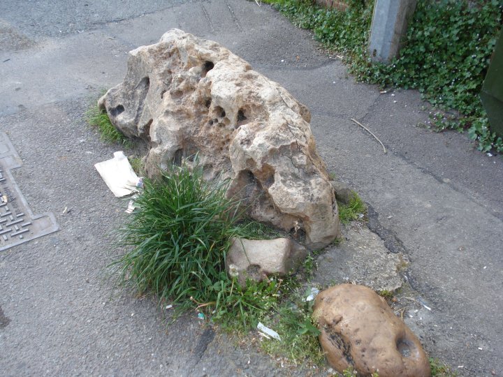
The Kauri-stone
The groove resembles the slit of the cowrie-shell which has been the universal divine yoni from extremely ancient to modern times.
In Hindu religious lore the megalith would be treated as a stone manifestation of the Goddess Devi-Kunti, and the cowrie-shell was her talisman.

Stone Circle and the presumed Cove on Harestone Down.
At the centre of the 10-metre (33-foot) diameter circle is a quasi-pyramidal standing stone.
1 is a broken sarsen; 2: a fallen triangular sarsen; 5: a fallen sarsen: 6: the stump of a missing sarsen whose bearing from the centre is the Hallowe’en sunset; 7: a splendid high megalith but fallen. Its direction from centre is the May-Festival sunset (62 degrees west of north).
3, 4, 8, 9 are positions suggested for missing stones.
The ‘cove’ may have faced either midwinter sunset or midsummer sunrise.
The bearing from the ‘cove’ of the centre stone of the circle is 50 degrees east of north.
The distance between ‘cove’ and centre stone is about 35 metres (38 yards).

Woodborough Hill, Picked Hill’s neighbour, as seen from the where the Ridgeway once ran

Picked hill from it’s neighbour, Woodborough Hill showing the gentle northern rise to it’s summit.

Looking Eastwards from just above the stone known as Adam’s fallen stone or Sweet Little Eve .
This may have been the great entrance stone to Adam’s Grave at the top of the hill.
From here, the sacred hill may once had looked like Glastonbary Tor, set among the ancient marsh of the young river Avon.

The Aldbourne Blowing Stone – All smashed up with no one to blow.
A lost piece of village history or an obstuction to modern living.

The Aldbourne Blowing Stone – As you can see the stone is next to the village phone box and 3 meters from the Crown Inn. It has survived the water co., BT and the electric co. laying cables and digging trenchs around it.
The Aldbourne Blowing Stone – If this is the famous stone, with a small deep hole at one end, then it looks like this section has been broken off.
Boys with toys, eh

The approach to Stonehenge by road from the east.
This view is one that has been seen by countless millions of motorists and their passengers travelling along the A303 to the West Country. As the sign at the side of the road says, ‘Fork left for Exeter’.
Stonehenge has not changed, but in 1930, in addition to the AA box, the view included two fairly new buildings. Dead ahead, in the fork of roads, lie the custodians cottages, built in 1920, and on the opposite side of the A344 is the slightly more recent Stonehenge Cafe.
This was not a popular addition to the setting of Stonehenge, being described at the time as `a cheap, flashy little building like the worst type of bungaloid growth’.
The cottages went first, the cafe followed soon afterwards.

The only glimpse most drivers get of the barrow looking up from the B4192. The damage to the Western side of the barrow is very evident from this angle.

The damage done by the erected fence of 1890 and the modern wildlife. This shot gives a good indication of the higher valley sides.

One of the protruding sarsen stones which may be part of the unexcavated burial chamber.

The Long Barrow with the Aldbourne Circular Route and bridleway stretches off towards Sugar Hill and down to the Aldbourne Four Barrows

All trace of the side ditches has been ploughed out or filled in.


The Long Barrow as seen from the Aldbourne Circular Route, the bridleway which runs along side the barrow.

At the E. end of the barrow there is a marked depression some 8.O m in diameter, which is probably the remnant of Thurnam’s 1860 intrusion.

The Easton Down Long Barrow looking at the side ditch and the area taken out of cultivation

The Easton Down Long Barrow looking East towards Tan Hill.

The Easton Down Long Barrow looking North towards its Bronze age Bowl Barrow neighbour

The Easton Down Long Barrow looking North showing fence posts for scale. Note the remaining ground marks of the side ditch.

The Easton Down Long Barrow looking East towards the A361.

General view of Easton Down Long Barrow from the farm track, which now measures roughly 40 m by 28 m.