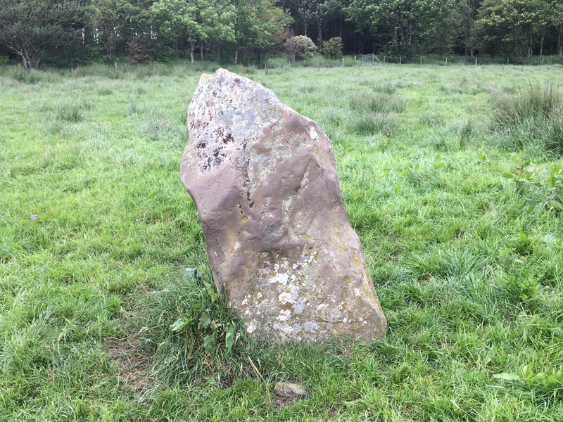
White Cairn, Beoch Hill is a robbed cairn on rough moorland near the summit of Beoch Hill.
I parked at the Observation Post at NX 1093 6679 on the road to Penwhirn Reservoir. I headed W across rough ground over a shallow valley onto Beoch Hill. The moorland became drier at the summit of the hill. White Cairn, Beoch Hill required a GPS to find the low lying cairn, hidden in a patch of long grass. A scattering of white stones and a central clearing is all that remains.
Canmore ID 60690 (go to Links) states that it “had been almost obliterated by 1911.”
markj99
Visited 24.08.19
Thanks to persistence and drewbhoy’s pictures, I managed to find this shy and retiring recumbent stone after 15 minutes of tramping in moorland. The stone lies in a hollow guarded by reeds. As ever, I thought it should be easier than that so I have formulated an improved method to find Glac A’ Charraigh.
Park in the large passing place 150 yards before the sharp corner at NR 29643 43061. Walk 200 yards NE from the gate at the corner of the field. If the stone is not visible look for a small clump of reeds concealing it. You need to be almost standing over it. The choke stone is easier to spot than the recumbent stone.
My grid reference for this site was NR 29754 43158.
Canmore ID 37289 (go to Links) describes it as a standing stone on their last visit in 1977.

Visited 22.08.19
I parked at the Kintra campsite. I had to turn back at the ford to get my wellies and stick for the burn crossing. They came in handy later. Frachdale ruin was easily reached and a rough road ran up the hill to Frachdale Chambered Cairn and Coille A’chnoic Mhoir standing stone, easily spotted a quarter of a mile up on the right. As drewbhoy observed Frachdale Chambered Cairn was less accessible. I went through the gate at the top of the hill and followed my GPS South down a steep ferny slope crossing a boggy valley to the summit of the mound. The cairn itself is vegetation free, unlike its surroundings. I retraced my steps to return, avoiding further adventures.
Canmore ID 37607 (go to Links) give further details of Frachdale Chambered Cairn.

Following in the stumbling footsteps of drewbhoy, I spent 20 minutes searching for Princess Yula’s Stone only to bump into it as I was leaving, unsuccessful in my quest. It was at this happy point that I realised there were less than 20 yards between the two stones! To prevent future Antiquarian’s frustration I have devised a GPS free solution:
Take the A846 out of Port Ellen, reaching Ardbeg after Laphroaig and Lagavulin. The road narrows to a single track for a further 2 miles until you reach the scenic Loch a Chnuic bay. There is an uphill hairpin at the end of the bay. 20 yards before the apex of the hill there is space to park snugly beside a black wrought iron gate on the right.
Walk down the hill 10 yards, look right to the smaller stone nestled in the edge of the wood. The low fence is easily negotiated. To find the second stone stress free, stand on the left of the smaller stone facing the trees, walk 10 yards forward at which point you should notice a faint path to your left. Follow this path for 10 yards and you will find the Fairy Dell that hides Princess Yula’s final resting place.
Canmore ID 38030 (go to Links) casts doubt on the relationship between the two stones , stating that the road side stone “is a smaller, insignificant set stone of doubtful association.”


Cairn MacNeilie, Cruise lies in a field N of Cruise farm on the minor road between Glenluce and New Luce, around 1 mile from New Luce.
Canmore ID 61666 (go to Links) describes it as a circular cairn of 17 metres across which has been expanded by field clearance stones. The top of the cairn is covered in whins which discouraged my investigation of a possible cist.
Cairn Macneilie, Inchparks is 7.4 km WSW of this site.

Maryholm Stone, 50 yards NW of large tree near the river Nith


Wallace’s stone is situated at Blairston Mains, the 1st non-private left turn on the B7024 to Maybole after leaving Alloway.
The stone is surrounded by a solid stane wall in a strip of trees.
The carving is suggested as a representation of Wallace’s sword but looks more like a cross to me, however some interpretation is required.
Canmore ID 41595 (go to Links) has more information on this site, suggesting the carving is “a cross in false relief” dating from the “10th to 12th century”.
Bain’s Hill or the Stinnie Stane is located at the northern boundary of Trump Turnberry. Park in the Malin Court Hotel restaurant car park. Head up to the flagpole and you will see the stone at the top of the hill.
Bain’s Hill is listed under Canmore ID 40856 (go to Links).


Logan House Garden is open from 1st February to 31st August. Follow the sign after going through Ardwell on the A716.
The standing stone is on the left of the one way avenue after around half a mile. The trees on the left make way for a large field in which the Logan House standing stone can be seen.
Canmore ID 61138 (go to Links) states “it is possibly a prehistoric standing stone.” The stone is c. 1.5m tall.


Kells farm is on the A710 along with its neighbour, Home Farm, which has two stones to visit. Kells Standing Stone is a 5 foot granite slab in a field SW of Kells.
It is listed as Canmore ID 65404 (go to Links).


I found this stone by sight as I was travelling S out of Twynholm. On passing Ingleston farm I noticed a large stone on the right side at the top of a hill.
I couldn’t find any online references to this stone but found it marked on my OS landranger map.
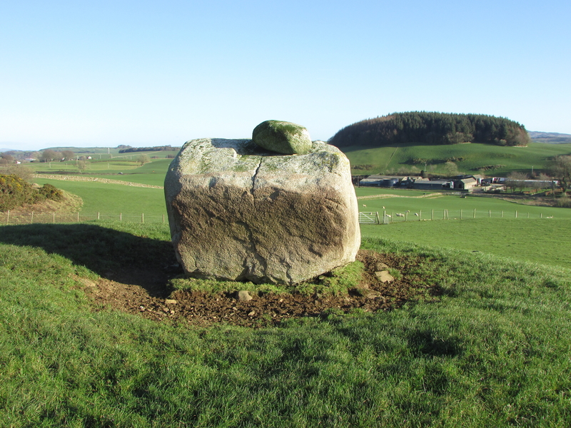
The Ingle Stone is a massive erratic measuring around 10x10x8 feet. There is a small moss-covered stone resting on top of the Ingle Stone. It is no wonder that the Ingle Stone has not been moved and has given the farm it’s name due to its prominence in the landscape.


Peatshiel Sike from SE, framed by Saddle Yoke and Carrifran Gans summits. Was a lunar standstill in this groove the reason for erecting this stone?

Peatshiel Sike, looking NE towards Bodesbeck Law. Does the profile of Peatshiel Sike mimic the summit profile of Bodesbeck Law?


The Devil’s Jump is located between St Breward and Camelford. There are two granite crags either side of a wooded valley. The western side is more prominent and easier to access via Carwether Village public path. There is a public path on the eastern side however access is limited.
I thought that a pillar of granite on the western side bore a diabolical resemblance maybe giving the site its name.

Buldoo 1, high and handsome. The recumbent stone is visible to the left of Buldoo 1 close to the house.

Visited 06.07.11
The 12 foot tall standing stone is easy to spot but the second stone is more reclusive. Canmore ID 8132 (go to Links) gives its location as ND 1992 3374. The split stone is around 6 feet high beside whins at the edge of the field. I’m not sure of the relationship between these stones. They’re like Arnold Schwartzenegger and Danny De Devito in Twins.
There is a large recumbent stone c. 70 yards SW of the taller menhir at the edge of Latheron. It seems like a better partner for the 12 foot stone. Canmore ID 8660 makes no mention of it.

Visited 24.01.12
Dun Flodigarry broch is located within the grounds of the Flodigarry Hotel. It is in a ruinous state, being reclaimed by natural forces.
Canmore ID 11388 (go to Links) gives details of an excavation on Dun Flodigarry carried out from 1978 to 1981.
It should be easy to visit Kirroughtree House Cairns, High & Low Lessons and Creebridge Cairn in the same day if you have not already visited them.
