


Tremayne Standing Stone looking towards Tremayne Farm.

An alignment of Tregeseal Holed Stones.

The interior of Tregeseal Entrance Grave.
Street View of Toldavas Farm Road.

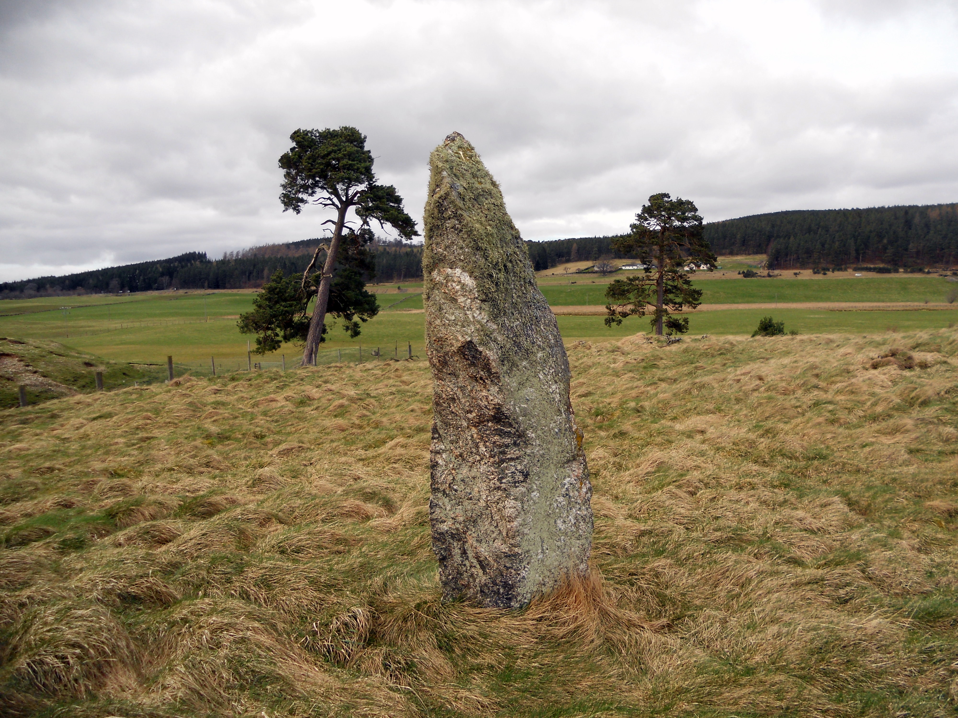
Toldavas Standing Stone looking E towards Toldavas Farm.

The broad face of Toldavas Standing Stone.

The narrow edge of Toldavas Standing Stone.
Visited 21.03.13
Toldavas is a squat standing stone in a cultivated field 150 yards W of Toldavas Farm. It measures c. 4x4x2 feet, resembling an erratic boulder more than a menhir. It would have been difficult to move this massive rock so it may be in its original location. Toldavas Standing Stone is included in Google Maps.
Directions
Follow the A30 round Penzance continuing onto Drift. After another 0.75 miles take the B3283 Porthcurno/St Buryan L turn off. Travel c. 0.9 miles along this road to reach a crossroads. There is room to park on the L at Toldavas Farm Road. Walk c. 400 yards down the road. Toldavas Standing Stone is c. 30 yards into the field on the R. If the field is in crop you can walk down the field edge.

A probable large capstone on Tolborough Tor Cairn.

An unusual Triangle marking on a Thimble Stone. It is probably a modern addition.

An unusual Triangle marking on a Thimble Stone. It is probably a modern addition.

The rock basins on top of the Thimble Stones, probably the result of natural erosion.

A rock basin on top of a Thimble Stone.

A double Cup & Ring Marking with a Cup Marking directly above on The Spiral Stone.

The Doon (Twynholm) Hillfort as viewed from the A75.

Ascending Doon Hill from E towards The Doon (Twynholm) Hillfort.


The featureless inner enclosure of The Doon (Twynholm).
The Doon (Twynholm) Hillfort
The Doon (Twynholm) is a ruined hillfort c 0.25 miles W of Twynholm. It lies within a circle of mature trees at the summit of Doon Hill. Canmore ID 64068 (go to Links) considers there to be an inner enclosure 24m across surrounded by an oval outer enclosure measuring up to a maximum of 65m on a N-S axis. The outer enclosure consists of a grassy rampart up to 2m high surrounded by a 9m ditch. No central features were observed.
Directions: Take the W road into Twynholm off the A75. Within 50 yards the 30 mph limit starts. Park at the gateway on the R within 30 yards. Walk along the edge of the field for c.100 yards to a gate into the adjacent field. Head W up the hill c. 200 yards to the obvious circle of large trees at the summit of Doon Hill.

The Taxing Stone, adjacent to Stranraer Coastal Path, looking S to Cairnryan.
Directions
Stroanfreggan Cairn is in the middle of nowhere so I have prepared a detailed account of how to get there from Dumfries & Newton Stewart.
Directions for Stroanfreggan Cairn: From S of Dumfries. Follow A75 through 3 roundabouts from edge of Dumfries. Turn R for Kilmarnock A76 on Glasgow Road Roundabout. (There is a McDonalds on the L at the first roundabout on the A76).
After about 16 miles reach Thornhill. Travel through Thornhill to N edge. Turn L for A702 Penpont/Moniaive. Stay on A702 for 8 miles to Moniaive. Stay straight through Moniaive. The A702 becomes the B729 a single track road with passing places. Stay on B729 for c. 10 miles until Stroanpatrick, a small hamlet. After passing a black tin hut on L park up at the first L about 400 yards further on. Walk down the Southern Upland Way for about 300 yards. Stroanfreggan Cairn lies c. 80 yards on your L in rough pasture.
Directions for Stroanfreggan Cairn: From Newton Stewart. Take A712 New Galloway on E edge of Newton Stewart. Drive around 18 miles on A712 to reach New Galloway via Clatteringshaws Reservoir. Turn L at the junction in New Galloway for A712 Crocketford. Cross over the Ken Bridge. Turn L for A713 Dalry/Ayr. About 4 miles later reach St John’s Town of Dalry. Take the R turn for A702 Moniaive up Main Street. After c. 500 yards take the second L turn at a crossroads in St John’s Town of Dalry. This is the B7000. Stay on this road past Kendoon Power Station for c. 6.2 miles to reach a junction with the A729. Turn R for A729 Moniaive, a single track road with passing places. After c. 2 miles you will see Stroanfreggan Mound on your R. Park at the junction with the Southern Upland Way. Walk down the Southern Upland Way for about 300 yards. Stroanfreggan Cairn lies c. 80 yards on your L in rough pasture.
Visited 14.04.12
Stroanfreggan Cairn is a greatly reduced round cairn in a rural location c. 5 miles E of Carsphairn. According to Canmore ID 64370 (go to Links) it originally measured c 75 feet on a N-S axis. The extensive stone robbing has exposed a cist in the E half of the cairn. Canmore states that the cist measured 3 ft 5 ins x 2 ft x 2 ft 3 ins internally, beneath a cover stone, 5 x 4 ft. The massive capstone is especially impressive. The centre of the cairn has been entirely reduced to ground level except for a c. 4x3 feet boulder. The perimeter has also been extensively reduced to a maximum height of 5 feet on the S arc. Canmore states there was an intermittent kerb of c. 2 feet high boulders now reduced to 3 remaining stones.
Stiddrig Long Cairn
Directions: Take the B213 Ivybridge turn off the A38. If you exit from the E, turn R, cross over the A38 and take the first L on the roundabout signposted for Cornwood. If you exit from the W, take the first L on the roundabout signposted for Cornwood. Follow the Cornwood Road for c. I mile until you reach a mini roundabout. Take the L turn onto a narrow lane for Cornwood. Stay on this road for c. 2.5 miles until you reach the Cornwood Inn at a crossroads in Cornwood. Take the R turn for Torr/Harford onto a lane. After 0.25 miles stay straight on the lane. After another c. 0.5 miles stay straight. After another 0.25 miles turn L up an un-signposted lane and bear R after a sharp corner. Follow this narrow leafy lane for c. 0.25 mile then take the L fork. The road will end c. 0.4 mile later just after Watercombe Farm. Park as close as possible and follow the track for c. 0.5 mile past the water treatment buildings reaching the open moorland of Stalldown Moor. When you are 100 yards clear of the buildings strike N uphill towards Stalldown Stone Row relying on GPS or Map Reading to reach the Southern Terminal 0.5 mile N at SX 63218 62074.
Stalldown Stone Row Cairn NW is incorporated within the area of the Stone alignment and cairns on Stalldown scheduled by Historic England.

Stalldown Stone Row viewed from NW across Stalldown Stone Row Cairn NW. The hollow in the top of the cairn is evident. Stalldown Stone Row Cairn NE is visible centre frame just below the horizon.

Stalldown Stone Row Cairn NW viewed from E.

The kerb of Stalldown Stone Row Cairn NW is delineated by c. 1.5 feet high stones.
There is a cluster of cairns in or near the Northern third of Stalldown Stone Row. Stalldown cairn circle (listed in TMA) is constructed a few yards to the E of the Stalldown Stone Row axis, a hiatus in the row of standing stones. Around 100 yards NNW in open moorland there is a small grass cairn measuring c. 30 feet across with a 4 feet earth bank. An intermittent perimeter of kerb stones c. 1.5 feet high define the edge of the cairn. There is a shallow hollow in the centre of the cairn suggestive of an excavation. It lies c. 30 yards E of Stalldown Stone Row.
A third cairn, Stalldown Stone Row Cairn NE lies c. 100 yards SE from here, on the E side of the stone row.
The concentration of several sites in a small radius suggests that it was the centre of ritual activities at Stalldown. The inclusion of Stalldown cairn circle into the stone row perhaps indicates that it was the focal point.
Historic England 1015806 (go to Links) has a full description of Stalldown Stone Row and its associated cairns.

Stalldown cairn circle in the context of Stalldown Stone Row, viewed from S.

Stalldown cairn circle viewed from S. Stalldown Stone Row recommences N of the cairn. The hiatus in the stone row suggests that Stalldown cairn circle was a site of ritual importance.

Stalldown Stone Row viewed from Stalldown Stone Row Cairn NE.

Stalldown Stone Row Cairn NE in its moorland setting.

The excavated interior of Stalldown Stone Row Cairn NE.

The central hollow in Stalldown Stone Row Cairn NE. It may be the site of a removed cist.

Stalldown Stone Row Cairn S in situ.

The grassy low lying remains of Stalldown Stone Row Cairn S.
The ruined cairn lies c. 250 yards S of the Southern terminus in Stalldown Stone Row. It has been reduced to a circle of rough uneven grassy lumps, measuring c. 10 yards across by 1 yard high. The dark green of the cairn contrasts with the light brown of the moorland.
Historic England 1012748 states that the centre of the cairn has a central hollow probably related to a past disturbance in search of a cist. It also speculates that the cairn may have been the original terminus of the stone row. The Stalldown area has been used for peat cutting in the past so some of the stones may have been removed or buried. In any case, the close proximity of the cairn to Stalldown Stone Row extends the area of the Stalldown Complex.
In its isolated situation in the Modern World, Stalldown Stone Row would seem to be an ancient monument frozen in time. However, Historic England states that Stalldown Stone Row is in an area where peat has been cut so the stone row may not be as original as it appears. In fact, Historic England speculates that many of the stones may have been restored in slightly different locations.
Historic England’s description of Stalldown Stone Row and its associated cairns.


