

Visited 11.08.23
High Baltersan Cairn is a circular grassy mound located in arable land c. 2 miles S of Newton Stewart in Dumfries and Galloway. It is situated adjacent to a natural rocky knoll which has field clearance stones deposited on its summit. The mound measures c. 33 feet in diameter and 3 feet high. The perimeter is studded with small and medium-sized stones. The flat summit is covered in grass. Canmore ID 63565 has further details of High Baltersan Cairn.


Visited 11.08.23
Cairnhouse E Cairn is a stony mound on the N edge of Cairnhouse Farm, c. 2 miles NNW of Wigtown in Dumfries and Galloway. The round mound is contained within a square stone-walled enclosure attached to a farmhouse. It is inaccessible due to the stone wall and surrounding ferns. According to Canmore ID 63373 material has been removed from the E arc. Canmore estimates that Cairnhouse E Cairn measures c. 60 feet in diameter and 7.5 feet high.


Field Clearance Stones on N Arc of Cairnhouse W Cairn.

Visited 11.08.23
Cairnhouse W Cairn is a grassy platform in arable land c. 0.33 miles W of Cairnhouse Farm, c. 2 miles NNW of Wigtown in Dumfries and Galloway. The round mound measures c. 50 feet in diameter and 3 feet high. Large field clearance stones have been dumped on the N arc. The remainder of the cairn has small to medium stones scattered on its surface. Canmore ID 63373 states that there is no sign of an exposed internment.
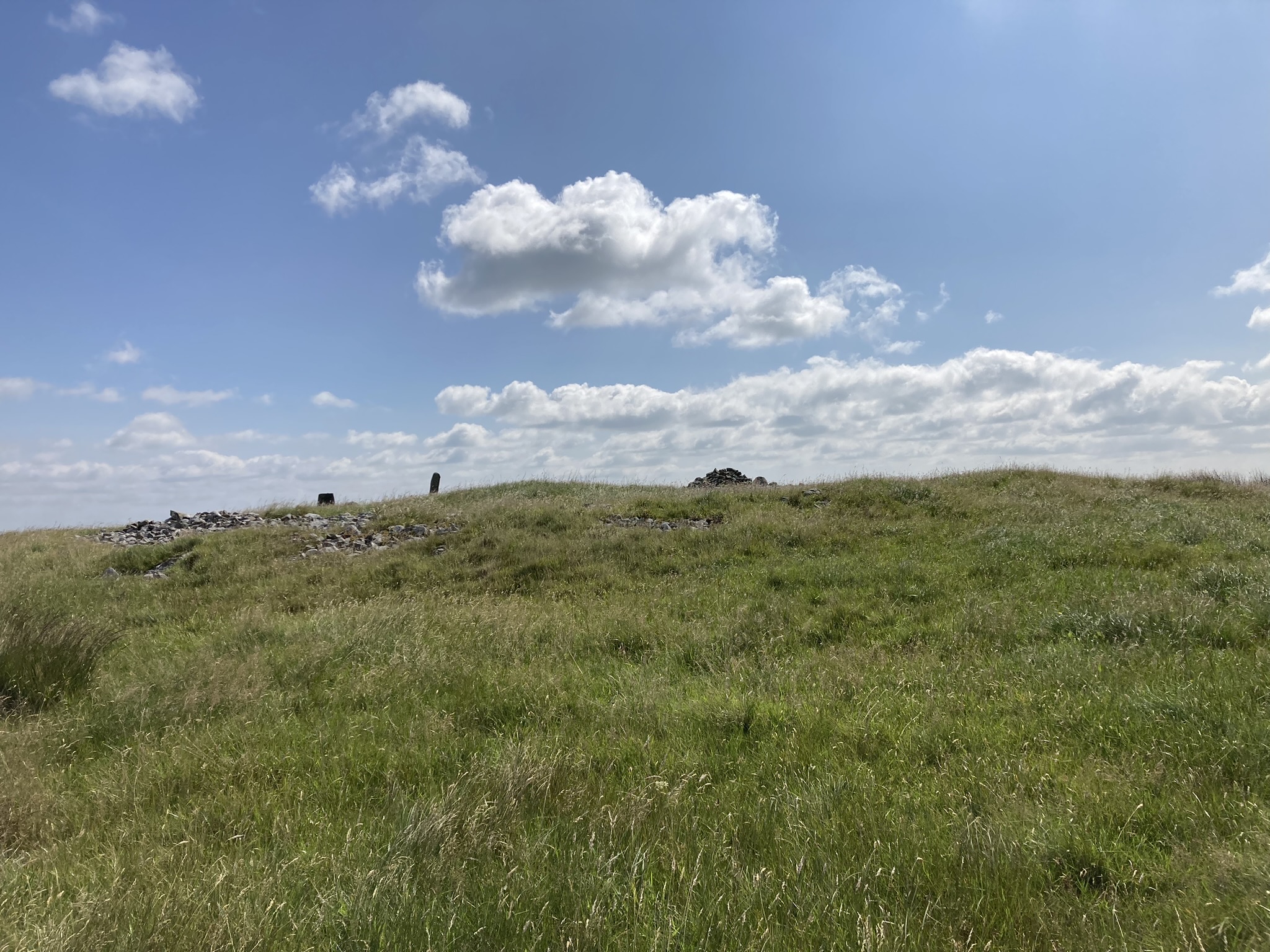
Visited 06.08.23
Elrig Cairn is a grassy mound c. 400 yards NE of Elrig, a small village in Dumfries and Galloway. The sub-circular cairn is located in arable land c. 350 yards SW of Elrig Farm. The mound measures c. 66 feet in diameter and 5 feet high. The S half is covered in thorn bushes. Old farm equipment and field clearance stones have been dumped in the N half. The cairn appears to be be unexcavated. Canmore ID 62713 has details of Elrig Cairn.


Modern Standing Stone in E Arc of Mochrum Fell (Elrig) Cairn.

Modern Marker Cairn in SE Arc of Mochrum Fell (Elrig) Cairn.

Centre of Mochrum Fell (Elrig) Cairn viewed from N.

Possible Ruined Cist in Centre of Mochrum Fell (Elrig) Cairn viewed from NW.

Possible Ruined Cist in Centre of Mochrum Fell (Elrig) Cairn viewed from SE.
Visited 04.08.23
Mochrum Fell (Elrig) Cairn is located c. 1.7 miles NW of Elrig in Dumfries and Galloway. It was constructed on the summit of Mochrum Fell (Elrig) with panoramic views. The sub-circular cairn measures c. 70 feet in diameter and 3 feet high. The perimeter is delineated by a belt of small stones with gaps in the N and SW. A stone slab, c. 3 feet high, has been erected as a standing stone in the E arc and a marker cairn, c. 3 feet high, has been built on the SE perimeter. These features are presumably modern additions to the cairn. The grassy centre of the mound has been cleared of stones. Canmore ID 62897 suggests that a central cist was destroyed by a bonfire previous to 1911. There is a central rectangular depression occupied by a large split rock with two large drill holes on its upper surface. The depression measures c. 4 feet long x 3 feet wide x 1 foot deep on a NE-SW axis. A c. 3 feet long slab on the SE edge could have been a cist side slab.

Cairn Hill (Dalquharran) Cairn viewed from N.

Cairn Hill (Dalquharran) Cairn viewed from E.

Cairn Hill (Dalquharran) Cairn viewed from S.

Cairn Hill (Dalquharran) Cairn viewed from W.
Visited 01.08.23
Cairn Hill (Dalquharran) Cairn is a ploughed-out cairn c. 0.5 miles north of Dailly in South Ayrshire. The grassy mound is located on the crest of Cairn Hill in arable land. According to Canmore ID 40870 the cairn measured 21m in diameter by 0.9m in height in 1982. Canmore also stated that in 1820 four cists were found in it.


Airyolland W Cairn viewed from Airyolland E Cairn.


Ruined Enclosures c. 20 yards E of Airyolland W Cairn viewed from NNE.


