We probably picked the wrong day to visit here as it was damned cold and quite overcast but the thought of possibly finding a cemetery of up to twenty barrows tucked away in the wilderness of mid-Sussex proved too much of a temptation. Parking is relatively easy as there’s a conveniently placed carpark just off the A272 between Midhurst and Petersfield and was very popular with the local dogowners the day we were there, just a shame they couldn’t be bothered to pick up after them. I always tend to think of Sussex as being quite highly populated, and I guess the bit I live in on the coast is, but inland you’ll find large tracts of land with barely any sign of habitation much like this. Here there seem to be endless glorious vistas of open heather with the occasional birch tree, small patches of conifer and the blue-hued hills of the South Downs on the distant horizon. It’s probably looked like this for centuries, possibly millennia. The first barrows you come to after leaving the carpark are a very small pair, possibly conjoined and only just discernible as they’re covered in heather, so it’s almost impossible to gauge just how big they are, or were. Travelling further South you come around a small pond and follow a track to a linear arrangement of five larger barrows which are part of Fitzhall Heath. The tallest of these is about 30-40 feet across and around 10 feet high, again heather covered and at some time in the past severely mauled, and from here you can see two other large barrows, one of which has been cleared of heather. On top of this we found the tattered remains of a sign politely asking the public to refrain from walking on the barrows and to use the cleared pathways around them. Whoops, sorry. Passing through the middle of all this apparently is a Roman road as well, though I couldn’t really work out where it was supposed to be, only surmising that it started in Chichester to the South. We only managed to seek out seven barrows on this visit, but given the size of the common it would take a good day to tramp around the whole area where I know there are at least another eight marked on the OS map. We’ll return when it’s warmed up a tad.

A R Cane

Two small barrows which appear to be almost conjoined on Fitzhall Heath, part of Iping Common, looking North near the parking area just off the A272.
Image credit: A R Cane


View across a frozen pond on Fitzhall Heath with three of the five linear round barrows almost visible beyond.
Image credit: A R Cane

Close up of the largest barrow on Fitzhall Heath looking West.
Image credit: A R Cane

Two of the three large barrows (there’s one behind to the very left) viewed from the top of the largest.
Image credit: A R Cane


Looking back at the largest barrow from the middle of the three main barrows in a vaguely Eastish direction.
Image credit: A R Cane

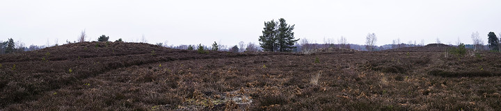
Panorama of the three main barrows on Fitzhall Heath looking North East.
Image credit: A R Cane

Panorama of the entrance earthworks on the South Eastern side. This is the entrance/exit they would have used when popping down to Sainsburys.
Image credit: A R Cane

Panorama from the ramparts on the Eastern side of the fort looking North.
Image credit: A R Cane

Panorama looking North West with the track to Chanctonbury Ring across the Downs visible to the right.
Image credit: A R Cane
I’ve been meaning to visit Coldrum for what seems like an eternity. It would pop into my head as I was lurching around the M25 after a hard days slog in London, but usually I’d find myself too tired, the light would be fading or the weather not quite right. So despite the on/off rain showers Mrs. C and I decided to try a visit on the way to friends in North Kent and as it turned out it couldn’t have been much better. I was a bit surprised once we’d located it that it wasn’t perched on the edge of the North Downs, which is how I’d always pictured it, but nestling in the valley below on a small raised platform of a hill. The views from here, however, are quite wonderful as your gaze tumbles along the bottom of the downs and across the surrounding fields and I doubt whether that view will have changed very much in the past 5000 years considering its isolation. Somebody else who turned up while we were there informed us that most of the surrounding land is to become a vineyard in the near future and I wondered how that might impact on the site.
As we were there as the sun was going down everything seemed to have that warm glow about it and the light gave the stones that extra strength and definition so reminiscent of childhood evenings in Wiltshire when we’d drive out to places like West Kennet and Avebury and the stance of the site is not unlike the Wiltshire sites also. The only detraction was that some imbecile had written the word ‘DEVIL’ on one of the burial chamber stones in charcoal but it must have been a while ago and it had faded and would probably disappear with the next good rain fall. The other thing that was interesting and which has been noted here before is the strange blueness of the stones once they’re in shadow. I couldn’t work out if this was just due to the comparison between the lit and unlit stone or perhaps something to do with the lichens that cover them and how they interact with light?
So what a delight and a place that I’m itching to get back to, along with the nearby Chestnuts at Addington, which we didn’t get to see on this occasion, but would be interesting to compare.

Panorama of the whole site with the North Downs as a splendid backdrop.
Image credit: A R Cane

Looking South East. Is this aligned on the Winter Solstice sunrise?
Image credit: A R Cane

The singing ringing tree in all its festooned glory. Personally I’m not that keen on this decorating lark. Why try and beautify the already beautiful? Or am I missing something?
Image credit: A R Cane

As noted before, the strange blue tinge that the stones take on in the shade juxtaposed with the beautiful honey tones of the lit rock.
Image credit: A R Cane


The setting sun casting it’s long winter shadow over the barrow and the surrounding fields.
Image credit: A R Cane


Looking North East with one of the massive curb stones highlighted in the foreground.
Image credit: A R Cane


Looking up at the burial chamber from the lower fallen stones.
Image credit: A R Cane

Like a scene from a battle between man and nature.... and this time man won! View from the South West (I think they were trying to rid the site of Rhododendrons, but it looks more like armageddon!)
Image credit: A R Cane


A rough-out found among rabbit diggings. Mrs. Windsor for scale.
Image credit: A R Cane
This solitary barrow sits on the edge of a track which diverts from the South Downs Way at Springhead Hill leading South West towards Burpham and North Stoke. There are superb views across the rolling downland hills and on this particular day a spectacular sunburst above Arundel Castle (Camelot!)
I like the fact that this barrow has a name as so few round barrows do, although I suppose they all did to begin with, they just got lost in the mists of time. This one, I believe, is a Saxon name and might possibly be connected to the strange earthwork slightly South of it. This looks like a giant dew pond but apparently isn’t. Possible explanations include a siege fort or animal enclosure. The latter would seem a more obvious choice as there are nearby field systems (celtic or medieval?) and it’s deep in livestock grazing country.

Looking South West along the track which eats into the side of the barrow while drunkenly swerving around it.
Image credit: A R Cane


This is a bit of a curiosity. It’s just a couple of hundred yards south of the Burgh and maybe where the Burgh barrow gets its name from. I presumed it to be a massive dew pond (130 feet across!) when I saw it a few years ago, but apparently not so and it’s not shown as such on the OS map either. Possible explanations are a ‘siege fort’ or animal enclosure but nobody really seems to know.
Image credit: A R Cane

Panorama of the interior ramparts near the entrance to the fort.
Image credit: A R Cane

The view to the South is just stunning. It was so clear on this particular morning that you could make out the clump of beeches on Chantonbury Ring some 30 miles away.
Image credit: A R Cane

Looking South along the ditch and dyke. One of the many cross-dykes you’ll encounter along the South Downs Way. This one is just before the mightily impressive Rackham Banks about 1/4 mile further West.
Image credit: A R Cane


The trees indicate the line of the cross-dyke as it bisects the SDW footpath.
Image credit: A R Cane

A nearby barrow with the watery meadows of Amberley scattered beneath the South Downs beyond.
Image credit: A R Cane


Looking North West. The beer garden of the Lewes Arms eats into the side of the mound. (See fieldnotes for The Tump, Lewes for explanation/excuse).
Image credit: A R Cane

Looking North East from the edge of the grounds around Lewes Castle.
Image credit: A R Cane

It’s behind you! Looking south from Abinger Place.
Image credit: A R Cane


The ditch and bank which runs down the south side of the hill. Mrs C for scale.
Image credit: A R Cane

The Lewes Mounds
If you lived in a small town in East Sussex and there were three large Silbury-like mounds within close proximity of the town centre would you not be curious as to why? Well this is the case for Lewes, the county town of East Sussex.
The most prominent mound is the one currently occupied by Lewes Castle and is designated as a Norman Motte dating from 1069 and built by William de Warenne, brother-in-Law of William the Conqueror. This stands broadly in the town centre overlooking all of its surroundings and the motte itself must stand at about 50 feet in height.
The second, known as Brack Mount, is also designated as a Norman Motte and was contained originally within the curtain wall of Lewes Castle and Lewes Castle is one of only Two Norman castles in the UK to have two mottes, the other being Lincoln. It is believed that Brack Mount was the original castle with a wooden barbican and that the superior stone barbican that we see today at Lewes Castle took some 300 years to complete. Brack Mount is about 40-50 feet high depending on where you’re viewing it from and is built on a slope slightly North East of the castle and is now completely surrounded by houses and a pub, the Lewes Arms, that back onto it. There have been 2 partial excavations of this site, the first being in 1838 when workmen discovered an inhumation and boars head in the north side of the mound and the second, more recently, found a chalk lined well in the top of the mound believed to be Norman in origin. Despite the fact that the garden of the Lewes Arms cuts into the mound there seems to be no evidence of any finds on that occasion or at least no report of anything of interest, though there have been recent assertions that the mound is pre-Roman in origin.
Now we come to the third mound, or the ‘Tump’ as it’s known locally, whose history is far from clear. It stands almost in isolation just South of the railway line that skirts the South of the town and is adjacent to the ruins of Lewes Priory. It too is about 45 feet high and takes the form of a ziggerat. Various explanations have been put forward to try and explain its origins. One is that it’s a Calvary built by the priory monks and was part of a punishment whereby misbehaving monks were made to carry a cross to it’s summit (there was until recently a socket still visible there for a cross erecting ceremony carried out by local Christians at Easter). Another theory is that it’s simply a large pile of earth left over from either the building of the Priory on it’s western side or from the ‘Dripping Pan’, a large salt pan (though the salt pan too is doubtful) on it’s eastern side now occupied by Lewes Football Club. As far as I know there has never been anything like a proper excavation of this site. The only nearby find was of a ground Neolithic hand axe which was discovered when railway abutments were created in 1911 just to the north.
So three large mounds and little archaeological evidence to work out just how old they are. But is it just three? Evidence suggests that there were at least another five tumuli within the vicinity. A Historic Character Assessment Report for Lewes carried out in 2005 reveals that there were another four tumuli in almost a linear arrangement running north east from Brack Mount. The report lists them as follows:
• Churchyard of St John-sub-Castro – two mounds, possibly representing Romano-British or Anglo-Saxon, or earlier, barrows. That destroyed by the building of present church in 1839 contained secondary inhumations, cremated human bone, boar and other animal bones, and an urn and spearhead. The second mound was in the south-east corner of the churchyard, and was destroyed in 1779 with no record of any finds. Several Roman coins were also found in the churchyard in the 19th century [HER reference: ES7176].
• Abinger House (Abinger Place) – mound, possibly representing Romano-British or Anglo- Saxon, or earlier, barrow. Destroyed in the early 19th century without record, though apparently contained internments and pottery.
• Elephant and Castle (Whitehill) – mound, possibly representing Romano-British or Anglo- Saxon, or earlier (e.g. Bronze Age) barrow, and possibly used as a medieval and later gallows mound. Destroyed when Elephant and Castle public house was built in 1838.
A further barrow seems to have been destroyed in 1834 during the creation of a reservoir near St. Anne’s Church where a Bronze Age inhumation and other cremation burials were discovered. This too lies within the town centre.
So are we looking at a large Bronze Age barrow cemetery, a sacred site of monumental mounds in the vein of Silbury (particularly in the light of the recent dating of the Marlborough Mound) or merely a disparate collection of barrows of different ages and usages? Because most of these barrows were destroyed in the gradual expansion of the town it’s very difficult to know which era they actually belonged to but I’m of the opinion that all these tumuli were of roughly the same period, probably Bronze Age, and the Normans merely utilized two of them in the highest positions, in the construction of their castle. Nearby Neolithic, Bronze and Iron Age sites on the South Downs would also suggest that Lewes’s mounds were of a pre-Roman era.

The Tump viewed from the ruins of the Priory.
Image credit: A R Cane
