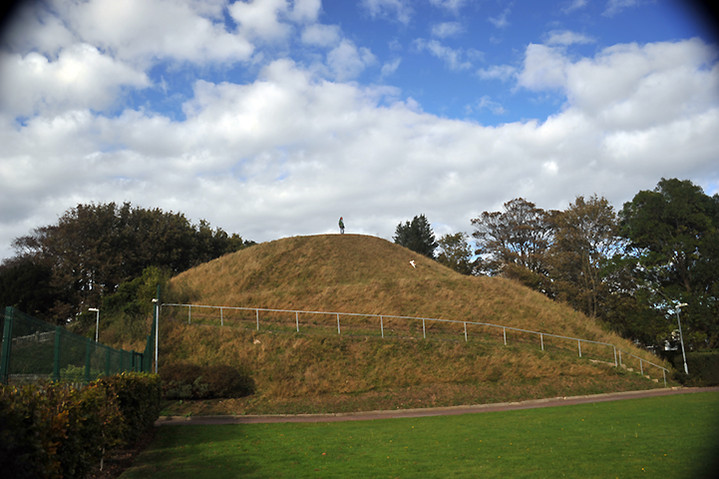


Looking North with Lewes Castle just to the left (one of three large mounds in the town centre! Read the field notes for further info.)

The view from the top overlooking the ruins of Lewes Priory in the middle distance.

A double row of barbed wire. They very obviously don’t want visitors.

View from the South West. The flag just to the left gives the game away.

Further, and more diligent map reading, made me realise that this is actually much longer than I thought. I’d assumed that it began/ended at The Valdoe but in reality the whole thing is much longer and extends, albeit brokenly, Westwards beyond Lavant all the way to West Stoke, just South of Kingley Vale. So this mysterious ditch/dyke is actually around six to seven miles in length and not the two miles I’d originally stated. Also the part I looked at this time is a dyke and not a ditch, as it was in The Valdoe with a height of around two metres in places. It would be interesting, but I’m not sure if it’s possible, to walk it’s entire length though some of it passes through private land and there are no footpaths available. At some points it seems to disappear altogether, most notably at Lavant, but that might be due to the build up of the village over the centuries and the section of road through East Lavant corresponds almost exactly with the ‘presumed’ course of the ditch. More visits will ensue no doubt.

Looking East. This section is near the main road from the car park at West Stoke (nearest parking for the Kingley Vale Nature Reserve).

As you can see this section is reasonably tall, just about two metres high at this point, but there are places where it’s barely visible and actually a ditch in other sections, as it’s name suggests.


Panorama looking South West. Shame you can’t see the fantastic view below because of the trees, but they were quite welcome that day as it was blowing a gale up there!


Looking East to the (very close!) main road from the back of the barrow.
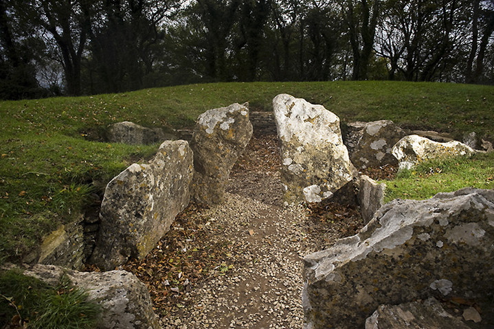


The re-opened tump with small concrete stumps and additional wooden posts. I guess these are to stop the infringement of agriculture and slightly better than the old fence that once surrounded it.

Long shot from the rear of the tomb back towards the entrance.

Rear left stall with the notch in the stone and, presumably, some new graffiti.

Brighstone Down encompasses quite a large area and also includes Gallibury Hump which sits just outside the forested area. The Tennyson Trail passes through the middle of it and it’s quite accessible by foot from Brighstone village to the South or from the road connecting Brighstone and Calbourne. This area of Downland forms the spine of the Island running east to west and is quite rich in tumuli of varying sizes and states of decay. Of the barrows in the woodland we really only encountered about three and it was quite a surprise to find quite large barrows hidden in the depths of the forest. These were situated just off a track which runs up from the reservoir (bounded by the Tennyson and Worsley Trails) on the southern edge of the forest. The map indicates three barrows near the bend and I was anticipating Bell barrows. As far as I could tell there were only two quite handsome barrows at this position about 2m high and 5-6m wide, but strangely there was a large but quite faint circle comprising a shallow ditch surrounded by a small bank about 7-9m in diameter. This either had to be a small enclosure (there are others not far away) or a reasonably large disc barrow! This was quite difficult to make out properly due to the density of the undergrowth and poor light on an overcast day, but if it does turn out to be a disc barrow then it’s possibly the only one on the island as far as I can tell. Having researched I can find no mention of this anywhere else. If anyone has any more information I’d be glad to hear it.

The more Easterly and slightly larger barrow of the two bell barrows hidden in the forest.

Western barrow viewed from the top of the Eastern barrow.

Looking Eastish from the top of the Western barrow.

View of both bell barrows with the more easterly barrow in the background.

Possibly quite exciting this. The darkish area in the middle between the path on the right and the lighter line running sort of diagonally from left to right indicates the edge of either a small earthwork or a very large disc barrow hidden in the Brighstone forest.

Looking back in an Easterly direction. The dark line in the middle-ground showing the barely perceptible ditch and bank.
This small gathering of barrows can be reached from the fantastic viewpoint of Limerstone Down, just off the Worsley Trail, about 30 minutes walk North East from the village of Brighstone. There are 4 barrows visible at the top of the Down, a further 2 about 100m west (though they may have been ploughed out as they weren’t exactly obvious) and 2 large barrows at the end of the spine of the hill at Cheverton Farm. There are great views across the island in most directions but the barrows aren’t exactly what you’d call ‘awe inspiring’ and the weather was also a bit flat the day we trudged through. Perhaps more intriguing are the strange earthworks around the viewpoint at Limerstone Down a few hundred metres South West though I can’t find any information about them so I’ve no idea just how old they are.

Looking West. There are, according to the OS map, three barrows here, but it’s difficult to make them out individually and you could be mistaken for thinking it was a rather ragged long barrow.

Looking North West back towards Brighstone Forest.


This, I think, is the isolated barrow near the footpath.


View from the top looking West. The soporific sunset belies the barrow’s somewhat ugly history.


The strange juxtaposition of ancient and modern. The view, from the top of the mound, back to the main road with the set up for ‘Bestival’ taking place on the left and an old quarry on the right full of skips!

Some of the flint tools held in the collection of Rochester Museum.
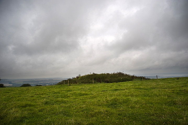
Looking North back towards the mainland. Shame about the barbed wire fence around it, but the field was full of cattle so maybe the farmer was trying to preserve it.
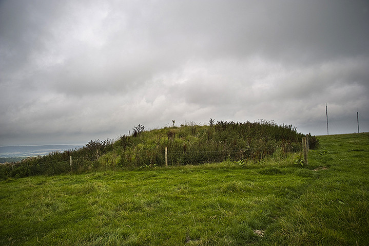
Looking East. Sure must be a lot of dead Frenchmen in there!


What a wonderful place to be buried! This barrow, the largest, still retains a small ditch around it and Mrs Cane for scale.

View looking north from the valley below. These are possibly the most prominent barrows on the island, visible for miles around.


