
Looking East from the LDP as it climbs towards Liddington.
Image credit: A R Cane

Looking East from the LDP as it climbs towards Liddington.


The Southern aspect of Uffington Castle viewed from the LDP.


Panorama of the White Horse, Dragon Hill and the Manger.

One of the barrows closest to the LDP at Sparsholt Down.


The South Eastern ramparts from the Southern entrance.

Looking back West towards The Devil’s Punchbowl and the Ridgeway path.

The strangely shaped Eve with Adam skulking in the background to the right. Odd that in all the years I lived close to these I didn’t know of their existence and so never visited them. I think it might have been because if you were travelling along the road to Beckhampton from Avebury your gaze was naturally captured by the awe-inspiring immensity of Silbury across the fields to the left!


Adam with Eve in the distance to the right.


When we came in February it was freezing cold. This time it was pouring with rain, though you can’t really tell from this! We’ll get it right one day. These barrows were at the highest point on the common near the trig point.


Two (or possibly 3 – the gorse was very thick on the third lump so it was difficult to tell) of the barrows looking South East.

Seaford Head and Cuckmere Haven viewed from Haven Brow, the first of the Seven Sisters. Just behind where I took the photo was the faintest trace of what I assumed to be a cross dyke running right to the edge of the cliff, but I’ve checked all over, including MAGIC, and it doesn’t seem to be there!

Squatting on the edge of the Seven Sisters cliffs, ravaged by rabbits and ramblers alike, this small barrow is barely visible now and presumably will share the fate of a lot of other ancient relics and eventually tumble into the English Chanel.

Looking East. As far as final resting places go, not a bad choice.
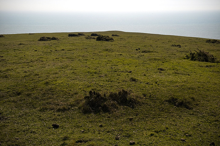
The second barrow from the cliff edge with the first just visible as a slight blip behind.

The view East to the Belle Tout lighthouse and enclosure.

The pock-marked/cupped stone bathed in friendly flash light.

Robin Hood’s Stride in the background to the right.


Strange how it can look so different from other angles.

Seemingly impregnable from this position, though we watched two climbers make it the top almost unscathed!

The way through to The Hermit’s Cave in the bottom right hand corner.

Entrance to The Hermit’s Cave which nestles below Gratcliffe Rocks.

Panoramic view from the western side of the fort along Combs Edge. The icing on the cake!
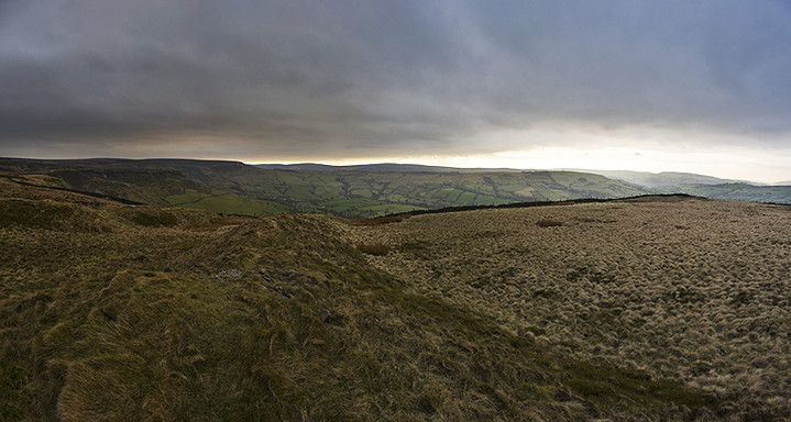


Panorama NW to NE with possible hut circles in the foreground.

Hut circles picked out by a sudden burst of sunshine on the North Western edge or quarrying? I’m not sure.

The North Eastern side with spectacular views of Chapel-En-Le Frith (Home of Ferodo (Baggins)) and the edge of the Pennines.


View along the ditch between the dykes from the Western side.

One of the reasons why the northern part of the fort needed no defences! (Combs Reservoir in the distance).

The largest barrow at Lord’s Piece looking west.

The strange misshapen hole next to the largest barrow.

The smallest barrow in the foreground and the larger just about visible within the trees beyond.

View from the ridge looking south west to the South Downs. Ah, the tranquility of it all!

The easterly barrow of the linear group.


The view along the southern pointing ridge. Note the criss-crossing boundary markers which I don’t believe are contemporary with the barrows.

The middle barrow with the strange boundary marker running through the middle of it.


The most westerly barrow of the linear group.
Lord’s Piece is a strange little triangle of heathland just south of the River Rother near Fittleworth. As somebody else aptly put it, “it’s like a little bit of the New Forest placed in the heart of West Sussex”. Where the name derives from I’ve no idea, but within the few acres of this conservation area are at least five barrows made up of a linear group of three and a pair (one large, one small) on a small ridge to the south. Also visible are a number of boundary markers criss-crossing the land which I at first thought were contemporary with the barrows until I came to the middle barrow of the linear group and discovered a ‘boundary marker’ passing right through the centre of the barrow, which seems unlikely to have been the barrow builder’s original intention. The linear group are all roughly the same size, about 10-12m across but not very high at about 2m max and they’ve all recently been cleared of vegetation and are now adorned with giant wire ‘hair nets’ (or at least that’s what it looked like from a distance) which I guess keeps the local rabbits and badgers at bay. The two barrows on the ridge are interesting because of the disparity in size, the larger being about 10m across and 2.5m high whereas the smaller barrow about 30m distant is only about 4m across and barely rises more than 0.5m. The larger barrow also has a curious hole at its northern edge almost suggesting that this was the source of its material, though it’s so messy no Bronze Age barrow builder worth his salt would ever admit to this below par workmanship! It’s probably more modern than that, possibly a dried up drinking hole for cattle. Parking is very easy as there are two small carparking areas on the western side of the heath.