
What remains of the barrow is a slight mound in centre foreground with the chimney of the Twyford Pumping Station rising directly behind its centre. Yes, you do have to look very closely... and it is being ploughed lower and lower each year.
Seen from the north, as I crossed the field on the “Monarch’s Way” footpath.
Another roaming sarsen? Was it tossed here by a giant sitting over the other side of the river in Badgers Farm? Does his grave now form the embankment where the bottle banks are at sainsbury’s car park? Am I not taking this seriously enough?
Hmmm, could there be a couple of smaller worked sarsens here at the base of the tower (on the side facing the river)?
“Dorsetshire Folk-Lore” by John Symonds Udal gives the quote Rhiannon has found, and then goes on:
“To this another correspondent in Notes and Queries (p.187) ‘C.W.’ – under which initials it is not difficult, I think, to recognize the well-known Dorset antiquary, the late Charles Warne, F.S.A – replies:
“Your correspondent ‘C.W.B.’ has not aluded to a mythological tradition connected with the ‘Giant’s Grave’ and the stones adjoining it, which is popular in the neigbourhood. It is to the following efect. Two giants standing on Norden (an adjacent hill) were once contending for the mastery as to which of them would hurl the farther, the direction being across the valley to Hanging Hill. He whose stone fell short was so mortified at the failure, that he died of vexation and was buried beneath the mound which has since been known as the ‘Giant’s Grave’. Myths of a similar kind are often found attached to blocks of erratic stone.“”
Every parish in Dorset (and many other parts of the country too) seems to have acquired its own version of this stone-hurling. Sometimes it is the Devil that does the chucking. It’s tempting to view this as medieval ignorance but perhaps each succesive trend in superstition going back to ye Stone Age has had its own version. But here it’s nice to see the two sites being woven together in one narrative.
Barrow to the west (down the road).
Barrow on the east (up the road).
I came zooming down the hill early one Sunday morning on a bike ride with no particular destination in mind, trying to get home quick before the rainclouds caught me up, and suddenly spotted these two bumps in the sloping field alongside the road. Slammed on the brakes and took a couple of pictures. When I got home I found they are on MAGIC but not on OS maps. They are asymmetrical, lumpy and lovely (I must get out more). You’ll see from the photos that they are at the bottom of a little scarp – why site them there rather than the more prominent top?
If you go up Hazeley Road from Twyford village, you will spot them on your right just after the pumping station. A little further up the road is where Hazeley Down mineral water comes from. I have given them a rather unromantic name but that’s all I could think of, and the pumping station is not without its own charms. There are two other barrows nearby overlooking this formerly hazeley hollow.
Looking over the Eastern barrow out towards the southwest, the land drops smoothly away under you and you are surrounded by sky.
Western barrow up close – there’s hardly anything left but a slight mound.
Westernmost of the barrows.
Pronounced Chezzit Head. This group of three bowl barrows, spaced quite widely, follow the line of one of the highest ridges in the area, on the south west side. There is a small car park by some trees near the highest point and if, from there, you walk along a path a little way away from the barrows, you can look down into Matterley Bowl, which is the site of an annual music festival which is constantly changing its name. It’s also a very impressive natural undulation with a flat bottom – in about 1995 there was a vast crop “circle” here of a stick man with a football and a halo, over the gigantic words “Le Tiss for England” – anyway, back to the barrows. They have suffered a great deal but they once occupied an absolutely regal position over the downs. The sorry story is all told at MAGIC if you can bear to read it. Eeeh, it makes me mad, it does.
This is a nice spot on top of the hills, with long views north into the upper Itchen valley and west across the sloping downs (well, you would have seen west at the time of construction, but there are now some tall trees). OS maps place ye Tumulus on the south side of the track, where there is just a very tiny bump that might be nothing to do with it. A much likelier candidate is the large mound with a bit of a ditch and a dimple on top on the north side of the track. But you never know...
25m diameter, 2m high. Sherds of Bronze Age pottery and worked flints emerged from the ditch, according to MAGIC. There’s not much more that’s known about it. It’s in relatively good nick and is not being ploughed!
Very diminutive bump on the south side of the track, among the trees in a tangled bit of set-aside.
Large mound on the north side of the track. In the distance you can see the gleaming planetarium at the Intech science museum. A nice contrast of Bronze Age mound and Space Age mound. The shadow is cast by the tall cypress trees alongside the track.
Riverside excavations 2008: just at the top of the rise near the end of the Avenue where Stonehenge suddenly appears is a point where some of the carving and shaping of the stones took place. A shallow dig found scattered sarsen and bluestone fragments on the surface of the chalk & flint “bedrock”. Intriguing that both types of standing stones were worked here with such a long time gap between them. The bluestone is on the left and two sarsen chunks on the right.
This is very tricky to photograph, so get your specs on and peer closely. The gate ditch extends from bottom left up to top right, passing in front of Jimit (kneeling respectfully? no just looking for his baccy) and ending up between the orange health ‘n’ safety netting and the blue archaeologist-carrier. It is on the surface about an inch or two’s depression, about 2 feet wide at most. Here, incidentally, we are just outside The Avenue’s “elbow” (there’s a water trough nearby for the sheep) and looking towards Stonehenge, which is just over the rise.
One lonesome and battered bowl barow, but if you’re going along Rhinefield Road west of Brockenhurst, you’ll spot it. Unless you blink. I came cycling to the New Forest the other day with a friend down from London, and was very restrained in taking no diversions from the route for snapshots of other bumps.
Second only to Slap Bottom in the Southern Silly Names League, once I’d spotted this on the map I had to visit really. Now that I’ve done so, I don’t suggest you try to follow. It is pretty inaccessible for this part of the country! Parnholt Wood is gorgeous and well worth a visit but is just over the geological boundary into acidic, sandy soil (viz New Forest) with bogs and badass bracken everywhere. So don’t stray off the rights of way kids. One noticeable thing about this barrow though is how its ditch has survived reasonably well. In these parts, ditches tend to have been silted up and ploughed over.
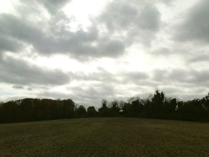
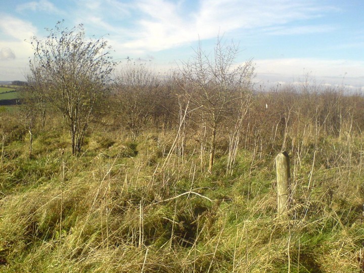
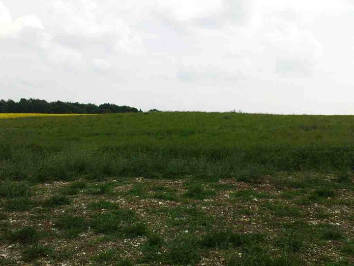
This is an interesting place (having said that, there’s nothing to see). Flash Earth and other aerial photos will show you, at some times of the year, a faint circle in crop marks, maybe 200m diameter. Hampshire Treasures calls it Iron Age, but offers no excavation evidence or finds to back that up. OS gives it Ye Olde Typeface, but only in the most recent maps. It is right next to the highest place for miles around, with steep sides to north and south, long views to the Isle of Wight, Danebury etc (Fawley Oil Refinery!) and big big open skies. It feels very much like the sort of place that made for neolithic causewayed mortuary enclosures, like Hambledon Hill. It doesn’t seem a logical place to have a farm enclosure, and it would be rubbish as a defensive structure. But I have no more to offer than that. I would love to hear others’ opinions of the place. Next door is a (19th Century)pyramidal white monument on top of a mound which is said by some to be a round barrow, though recent excavations have revealed nowt. Perhaps “excavations” involved radar only? To complicate maters further, I see no causeway in the crop mark, but then the circle is not completely exposed. Is there a square crop mark inside the circle, on the northwest side? Is there a larger patch of disturbed land on the east side, facing the “barrow”? Hmmm. One more thing to bear in mind is that there was an anti-aircraft gun placement up here in the Second World War and some of the crop marks may be down to that.
“Robin Hood’s Butt” appears through the trees as you step away from the road.
The “Burrow Road” barrow emerges if you go down the little footpath between the Forestry Commission gravel road and the bridleway-signposted Burrow Road.
The eastern (Burrow Road) bowl barrow
These are two bowl barrows on top of the west-east ridge of chalk running between Winchester and King’s Somborne. They are quite a decent size for this modest district and fairly well preserved by being in woodland for a long time. There used to be two distinct groups of bowl and disc barrows downhill to the north, all now sadly gone under the plough. The eastern one is next to a bridleway called Burrow Road, which probably took its name from the barrow (beorh). The western one is given the name Robin Hood’s Butt by Hampshire Treasures. They are just over a kilometre apart but are so similar in size and position in the landscape that if they weren’t constructed at around the same time, then one must have been modelled on the other. The grid ref I’ve given is for old Robin’s Butt, which is easy to find if you are passing through in a hurry or can’t get far from a car park through narrow footpaths. There is a small car park next door; facing away from the road, go right through the trees and on the other side of an old line of beeches is the barrow. It is about 20m diameter and 2m high, dimpled from excavation, and with a slight trace of ditch round the outside. There may even have been a bit of a narrow berm but it’s hard to tell with big trees up close. When I visited there was a little vase of plastic flowers on top “in loving memory”. Not a bad place to become a secondary Space Age cremation. But(t) its proximity to the car park meant I also found several broken beer bottles and one lens out of someone’s sunglasses. This could be rich pickings for the 5000CE excavators (actually I tried to remove the rubbish as best I could without a trusty Sainsbury’s bag).
Hants Treasures also claims there are two at the Burrow Road location (SU424295) but I’ve only seen one; maybe the other is still deeply overgrown. There is a Forestry Commission-signposted gravel road (with locked gate) going north into the wood off Sarum Road. Walk up that and just before it turns a little right, look on your right and through the trees you will spot a clearing full of barrow. I make the Burrow Road mound to be about 35m diameter and 3m high, and is dimpled on top from excavation.
I was really chuffed to see that the butterfly folk who keep the nature reserve in excellent condition are now keeping the grass trimmed back on the two very flat barrows to reveal their location for the first time to casual visitors.
A warm summer evening. Counting from west to east, this is no. 3 seen from no. 4.
A large bowl barrow with tree on top, left otherwise unmolested by the farmer. No real access but you can admire it from the bridleway that passes the south side of the field. Stop and peer over to your right just as it turns into a very narrow and overgrown fotpath. If you are Julian height you will be fine; I stretched and leant and stretched some more and just as I caught a glimpse through the hawthorns, I fell silently and gracefully into some stinging nettles. There are no dock leaves for miles! MAGIC says that excavations created a deep hollow which makes it look like twin barrows from some angles.
There it is, off in the distance. A stepladder and binoculars might have helped...
There are, we are told, fourteen round barrows on the slopes below the hill fort. Some of these are fenced off, which is probably a wise move as they are all rather delapidated. I wonder how many others might have been on top and maybe got obliterated to make way for the hill fort. As Jimit reports, you can’t see much of the fort because the top belongs to Lord Snooty and he has decided to plough it up, but you can see a nice causeway entrance. The view from there is now blocked by trees but if you go a bit further West you can see across to Danebury very clearly. The two forts must have made an impressive sight flanking the Test valley.
The Uni of Winchester (or King Alfred’s College to locals) have started work on a publically accessible digital archive of the prolonged battle over the re-routing of the M3 motorway. This culminated in a stand-off at the protest camp on the building site in the early 90s, but the digging went ahead and took out earthworks associated with a Neolithic settlement as well as part of the Dongas (see fieldnotes and pics under this site). Rescue excavations took place and found some burials of Iron Age date if my memory serves me correctly. Read all about it at winchester.ac.uk/?page=9559
Access is not really possible unless you are happy to climb through a cut bit of fence and past a “No public access” sign. If you do you’ll be rewarded with this compact line of barrows at the edge of a steep but short drop. From west to east there is one largeish bowl barrow, two smaller bowls with shared ditch, another pair with a shared ditch, and a saucer barrow. Alas, my battery ran out here and I didn’t get photos of the latter pair and the saucer barrow. There are also two marked as in the woodland further to the west, but it is hard to make out what might be man-made mounds when peering in from the bridleway. You can see across to Woolbury and Danebury and indeed all the views around here are breathtaking. The aspect that was important to the barrow-builders was very much towards the Test valley. The redoubtable Jimit informed me later in the pub that he thought there was easier access from the track that leads off the Clarendon Way towards the southwest, into Parnholt Wood.
The larger pair of bowl barrows next to the large single one, seen from the top of the “bank” that they all create.
The largest of the bowl barrows, seen from downhill.
Peering into the woods slightly down the slope to the east on the Clarendon Way footpath, I tried to see the two small barrows marked on the OS map but could only make out this bit of a mound. Hmmm...
Now I don’t know which of the Crawley parish barrows this refers to, but...
LV Grinsell, “Dorset Barrows” 1959 p. 68, under “Use as repositories for votive offerings and concealment of hoards”: “...a find of a small hoard of Iron Age currency-bars has been reported from a barrow near Crawley, not far from Winchester (Hants).”
Lots of detail of the damage caused by the farm track and ploughing at magic.gov.uk/rsm/34158.pdf which concludes with the telling sentence “The piles of logs, gamefeeders and fence situated on the monument are excluded from the scheduling, although the ground beneath them is included.” Kind of makes you wonder what the value of scheduling is...
A saucer barrow, a disc barrow, and a bowl barrow, all arranged in a compact triangle. And then someone dug a forestry track through the middle of them at some point between the 1930s and the 1970s. Nice one. The arrangement is very unusual and definitely worth a visit I thought. Well, I didn’t make it. They are well inside private woodland and although I decided to strike out for them for some guerilla photography along the track which actually bisects the barrows, I got spooked. I’m not one for that sort of thing (I’m a statistician you know!) and I usually feel at home in dense woodland but somehow it felt really hostile in there. When I hit a fence not marked on the maps, I legged it back the way I came as fast as I could.