
The southern member of the group with that strange chunk dug out of it...
Image credit: Copyright waived UncleRob
The southern member of the group with that strange chunk dug out of it...

The northwest member of the group, also the largest at about 5 foot high and about 14 foot diameter.

Two barrows on the East side of the group, looking towards the road. Shallow and narrow ditches are visible, right up against the bowls.

Looking uphill, you can see the profile of the barrow and the odd brick still scattered about.

The foundations of the hut. Normally I’d express some indignation, but this is just daft.

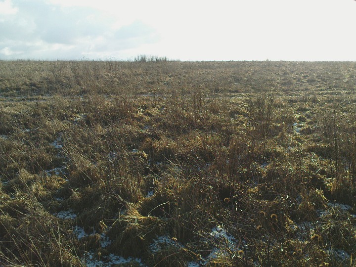
Looking out from the top of the hillock. As the barrow is right on the top of the slope, there is hardly any height to it on this side.
This is a single round barrow on the false brow of the most obvious hillock in the area, overlooking a good expanse of heathland to the south and west. It also overlooks a busy and notoriously dangerous crossroads so don’t expect it to be a sylvan idyll. There is no obvious ditch but that is understandable as a small brick hut was built on top at one point! You can still see the foundations and some bricks scattered about. Hampshire Treasures piqued my interest with the quaint words:
Disturbed by insertion of building.
Fascinating group of four very small and very well-preserved bowl barrows. I wonder if they might be pagan Saxon; I shall have to delve into the records and get back to y’all on that. One of them (the southernmost) has had a big chunk of ditch and the outside edge of the mound dug away fairly recently. Why? Where has the spoil gone?
A group of 8 barrows, spread over an area about 500 x 200 metres. Some of them are on private land but up against the fence and easily visible. One has been heaped up with more earth to make an old rifle butt. The one I visited up close had been dug into in several places by large tunnels – badgers maybe. The soil is quite wet here and that perhaps accounts for the very shallow ditches which have filled up over the millenia.

The shared bank between the barrows can be seen with a path snaking across it like a sort of causeway.

Fence posts dumped in the ditch and against the bank

Looking east at both barrows (oil refinery in the distance)
There are two large barrows togther here on the south side of the road. In passing, they may look like another clump of gorse but they are worth a look because they are quite unusual. Hants Treasures calls them bell barrows but using Grinsell’s taxonomy I would say they are bowl barrows with an outer bank. In Dorset Barrows he has this to say:
Only a very few barrows of this type are known in the whole of Wessex
The bank is shared at the point between the two barrows, making a raised pathway pressed down either by human or equine visitors.
Unfortunately the well-preserved ditches have also been a convenient place for some cretin to dump two lots of concrete fence posts. Boo!

The depth of the ditch and the height of the barrows are still impressive. This must have been a very significant monument in the area. We can only speculate about why they are together in this unusual pattern.

Feasting to commemorate the ancestors is still observed by local folk.

The large barrow at the south end of the line

An unusual line of three or four barrows, depending on how you count them. Hampshire treasures suggests there is a bell barrow, then a twin bowl, then another bell, though only two parts, the twin bowl and what I would think is a larger bowl, seem obvious on the ground. The twin has two excavation dimples on top and is more of a oval than an hourglass shape. No, I don’t think it’s a long barrow; it’s aligned north-south, it has 360 degrees of ditches and there are no other neolithic sites in the area. There is a lot of gorse growing on the barrows but they are in good shape, over 2 metres high, and have well-preserved ditches of almost 1 metre depth. None of the barrows seems to have a berm at all. It’s easy to access this site from the track parallel to the road.


I’m holding the camera over the East chamber to give the impression of looking out between the portal stones toward the East.

Looking up the passage from West to East. Contrast with Chris Collyer’s photo of the site overgrown in 2003!

Winter makes the woods all the more dramatic, and brings out the ditch nicely in the low light through the bare trees.

How old is that bank out of which the yews are growing? Well, as old as a middle-aged yew tree, which rules out the last 200 years at least, and possibly much longer. This appears and disapears at exactly the points where one would expect to see the enclosure ditch-and-bank appear on t’other side of the path.
This path, incidentally, is the one that passes close to Withering Corner bowl and saucer barrows. They are clearly Bronze Age by typology. Is the enclosure even older?

Looking East, the intersection of ditch and track is at the point where the track curves to the left, echoing a bend in the path (behind trees off left).

Looking across the point where the ditch crosses the farmer’s track, i.e. looking West. About one-third of the way up from the bottom of the photo is a thicker tuft of grass in the middle of the track. That’s the ditch! You can see slightly darker shade in it from the slope and between it and you, viewer, is what remains of a little bank.

As with the other dead wildflowers photo, this is the ditch in the NW corner, again looking south. Here they form more of a J shape across the 2-D of the photo.
Dead exciting this. See the taller plants in the immediate foreground? There is a curving line of them, heading off to the left of the photo, where they cross the farmer’s track, then they curve backing to the skyline where you can see the little tuft in silhouette. A shape across the photo like a letter C. That, my friends, is the mark on the surface that best reveals the ditch of this mysterious enclosure. This is the NE corner, looking south.
For those who like this sort of thing: this photo was automatically numbered 00666. Smack my ditch up! (It had to be said sooner or later)
On probably the last nice bright winter day before I go back to work on Wednesday, I headed up here today on a long walk out West along the Roman Road and back again. Cold but bright, one of those days that seems almost warm when you are sheltered by trees and catching the sun, but the yellowish snow clouds were never far away with the odd flurry.
And as it’s the best time of the year to see tiny bumps in the ground, I wasn’t disappointed. In fact I was delighted to find the slight ditch and bank visible as crop marks on aerial photos. This is variable and the tufty grass makes it hard to follow except for where it crosses a farm track at the North side of the field. The variation in the surface is generally no more than six inches (!) but there is a startlingly clear curving line of higher cornflowers which follow exactly the crop marks. If you are still reading at this point, then you might just find the images interesting, though I get the feeling I ought to draw a diagram on a napkin and scan it in.
The circle of crop marks seems to cut slightly across the path to the north so I was keen to have a poke around in the hedges and see if any better-preserved ditch was evident. Well, nothing is very conclusive because the path itself has quite deep ditches on either side which certainly post-date the enclosure, but there are deeper sections at two points where one would expect the enclosure ditch to be cutting across. Sheer conjecture and coincidence, I hear you scoff. Probably true. On the other side of the path, between these two intersection points, there is a little bank of about 18 inches height in the yew hedge which may or may not be of significance; it stops where I would expect it to if it was a relic of the enclosure.
One last observation before hitting the road home: the view once the snow clouds cleared is unparalled in this district. Danebury, Popham Beacons, some faraway stuff down southeast (is that Old Winchester Hill? Can’t be Portsdown Hill can it?), St Catherines on the Isle of Wight. 270 degrees of fantastic views.
In case you’re visiting sites in Hants and wondering what formicaant, pure joy, jimit and others are referring to, this is it. Indispensible but only as good as its sources. Refers often to PHFC (Proceedings of the Hampshire Field Club, which is now published as Hampshire Studies, an annual journal), which is available at the Hants Record Office next to Winchester railway station.
As Hampshire Treasures rightly says, the entire parish of Kilmeston is in an area of outstanding natural beauty. Not rich in prehistoric sites, but what a pleasure to meander around these deserted lanes visting what there is. These three barrows are ploughed low so best seen in the bleak midwinter when the crops and the sun are both low. They were once pretty big but are near the bottom of a dip in the undulating landscape so not visible except from within a mile or so’s radius. OS maps show the middle of the three to be oval in shape with major axis roughly along the line of the three barrows (NE-SW).

Three barrows, centre of photo in the nearest field, which was recently sown so they are still visible.

30 Dec 08: freezing fog covering Salisbury Plain, minus 2 degrees when we arrived at 2:30, shivering and running to keep warm but pleased to be back at old Avebury after several years’ absence. Going round anticlockwise, entering the NE quadrant.

30 Dec 08: freezing fog covering Salisbury Plain, minus 2 degrees when we arrived at 2:30, shivering and running to keep warm but pleased to be back at old Avebury after several years’ absence. Looking west across the SE quadrant.

Two small barrows together at the top of this steep slope, here looking towards the NE. The road is fairly quiet so it’s safe to gazeover the gate if you are on foot or bike but parking would be tricky round here – probably need to go for some nearby field entrance and keep an eye open for the farmer needing in – or walk down from the pub (I haven’t been and can’t endorse it yet).
An Explorer map (1:25000) shows the detail. I went by at some speed today and it is indeed hard to spot them. The pub used to be called the Fox and Hounds but is now Milbury’s (geddit?) and is a well-known landmark to anyone plying the road between Winchester and the Meon Valley.
Psychologically it feels like a real crossing point from looking to the East (Meon) and the West (Itchen). Only once you reach this ridge does the landscape switch from one direction of views to the other. And they are pretty good views. It is very, very quiet and empty to the East, which is nice but gets a bit creepy after a while, so getting back to the ridge and seeing the roadsigns to Winchester (rather than Royston Vasey) feels like a homecoming of sorts.

Looking over the barrow along its alignment to the ESE, and a gap in the surrounding hills.

The barrow seen from the gap in the lane (looking North).
Three and a bit years (gasp!) after Jimit’s fieldnotes, I dropped by today during a leg-knackering bike ride. Still being saved from the plough, hooray! And I was struck by its peaceful location above valleys in three directions. If you approach from the Itchen Valley west of Alresford and then up through Cheriton, you will be following the river to within half a mile of its source (at the other end it forms Southampton Docks). And I strongly recommend that as it’s fairly unspoilt swampland down there (particularly enjoyed the old single track road around Ovington – not to be confused with Lovington, Yavington or Avington, which are all nearby) and you can almost imagine yourself out in your Neolithic get up, hunting ducks and chasing beaver and whatever else they got up to. Then you emerge from the riverland to this peaceful spot.
It’s a rather short long barrow, and its ditches are lost under the plough as far as I can tell. Not clear if it has been excavated. The track which runs east-west past the south side of the field is in good nick and has a gap in the fence next to the long barrow where you can admire.

Another fascinating interpretation of this site’s various stages of use. In this version of events, there is a small house of the dead (with porch!) before the palisade is erected or the earth heaped up. It seems plausible that many other long barrows (but not all) had some wooden structure around the bones and in some cases (viz Nutbane) these had even been burnt prior to the heaping up of earth. Did one set of beliefs violently supersede another like the dissolution of the monasteries?

Looking NNE from the top of the ridge, towards Danebury, this big barrow and its two smaller companions would have had a commanding position over the land around the Wallops.

Looking SE, the Turret is in the next field on the skyline.
Impressively large bowl barrow, visible as you walk along the top of Whiteshoot Hill / Broughton Down through the trees. It is however under large-scale ploughing so expect it to get less impressive with each passing year.
Hampshire Treasures says
“Also known locally as Bol’s or Bald Turret. Average diameter 43m, height 3m.”
A fine place for a walk to burn off yuletide excess. Actually it was bitterly cold in the easterly wind today, but the view, the teeming birds and the barrows more than made up for that. And the enormous lunch on the way back in Stockbridge helped too.
Hampshire Treasures lists three barrows here, one bell and two saucers. The saucers were not obvious to me as the whole area is quite lumpy with old field boundaries and trackways, which makes it really interesting to clamber over. A good place to bring non-antiquarian family members as there’s something for everyone. Having said that, there’s no Primark.
The large barrow here has less distinct berm and ditches on the downhill side, though ploughing seems unlikely on this steep hillside. I make both berm and ditch to be narrow, about 3m each and ditch is no more than a foot depression visible on the surface.

Looking roughly North into the field with the barrows, from the top of the byway that leads to/from Abbotstone farm. On the left you can see two bumps marked with my bright yellow panier bags on top, and over to the right is the third barrow marked with my red fleece (which is a faint dark dot). Jumpers for goalposts isn’t it?
Three barrows in a loose triangle arrangement on top of a beautifully isolated and silent bit of downland with views all around. You can get here on foot, bike or horse as it’s a spot where four byways and one bridleway meet. If you are unsteady on the old pins or using a wheelchair your best bet would be the 500m byway which crosses the paved road from Itchen Stoke to Abbotstone.
Sadly, they are being ploughed now and are not as grand as they might have been even just fifty years ago. Two undulations can easily be spotted against the west edge of the field. Pause here to enjoy the birdsong, the big open skies and the views. Ahhhh.
Oddly they are not scheduled, so no info in MAGIC. Hampshire Treasures has little to say but (probably following their LV Grinsell reference at P.H.F.C., Vol. 14, 1938-40, p.353) suggests two of the barrows “may be of the saucer type”. Well, that didn’t automatically seem the case to me. I could just as easily see these as bowls that got plundered for chalk and flints and then excavated and ploughed down gradually. There is also a reference to RAF aerial photograph
CPE/UK/1842/3154/5. I wonder how one finds these... I’m sure there is some MoD archivist out there who would love to hear from the likes of us.
I paced across the field and took some photos, gazed about the place and eventually reluctantly made my way back through some lovely old lanes to civilisation.
I spent my lunch break strolling round the Bronze Age parts of the British Museum today and came home determined to look up the Badbury stone in Grinsell. It’s a bit confusing as he doesn’t use the name the Three Kings at any point, but the barrows in question are probably what he calls Shapwick 5, 6a and 6b (6a having yielded the stone). But although the Museum information says the barrow was destroyed, Grinsell puts it down at 9 feet high and I suspect it has not been destroyed since. Anyway here’s his marvellous description:
“...nearly levelled 1845, but removal of the centre was watched by JHA [J H Austen]. About three inhumations, probably primary, two with food-vessels and one with an ornamented handled pot resembling those of Cornish type; up to 15 cremations (perhaps more), a few possibly contemporary with the inhumations, the majority clearly secondary and a few with E/MBA [early to middle Bronze Age] collared urns of a latish type; as far as can now be ascertained, none was LBA [late Bronze Age]. The barrow consisted of a central cairn of local sandstone blocks enclosed in a ring of flints, which was bordered by a massive wall of sandstone 30 feet diameter, outside of which was a ring of chalk about 15 feet wide, which must have originally covered the mound. The interments were probably all in the central cairn. In the centre according to Durden (not in the surrounding wall as often stated) was the well-known large slab of sandstone which was decorated with carvings of daggers and axes, the former of type similar to those from Stonehenge, conjectured to be of Mycenean type.
from “Dorset Barrows”, 1959.

The barrow occpies a fine position to be seen from around the Chilcomb valey and other hills. This is from Magdalen Hill Down, without zoom, by the (modern) cemetery, a distance of about one and a quarter miles. See the cow on the right? Look at the skyline straight above its backside. There’s a copse on top of the hill and a lower dark mound immediately to the left – that’s your barrow, that is.

The barrow at the east end of the down is next to a footpath but there’s not much left of it. It fills the width of this photo behind the gate and is about 2 feet higher than surrounding pasture. Location SU 515 291.

Here’s the barrow at the East end of the down, seen by peering through a hedge and down the slope. It is the greener patch of grass (slight bump) just below dead centre of the photograph.
One of the rarities left near home that I had never visited. I came out for a walk to St Mary’s Church, Twyford and then up the hill and down the pleasant Love Lane with its view across the Hazeley hollow. At the end of the road you pop through into a ploughed (oh yes) field following the sign for the “Monarch’s Way” and the barrow is up the slope on your right. You have to really walk up the edge of the field for a minute or so to see it.
There’s very little left, poor thing, maybe 50cm height over the surrounding field. It would have been quite splendid in its prime at about 15m diameter. Maybe I should have paced over it to measure it out properly and look for any fragments of relic turned up by the plough, I didn’t want to intrude. Like visiting a dying relative in hospital, you feel you ought really to just let them be and stop bothering them.
The Ordnance Survey don’t seem to get their Sitef of ye Olde Antiquitief very accurate round here, showing this as a biggish mound and omitting the Twyford Pumping Station barrows completely.