...uncovering the layers of Irish Mythology. On this site, you will find a regular podcast and articles about Irish Mythology by the Story Archaeologists, Chris Thompson and Isolde Carmody.
ryaner

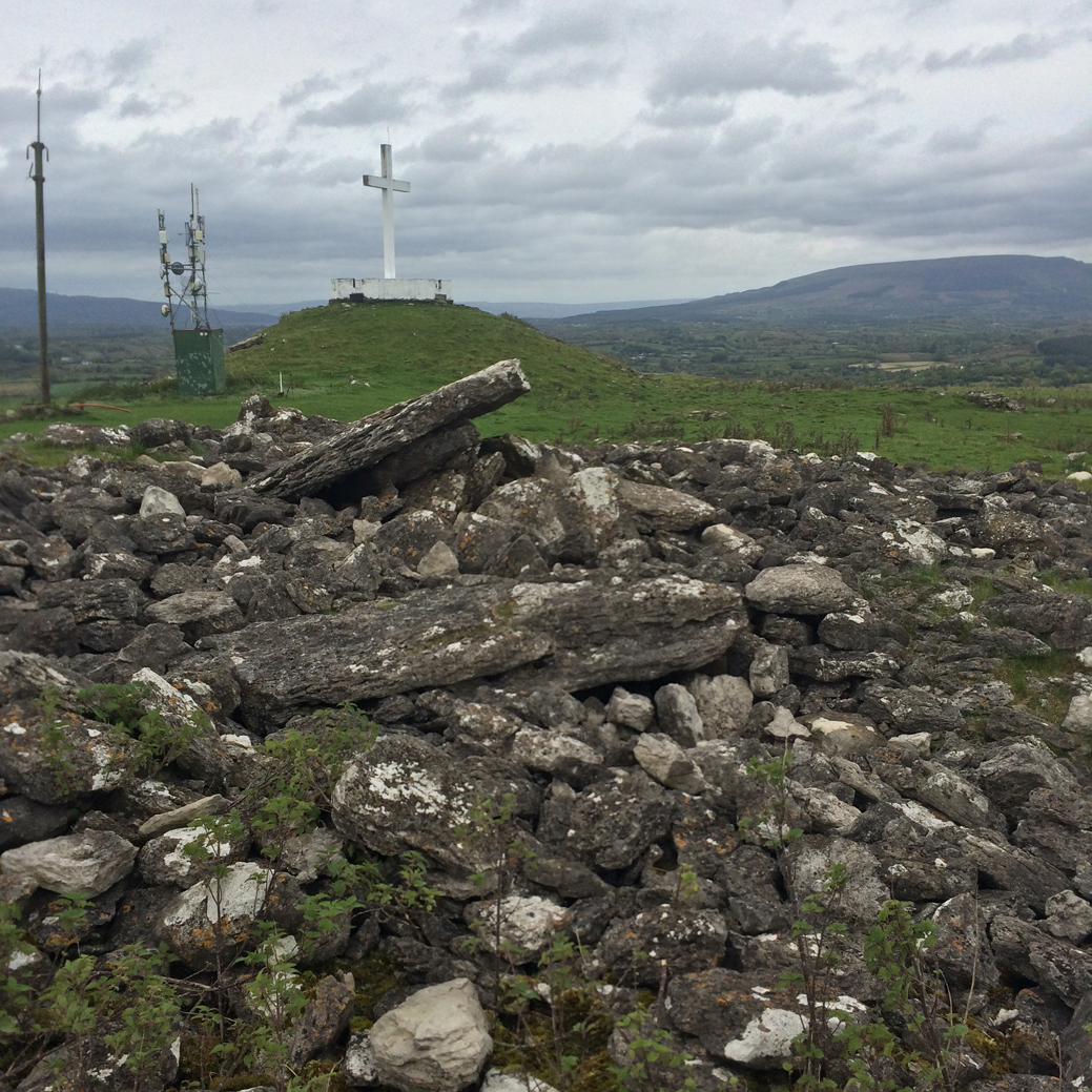
From the shoulder of Sheebeg, Sheemore and its largest tomb are visible in the distance to the south-west.
Image credit: ryaner

A quote from the Irish Independent in 1931: “Sheebeg from which five counties and fourteen lakes are visible, has been stated by historians, to contain the remains of a dynasty whose origin is lost in the mists of antiquity.”
Image credit: ryaner

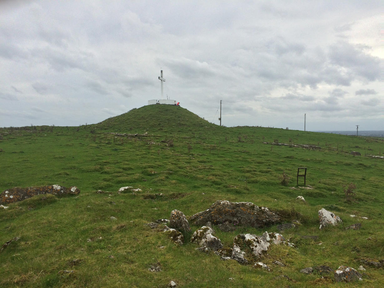
Sheebeg, “A large cairn, about 22m in diameter and 4.5m high...” Unofficially excavated in 1931, Mr. O’Hara unusually dug down from the top, finding a large chamber with reports of two human skeletons and some grave goods.
Image credit: ryaner

A pano of the plateau on the summit of Sheemore with the southerly tomb to the left. The exposed limestone pavement was plundered to construct the monuments here.
Image credit: ryaner


The northern tomb, the best of the three on the summit of Sheemore.
Image credit: ryaner
The ruin of the northerly tomb in the foreground, with the ruined middle tomb in the distance.
Image credit: ryaner


The kerb on the most northerly tomb with the large, middle tomb and its hideous cross/construction in the background.
Image credit: ryaner
The southerly tomb with the large, middle tomb in the background.
Image credit: ryaner

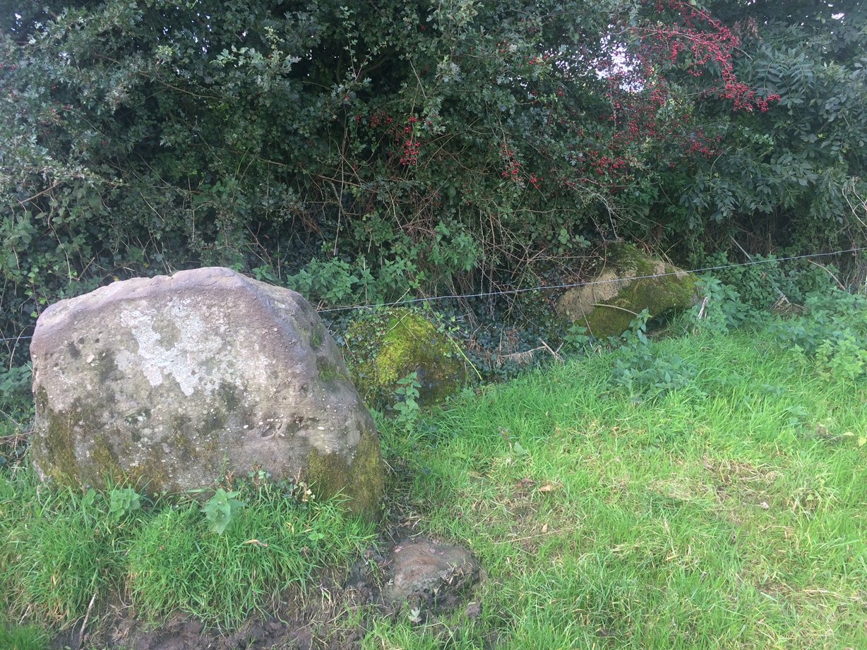
Stones in the field boundary of the field that has Aghawee dolmen – they look like the remains of a second megalith and are embedded in the ground, but are unrecorded anywhere I’ve looked.
Image credit: ryaner


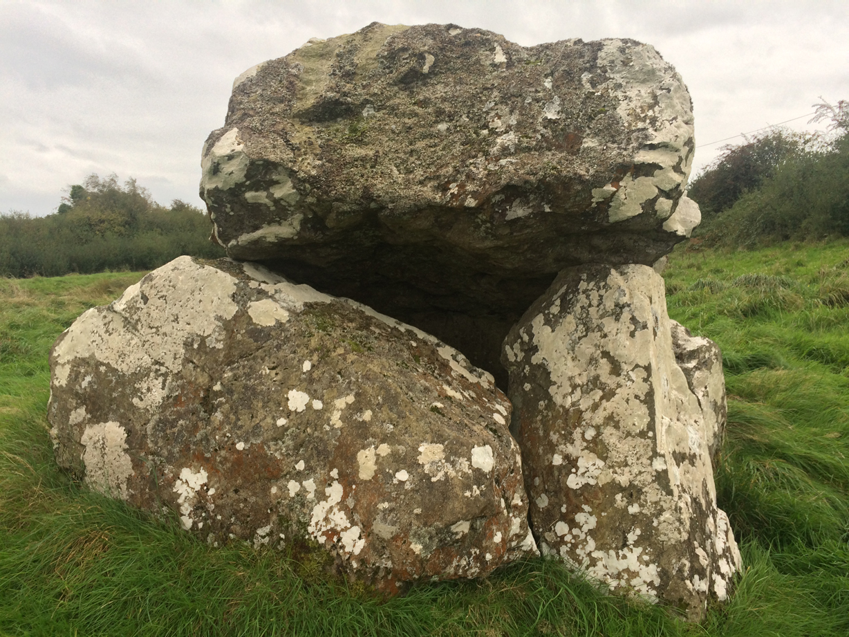
From this angle it looks like it’s almost imploding in on itself. The weight of the capstone, and its flaws, have caused it to snap in two. It’s a wonder it’s still standing.
Image credit: ryaner


Aghawee portal tomb is actually quite substantial. The capstone has snapped in two and fallen back off the portals. Most of the structure of the classic dolmen is still there.
Image credit: ryaner

The small dolmen at Aghawee skulks in the corner of the field, like a naughty, unloved child.
Image credit: ryaner


This is another dolmen that looks completely different from whatever angle you view it from.
Image credit: ryaner

The mighty Cleenrath, not to be missed if you’re down the road at Aghnacliff.
Image credit: ryaner

Looking over what may be a small barrow towards cairn T on Carnbane East. Glorious Indian summer day, equinox ‘17.
Image credit: ryaner

A stone circle, standing stones, rock art carved onto outcrops, cashels, raths, cairns, passage graves... pano from Carnbane East looking north and arcing round to the east.
Image credit: ryaner


Danny Healy-Rae and the Little People: Fairies to blame for problems on bad road, says TD
It was a puzzling case of Danny Healy-Rae and the ‘little people’.
The Kerry TD is blaming poor road conditions around Killarney on fairies, according to his daughter.
Mr Healy-Rae believes that mythical creatures are at work on the main route between Killarney and Cork and that they are responsible for the appalling condition of the road.

On the north side of the tomb, the rabbits digging their burrows reveal some quartz.
Image credit: ryaner

Still there, as more aerials and mountain-bike tracks are added.
Image credit: ryaner
Illegal metal detectors have caused irreparable damage to a prehistoric road in the Midlands with Ireland’s leading heritage charity calling on the Government to intervene to save the road.
An Taisce: The National Trust for Ireland has written to the Heritage Minister Heather Humphreys to request that the oakwood-built roadway, located on Mayne Bog in Coole, Co. Westmeath, be protected fully by the laws of the State.
Its Antiquities and Monuments committee has criticised the Minister for “standing idly by” and wants a licensed metal detector survey carried out along the route.
Dr Mark Clinton of An Taisce said that the area is of international importance and should be placed on the Record of Monuments and Places (RMP) list. Much of the 647-metre, 3,000-year-old wooden track has been dug up by workmen cutting peat.
More: independent.ie/irish-news/illegal-metal-detectors-damage-3000yearold-wooden-road-35780708.html
Paleolithic-era drawings found in Axturra cave are in ‘Champions League’ of cave art sites, team leader says
Spanish archaeologists say they have discovered an exceptional set of Paleolithic-era cave drawings that could rank among the best in a country that already boasts some of the world’s most important cave art.
Chief site archaeologist Diego Garate said that an estimated 70 drawings were found on ledges 300m (1,000 ft) underground in the Atxurra cave in the northern Basque region. He described the site as being in “the Champions League” of cave art and among the top 10 sites in Europe. The engravings and paintings feature horses, buffalo, goats and deer, dating back 12,500-14,500 years.
More: theguardian.com/science/2016/may/27/spanish-archaeologists-discover-cave-art-axturra-paleolithic
We traipsed up a waterlogged lane at the side of some forestry on the north side of the Slieve Bloom range. You never know quite what to expect on these little ventures, and when accompanied by two half-interested companions, trepidation that the discomfort might be a complete waste of time increases with proximity to the goal. This is one of those ones however that lives up to my middling expectations, with some awesome scenery and fairly magical atmosphere.
The first of the five barrows that we encountered as we approached from the west is named a pond barrow on the slightly dodgy entries at the National Monument database. It’s very small, quite eroded and relatively dry at the centre, though with the tell-tale rushes signalling that it could be quite wet in winter. You’d almost pass it by as your eye is drawn to the next in the west-to-east line that we followed. This is the most impressive of the five and the most obvious, described on archaeology.ie as a ‘mound barrow’ and “On top of high ground in mountainous area. Circular flat topped mound (H 3m approx. top diam. 7m; base diam. 15m) with circular depression (Wth 2.5m; D 0.6m) on top with evidence of stone kerbing around depression (possible collapsed burial).” The collapsed, dead thorn tree on the flattened top added to the atmosphere.
We moved over to the middle of the 5 barrows, a so-called ‘ring barrow’ and indeed it is surrounded by a ring of hawthorn trees. There is a clatter of bushes growing on the mound itself and it’s hard to make out, but, like at the mound barrow, there are some stones that may have formed a cist or chamber at one time.
In the next field over are the very large bowl barrow, described on archaeology.ie thus: “Located on top of high ground in mountainous area. Circular raised area (diam 16.5m; H 0.8m) enclosed by a slight bank (Wth 2m; ext. H 1m) and poorly preserved external fosse. Marshy raised interior is unusual.” Not far from this a little further east are the very poor remains of the fifth, unclassified barrow.
The records for these at archaeology.ie are incorrect, with the bowl barrow and the mound barrow inverted and the ring barrow description given for the most easterly, least impressive of the five.
We spent quite a while here, only taking our leave when the bullocks in the fields decided that we did have food after all and approached us expectantly.

Most easterly and least impressive of the 5 barrows in Coolcreen townland.
Image credit: ryaner

Largest of the 5 barrows at Coolcreen, a ‘bowl barrow’.
Image credit: ryaner

Cist-like arrangement of stones at the centre of the middle barrow of the 5.
Image credit: ryaner

Unsatisfying attempt at photographing this intriguing barrow.
Image credit: ryaner

The hawthorn trees form a ring around the middle, unclassified barrow.
Image credit: ryaner


From the top of the ‘mound barrow’, looking east.
Image credit: ryaner

A ‘mound barrow’, the best preserved, but still interfered with, of the 5.
Image credit: ryaner

Looking west onto the mound, the most impressive of the 5 barrows here.
Image credit: ryaner