I had to clean this monument up a little. i had gloves in the car and went after the ivy and brambles. I’m thinking of carrying a secateurs in future.
Image credit: ryaner
I had to clean this monument up a little. i had gloves in the car and went after the ivy and brambles. I’m thinking of carrying a secateurs in future.

The backstone is missing and the capstone looks to be in a precarious state from this angle.


Left is the western portal. Maybe the eastern has been pushed outwards and is falling slowly under its own weight.

The capstone rests on the two sidestones and the western portal. It may never have rested on the eastern portal as it seems the eastern sidestone has a notch carved out to stop the capstone slipping.
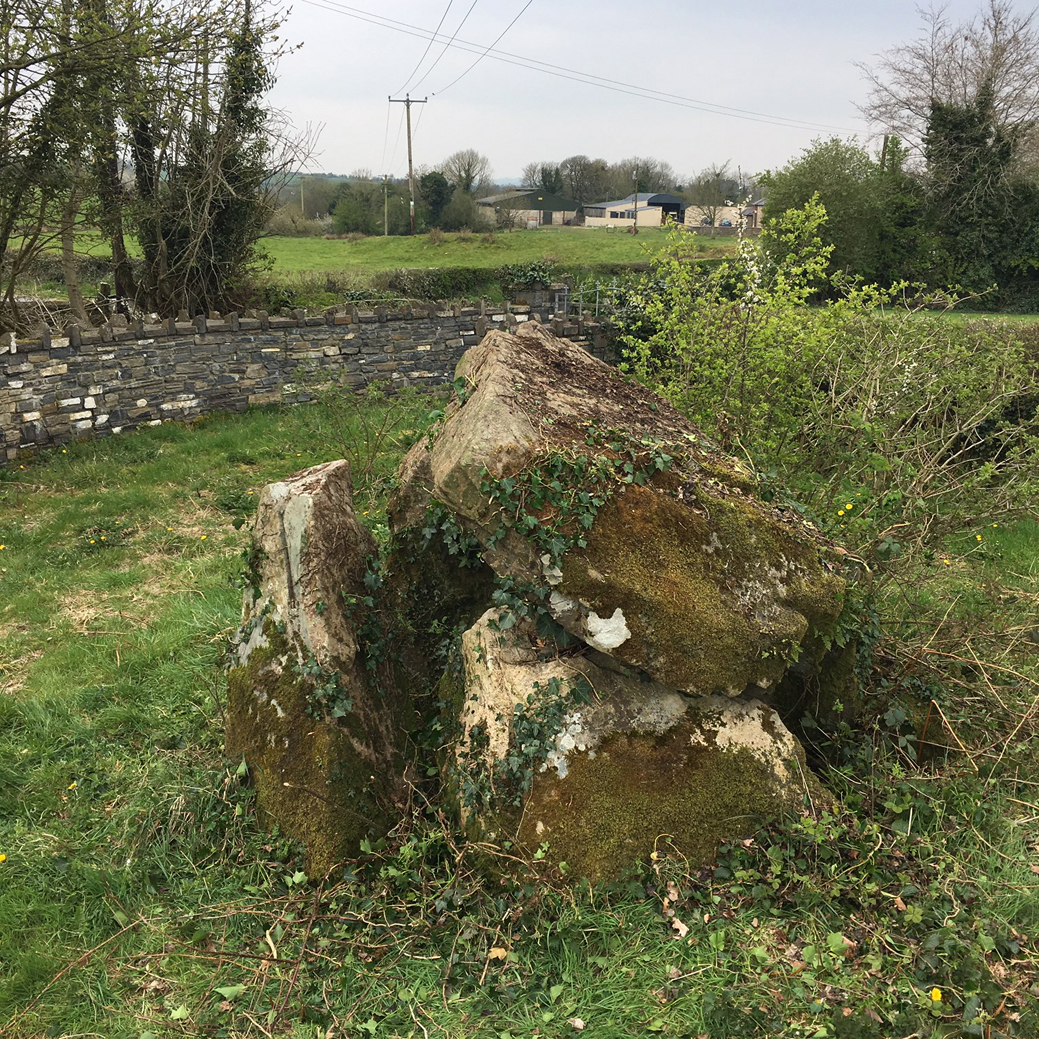

This is how I found it, in its own enclosure built in 2010, but obviously neglected ever since.
The ancestors of the people who built Stonehenge travelled west across the Mediterranean before reaching Britain, a study has shown.
Researchers in London compared DNA extracted from Neolithic human remains found in Britain with that of people alive at the same time in Europe.
The Neolithic inhabitants appear to have travelled from Anatolia (modern Turkey) to Iberia before winding their way north.
They reached Britain in about 4,000BC.
Details have been published in the journal Nature Ecology & Evolution.
The migration to Britain was just one part of a general, massive expansion of people out of Anatolia in 6,000BC that introduced farming to Europe.
Before that, Europe was populated by small, travelling groups which hunted animals and gathered wild plants and shellfish.
One group of early farmers followed the river Danube up into Central Europe, but another group travelled west across the Mediterranean.
DNA reveals that Neolithic Britons were largely descended from groups who took the Mediterranean route, either hugging the coast or hopping from island-to-island on boats.


Like its near neighbour at Middletown, one wonders if the capstone was ever supported by the portal stones.

The sidestone here is collapsing inwards into the chamber under the weight of the capstone.

This is from the rear of the tomb. The capstone rests on the backstone and one of the sidestones.

The front of the tomb. The people of the house are used to visitors.


That point where the upper capstone touches and presses down on the remaining portal stone.


13 years since I was last here, still unforgettably stupendous.

This is the corner of the field where a quite fascinating multi-chambered tomb once was, before it “was almost totally demolished during land reclamation in 1982-3.” The remainder was excavated over three seasons, but what’s left is now totally overgrown, the little white flowers a tribute to the ancient past of this place. I came here more in hope than expectation, but left disappointed still.

Looking north over the top of the mound. The wooded hill on the right is called Noggin Hill. The pond is described as a ‘kettle-hole lake’.


Another cropped pano, this time looking west. Both bank and mound seem to be constructed of stone and soil, the mound rising 3 metres above the bottom of the ditch. The hill in the distance is at Fore.

Erosion on the mound. There are quite a few large stones around the mound, well in from the bank and ditch, almost like a kerb.

Cropped pano, looking north-east. The site is a bowl barrow, so-called because of its upturned bowl shape. It was my first site of the day on a journey through the midlands and is well worth a stop-off if you’re in the vicinity.


A miniature Bronze Age axe head was handed over to the National Museum of Ireland after pictures emerged of it on social media.
The axe was discovered through illegal metal detecting in Adare, Co Limerick.
NMI Keeper of Irish Antiquities Maeve Sikora said a member of the public alerted the museum to the images and the axe was recovered following an investigation by gardaí.
More: rte.ie/news/ireland/2019/0408/1041305-bronze-age-axe-find/

Ante-chamber on the southern side of the portico filled with cairn material.


The front of the tomb, peculiarly, faces into the slope of the mountain to the west.

North side of the tomb with portico stones in the foreground. The ground falls steeply away just beyond the tomb.


The tomb lies on “a terrace on a steep, east-facing slope of Cuilcagh mountain.”


Looking east over the front of Greenan wedge tomb towards Knockninny and Upper Lough Erne.


Looking north over the mound on the windswept plateau in Beihy.

Small animals come here sometimes and enter the mound by the entrance jambs.

3 gallery sidestones peep out from the mound, revealed by turf cutting.

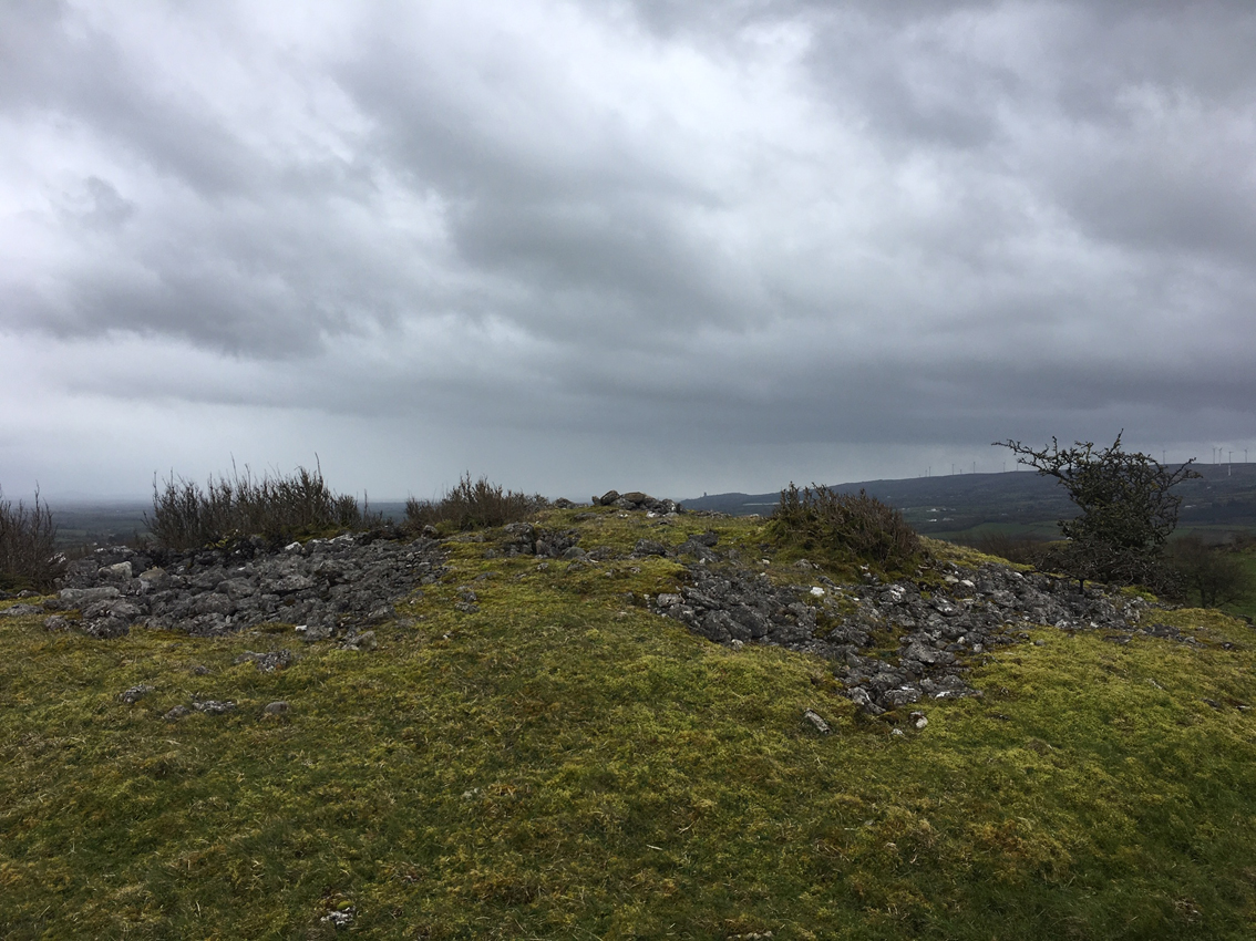
There is a court tomb under there somewhere – single court stone at the eastern end of the heather-covered cairn.