Detail of cupmarks on the stone just inside the field gate below Newtown Hill.
Image credit: ryaner
Detail of cupmarks on the stone just inside the field gate below Newtown Hill.
Decorated stone concreted into the ground beside Cairn O. Possibly from the remains of one of the passage graves in the area.
The relatively isolated Cairn W, down on the eastern slope of Carnbane East, is my favourite tomb on the hill, tranquil and bereft.

Been here loads of times before and never noticed the carving on top of the stone. There’s lots of other carvings in Cairn U to distract you, in fairness.
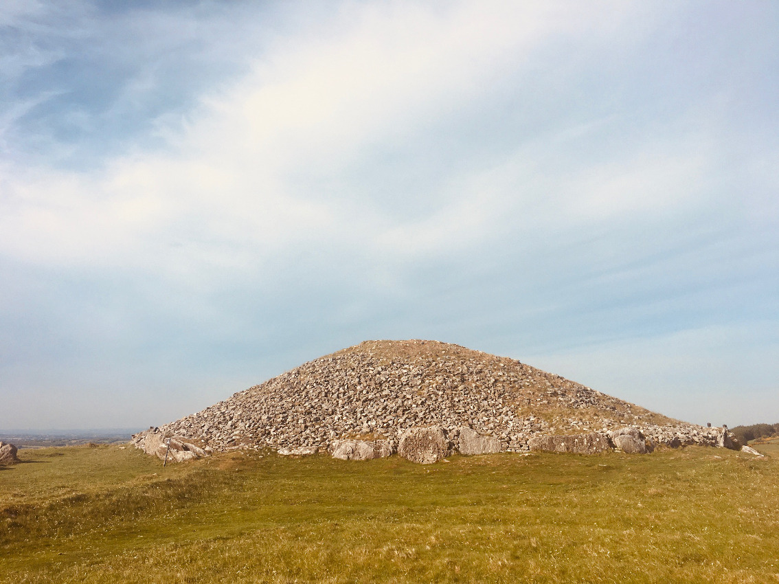


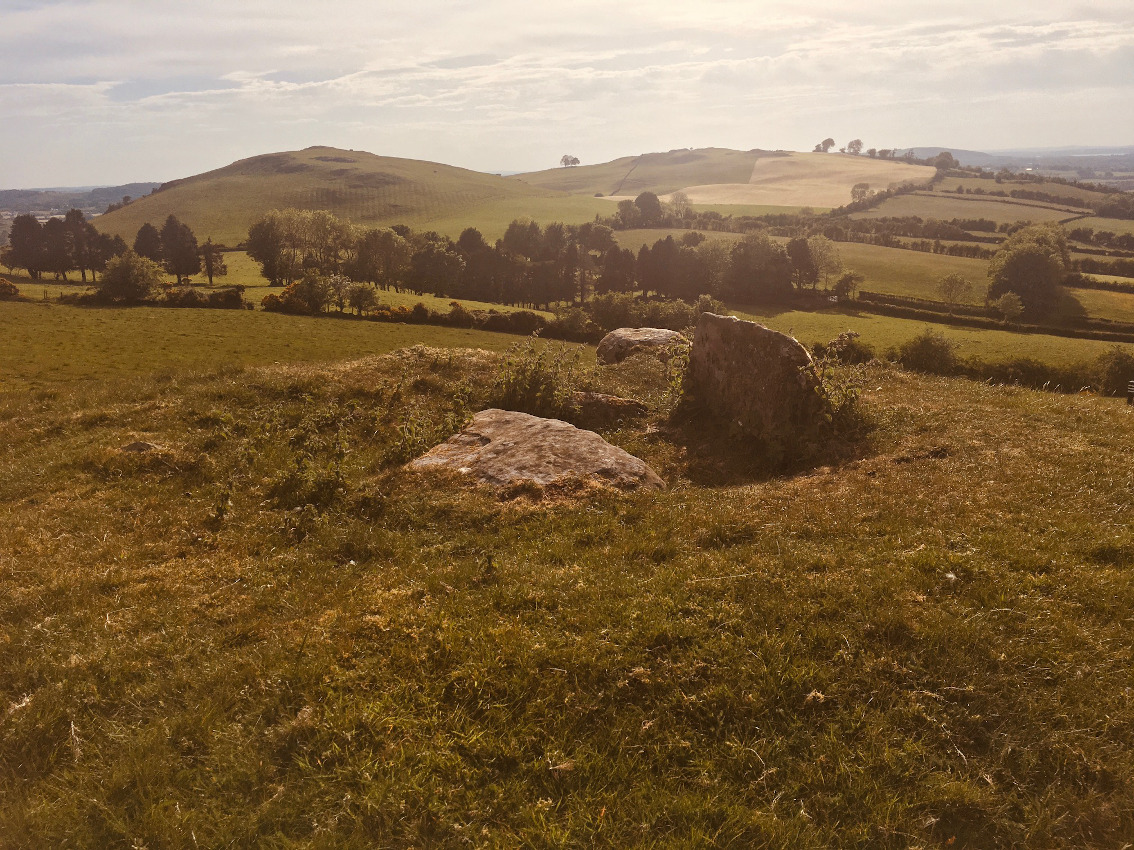
The most easterly of all the monuments in what you could call the Loughcrew complex. Park at the parking spot on the Kells to Oldcastle road where it crosses over the back of Patrickstown Hill.
The stone, 1.7 metres tall, is at the back of the grassy area, to the right of the forest track. It’s hidden from view in summer, but if you continue along the track to the end of the grassy area, there’s a slight track on the right. Go up here for 20 metres and the stone is on the right.

Cup-marked erratic just south of Cairn N, with Carnbane West in the distance.

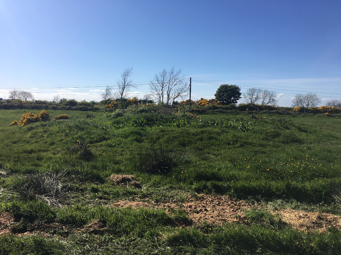
Ring barrow, with Carnbane East in the distance.

Remains of a ring barrow below Newtown Hill.

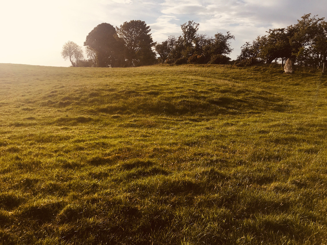
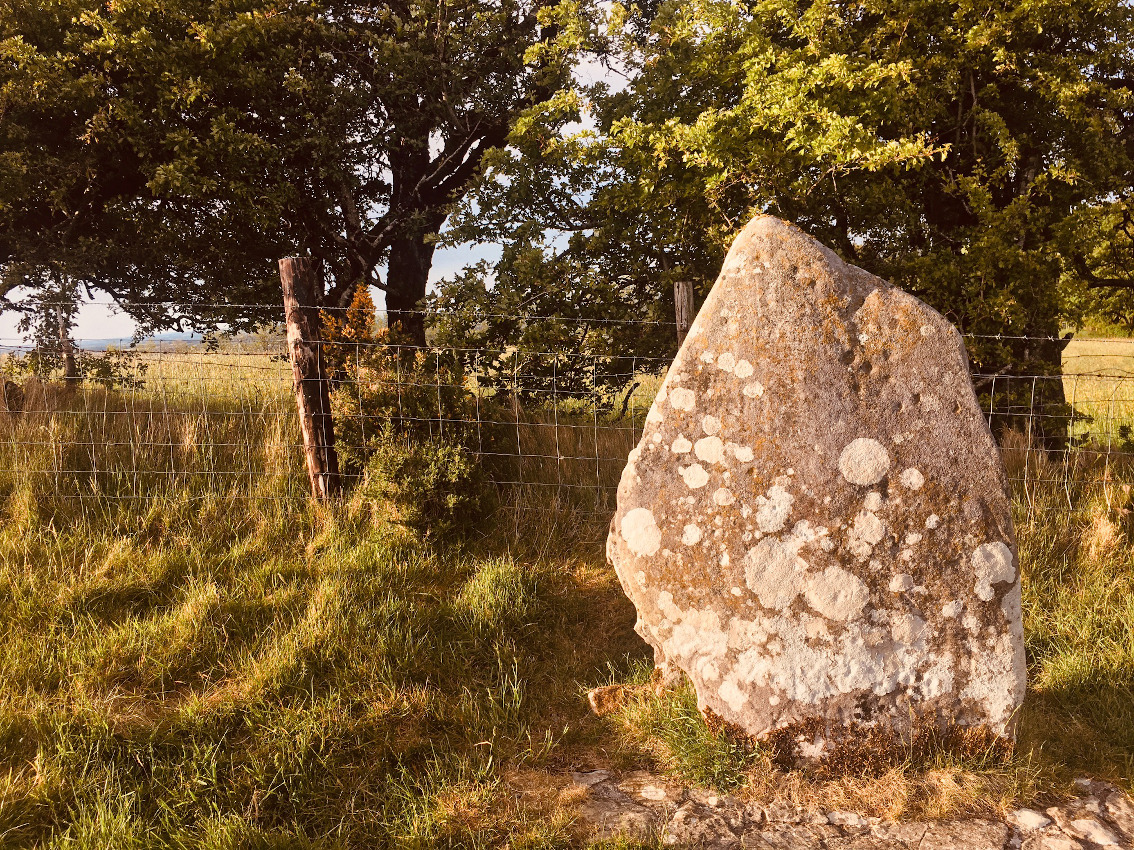
100 metres from the road and car-park on the Oldcastle road.
1.7 metres tall and leaning to the south-east.

Looking east towards the road.
Slieve Beagh is a low, ridge-back hill in north Meath, close to the Louth border and north-west of the town of Slane. Indeed it can be seen from the top of the Hill of Slane, amongst a larger group of hills and aligned west-south-west, east-north-east. A road traverses the northern side of the hill in Rathbranchurch townland. Between that townland and neighbouring Creewood, in an area about 500 metres by 250 metres, is the Slieve Beagh barrow cemetery, mostly to the south of the road.
The updated record at archaeology.ie says there are 26 barrows here, along with 3 raths, 6 houses of indeterminate age (presumably bronze-age) and 2 hut sites, one of which was excavated in the 1960s and given a date from the neolithic.
I’ve been here twice before and on both those occasions was impressed by the views, especially from the road below the cemetery. It reminds me of Tara and the way the ground falls away to the west and seems to go on forever. There are also extensive views to the east but these are blocked in places by a large gorse hedge. The land on that side of the hill is cultivated whereas most of the barrows are hidden in the gorse in a sheep pasture.
The actual monuments are increasingly difficult to identify as more and more gorse takes over. Walking up the track from the gate, the first you see are two enormous, conjoined and flattened round barrows, their banks visible but their ditches are gradually filling. After that it’s more difficult to identify anything, except what seems to be a central, focal bowl barrow, over two metres in height. The graffiti-carved stone still sits atop this, but the carvings are weathering and the whole of the barrow might soon be inundated with gorse.
I like this place. Most of fertile Meath is under cultivation, but this hill stands out, wild and wind-swept. The mystery of the barrows drew me back and retains enough pull to make me want to return. Maybe some day the landowner might cut back the gorse, or it may catch fire, and reveal some more of monuments.

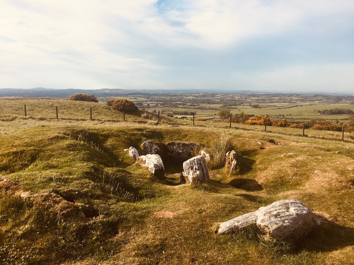
The tall stone in the middle seems to be an entrance/blocking stone, set back from the kerb.

Pano looking across the passage and chamber with kerbstones at the right (west).


Pano of the largest, flattened out barrow.


Mound, ditch and bank at Slane motte. See Rhiannon’s folklore for provenance.


The south-eastern arc of Dowth mound. The southern chamber entrance is just out of shot to the left. A contiguous row of kerbstones is visible to the right.

Kerbstones, including the Sundial stone, on the eastern edge of Dowth mound.
Saggart Hill/Knockananiller/Crockaunadreenagh/Knockandinny sits at the western end of the chain of south county Dublin Hills, the northern edge of the Wicklow mountains. Have a glance at the bottom of Sheet 50 of the Discovery Series OS map and you’ll see that this chain is quite the megalithic playground, peppered as it is with a fair smattering of red monument dots. It also happens to be on the edge of the city and consequently is a favourite spot for non-megalithic adventurers, both benign and malign.
It’s almost exactly 14 years since I last visited here and I was looking forward to seeing the slight remains of the passage tomb and the neighbouring cairn. From back then I remembered a large, overgrown Knockananiller cairn, with the Crockaunadreenagh passage tomb remains over the usual countryside fence. What I encountered today made my heart sink. The forest walks on the hill are increasingly popular and there are mountain-bike trails running through them. More and more people use the hill as an amenity and as a drinking place. As a consequence, there is now a concentration camp-like electric fence separating the cairn on the public land from the ruined passage grave, not 15 metres away on private land in the neighbouring townland. The message here is plain and simple – fuck right off.
It’s not often that one feels like giving up on a place – to do so would be to give up on humanity and the little bit of love that we get from the passion we have for these places, but the absolute, complete wreck that is Crockaunadreenagh and the disdain shown for its neighbouring cairn by the outdoor drinkers and the mountain bikers, almost makes one want to. If you’re going to be that mean-spirited to erect the aforesaid fence, however you may feel about the lumpen attitude of the general populace, well keep it; in fact shove it so far up your…
I remember a short debate a few years back with Fourwinds about the derivation of Crock in Crockaunadreenagh and I think Julian mentions it somewhere in one of the books, and Fourwinds saying it’s an alternative to cnoc, or knock, meaning hill and that that’s where he reckoned the phrase crock o’ shit comes from – as more and more of south Dublin gets opened up and landowners get more and more paranoid, it’s in danger of becoming just that. Apologies but I can’t say anything better.

Looking more or less east. Knockananiller cairn is very substantial.

The cairn is straight ahead and to the left behind the tree. The insane electric fence separates it from Crockaunadreenagh passage grave in the neighbouring townland.

The large cairn, said to be a passage grave, as you first see it from the track.


From the north end of Knockananiller cairn, the passage is clearly visible.

You can see one of the passage orthostats peeping over the top of the mound. The gorse to the left of the mound covers the gouge where the tomb’s chamber would have been.
The SMR entries for Dublin on archaeology.ie have improved over recent times. There are three barrows clearly marked now in Crooksling townland. These do not include the mound in my previous shots from 2013.
I did a flying visit to this barrow, on the eastern side of the Kiltalawn to Brittas road, opposite the aforementioned mound. It’s quite clearly a round barrow, with bank, ditch and central mound, though with lots of interference and overgrowth.
Not exactly spectacular, but worth hopping the fence for a quick nosey.

Again looking roughly north, but closer in than the pano.

Looking roughly west. The barrow has been interfered with down through the ages, but is still clearly recognisable.

Conference hears many more discoveries could be made at archaelogical site
An underwater archaeological reconnaissance of the bed of the River Boyne near the Brú na Bóinne complex in Co Meath has revealed features that may represent log boats or man-made quays, a research conference was told on Saturday.
The sonar study, carried out by Annalisa Christie of University College Dublin and Dr Kieran Westley of University of Ulster, surveyed 10km of the river from Oldbridge to a weir 1.8km east of Slane Bridge.
Christie told the conference, titled The Pleasant Boyne and organised by the UCD school of archaeology as part of its world heritage programme, that it was likely that for the first visitors to this landscape, the river provided the easiest way to travel, offering an accessible route through a largely wooded landscape. As such, it represented a major communications artery, not just for local visitors but also connecting communities in the area to those from farther afield, such as Wales or even Orkney.
Cabin fever struck around 8pm last evening so I made a quick dash for the Shed Stone, slightly beyond the 5 kms limit set by the powers that be (6 on the odometer), but still a local monument. It is quite hard to believe that it’s been 14 years since I was last here.
There’s a parking space on the Upper Cunard Road, south after the brook (Trumandoo?) that you must follow to reach the ‘tomb’. I parked here, changed into my boots and headed down. The first time I was here (taken to it by Fourwinds – it’s not marked on the map) I’d gotten my feet soaked, the boggy ground of Glassamucky Brakes/Cunard unforgiving in Spring, but not today. The recent good weather made for easy hiking.
The monument is hidden from the road, maybe 350 metres down and on the northside of the brook. The beauty of the location, so close to the city, brings a gladness to the heart. And it’s ultra-quiet now, a few sheep farmers hereabouts tending to their essential work. There’s deer on the Brakes tonight, venturing further down the Dodder valley than might normally be their wont.
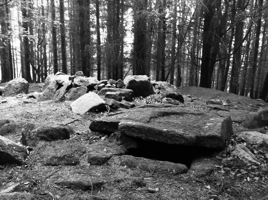
And then to the stone. It’s nestled above the brook on what seems like a levelled out platform, but there are a few of these on the way down and they may be natural. In fact, everything about the Shed Stone may be natural. The debate is still ongoing as to whether this is a tomb at all. The supposed entrance faces roughly south, towards the brook that babbles not 5 metres away, portal tombs and water being a generally accepted conjunction.
The capstone rests on two of the three stones beneath it. Healy says that these are three pieces of the one stone, split by the weight of the glacial erratic capstone, and I can see why he believes that. However, the underside of this capstone seems to have been worked to flatten it, though not into one sheer plane; there are two sections, the major one towards the ‘front’ of the stone. The rear of the ‘capstone’ rests on a fourth stone. There is the possibility that this small arrangement of stones were in situ and then the ‘capstone’ was placed on top of them, the assemblage being some sort of ritual monument and not a tomb. Maybe a fanciful theory, but an explanation for the working of the underside of the ‘capstone’. The natural groove around the ‘front’ of the ‘capstone’ adds to the theory that this stone was chosen, as opposed to to it being an accident of nature.
I spent a while here, drinking in the place. The colour of the day was leeching out as I headed back up to the road. Deer were heading south above me, back to the wilder hinterlands of Dublin county, and then the sun broke out over the back of Ballymorefinn, lighting up the hillside in an orange glow and I didn’t want the day to end. And then it was back to ‘civilisation’, and TVs and laptops, and pandemics.


From the ‘front’. Piperstown Hill is just over the shoulder of Glassamucky Brakes, to the left of the monument.