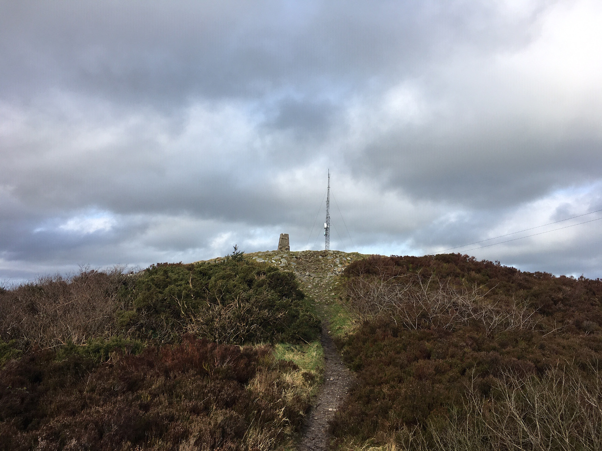
Low, evening light, looking north-west along the Glenasmole valley.
Short (almost 11 minutes) piece about Professor O’Kelly’s excavations at Newgrange. This episode of ‘Newsview’ was broadcast on 14 August 1962. The reporter is Sean Egan.

Roadside stone, not marked on the SMR.

Looking west towards the Upper Dodder valley.

By Michael Le Page
A piece of 50,000-year-old string found in a cave in France is the oldest ever discovered. It suggests that Neanderthals knew how to twist fibres together to make cords – and, if so, they might have been able to craft ropes, clothes, bags and nets.
“None can be done without that initial step,” says Bruce Hardy at Kenyon College in Gambier, Ohio. “Twisted fibres are a foundational technology.”
His team has been excavating the Abri du Maras caves in south-east France where Neanderthals lived for long periods. Three metres below today’s surface, in a layer that is between 52,000 and 41,000 years old, it found a stone flake, a sharp piece of rock used as an early stone tool.
Examining the flake under a microscope revealed that a tiny piece of string (pictured top right), just 6 millimetres long and 0.5 millimetres wide, was stuck to its underside. It was made by twisting a bundle of fibres in an anticlockwise direction, known as an S-twist. Three bundles were twisted together in a clockwise direction – a Z-twist – to make a 3-ply cord.
“It is exactly what you would see if you picked up a piece of string today,” says Hardy. The string wasn’t necessarily used to attach the stone tool to a handle. It could have been part of a bag or net, the team speculates.
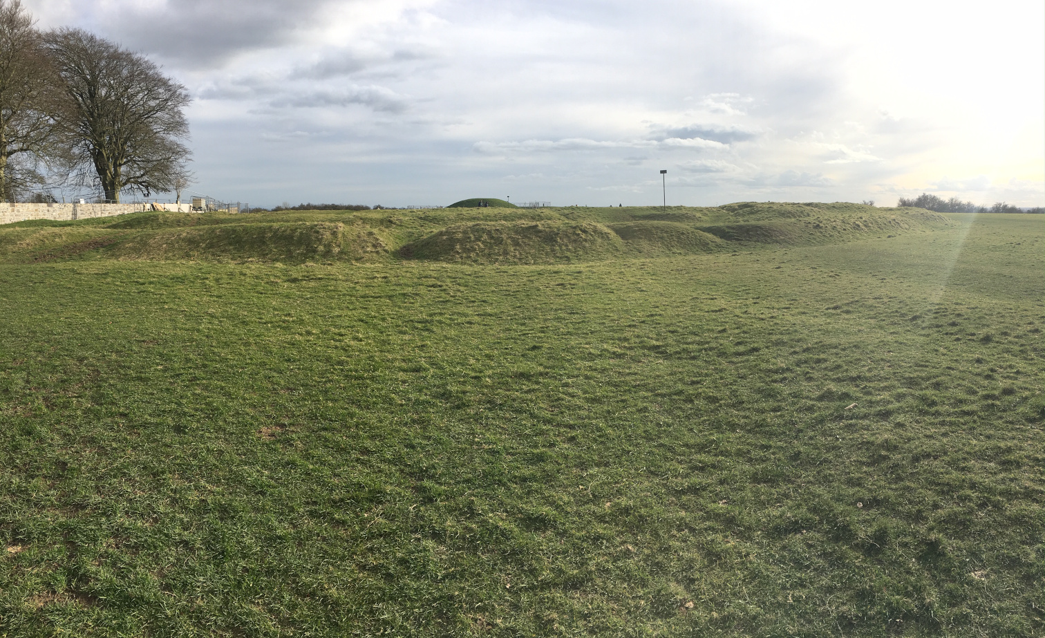
We’d been up at the crowded Hill of Tara sites, open to the public and increasingly popular, and felt the need to escape to somewhere quieter. Rath Maeve (misnamed, like the monuments up at Tara) henge is on private land, usually full of livestock with the banks overgrown and generally as unsatisfying as Tara itself. However, not today. We spent well over an hour here and got quite a sense of the place, but as usual left with as many questions as answers.
It’s described as a henge on the SMR and is really rather massive, so you can see why some think it a hillfort. The interior is low dome-shaped and as a result, from ground level, it’s hard to see the opposite bank in places. The bank on the northern perimeter is the best preserved and, in mid-March, not too overgrown to appreciate. The southern arc has quite a bit of bank remaining but doesn’t rise to the same height as at the north, but, like at the north, falls away to a depth of about 4 metres.
The eastern edge of the bank has been flattened, with the modern road just skirting its edge. A modern field boundary cuts off the western sector from the rest of the monument and that portion was too overgrown to explore.
As mentioned above, the best preserved and most interesting part of the henge is at the north. There’s a gap just west of north with a clear view up to the Hill of Tara. The back of the bank here resembles a defensive rampart more than a ceremonial enclosure and the construction is impressive. That said, I still had the sense that this was a place of ceremony.
From archaeology.ie:
Described by Stout (1991: 257) as:
Rath Maeve is located on an escarpment which occurs on the summit of a ridge 1km south of the Hill of Tara. The soil is a grey-brown podzolic. A bank encloses an oval, dome-shaped interior with an overall diameter of 240m north-south by 275m east-west. It is best preserved in the north and south, where the bank reaches a maximum internal height of 2.5m, with a flattened top, and an accentuated drop to the exterior of 4m. In well-preserved stretches, the bank is 7-10m wide at the base. It reaches a maximum width of 15m in the West. The ground level surrounding the enclosure to the west is much lower than the level of the interior owing to its location on the escarpment. Thus the builders of this monument used a natural feature to enhance the size of the enclosing banks, and the shape of the natural escarpment dictated, to a certain extent, the ground plan of Rath Maeve. A townland boundary ditch runs outside the north-east section of the site; with dimensions of 1.5m wide and 1m deep, it could not have been the source of the bank. This material is most likely to have come from a scarped area, 25m wide, which can be traced along the inside edge or the bank. This gives the interior of Rath Maeve a domed shape common amongst the larger embanked enclosures. There are a number of breaks along the circuit of the enclosure, most of which appear to be the result of later disturbance. The original western (259 degrees T) entrance has a maximum width of 20m, and has been hollowed out of the natural escarpment. The townland boundary, which cuts across the western end of the monument, has an irregular kink and may have been diverted in this manner to respect an internal feature which was remove after the construction of the boundary. This occurs at the highest point within the enclosure, at a position where the entire site is visible. A circular cropmark, probably a ring-ditch lies north-east of this feature (L. Swan, pers. comm.). (Petrie 1837, 206; ÓRíordain 1964, 24; Evans 1966, 177)
Date of revision: 10 January 2017
This monument is subject to a preservation order made under the National Monuments Acts 1930 to 2014 (PO no. 2/2008).
References:
1. Evans, E.E. 1966 Prehistoric and Early Christian Ireland: a guide. London. Batsford.
2. Moore, M. 1987 Archaeological inventory of county Meath. Dublin. Stationery Office.
3. Ó Ríordáin, S. P. 1964 Tara: the monuments on the hill. Dundalgan Press, Dundalk
4. Petrie, G. 1837 On the history and antiquities of Tara Hill. Transactions of the Royal Irish Academy, 18, 22-232.
5. Stout, G. 1991 The embanked enclosures of the Boyne region. Proceedings of the Royal Irish Academy 91C, 245-84.
6. Thornton, G. 1980 A survey of the earthen enclosures of the Boyne Valley and related sites. MA thesis, University College, Dublin.


Called a hillfort here, Gráinne’s enclosure is actually a massive ring barrow. This distorted pano is looking south-eastish.

Pano of the King’s Seat (An Forradh) from Teach Cormac and the Lia Fáil.


The ditch on the north side of Teach Cormac is quite substantial.

Usually the first of the many monuments the Tara visitor encounters, they’re not a bad start.


Looking south up along the Banqueting Hall cursus
Rath of the Synods with the Mound of the Hostages in the distance.


Impressive bank on the outside of the north-western arc of the henge.

There’s a gap, probably modern, slightly west of the northernmost point of the henge. Through this, a kilometre to the north, is the Hill of Tara with its many monuments, the trees on the centre skyline here being those in the Churchyard.


Another view of part of the southern arc of the henge, looking west.

The southern bank is quite shallow on the interior (left) but falls to about 5 metres on the outside.

I have a photo of this stone by Ken Williams on my wall. Du Noyer does it justice.


I can drive to within a 5 minute walk of this little tomb. It’s now more open and accessible than I’ve ever seen. So what better to do in these days of plague and isolation than to take the 10 minute drive in the social isolation direction, up into the low Tallaght hills? Well, like most on here, I’d do that anyway, and like most everyone else, hours and days of bewilderment are beginning to grind.
Someone has taken it upon themselves to clear the monument of gorse. There’s a hammock strung between the two trees to the north-east, and there’s the remains of a substantial fireplace in the quarried gouge in the same direction. The remains are opened up, the central cist, or what remains of it, are visible, and all the kerbstones are uncovered. It’s more than I that reveres this place.
The views across Tallaght, further across Dublin City and Dublin Bay and thence over to Howth are fantastic. Though what is still extant is relatively scant, you can see why the ancestors picked this site and put in the effort to give their dead a fitting tribute. The forestry to the south and west crowds the stones a bit, but the power of the place persists. LilyMae and I left a little less despondent.
Plans to dig a two-mile (3.2km) road tunnel near Stonehenge have been given the go ahead by the chancellor.
The A303, which often suffers from severe congestion, currently passes within a few hundred metres of the ancient monument.
The plan is to build a dual carriageway alternative out of sight of the World Heritage site but it is opposed by some archaeologists and environmentalists.
Rishi Sunak told the commons: “This government’s going to get it done.”
Chauvet Cave: a 36,000-year-old art gallery, normally closed to the public, opens to everyone through immersive tech
Gold bulla is described as one of the most important bronze age finds of the last century
The British Museum has acquired a shimmering 3,000-year-old gold sun pendant heralded as one of the most important bronze age finds of the last century.
The astonishingly well-preserved pendant, or bulla, was discovered by a metal detector enthusiast in Shropshire in 2018.
Neil Wilkin, the museum’s bronze age curator, recalled dropping everything when he first saw it. “I was absolutely flabbergasted, I couldn’t believe my eyes,” he said. “To me it is the most important object from this period, the first age of metal, that has come up in about 100 years.”
The pendant has been purchased for £250,000 using money from the Art Fund and the American Friends of the British Museum.
More: theguardian.com/culture/2020/mar/04/british-museum-acquires-3000-year-old-shropshire-sun-pendant
The Loughanleagh is a region of high landscape value situated in east Cavan between the towns of Bailieborough and Kingscourt off the R165. It covers an area of approx 3 kilometres in length by up to 1 Kilometre wide and rises to a height of 344 meters (1119 ft) above sea level. It is an area of outstanding natural beauty offering spectacular panoramic views of up to fourteen surrounding counties of the Irish countryside.
It’s name Loughanleagh originates from Lough-an-Leighis or ‘Lake of the Cures’. It’s former name was Sliabh Gaileng-‘The Mountains of the Gailenga’. Loughanleagh is steeped in history and folklore covering the Neolithic, Stone age, Celtic and Norman periods. There are three Stone Age Cairns straddled across the ridge of Loughanleagh mountain.
The name Loughanleagh is derived from the Irish language Lough an Leighis – the lake of the cures. Immediately west of this panel there was a small lake until fairly recent times. Sadly, it has since dried up and is surrounded with forest. Reputedly, this lake had healing waters and mud, a tradition that dates back to pre-christian times. It may have been a sacred Celtic pool and in later times was regarded as being a potent cure for scurvy and skin diseases.
...
Ancient folklore dictates that there was a Cailleach (a goddess) who dropped stones out of her apron that form the cairns on the mountain. Apparently, she was a ferocious being who could take on the appearance of a beautiful maiden. In one infamous encounter it was said that St. Patrick struck and killed the Cailleach.
...
Yet another story has it that the mountain was home to a resident hare who had a big red eye. The hare of Loughanleagh could leap into the lake and return to the otherworld. Hares are today common around the area.
From the Coillte notice board.

The almost dry lake that gives the area its name.

Looking east at the cairn, with the fógra sign telling of its protected status.


You can see how the remains might get swallowed up in the summer. The slab leaning at the angle under the capstone is said to be a possible doorstone, but I thought it more likely to have split from the capstone.
Twelve and a half years since I was last here, it was different than I remembered. A massive capstone, a portal stone, what looks like a flaked part of the capstone split off from the bottom and some various possible chamber stones are what remains.
It’s one of those sad reminders of what once may have been, neglected, but in the end not wholly ignored – there were signs that we weren’t the only ones to check out the tomb.
Access is not as straightforward as I thought, though the monument is in a roadside field. Now is the time to visit – this will be overgrown in the summer months.