

By Seán Mac an tSíthigh
Iriseoir Fise
An ancient tomb, described by archaeologists as “untouched” and “highly unusual” has been discovered on the Dingle Peninsula in Co Kerry.
The tomb was uncovered in recent days during land improvement works being carried out by a farmer.
The National Monument Service has requested that the location of the structure should not be disclosed in order to prevent the possibility of disturbance.
The tomb was uncovered by a digger during land reclamation work when a large stone slab was upturned, revealing a slab-lined chamber beneath.
On closer inspection an adjoining sub-chamber was found at what appears to be the front of the tomb.
The tomb contained an unusual smooth oval-shaped stone and what is believed to be human bone.
More:
rte.ie/news/2021/0416/1210287-tombs-kerry-dingle-peninsula/

Called a stone circle on some maps and a hut site in the Wicklow inventory, the Ancient Village etc. descriptor here is equally unhelpful.


Archaeologist says neolithic discovery may be among oldest salt-processing sites in western Europe
Neolithic people were manufacturing salt in Britain almost 6,000 years ago, before the building of Stonehenge and more than two millennia earlier than was first thought, a new archaeological discovery suggests.
Excavations at a site at Street House farm in North Yorkshire have revealed evidence of the earliest salt production site ever found in the UK and one of the first of its kind in western Europe, dating to around 3,800BC.
The finds, uncovered at a coastal hilltop site near Loftus, include a trench containing three hearths, broken shards of neolithic pottery, some still containing salt deposits, shaped stone artefacts and a storage pit – all key evidence of salt processing.
The project was commissioned jointly by Kildare County Council
and the Department of Defence in order to:
help protect and conserve the special status of this landscape.
help manage more effectively the diverse yet critical uses of the Plains; and to
help realise its potential as a destination of value to locals and visitors alike, thereby contributing to the local and regional economy.
I saw some shots elsewhere that showed that the trees have been felled from around the tomb and I had to investigate. I’ve approached from the farm track to the north-east of the tomb on the occasions I’ve previously visited. Looking back at the shots from those visits on here it seems that it’s been eight years since I was last here. That’s a bit of a shock, considering that it’s such a well-preserved and fine example of a wedge tomb as to be found anywhere else. I guess the off-putting restriction of the views and adventures in other parts have meant that I’ve ignored the place.
This time we approached from the south, across what used to be a golf course and is now The GAP (Glencullen Adventure Park), a hybrid mountain-bike, trekkers adventure fun-park. You can park here Wednesday to Sunday for €2. Access to the tomb is easy, a 15 minute stroll, partially uphill, but not at all strenuous. The old tree-line is still visible directly south of the monument – these trees are of the same vintage as those recently felled so more hope there, except that the GAP seem to use this area for some forested mountain-bike tracks. Also, I don’t suppose that it will be anytime soon when Coillte will take the views from ancient sites into consideration when they plant and re-plant trees. Looking at the photos in the excavation report from 1945, the forestry is a relatively recent addition. And now that they’re gone I wonder will Coillte allow at least the eastern and south-eastern views to remain. I didn’t see any new planting so we can hope.
The views aside, the thing that Ballyedmonduff has going for it is that so much of it remains. When Ó Ríordáin and de Valéra arrived to conduct their excavation, it seems that much of it was contained within its covering cairn, minus the chamber roofstones. They did find some interference and they did remove all of the soil and cairn material, but what you see is very much the skeleton of an almost perfect wedge tomb, aligned just about west/-east, with the entrance at the west. It had been speculated by some that Howth would be visible from here and as we headed up we could indeed see the peninsula but then on arrival you realise that the north-east shoulder of what is Two Rock mountain blocks that view. The tomb has two chambers and one ante-chamber, almost a complete and continuous set of double-walling, almost complete revetment between the walling and the chambers and much of the orthostats of those chambers. One of its stones has cupmarks.
The tomb lies there on a slight slope, pancaked almost and breathing freely and much more fascinating than when crowded. A few miles almost directly north-east Killiney Head hugs the shore. Swing around 90 degrees and there are the Sugar Loaves, revealed at last. Over the rear of the tomb almost due east is Newtown Hill with its barrows and standing stone. At the hill’s foot to the south is Johnny Foxes famous pub in Glencullen village. This ever popular tourist draw brings thousands on a weekly basis. Hopefully Ballyedmonduff wedge tomb stays protected from the hordes. The glorious quartz obelisk of Glencullen standing stone remains mostly ignored. There are works continuing in the vicinity so Ballyedmonduff will be worth checking on every once in a while.
Some of these ancient mounds date back to 3000 BC, but many are buried under motorways
Manchán Magan
As our faith in fairies has receded in recent years, the fate of Ireland’s 32,000 remaining fairy forts has become increasingly perilous. Many of these circular earth mounds are over 1,000 years old, the remains of stone or wooden forts which housed an extended family in early medieval times. Others are remnants of underground passage tombs dating back to around 3000 BC.
In 2010 the environmentalist and author Tony Lowes first wrote about farmers destroying the forts on their land in the name of modernity and progress. A man on the Dingle Peninsula levelled a large part of the 3,000-year-old Dún Mór fort while the government was in negotiations with him to purchase it, and a farmer near Mallow in Cork destroyed the half of an extensive ringfort that lay on his own land, then tore down the other half when his neighbour was at a family funeral. There was also the story of a Cork dairy farmer who demolished two ringforts on his land, and whose family had previously destroyed three others.
The title of Lowes’ article in Village magazine was The Men Who Eat Ringforts, in recognition of the fact that these farmers (and developers and engineers) are invariably male. The title has been adopted for a volume of book art, Men Who Eat Ringforts, published by the conceptual artists Sean Lynch and Michele Horrigan of Askeaton Contemporary Arts. It’s a large-format book designed by Daly+Lyon, with thought-provoking essays by Sinéad Mercier and Michael Holly exploring the determined desecration of our ancient past.
A prominent prehistoric burial site near Augher was ransacked by “40 bikers” last weekend, a Clogher Valley councillor has said.
Speaking at a meeting of Mid Ulster District Council’s environment committee, Councillor Sharon McAleer told “how up to 100 bikers” arrived at Knockmany Forest on Sunday.
The SDLP representative claimed 40 bikers were seen going over Queen Anya’s burial site at the summit of Knockmany Hill and branded this act “not acceptable”.
“I have just been made aware of an issue that happened at Knockmany on Sunday [March 7] where up to 100 bikers had come to the car park and taken up all the parking spaces,” said Cllr McAleer.
“Unfortunately at Queen Anya’s burial site 40 bikers were counted going over the burial site which is just not acceptable.
“They have dug up all the ground and then proceeded to go down through the forest and destroy the wildlife, nature and fauna along the way.
“Lots of people in the community are annoyed about this as the place is packed with walkers.”
Researchers in Murcia find exquisite objects at women’s graves later used as sites for elite warrior burials
A burial site found in Spain – described by archaeologists as one of the most lavish bronze age graves discovered to date in Europe – has sparked speculation that women may have been among the rulers of a highly stratified society that flourished on the Iberian peninsula until 1550BC.
Since 2013, a team of more than a dozen researchers have been investigating the site of La Almoloya in the southern Spanish region of Murcia.
Home to the El Argar, a society that was among the first to utilise bronze, build complex urban centres and develop into a state organisation, the site is part of a vast territory that at its peak stretched across 35,000 sq km.
Research published on Thursday in the journal Antiquity has documented one of the site’s most tantalising finds: a man and a woman buried in a large ceramic jar, both of whom died close together in the mid-17th century BC.
More:
theguardian.com/world/2021/mar/11/bronze-age-burial-site-in-spain-suggests-women-were-among-rulers


The back of the tomb showing the almost complete set of kerbstones.

The view to Newtown Hill over the northern side of the tomb.

The southern side of the facade. Newtown Hill is almost directly east behind the tomb.

The Sugarloaf almost directly south-east of the tomb.

These two stones are located about 150 metres slightly east of south of the cairn in the same townland that I had visited earlier. No connection is made between them and the cairn in the Eogan notes on the SMR at archaeology.ie. These notes are taken from a paper that I haven’t been able to access, so he may have mentioned a connection that I would say is fairly obvious.
The southern side of the cairn is truncated and a wall has been built that delineates the two different fields that I suspect are owned by separate people. The cairn is somewhat preserved in the northern field. On the southern side it has been flattened to the surrounding ground level, ergo, these are two of the stones that were pulled from the cairn during this destruction.
Anyhow, the broad flat face of the leaning stone is covered in what seem to be natural solution pits (they reminded me of the capstone at Rathkenny). A couple of these have rings carved around them and some of the pits may well have been enhanced. There are other markings on the stone, but in overcast light and without water, these were hard to make out. The stone leans at a 45 degree angle on another possible orthostat/kerbstone and as a result the carvings are now badly eroding.
Having read Eogan’s notes (see below) before setting out I was excited and intrigued at what I might encounter. After a long explanation about what we were after at the house at the bottom of the hill, we set out for the not too strenuous walk. There’s an old railway cutting that needs to be surmounted and from the satellite pictures I was unsure of how to achieve this. Thankfully there is a gated gap that leads to the field in which the cairn lies.
Early March is possibly the only time that you will get to see anything here. The cairn is a tangled mess of brambles, thorn trees, barbed wire and shrubbery. I couldn’t see the opposing uprights that Eogan mentions. I did see some cairn rubble and what looked like two kerbstones, one in situ and one fallen outwards. From my prior research I wasn’t really expecting much and I wasn’t that disappointed, though there were the usual pangs of regret at the sad neglect.

Supposed to be 140 individual cupmarks. I didn’t count them.

The art is getting very badly eroded here. Cup and ring mark at the south end of the stone.

I could have done with some water here today.


The only two large stones I could manage to see here.
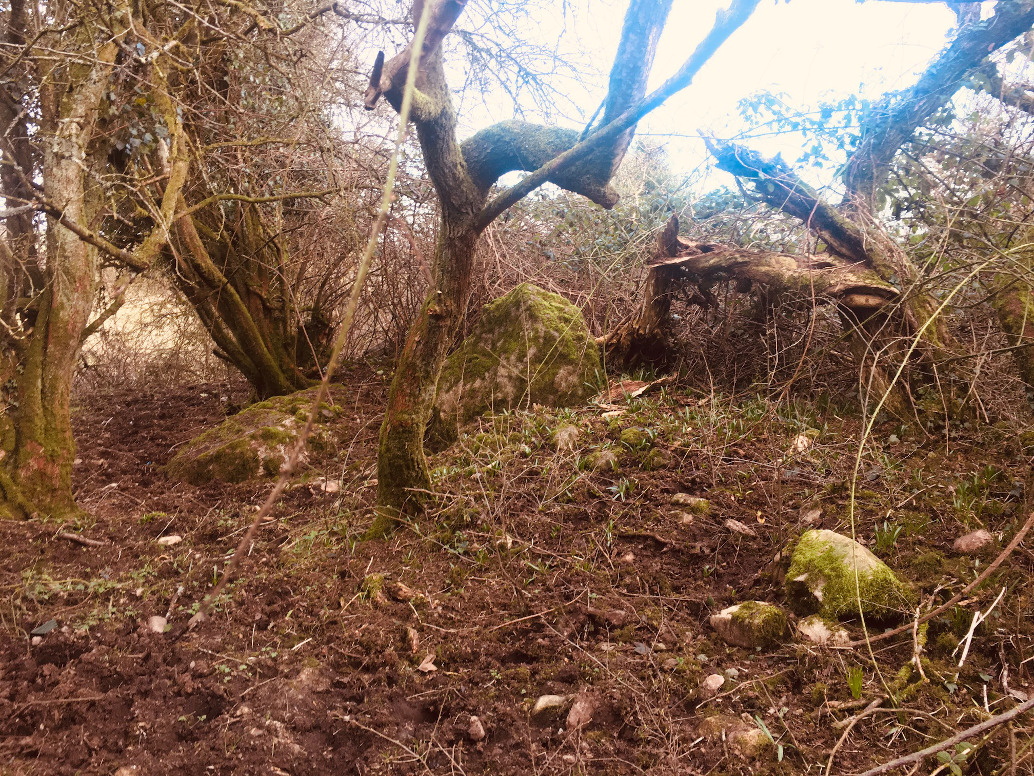
Two large kerbstones in this drastically overgrown monument.
The SMR entry from archaeology.ie:
Class: Decorated stone (present location)
Townland: CLONASILLAGH
Scheduled for inclusion in the next revision of the RMP: Yes
Description: The remains of this monument have been described by Eogan (2000, 7-9) as follows: ‘What survives to-day is a large flat stone and a rounded boulder, possibly an orthostat and kerb-stone. These are not in their original position but were dumped there after destruction. There are some other stones in the area, but these are much smaller. The large decorated stone is at least probably one of the “large upright stones” referred to by Conwell. From local information, it appears that a monument stood very close to where the stones now are, but it is not possible to determine its precise location or the date of the removal, but this may have been about 1990. It was removed by bull-dozing; the two stones described in this paper were thrown aside and according to a local informant, a pit was dug into which other large stones were dumped. The area tends to slope to the south-east but adjoining ground to the north-west is higher. ??Stone A is a large flag 2.40m long. At one end it is 1.35m in maximum width; at the other it is about 1m. It is 0.40m in average width. The material is carboniferous sandstone with round calcareous concretions. Two parallel grooves near the top left-hand corner were caused by the teeth of the bulldozer bucket. Decoration occurs on the broad face that is visible and on one of the narrow sides. There is no decoration on the other three narrow sides. The other broad face is lying on the ground, but as it has not been possible to have it lifted, it is not known if it has decoration. The surface of the stone is weathered and this restricts information about the motifs, and in particular about the technique used in its application, but it may be assumed that pocking predominated. ?On the broad face cup-marks predominate, one hundred and forty one examples being present. These are natural hollows, often elliptical in shape, but there is a hint in some that human modification took place. The “cup-marks” vary in size from small examples 4cm in diameter to larger examples 10cm in diameter and 2cm in depth. Two other principal motifs are present – curvilinear and rectilinear. There are three curvilinear motifs. Two are similar, each of which consists of a hollow surrounded by a circle, the uppermost motif being the larger of these two circles. The lowermost circle is the largest overall example. This also has a central hollow which is surrounded by two concentric circles. A third member consists of an arc on one aide. A somewhat crescentic-shaped motif extends across the upper portion of the surface. This has inward-hooked ends. One end extends above and down one side of the central cup-and-circle motif. Another large motif consists of a straight line which extends up most of the surface. This appears to cut across the left side of the hooked motif and is, therefore, a later addition. Its overall chronological position cannot be determined, but its surface weathering is similar to that of the other motifs. Perhaps it is an overlay on a primary composition. However, prominent straight lines are not a feature of megalithic art. ?The decoration on the vertical side consists largely of a series of lines. These are usually parallel, either vertical or horizontal. Some constitute a motif in the shape of an inverted L, but others tend to form a gate-like pattern. Towards the broad end, the side slopes and in this small area there are twelve hollows, some of which Beam to have been modified. ??Stone B is a boulder that has minimum dimensions of 1.77m in length, 1.69m in width and 0.83m in depth. The material is also carboniferous sandstone. It has been damaged, probably at the time of bulldozing and flakes have been detached. There are ten hollows on one of the broader surfaces, mainly close to one of the edges. As is the case with Stone A, all seem to have been natural, but possibly some were modified as was suggested for Stone A.’ (Eogan 2000)
The SMR entry on archaeology.ie:
Class: Cairn – unclassified
Townland: CLONASILLAGH
Scheduled for inclusion in the next revision of the RMP: Yes
Description: This has been described by Eogan (2000, 9-11) as follows: ‘This site is situated on a knoll, from which visibility is not very extensive, the most prominent feature being Carrigasimon hill about 4km (slightly over 2 miles) to the north-east as the crow flies. Before clearance, in July 1999, the site was very overgrown with a variety of bushes. Hence, apart from the top of what appeared to be a couple of longish stones, it was almost impossible to distinguish the type of monument. After clearance, the presence of eight stones arranged in a circle was revealed. There is also a small stone near No. 6. Only three of these, Nos. 1, 2 and 6, were in their original positions, the other five having fallen. There is a gap between the stones, and without excavation it is not possible to say if the circle was complete, but if it was, then, taking the dimensions of the stones surviving in situ, about fifteen stones are missing. If so, the original number would have been about twenty three. An interesting feature of the circle is the presence of two large stones (Nos. 1 and 6). They are the most substantial in the monument, with that on the east being 1.70m in height. Its opposite number is 1.66m in height. Furthermore, they are opposite each other, giving an East-West orientation. These are much larger than the only other surviving upright stone. No. 2, which is 0.93m in height. The dual east-west orientation recalls the similar orientation at Knowth, Site 1 (Eogan 1986, Fig. 16). This monument is 15m in external diameter. No internal features are visible but there is a spread of cairn all over, and while its average depth cannot be determined. It appears to be about 40cm. The surface of the interior is generally flat, but in a couple of places there is a greater depth of cairn than in others. Outside the kerb, for most of its circumference, there is a spread of smallish stones. These might represent cairn slip, if a higher cairn existed, or it could represent cairn debris that accumulated if such a cairn was removed. Professor Phillips reported that “all the stones at this site are composed of massive unstratified coarse grained greywacke formed by submarine debris flows. The greywacke shows a prominent cleavage and there are some elliptical shaped calcareous concretions which have been flattened and stretched on the cleavage. The rock type is typical of the Silurian aged bedrock of nearby Carrigammon Hill. The surfaces of the stones are rough and have a growth of moss, but it has not been possible to detect art.’ (Eogan 2000) ??ME010-044----_01.pdf: Plan and section of the monument (surveyed May 1995). ??Compiled by: Paul Walsh ??Date of upload: 21 April 2015
References:
1. Eogan, G. 2000 A group of Megalithic monuments at Kingsmountain – Clonasillagh, Co. Meath, Ríocht na Mídhe, 11, 1016.
Nearly 15 years since I last visited here. The residents of the house to the right at the bottom of the lane that leads to the stone are as friendly as I remember. That last time I had met the farmer and his son in the field and they were more than happy, proud even, to let me have a look at the stone.
This is well worth checking out if you’re in the vicinity at Loughcrew about 4 kms to the south-west. The stone most probably came from a destroyed passage tomb in the locality. It would probably be worthwhile examining and surveying the ditches and hedgerows nearby and I would if I lived locally.
The SMR record at archaeology.ie:
Class: Passage tomb art
Townland: KINGSMOUNTAIN (Kells Upper By.)
Scheduled for inclusion in the next revision of the RMP: Yes
Description: Described by Eogan (2000) as follows: ‘According to Conwell (1873, 14) a mound existed at this site up to a few years previously when it was removed by the land owner and the material spread over the field as top dressing. This implies that the mound was of earth. The stone was in the centre of the mound and it is stated that it covered a chamber that was constructed from flag stones; these were smaller than the decorated stone. However, the size and shape of the decorated stone suggests that it was an orthostat rather than a capstone.
To-day the decorated surface faces in a southerly direction, but as the stone has been re-erected, its original orientation is not known, nor can it be assumed that it was re-erected the correct way up. The chamber contained bones “all of which have disappeared”. The stone, rectangular in cross-section, is slightly over 2m in height and measures 0.85m in length at the base. The material is sandstone, the surface being uneven and flaked in places. Professor Phillips reports that “this stone is composed of well sorted cross-bedded quartz sandstone with a few circular calcareous concretions. This rock is of Lower Carboniferous age and could have been quarried in the Oldcastle area to the west.” The decoration is confined to the lower half of one of the two broad faces where it occupies virtually the entire surface. The motifs consist almost entirely of spirals. These are six in number. The bottom two are anti-clockwise; the remainder are clockwise. There are three main spirals and these extend diagonally along the face from top to bottom. The uppermost spiral is of four turns but portion of the top is now missing. At its base there are two sagging lines; perhaps these are all that remain of two further members. To its upper left there are traces of a curvilinear motif. The middle spiral consists of seven turns. The bottom example has five turns. It has been damaged due to the removal of part of the stone’s surface, especially on the right hand side. To the left of the central spiral there are three further spirals, but smaller and not so well preserved. That on the top has four turns; the middle has three and the bottom possibly five. To the bottom right of the large uppermost spiral there are two further lines. These are parallel and almost vertical. Between the outermost one and the edge there appears to be same slight depressions, possibly pickmarks.’ (Moore 1987, no. 26; Herity 1974, 244; Shee Twohig 1981, 224-5; Eogan 2000, 4-6)
Compiled by: Paul Walsh
Date of upload: 21 April 2015
References:
1. Eogan, G. 2000 A group of Megalithic monuments at Kingsmountain – Clonasillagh, Co. Meath, Ríocht na Mídhe, 11, 1016.
2. Herity, M. 1974 Irish Passage Graves. Dublin. Irish University Press.
3. Moore, M. 1987 Archaeological inventory of county Meath. Dublin. Stationery Office.
4. Shee Twohig, E. 1981 The Megalithic Art of Western Europe. Oxford, Clarendon Press

The spirals are holding up against erosion.


The lichen patches on the north-eastern side stand out.

I’ve mainly added this because of the townland name. The SMR/Archaeological inventory entry is: Small sub-rectangular mound (diam. 9m N-S, 9m E-W, H 1m) in centre of wood. Trees have since been cleared and spoil added to original mound making it oval (dims. 50m NW-SE, 40m NE-SW, H 2m). The Meath inventory was published in 1987. It’s a long, barrow type mound but that classification is in doubt given the SMR entry.


Looking north. The bullaun rests beside the remains of a high cross.

Rathkenny is a relatively isolated North Meath townland, just west of the hills that include the Slieve Beagh barrow cemetery. It’s off the beaten track, about 10 miles north-west of the Brú na Bóinne complex. I visited here maybe 12 years ago but never posted any pictures, for some unknown reason.
A public road ends where a farm track begins, leading to the big old house where we asked permission to visit the tomb. Duly granted we headed off into the pasture field where the remains lie. The ring barrow that you meet as you head over from the gate was a pleasant surprise. It’s quite low but is very noticeable and there are many large stones in its fosse that may have come from the tomb.
All that remains are a large, chunky capstone leaning on an upright stone, presumably a portal stone from this destroyed portal tomb. The top of the capstone is heavily marked with solution pits and cupmarks, some of which are said to have been artificially enhanced. There are many linear scorings on the capstone too, all of which seem ancient. I speculated that the tomb had been destroyed by the time the bronze-age barrow builders constructed the tomb to its west and had used the stone to sharpen their swords, but maybe I’ve been watching too much Game of Thrones lately. The tomb was in this condition when Borlase visited it in the late nineteenth century. He noticed, and gives a drawing of, some circular markings on both the underside of the capstone and the northern face of the upright. I only remembered these after I got back home (The circles on the underside of the capstone are actually visible in one of the shots I’ve posted here). Oh well.
Some friendly horses sauntered over to visit us as we were there. The ground rises to the east to the wooded hills of Simpson’s mountain, which in turn hides the higher ground, further east, of Slieve Beagh with the aforementioned barrow cemetery. Further east again is the decorated stone of Mullagharoy, a standing stone with passage tomb art.

Possible portal stone and capstone, taken from the south.

The capstone leans south on to the remaining upright stone. There are some other, smaller stones in a cairn pile around the upright. (The carved circles that I missed are visible in this shot where the sun is shining on the underside of the capstone)


Solution pits and what looking like sharpening marks cover the top of the capstone.


Looking west. The barrow is unrecorded for some bizarre reason.
