


Part of the mad minilithic playground that is Beaghmore.
This was a first. In a howling gale and horizontal rain we headed up the farm track in the car, went into the farmyard and did a u-turn and faced outwards at the side of the house. The tomb is in the field at the back of this house. So on with the coat and over to the door, ring the doorbell and ask is it ok to have a look at the old tomb of the lady who answered the door. No it’s not, says she. Shit, said I to myself and not out loud. Ok, so re-strategise. Do you own the field?, I ask. Yes, says she. Do you mind me asking why you won’t let us? (after all it’s just over the fence there – to myself), I ask. Contamination, says she. Ah, I see, Covid? I ask. No, there’s cattle in the field, says she. Oh, ok, says I, completely deflated. (In my mind – lady, have you any idea of the thousands of cattle and sheep that I’ve met in my sojourns into the Irish countryside in search of amazing megaliths like the one in your backyard?) But no, the weather had already demoralised us and this just topped a sense of impending shittiness. A most unfriendly experience.


Looking north-west along the north-eastern arm of the court.


Over the entrance lintel and court towards Lough Mallon.

The stone on the right is thought to be a possible roofstone from some sort of burial chamber –“Feels like a wedge” says the SMR note.


The west end of the ‘tomb’ has some massive stones that almost look like an outcrop, but are similar to some of the larger stones at the more famous court tomb up the road.


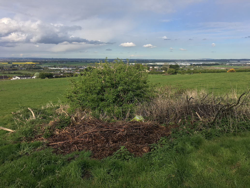
A cairn? A barrow? Something even grander? Who knows? The good news is that it seems the owners of the site care about what they have on their land and have recently cleaned up the site. This is the text of the note on archaeology.ie taken from the Inventory of Co. Wicklow: Situated on a gentle W-facing slope. A cairn (diam. 13m; H 2m) with small boulders around the perimeter, some of which may be kerbstones. Sounds about right but I would add that some of the stones may also be field clearance, or structural stones from some kind of ruined chamber or cist – some of them are quite blocky and shaped, some are embedded, some not, and some are contiguous and some are not. The view across to Slievethoul draws the eye.
Two fields away from the road, the lowest of a co-called complex of megalithic sites in this aptly named townland. The last time I was here 15 years ago there was way less gorse. Even at that I hadn’t been too impressed, not really knowing what I was looking at, so I was quite surprised to see the amount of the tomb that remains, despite its almost complete colonisation by the gorse.
The tomb is aligned roughly NE/SW with the entrance at the south-west overlooking a narrow neck of the Poulaphuca reservoir. This watery view wouldn’t have been there when the tomb was built, of course, but is very pleasant all the same. I ventured in under the tangle of gorse to the now hidden chamber, the walls of which are still quite extant. Most of the stones here are large and bulky, double walling visible of there western side. The remains of the wrecked portico and facade are inundated, some of the structure still embedded in the turf and some lying flung around.
This place could really do with a relatively simple clean-up as Bogman says below, but I’m not holding my breath – seems that no-one cares enough.


Not much to say about this except to post the note from archaeology.ie. I couldn’t see anything here remotely close to 46 metres in diameter. Maybe I was in the wrong place, but I was in the exact location given on the Historic Environment Viewer and there’s nothing else similar nearby.
Class: Barrow – unclassified
Townland: ATHGOE,HIGHDOWNHILL
Scheduled for inclusion in the next revision of the RMP: Yes
Description: Located on the N face of Athgoe Hill in an area indicated as a copse on the 1837 OS 6-inch map. A sub-circular area (diam. c. 46m) defined by a fosse (Wth 2.8m; D 0.9m) and an outer flat-topped bank in the NW and W (Wth 4m at base; 1.2m at top; H 0.6m) and by bushes in the E and SE. The interior of the site is planted with trees (Stout 1998, 151-2).
Compiled by Geraldine Stout
References:
1. Stout, G. 1998 The archaeology of Ballymount Great, County Dublin. In C. Manning (ed.), Dublin and beyond the Pale, 145-54. Bray. Wordwell.
Looking east. Maybe you might give this one a miss if you’re at the seriously worthwhile one at the top of Athgoe Hill.


South-west towards Kilteel, lumpy and bumpy and hard to interpret.
How many times have I been here and failed to identify this stone? Too many, but sure what the heck? It’s a tranquil setting with a satisfyingly ancient feel about the place. That said, it’s important to say that this stone is not recognised by the SMR at archaeology.ie as ancient. It doesn’t mention it at all. However, on the tourist board outside the graveyard that records the monuments in the locality and gives a map of the area, it’s called a pagan stone and says that it maybe marks an old, pre-christian burial site. And sure what more would you need?
It’s very firmly embedded in the ground at the rear of an old chest tomb, a granite slab about 1.3 or 1.4 metres tall, aligned almost north-south on its longer axis, tapering to a point and reasonably convincing. And yet the nagging doubt is there. Does it even pre-date the adjacent tomb. The granite doesn’t look worn enough for a stone that has been erect for thousands of years. I guess the only way to be really sure is to excavate it, a prospect not too likely for the foreseeable.
Most of the small hamlet of Valleymount survived the 1940 inundation that drowned the village of Ballynahown (memories of which can be found here poulaphuca.com/ ) not a kilometre north-east of it, thirst for water and hunger for power necessitating the damming of the Liffey at Poulaphuca falls. A story is told of the Valleymount man who stayed put until the last moment, clinging on hopelessly against the literal and relentless rising tide of modernity, only to have to give in eventually as the water lapped across his doorstep.
What remains of Valleymount is now a narrow, northwards pointing peninsula, the drowned Kings river valley to its west and the largest expanse of the Poulaphuca reservoir, created by the dam on the Liffey, to its east. On the southern shore of the reservoir was discovered/identified in 2010 this small wedge tomb. It was rescue excavated by Chris Corlett not long after, the urgency brought about by the tomb’s proximity to the shoreline and the threat of consistent erosion from the rise and fall of the lake levels.
You can access the area from central Dublin by taking the 65 bus that occasionally terminates on the Ballyknockan road. Directly north of the bus stop about 200 metres across the field is the tomb.
The wedge tomb is not much to look at but the setting is beautiful. The water gently laps a few metres away and the abandoned pleasure boat nearby adds a Ballardian sense of weirdness to the altered environment. The view north across the lake to Carrig with it’s complex of monuments is probably best appreciated on an intermittently cloudy day like today, the changeable sky offering varying light and perspective. Plants are encroaching on the tomb and, without the plan on archaeology.ie, it’s difficult to interpret, with many unsocketed stones confusing the whole array. We spent quite a while here, wistfully lost in thought and our own meanderings, together but all the while separate, maybe mesmerised by the ghosts of the sunken Ballynahown, and those of the small tomb builders.

Kind of ambivalent about this site – whatever about it being eroded by the reservoir, it’s also getting overgrown and is obviously uncared for, post-excavation.

Pretty place, and well spotted by the gent that identified it it in 2010.

The front of the small wedge tomb, aligned almost due west.

It looks messy from this angle, the many stones thought to have been dislodged by the consistent erosion of the reservoir.


The stone fells very embedded and said to mark a pre-christian burial in this old cemetery.

‘Pagan’ stone in COI graveyard in Newcastle.

The Office of Public Works has said a security company will carry out a patrol of Loughcrew in Co Meath every evening, in light of recent vandalism at the historic site.
Earlier this week, it emerged that graffiti had been scratched into a stone at the Neolithic burial monument and an investigation was launched.
The OPW and the National Monuments Service said it is latest in a series of acts of vandalism at the national monument site.
Anthony Murphy, who discovered the famous ‘Dronehenge’ near Newgrange, made the discovery using a drone
A citizen archaeologist who discovered the world famous ‘Dronehenge’ near Newgrange, county Meath during the heatwave of 2018, appears to have found another potentially significant discovery in the Boyne Valley using a drone – a logboat that could date to Neolithic times.
Anthony Murphy said, “I went looking for a dolphin. I didn’t find him but I did find a logboat.”
Made by hollowing out a tree trunk, such logboats or dugout boats have, according to Dr Stephen Davis, UCD School of Archaeology, “an immensely long history of use in Ireland, with examples known from the Neolithic right the way up to Medieval times.”
“Closer investigation will be able to show more – for example tool marks would be able to tell whether it was made with metal or stone tools, and radiocarbon dating give an approximate age,” he added.
In the heatwave of 2018, a previously unknown henge was found near the Newgrange monument by Mr Murphy and Ken Williams.
More: independent.ie/news/citizen-archaeologist-discovers-ancient-logboatin-the-boyne-valley-40366402.html


The entrance is at the wsw, almost directly centre of this shot.

There is a relatively intact wedge tomb under all that gorse.


A quick visit to Paddock wedge tomb in south county Louth. It’s a relatively isolated example and oddly inaccessible, though the M1 passes by only 400 metres to the east.
A quick leap over the farm gate and up through the (Paddock) paddock and it’s obvious that someone has cleaned up the site (see Bogman’s pics). I had seen elsewhere that there had been improvements. The clatter of herbage hadn’t been as bad when I last visited 15 years ago, but invasive elder trees were already taking hold back then.
The tomb is incorporated in a field fence (or is it that the fence is incorporated into the tomb?). The western entrance is blocked and it’s difficult to identify the monument stones from the walling here. The northern side is the most pleasing, though this is possibly because the outer walling has been removed from here, exposing the gallery stones. Outer walling is visible on the south side, though there is much material between it and the gallery stones.
We didn’t stay long, an appointment in Ardee pulling us away. North of the farm gate, behind the houses, is this: irishmegaliths.org.uk/zTinure.htm a place that will have to wait for another day.


The trees have been felled and tomb opened up a bit. This is as you approach from the north.

Land improvement at Fourknocks threatening the second mound.


I always come across these by accident, this time on the way from Fourknocks to Paddock. (The site is actually in Damselstown if the eds would like to fix it)

Looking back towards Bremore (middle on the horizon) across Knocknagin, the reputed site of a destroyed passage tomb.

